-
-
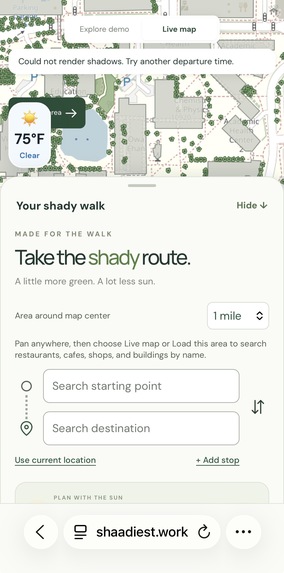
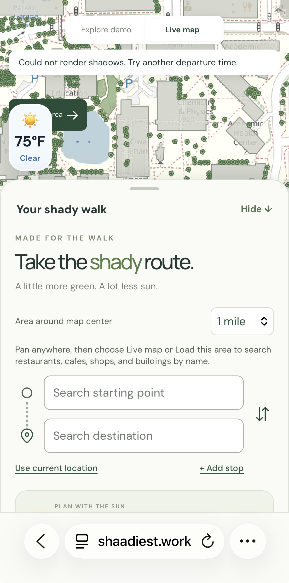
Search bar with different settings
-
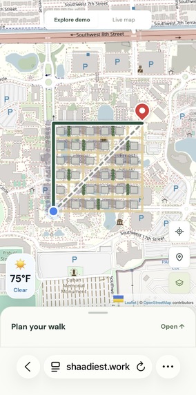
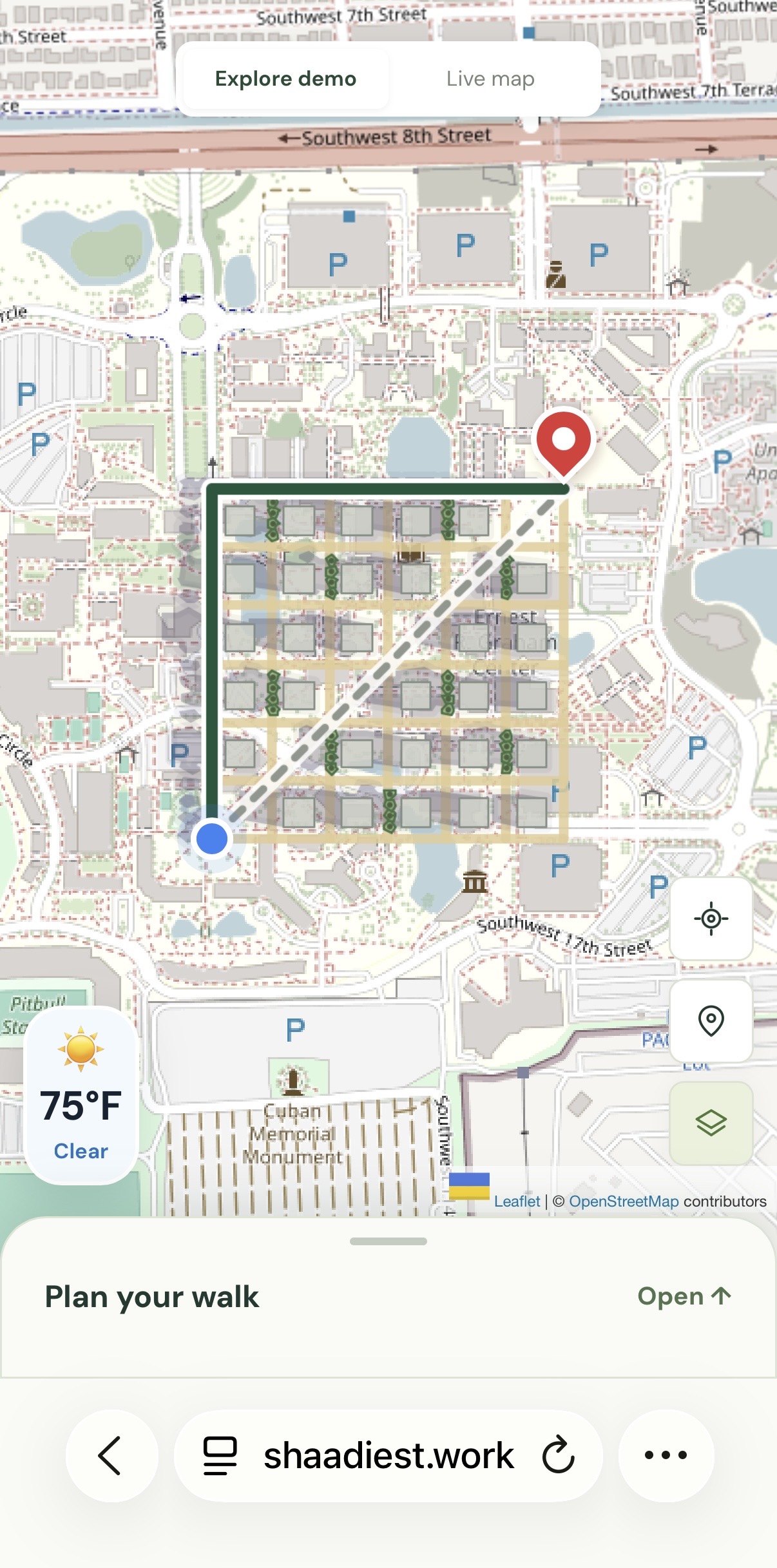
Shaadiest demo and concept
-
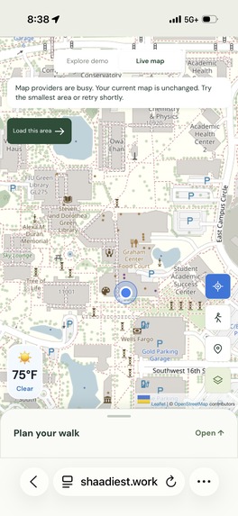
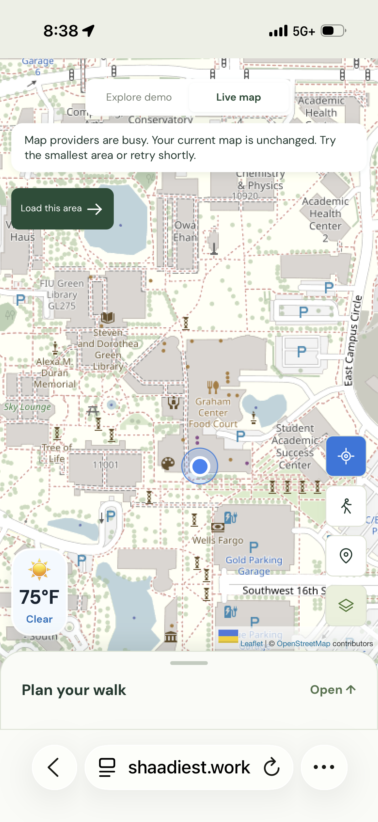
Shaadiest live map at FIU campus
-
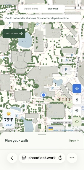
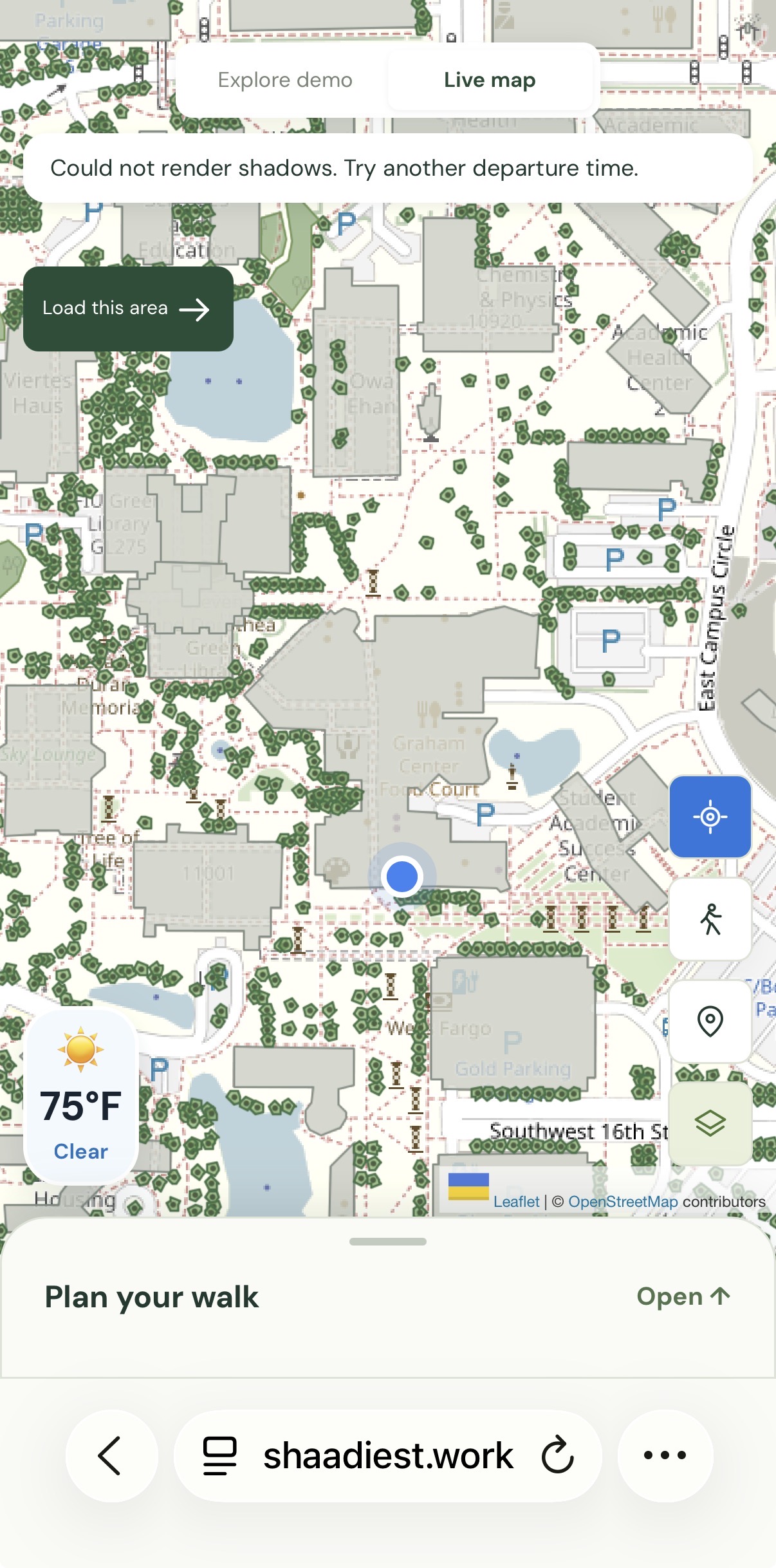
Shade of the buildings and tree canopies
-
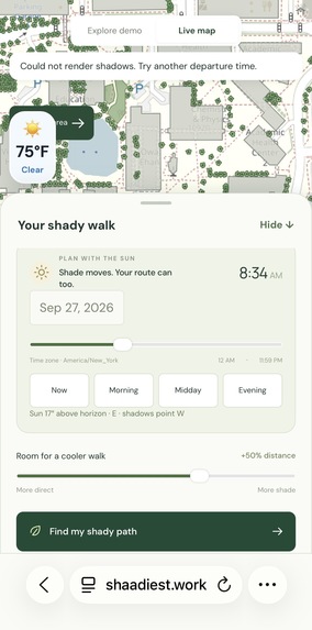
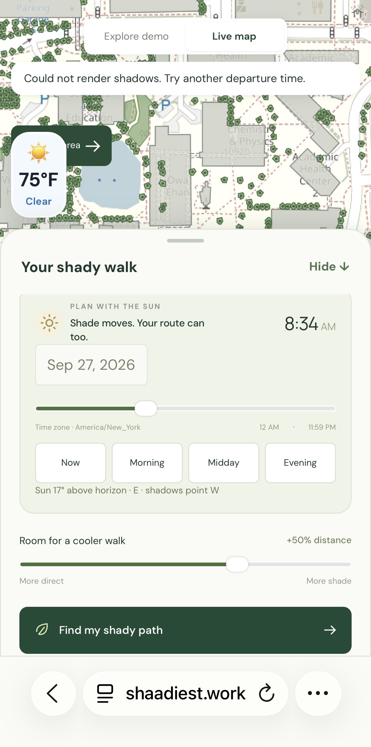
Slide bar for shadow visibility at different time
-
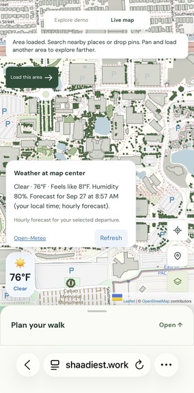
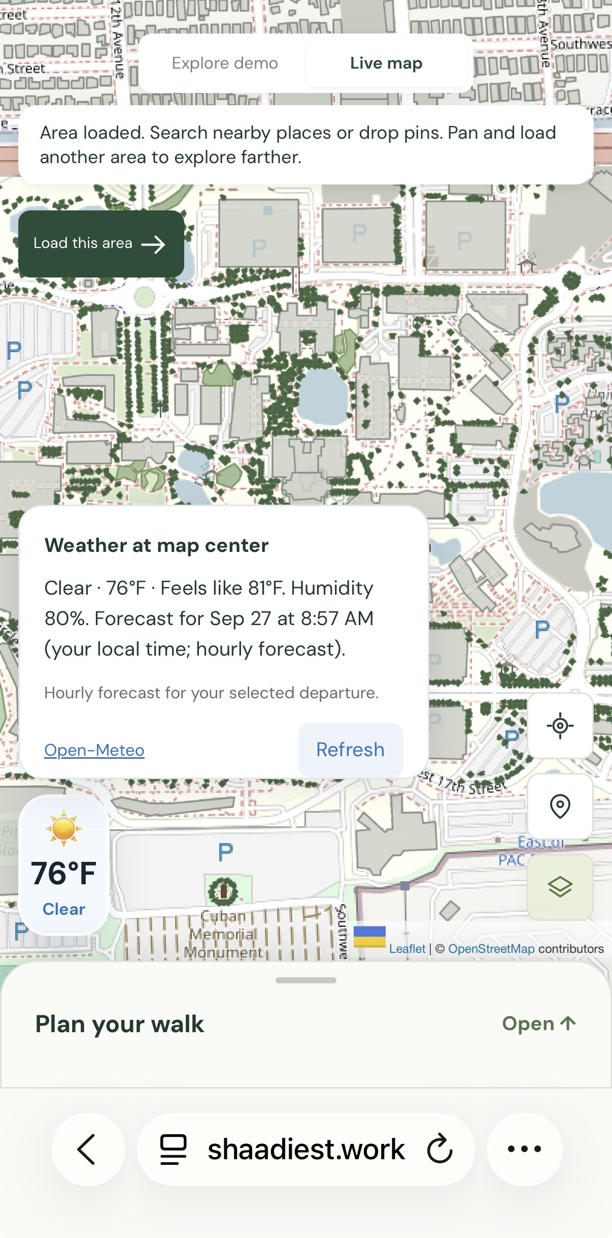
Real-time weather and humidity features
Inspiration
Florida's weather is insanely humid and scorching hot. Walking across campus in Florida can feel like choosing between the shortest route and the most comfortable one. A few minutes under trees or beside shaded buildings can make a difference, but most navigation apps focus on distance and time. We built Shaadiest around a simple question: What if your walking route considered the sun?
What it does
Shaadiest helps pedestrians find routes with less direct sun exposure. The first launch starts with Florida International University’s Modesto A. Maidique campus. Users can search for a starting point and destination, use their current location, or place pins on the map. The app compares the shortest walk with a shadier alternative. Users can adjust time and extra-distance allowance to see how shifting shadows affect their options. Live location tracking displays the walker’s position, location accuracy, and estimated remaining distance. Routes avoid mapped building interiors and use available outdoor walking paths.
How we built it
- We built Shaadiest with JavaScript, Codex, Vite, Leaflet, Node.js, and Express, with deployment support for GoDaddy.
- OpenStreetMap supplies walking paths, buildings, and trees through the Overpass API. We convert those paths into a walking graph, respecting pedestrian access restrictions and walking directions.
- Using SunCalc, we calculate the sun’s position for the selected location and departure time. We estimate shadows from building footprints, heights, and tree crowns, then sample walking segments to estimate their sun exposure.
- Open-Meteo powers humidity and feels-like temperature visibility.
- Our routing algorithm compares the shortest route with candidates that penalize exposed walking distance. It chooses the candidate with the least estimated exposure that fits the user’s distance allowance.
Challenges we ran into
Predicting exact shadows was challenging because their shape and position at each moment of day depend on building heights and tree coverage that map data does not always capture accurately. Expanding beyond our initial campus area introduced challenges with data coverage and loading performance. Finding precise locations was also difficult: GPS readings can drift, and a building’s mapped location does not always point to its walkable entrance. We also faced the challenge of incorporating rain and severe-weather information, since shade alone cannot determine whether a walk is comfortable or safe.
Accomplishments that we're proud of
We're proud of the idea we came up with and the process of making it. Though with limited experience, each member of the team made the journey of our First Hackathon more special. We're excited about the features we designed and the potential it would bring in the future.
What we learned
It is said that the shortest path is only one way to define a useful route, but through Shaadiest, we learned that comfort introduces another objective, and balancing the two requires trade-offs. We also learned how much geographic data quality matters. A working algorithm still depends on accurate footprints, connected paths, and mapped access rules. Finally, we learned that responsiveness is part of usability. A useful calculation needs to update without interrupting the person exploring the map.
What's next for Shaadiest
We want to validate routes through real campus walks, improve building and tree coverage, and refine destination selection around outdoor entrances. Future improvements include automatic rerouting, accessibility-aware route options, shade estimates that account for movement during the walk, and expansion to additional campuses. Our goal is to make finding a more comfortable walk as simple as finding the shortest one, not only in FIU, but also in Miami and later Florida.
Built With
- codex
- express.js
- github
- godaddy
- javascript
- leaflet.js
- node.js
- open-meteo
- overpass-openstreetmap
- suncalc
- vite


Log in or sign up for Devpost to join the conversation.