Seismic Risk Atlas - Project Narrative
Inspiration
Most existing earthquake tools stop at shaking intensity. However, decision-makers and communities care about a more fundamental question:
What is the expected financial impact on households?
This gap inspired us to build Seismic Risk Atlas - a system that translates physics-based seismic simulations into tract-level economic risk.
We were particularly motivated by:
- The disconnect between scientific outputs (PGA, PGV) and real-world decisions
- The lack of accessible, interpretable risk tools for urban planners
- The opportunity to combine ML systems, geospatial data, and physics models into a unified pipeline
What We Built
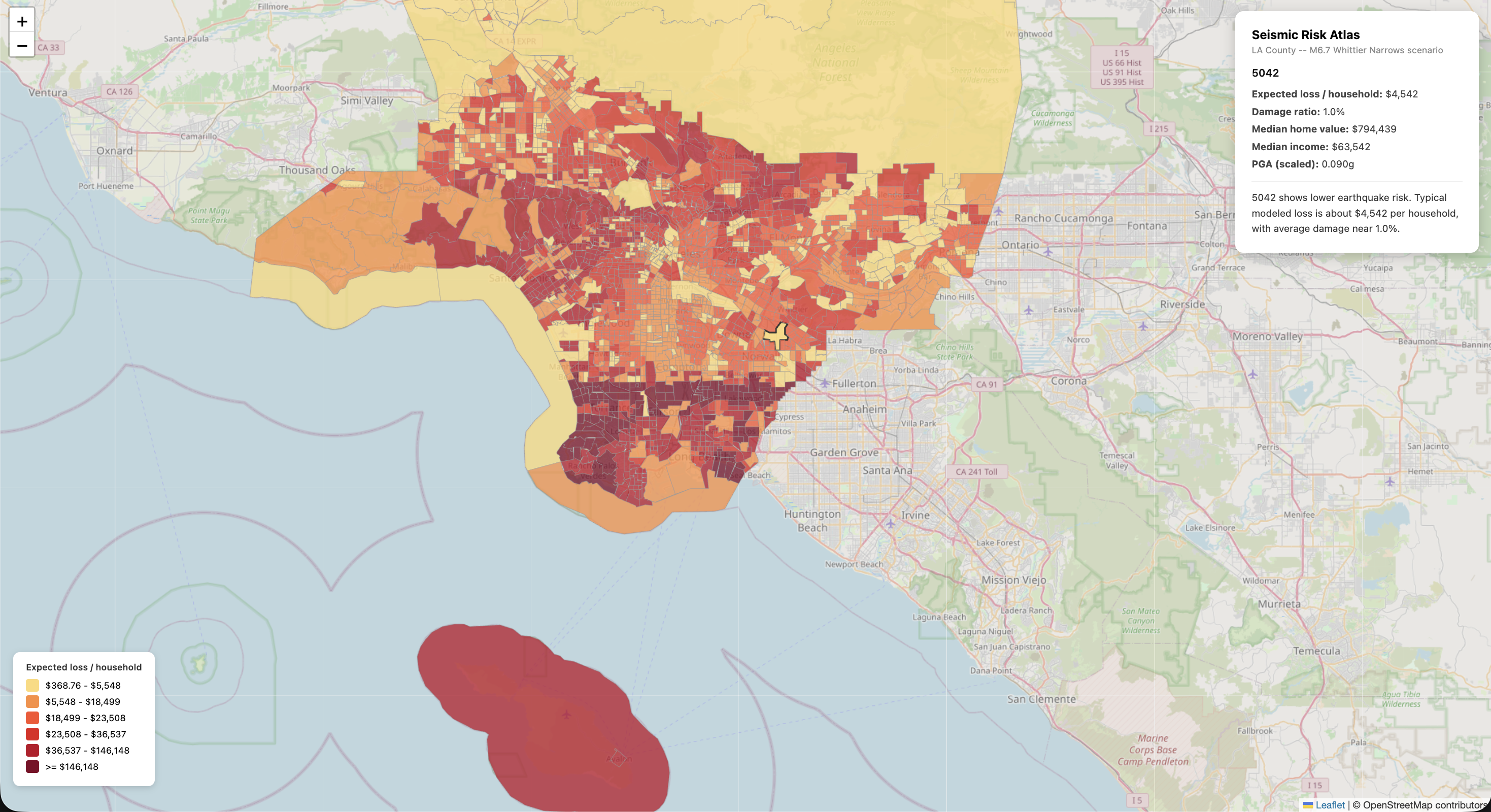
We developed an end-to-end ML-driven system that estimates expected household earthquake loss across 2,498 census tracts in Los Angeles County.
At its core:
$Expected\ Loss = Damage\ Ratio \times Home\ Value \times Structural\ Fraction$
The platform includes:
- Physics-based seismic feature extraction (PGA, PGV, Arias intensity)
- HAZUS-based damage modeling
- Monte Carlo aggregation across 500 scenarios
- Interactive choropleth risk map
- Explainable API for natural language summaries
Built With
- brev
- databricks
- fastapi
- geojson
- geopandas
- javascript
- leaflet.js
- marimo
- numpy
- nvidia
- openai
- pandas
- pygris
- python
- scipy
- sphinx
- unittest
- xgboost

Log in or sign up for Devpost to join the conversation.