-
-
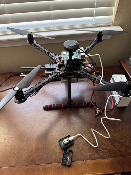
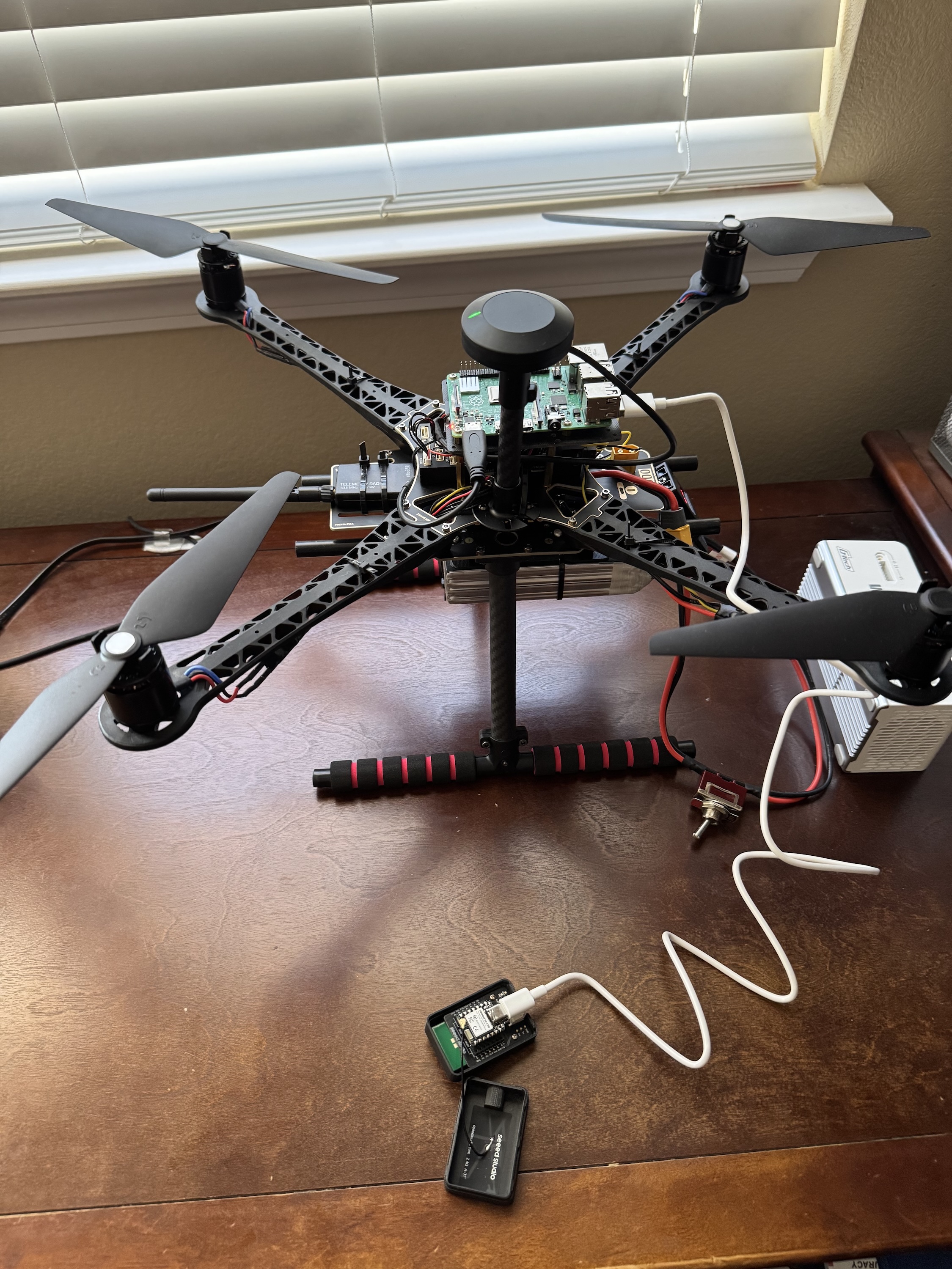
Drone image
-
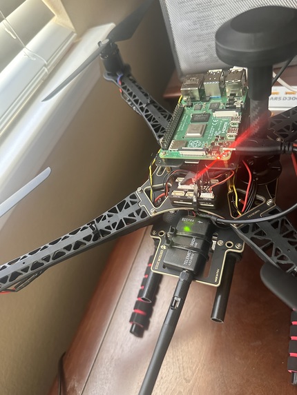
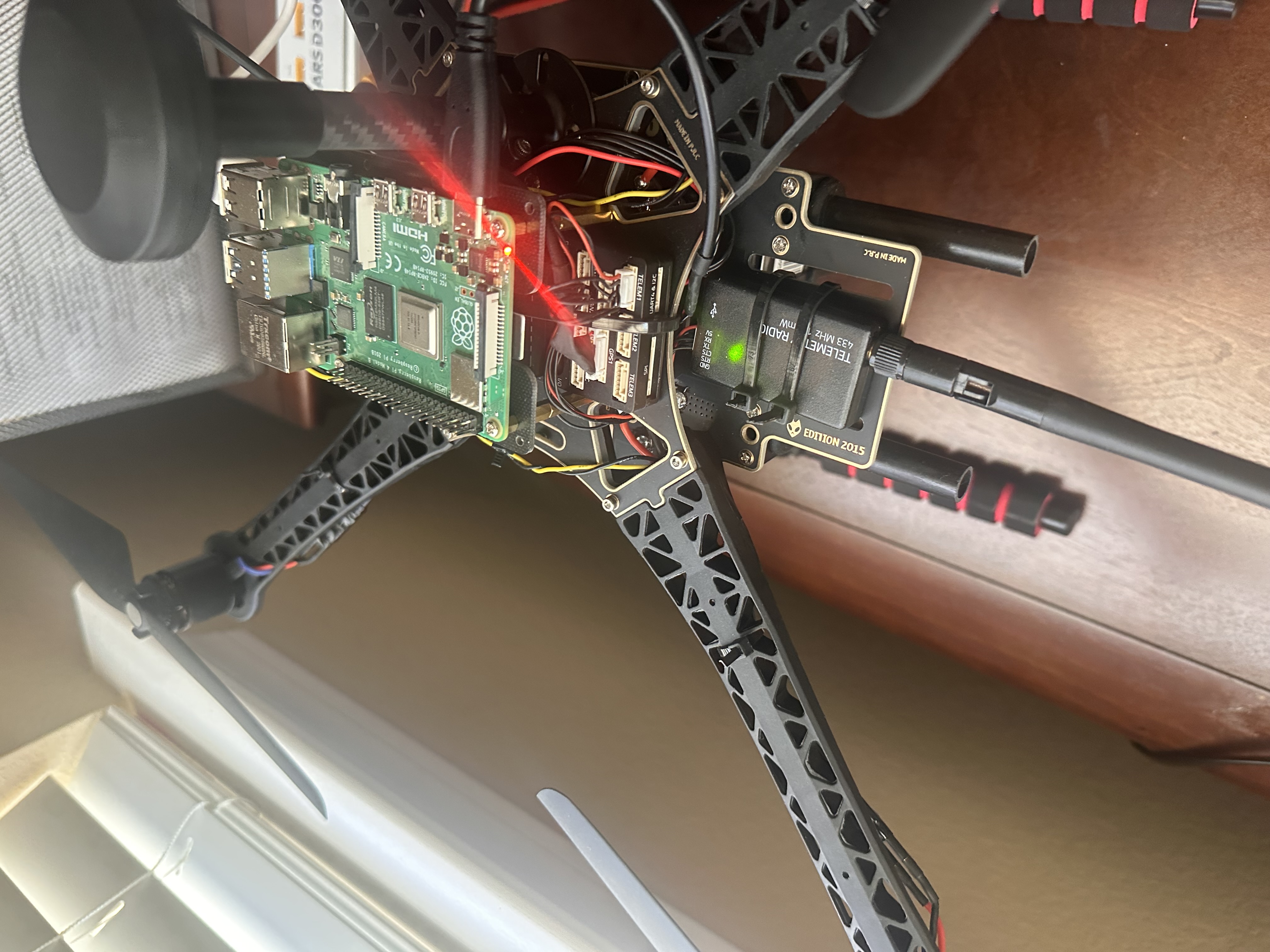
Drone with Raspberry PI
-
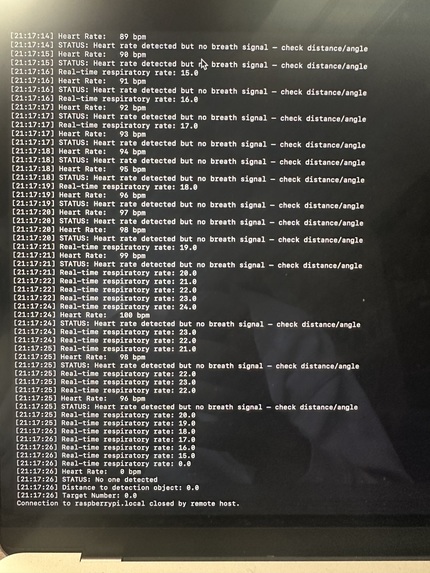
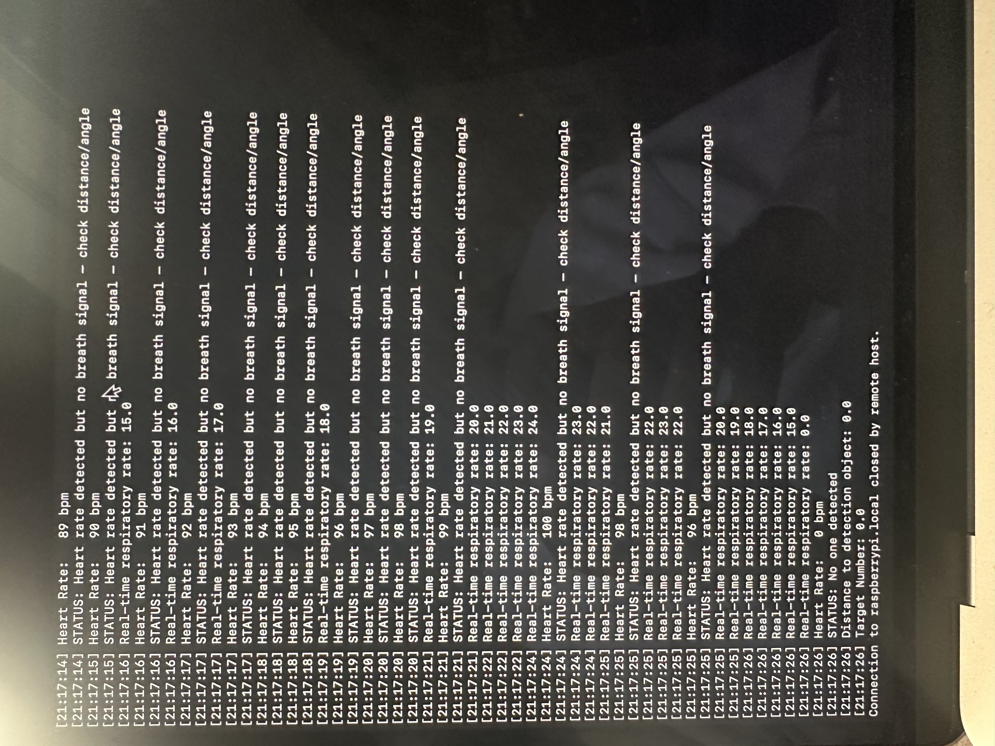
terminal output of breath sensor
-
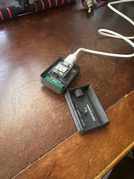
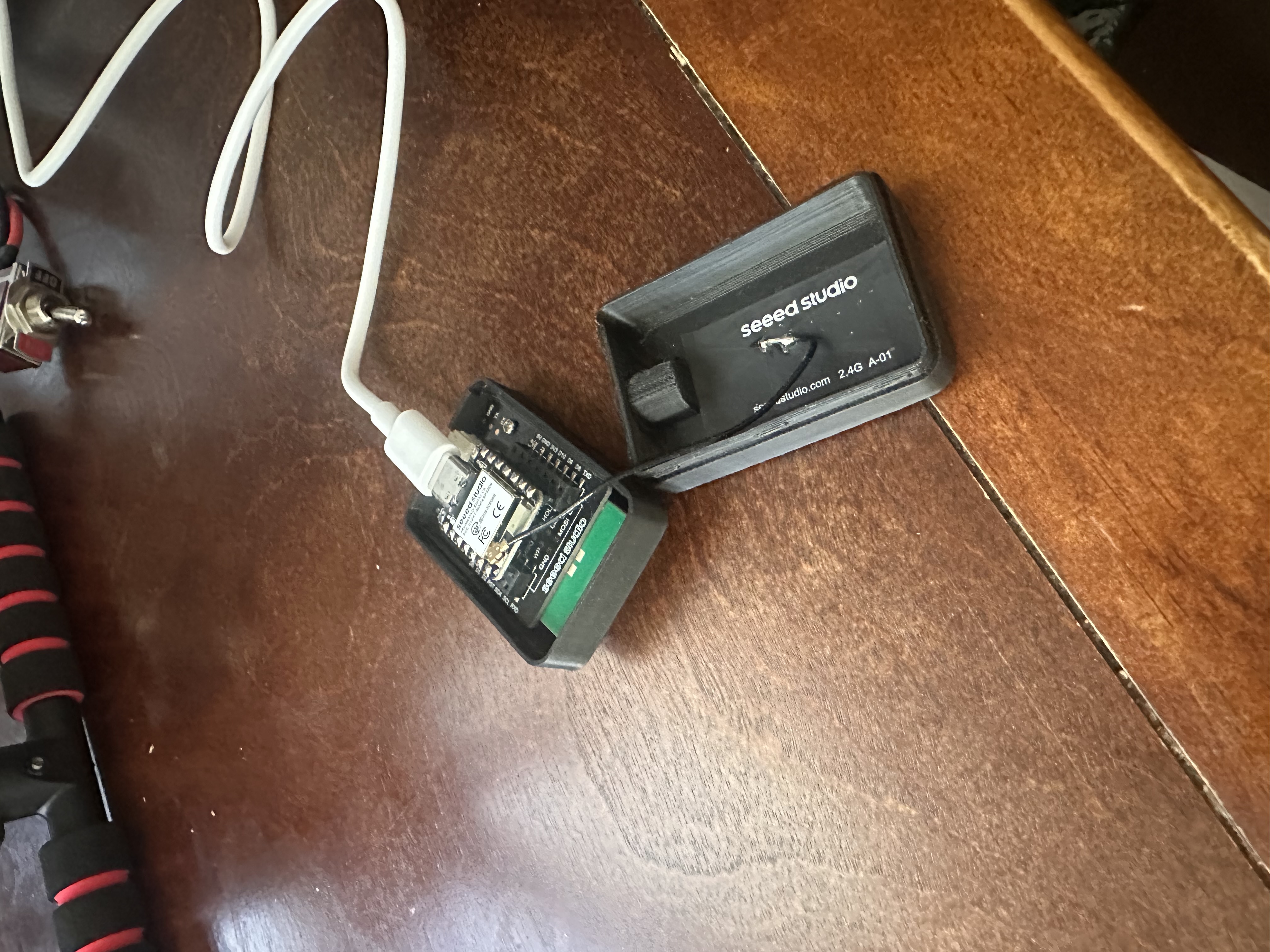
Breath sensor
Inspiration
Earthquakes have been ramping up in frequency, leaving more people trapped under rubble with rescue teams racing against time. Traditional search methods struggle in unstable, collapsed structures, and GPS doesn't work indoors or underground, so drones lose the ability to navigate or report a victim's location right when it matters most. We wanted to build a system that could reach places conventional search efforts can't.
What it does
SARlink is a search and rescue drone designed to operate in GPS denied environments. Exterior drones, positioned using regular GPS, act as fixed anchor points broadcasting UWB (ultra wideband) ranging signals. An indoor drone uses those signals to triangulate its own position without ever needing GPS. That same indoor drone carries a 60GHz mmWave radar that detects breathing and heartbeat through walls and light debris, allowing it to locate survivors that visual methods would miss.
How we built it
The drone is built on a Holybro S500 V2 frame with a Pixhawk 6X flight controller running PX4 firmware. A Raspberry Pi acts as the companion computer, handling sensor integration. The mmWave radar (Seeed MR60BHA2) outputs breathing and heart rate data over serial, which we parse with a Python script and relay to the flight controller via MAVLink using MAVSDK, with pymavlink as a fallback. QGroundControl serves as our ground station for telemetry, virtual joystick control, and diagnostics.
Challenges we ran into
We were not able to get access to the UWB hardware needed to build out the full multi-drone anchor system, so that part of our design remains a concept rather than a working build. We also ran into ESC configuration issues since PX4 lacks BLHeli passthrough support, requiring external tools and workarounds. Component availability in general was a recurring obstacle throughout the build.
Accomplishments that we're proud of
We got the mmWave radar fully integrated end to end, from raw sensor parsing to real time MAVLink alerts on the flight controller. We also worked out a complete hardware and firmware stack for the drone itself, including power delivery, telemetry, and sensor wiring, despite several hard to diagnose issues along the way.
What we learned
We learned how GPS denied navigation actually works at the hardware level, and why UWB ranging is a practical substitute for satellite positioning indoors. We also learned the limits of what mmWave radar can realistically detect (through drywall and light debris, not thick concrete or metal) and the importance of representing that honestly.
What's next for SARlink
Our next step is acquiring the UWB hardware needed to build out the full multi-drone anchor swarm and test real indoor positioning. From there, we want to complete first flight testing and combine live position data with radar detections into a single ground station view.
Built With
- drone
- gps
- pxhawk
- python
- raspberry-pi
- sensor

Log in or sign up for Devpost to join the conversation.