inspiration
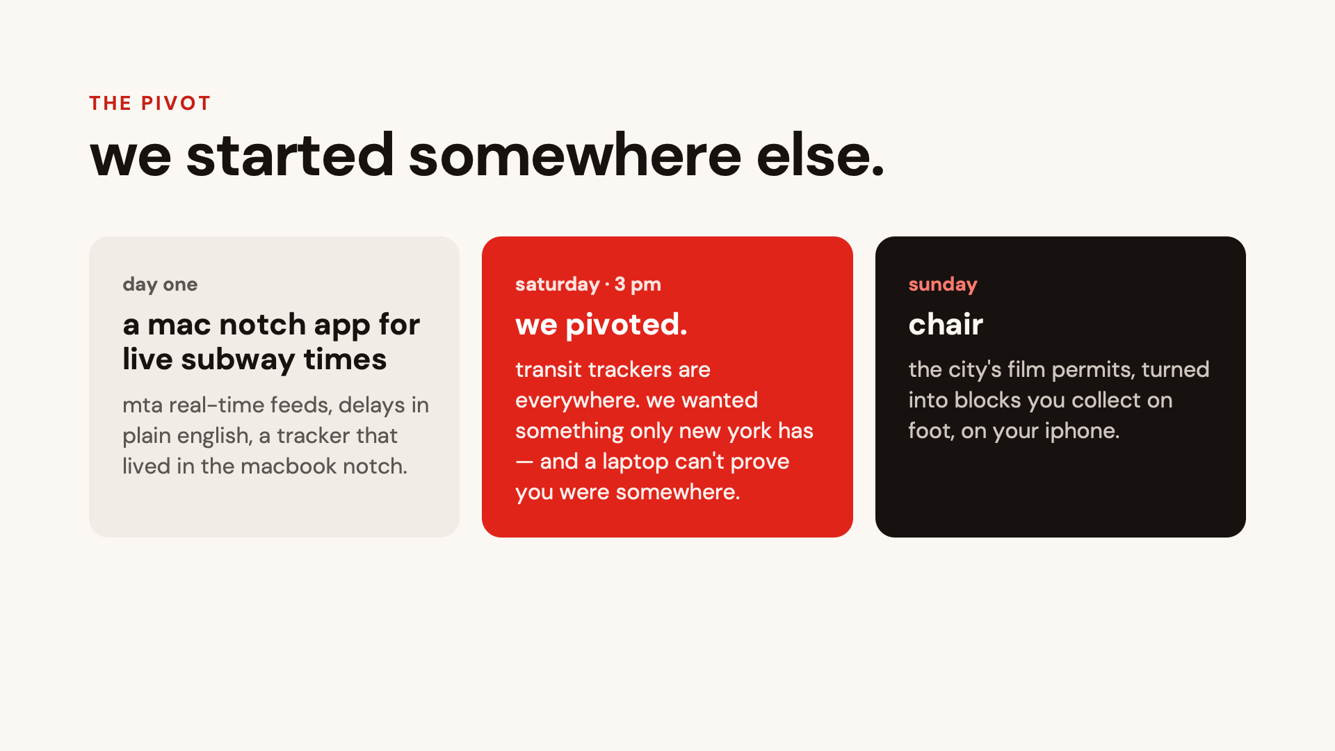
this isn't the project we started. on day one we were building a mac app that lived in the macbook notch and showed live subway arrivals and delays from the mta's real-time feeds. at 3 pm on saturday we pivoted. transit trackers are everywhere, and we wanted to build something only new york has. we also wanted people to be able to prove they'd been somewhere, which a laptop can't do.
new york is one of the most-filmed cities in the world, but most of us only notice when we walk past the trailers and "no parking" signs. every shoot files a permit with the city, and that data is public. nobody reads it because it's a spreadsheet of street closures. we wanted to turn it into something you can go out and experience.
what it does
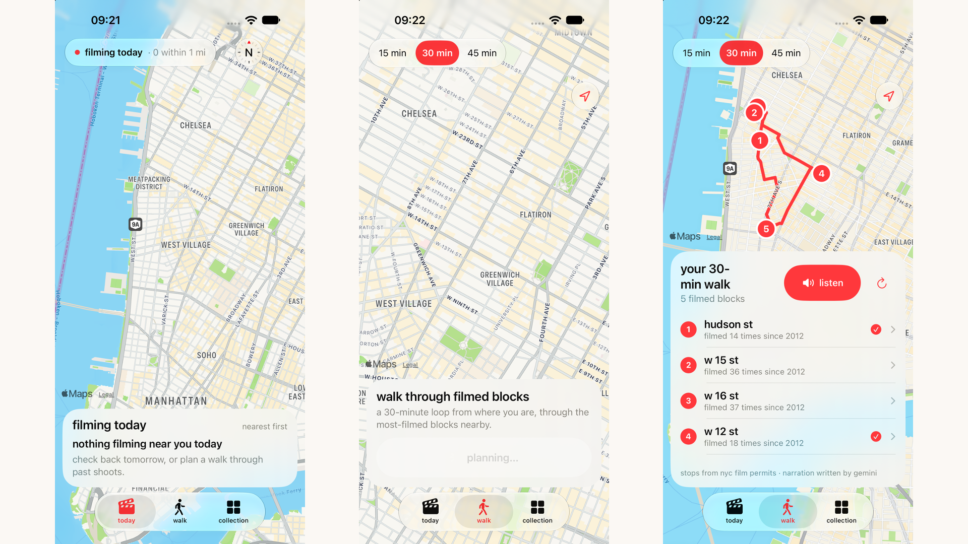
chair is an iphone app with three tabs:
- today: a map of every film permit active right now, nearest first.
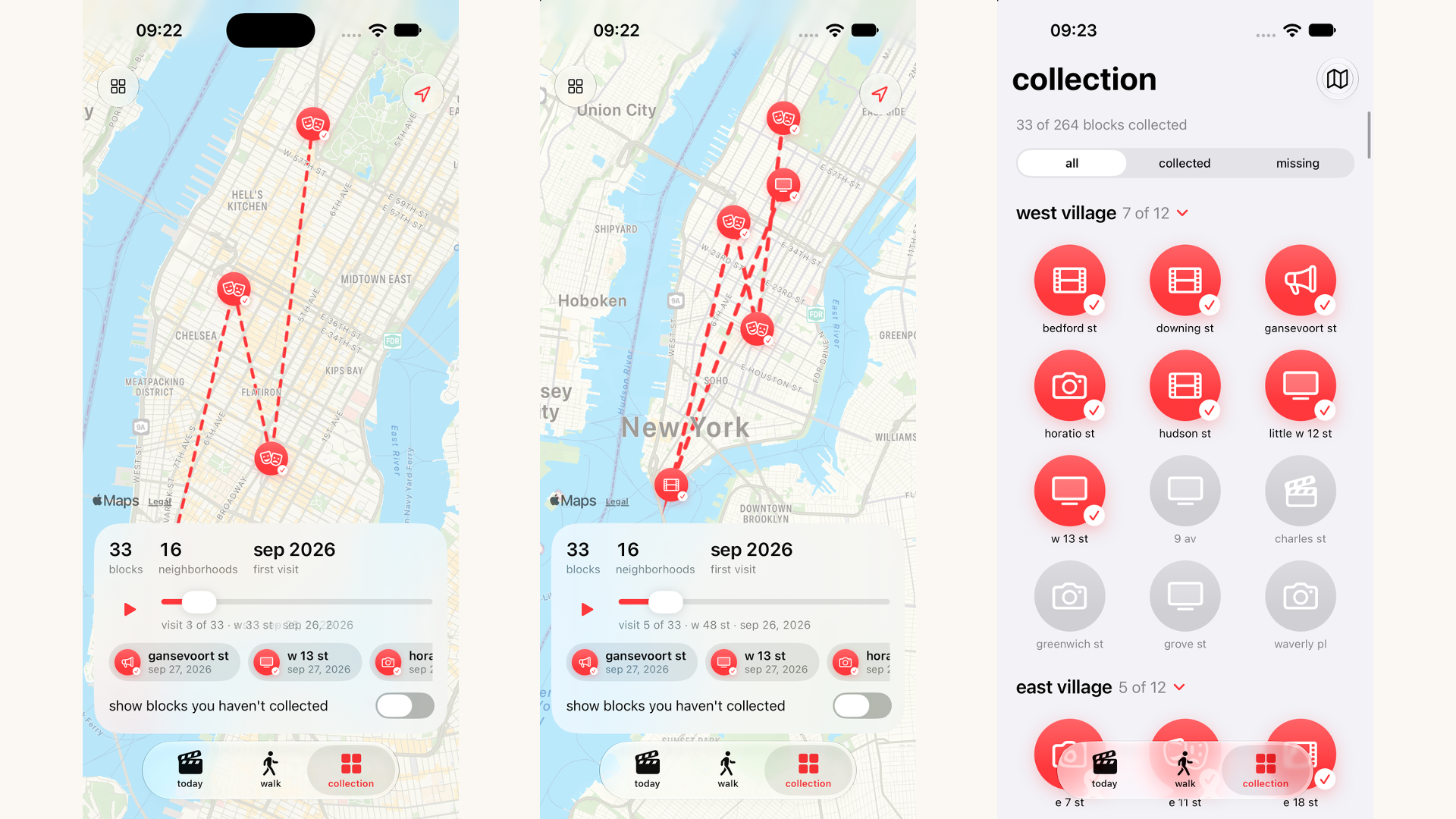
- walk: pick 15, 30 or 45 minutes and chair plans a loop through the most-filmed blocks near you. gemini writes the narration and elevenlabs reads it aloud.
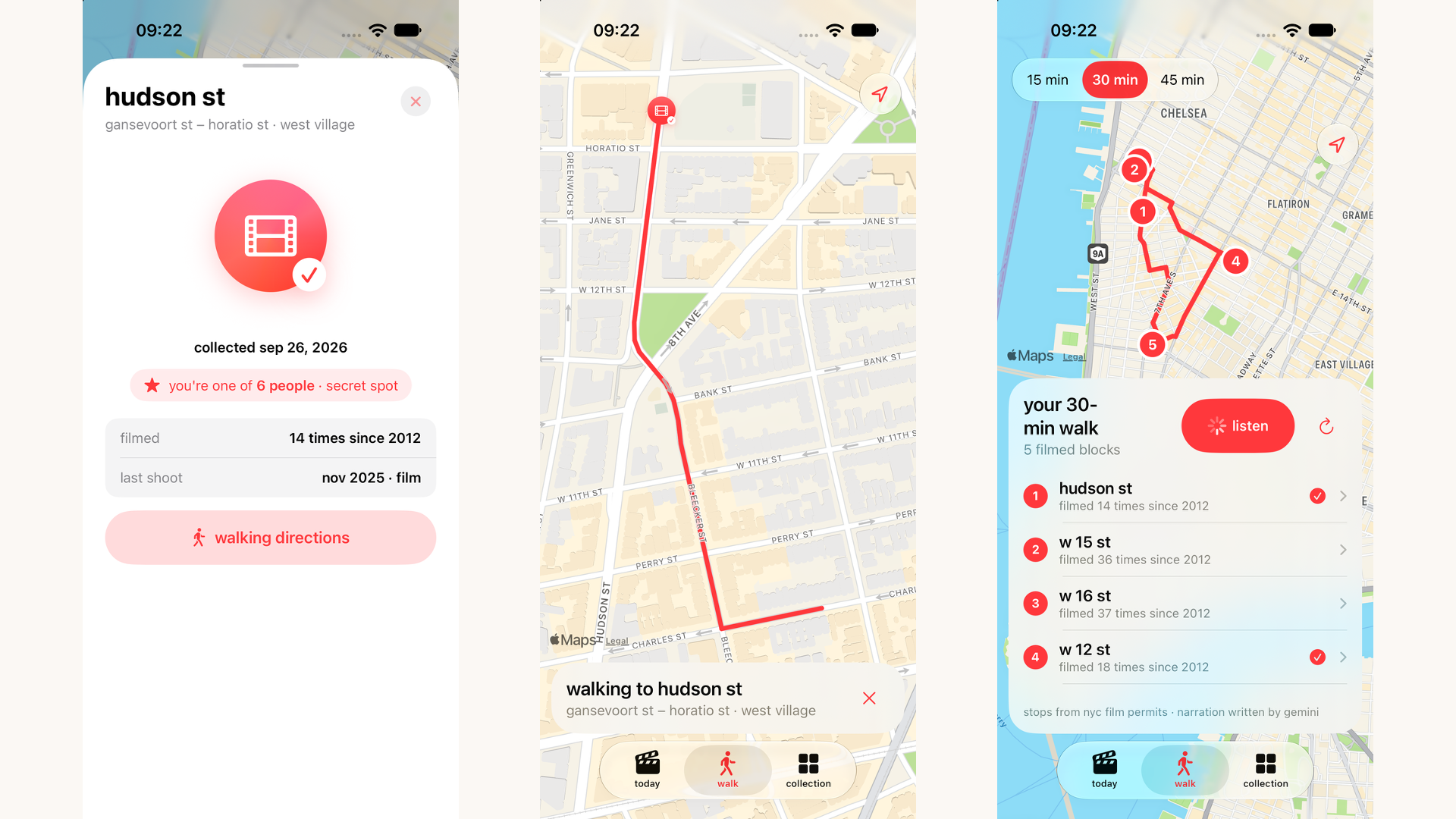
- collection: each neighborhood's most-filmed blocks become pins. the only way to collect one is to physically go there. the check-in unlocks within 100 m and the server verifies it again. collecting plays a spin-and-sparkle animation, and collected pins can be dragged to turn in 3d with a holographic sheen.
every pin shows how many people have been there. hundreds of visitors makes it a classic, a handful makes it a secret spot, so you get either validation or discovery. my map shows the area you've explored, a trail through your visits and a replay of your history.
permits never say which show was filming, so chair never guesses. every fact on screen comes from city data.
how we built it
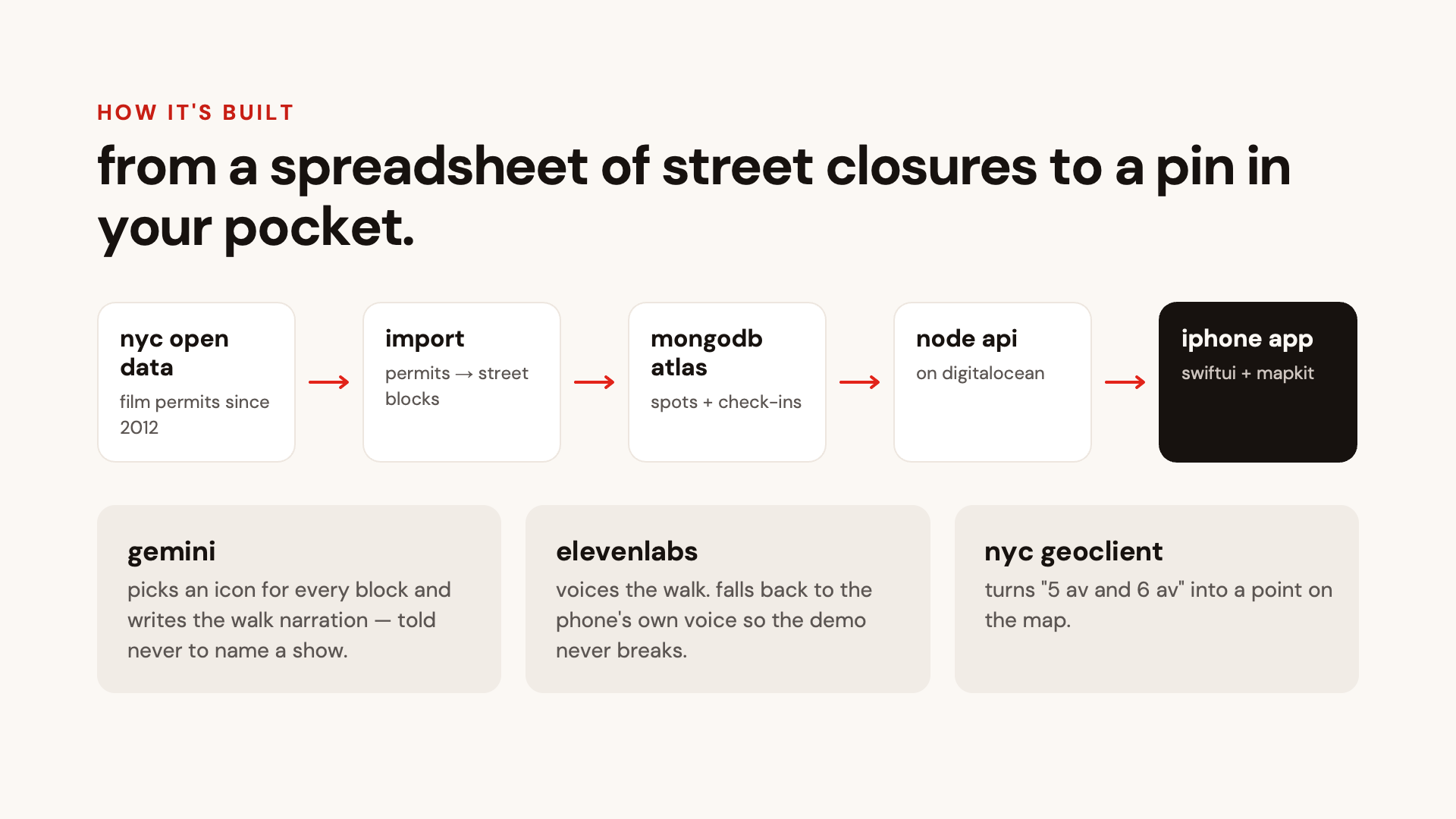
- data: a node importer pulls every manhattan film permit since 2012 from nyc open data, parses the held street blocks ("w 20 st between 5 av and 6 av"), and folds them into one record per block: times filmed, last shoot, neighborhood. each neighborhood's 12 most-filmed blocks become the collectible set.
- geocoding: nyc geoclient turns each block's cross streets into coordinates. we use the midpoint of the two intersections.
- backend: express api with mongodb atlas for blocks, check-ins (unique per device per block) and walks, hosted on digitalocean. tested with node's built-in test runner.
- ai: gemini picks an sf symbol for every block from a fixed allowlist, so it can't invent an icon that doesn't exist, and writes the walk narration from permit facts. it's instructed never to name a show. elevenlabs voices the narration. the app falls back to the phone's built-in voice so the demo never breaks.
- app: swiftui, mapkit (apple maps, walking directions) and corelocation on ios 27, with no third-party packages and no api keys in the app. everything runs on mock data too, so the ui could be built before the backend.
challenges we ran into
- the pivot. throwing away a working prototype at 3 pm on saturday and rebuilding the data layer, backend and app in the time left.
- permits have no titles. we had to design the whole experience around what the data actually says, instead of the "law & order is filming here" pitch we first imagined.
- turning street closures into points. permits describe blocks as text, not coordinates. parsing and geocoding them reliably took several tries.
- honest gps check-ins that still work on a phone with a noisy gps signal (100 m in the app, a little more slack on the server).
- xcode build issues. swift 6's default main-actor isolation threw warnings on our model classes, and macos's case-insensitive disk made xcode report the project folder as
Chairin one place andchairin another until we renamed everything to lowercase. also,//starts a comment in.xcconfigfiles, which silently cut our backend url in half. - api key setup. juggling keys for gemini, elevenlabs, mongodb atlas and nyc geoclient. the geoclient portal's endpoint path didn't match older docs, and we kept every key on the server so the app itself ships with none.
- mongodb atlas network access. atlas only accepts connections from allowlisted ips, and our public ip changed every time we switched wifi, went to cellular or used a vpn, so we had to keep re-adding it. for a dev database used from many networks, allowing
0.0.0.0/0is more practical but less secure, and we had to decide that deliberately rather than default into it.
accomplishments that we're proud of
- a shared "who's been here" counter that makes a quiet side street feel like a secret and a famous block feel like a pilgrimage.
- the collect moment: the pin spins as it gains color, sparkles burst, and you can turn it in your hand.
- every fact comes from public data. we never invent a title or a visitor count.
- rebuilding end to end after a mid-hackathon pivot.
what we learned
- public city data is rich but messy. the work is in turning it into something human.
- constraining an llm (an allowlist of icons, "only use these facts") makes it far more reliable.
- design around the data you have, not the data you wish you had. mock data was our best friend!
what's next for chair
- vr scene replay: stand on the block and watch the scene that was filmed there, in place. this requires licensing from studios.
- matching permits to titles, carefully and with sources.
- all five boroughs.
- an imessage version ("what's filming near me?") via photon.
- stronger anti-spoofing for check-ins.
👩💻 developer info
judges & fellow hackers, if you liked this project, please feel free to connect with me: 🔗 riavadhavkar.com
thank you for your time & attention! :)
Built With
- avfoundation
- core-location
- digitalocean
- elevenlabs
- express.js
- gemini-api
- ios
- javascript
- mapkit
- mongodb-atlas
- node.js
- nyc-geoclient
- nyc-open-data
- swift
- swiftui
- xcode


Log in or sign up for Devpost to join the conversation.