-
-

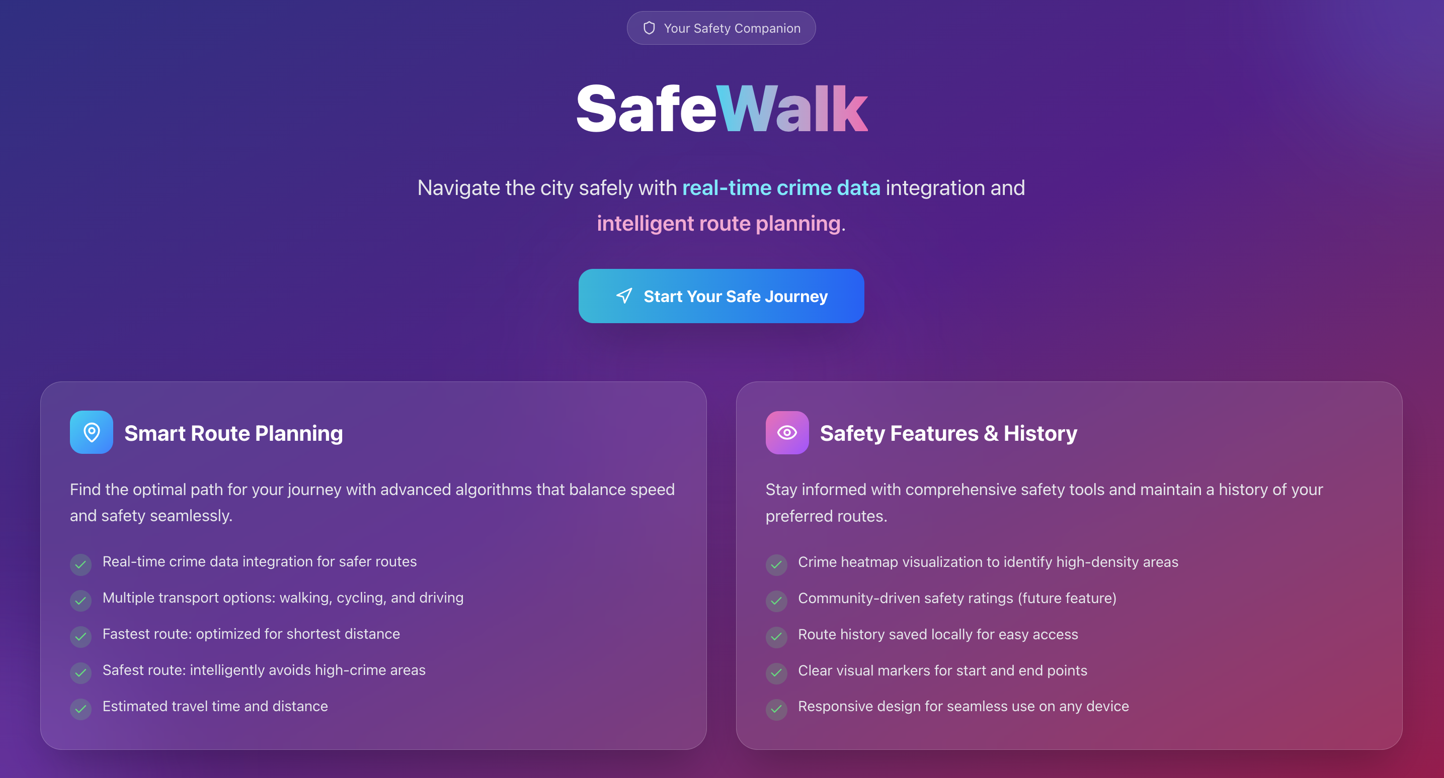
Home Page 1
-

Home Page 2
-
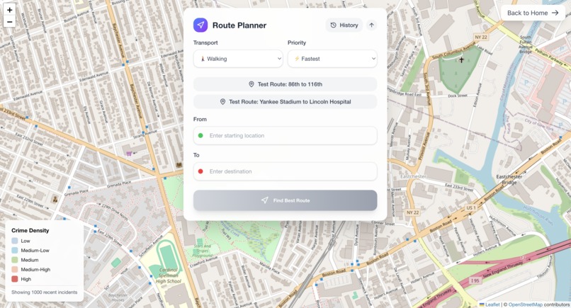
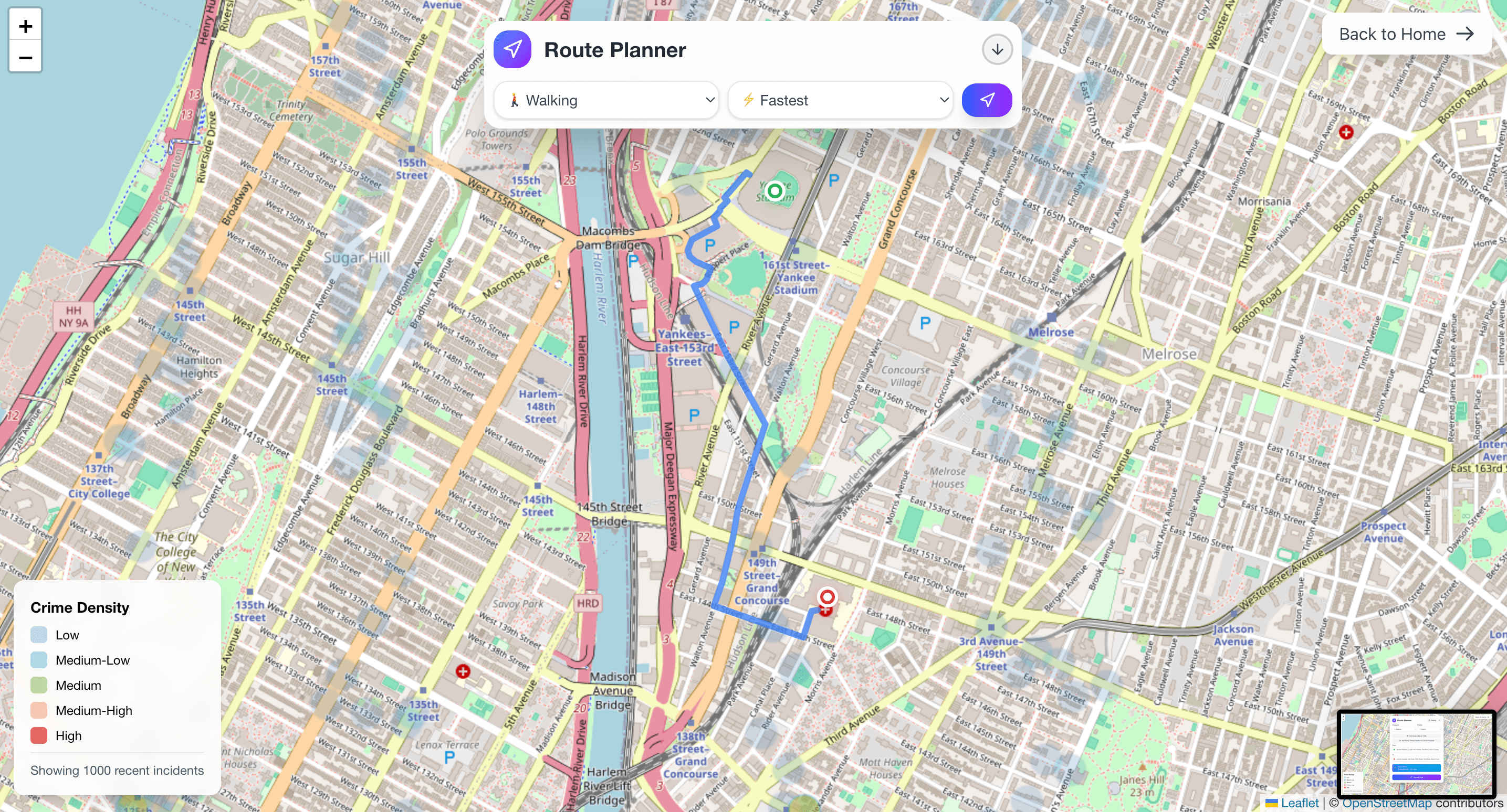
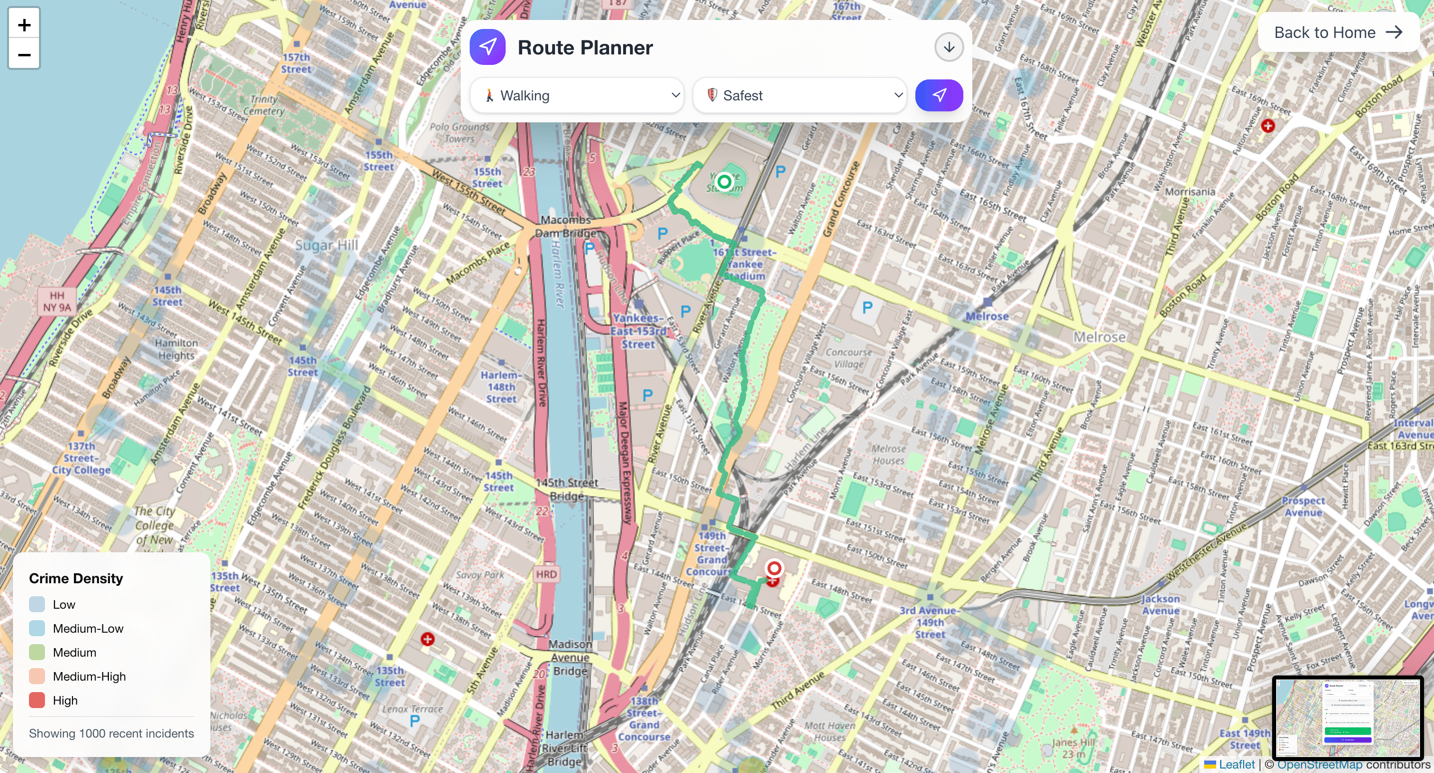
Route Planner
-
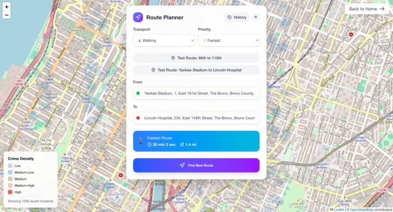
Route Planner Fastest Input
-
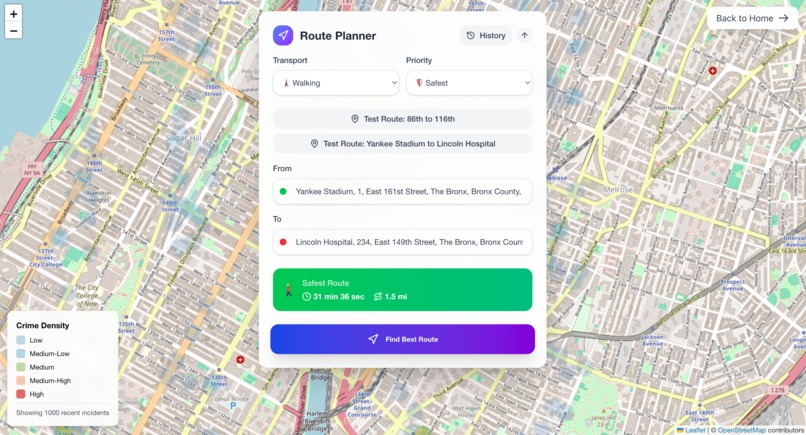
Route Planner Safest Input
-

Route Planner Fastest Output
-

Route Planner Safest Output


SafeWalk - Making NYC Streets Safer Through Smart Navigation
Inspiration
Growing up in the Bronx, I've witnessed firsthand how safety concerns can impact daily life and limit people's freedom to move around their neighborhood. Many residents, especially students and young people, often have to make difficult decisions about which routes to take when walking home from school or work. This inspired me to create SafeWalk - a solution that empowers Bronx residents to make informed decisions about their travel routes by providing real-time safety data and alternative paths.
What it does
SafeWalk is an innovative route planning application that helps users find the safest walking routes by considering real-time crime data. The app features:
- An interactive map showing crime density through heatmaps
- Smart route planning that suggests safer alternatives
- Real-time integration with NYC Open Data for up-to-date crime statistics
- Multiple transportation modes (walking, cycling, driving)
- Route options balancing speed and safety
- Location search with auto-suggestions
- Estimated travel time and distance calculations
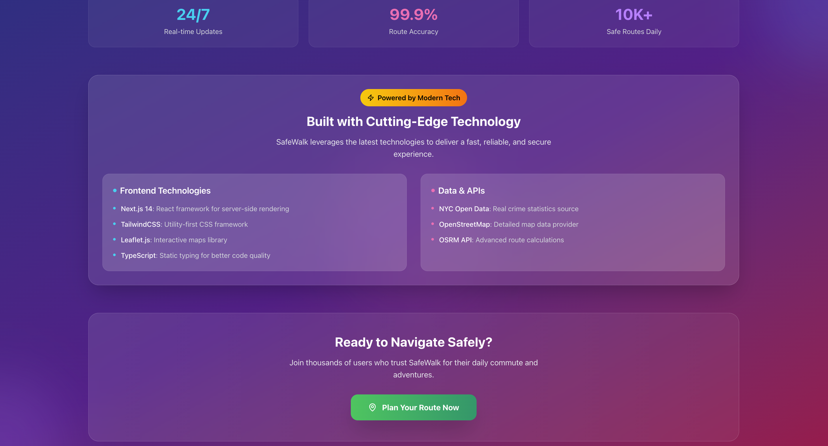
How we built it
SafeWalk was built using modern web technologies:
- Next.js 14 for the frontend framework
- TypeScript for type safety and better code quality
- TailwindCSS for responsive design
- Leaflet.js for interactive maps
- Integration with NYC Open Data API for crime statistics
- OpenStreetMap and OSRM API for routing
- Nominatim API for location search and geocoding
Challenges we ran into
- Integrating real-time crime data with the routing algorithm while maintaining performance
- Balancing route safety with practical travel time
- Ensuring accurate geocoding for Bronx addresses
- Optimizing the map rendering for mobile devices
- Handling edge cases in route calculations
Accomplishments that we're proud of
- Successfully integrating NYC Open Data to provide real-time safety information
- Creating an intuitive user interface that works well on both mobile and desktop
- Implementing a sophisticated routing algorithm that considers both safety and efficiency
- Building a responsive application that serves the specific needs of Bronx residents
- Developing a solution that can be easily adapted for other neighborhoods
What we learned
- How to effectively process and visualize large datasets of crime statistics
- Best practices for implementing real-time map features
- The importance of user experience in safety-focused applications
- How to balance technical complexity with practical usability
- The value of community-focused problem-solving
What's next for SafeWalk
- Community feedback integration to improve route suggestions
- Expansion to include more safety factors (street lighting, pedestrian infrastructure)
- Mobile app development for better on-the-go experience
- Integration with local community safety programs
- Adding features for reporting safety concerns
- Potential expansion to other NYC boroughs
Built With
- custom-css
- eslint
- git
- github
- leaflet.js
- local-storage
- next.js-14
- node.js
- nominatim-api
- npm/bun
- nyc-open-data-api
- nypd-complaint-data
- openstreetmap
- openstreetmap-data
- osrm-api
- react
- react-leaflet
- svg
- tailwindcss
- typescript
- vercel

Log in or sign up for Devpost to join the conversation.