-
-
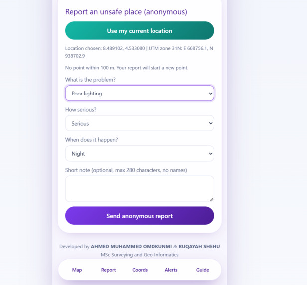
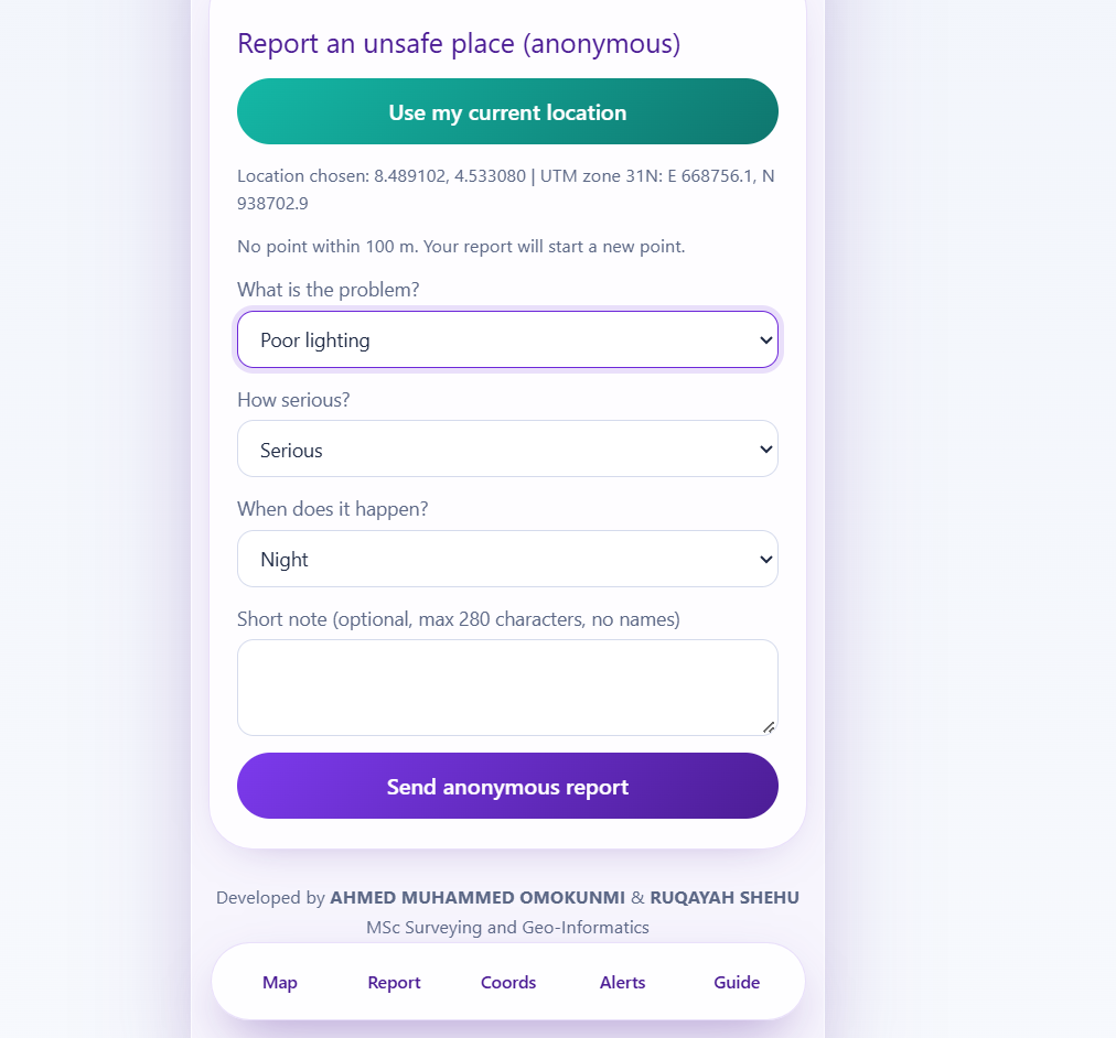
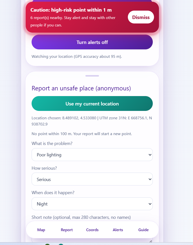
Your report will be added to a point
-
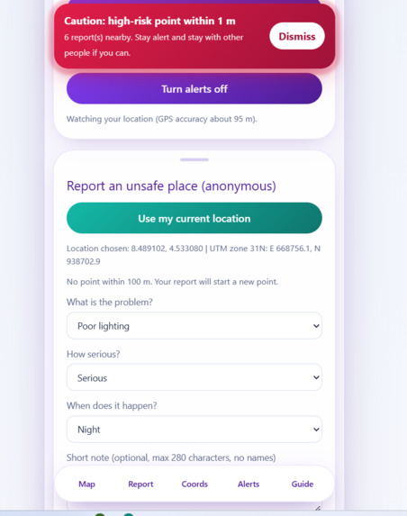
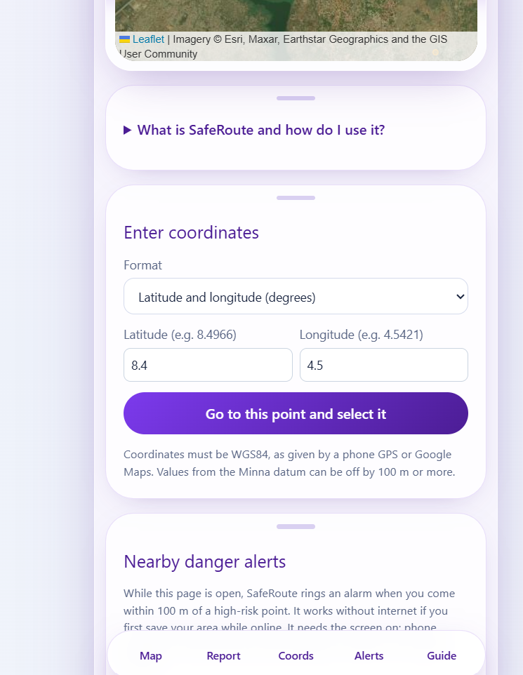
Coordinate entry: easting and northing
-
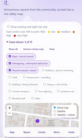
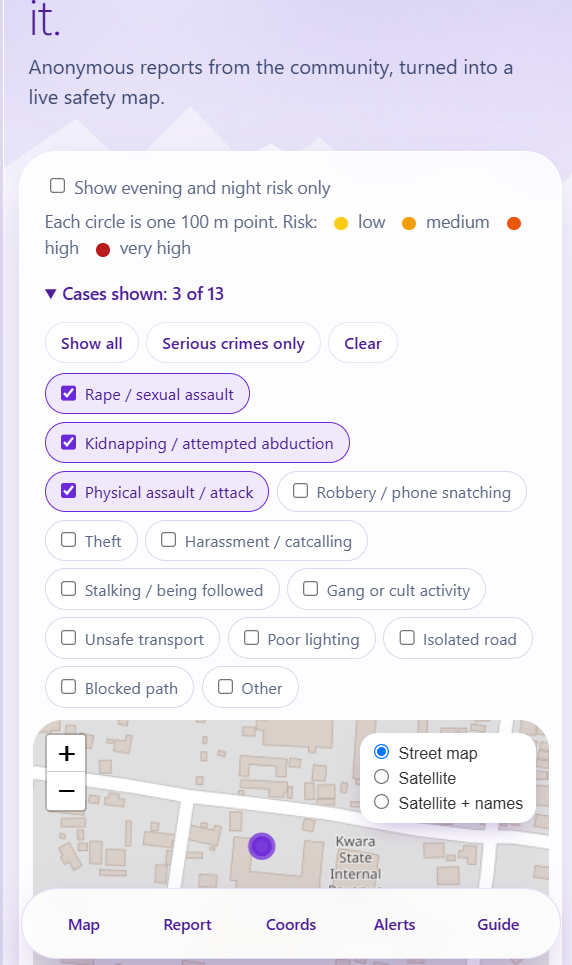
Case filter with one case type ticked
-
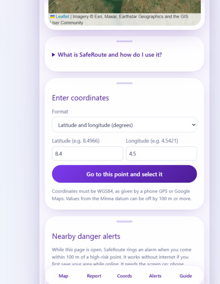
easting and northing
-
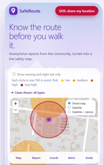
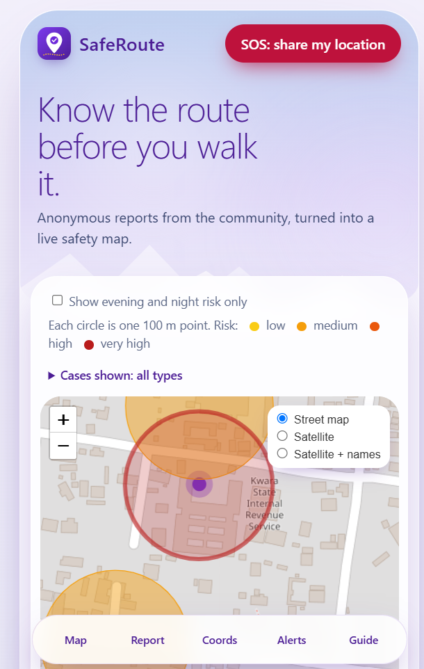
Risk map with coloured 100 m circles
-
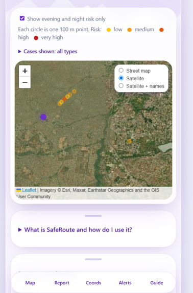
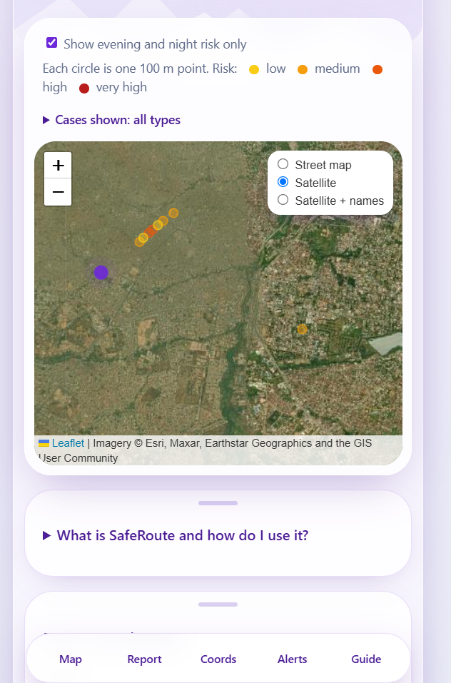
Satellite view of a point
What it does
SafeRoute is an anonymous, mobile-first community safety map for women and girls. People report unsafe places using 13 case types, from poor lighting and harassment to robbery, kidnapping and rape / sexual assault. The map turns the reports into coloured risk circles, so anyone can see where danger is higher, especially at night.
- Report by GPS, by tap, or by coordinates: the place can also be typed as latitude/longitude or UTM easting/northing, as surveyors work.
- 100 m points: reports within 100 m of each other count as one point, scored by severity, time of day and recency.
- Case filter: show all types, only serious crimes, or any single type. Street, satellite and satellite-with-names views.
- Danger alarm: within 100 m of a high-risk point the phone rings and vibrates, with built-in tones or the user's own ringtone. It works without internet after the area is saved.
- SOS: one tap sends the user's current location to a trusted contact by SMS or the phone's share sheet.
- Installable: it installs on a phone like an app, with an in-app guide.
Why it matters
Women and girls often plan their day around fear, but there is no simple local map of where danger happens. SafeRoute gives communities a shared, anonymous picture, and gives campus security and local authorities location data they can act on, such as fixing lights or adding patrols.
Technical execution
- The 100 m grouping and the risk score run inside PostgreSQL functions, using real ground distance (haversine). Each point has an anchor report, so clusters cannot chain into long strips.
- A WGS84 to UTM converter is written from scratch and was checked against a reference library: it matched to the millimetre at six test points across Nigeria's UTM zones 31, 32 and 33.
- The public can only add and read reports. This is enforced with row-level security and column-level permissions, and a trigger limits each device to 5 reports per hour.
- The case filter passes a list of categories to a database function, so counts and scores reflect only the cases chosen.
- The alarm uses the phone's GPS and the Web Audio API. A service worker and saved risk points let it work with no internet, and the screen is kept awake while alerts are on.
Privacy by design
No accounts and no names. For rape, kidnapping and assault reports, no free-text note is collected and seriousness is set to the highest level. The map shows a 100 m circle, not an exact home or shop.
Stack
Next.js, React and TypeScript; Leaflet with OpenStreetMap and Esri satellite imagery; Supabase (PostgreSQL); Web Audio API; progressive web app; hosted on Vercel.
Honest limits
Alarms ring only while the app is open with the screen on, because phone browsers cannot read location in the background. Coordinates must be WGS84. The demo points are made-up test data.
What we'd do next
A native Android and iPhone app with background alerts, a moderation page to remove false reports, a Minna datum option, local languages, and partnerships with campus security and local authorities.
Team
Ahmed Muhammed Omokunmi and Ruqayah Shehu, MSc Surveying and Geo-Informatics.
Built With
- github
- leaflet.js
- next.js
- openstreetmap
- postgresql
- pwa
- react
- supabase
- typescript
- vercel
