Inspiration
Over the past year, I watched the news and felt helpless. Wars breaking out, natural disasters leveling entire communities, people caught in the crossfire who never asked for any of this. I kept thinking: what if there was a way to help? Not just thoughts and prayers, but something tangible. Something that could give people trapped in chaos a fighting chance to get out safely. That's why I built SafePath, a lifeline for the people who need it most.
What it does
SafePath turns your phone into a survival tool. When everything around you is falling apart, you need accurate information and a way out. Here's what it does:
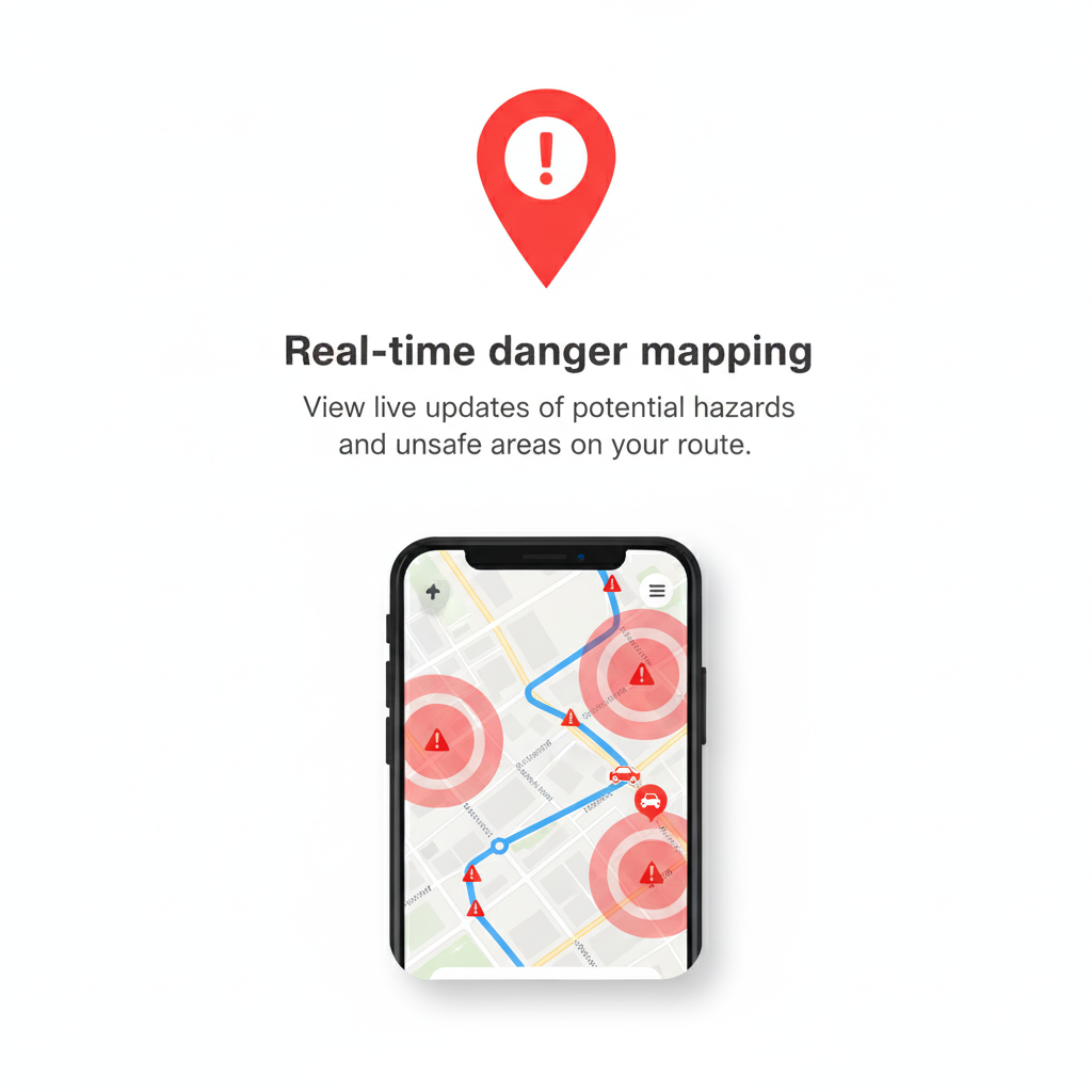
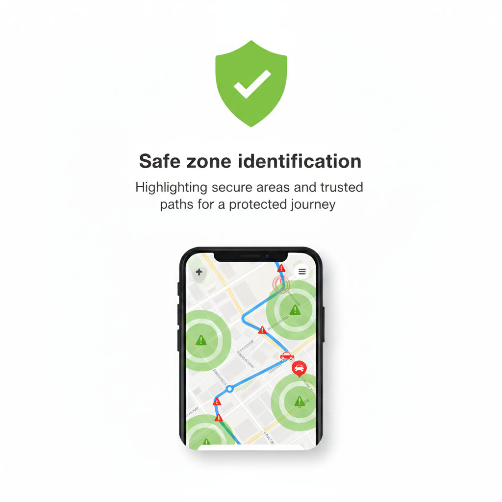
Community Intelligence: Drop markers anywhere on the map. Is that street blocked by debris? Mark it as danger. Found a safe shelter? Drop a pin. Medical station nearby? Tag it. Everyone in the area sees these markers in real time, creating a living map of safe and dangerous zones that updates as the situation changes.
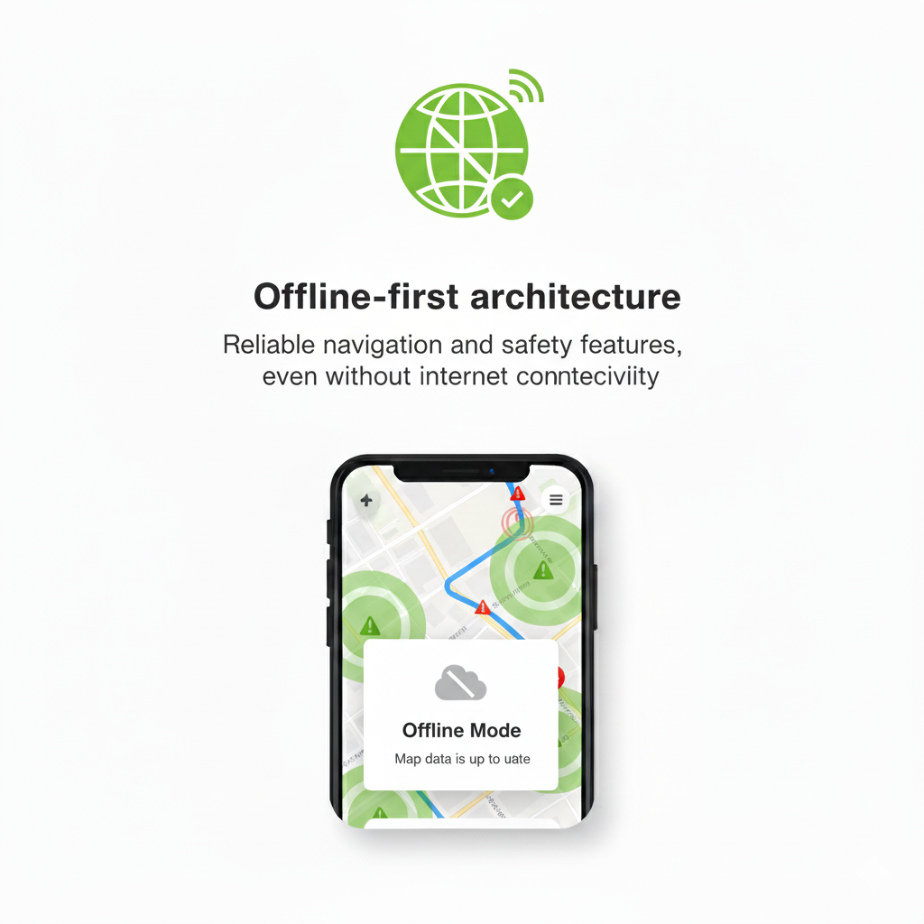
Smart Navigation: Create a trail to any location, and SafePath calculates your route but not just any route. It automatically detects and avoids danger zones you and others have marked. No more accidentally walking into a disaster area because your GPS didn't know better. If you're offline (because let's be real, networks fail when you need them most), it still works, routing you around known hazards using local data.
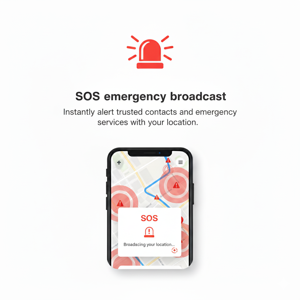
SOS System: Hit that SOS button and your location broadcasts to everyone nearby. People can see you need help, track how many responders are coming, and navigate directly to you. And if you're the helper? You can respond to someone's SOS, and they'll see you're on your way. There's even an SOS flashlight for when screaming for help isn't an option.
Works When Everything Else Doesn't: The mobile app stores everything locally. No internet? No problem. Keep marking danger zones, creating trails, responding to SOS alerts. When connectivity comes back, everything syncs automatically. You're never stranded without critical information.
How we built it
React Native and TypeScript for both mobile and web, so people can access SafePath however they need to. MapTiler and OpenStreetMap provide the mapping foundation because proprietary maps can fail when infrastructure goes down. The native apps use SQLite for local storage, and Supabase handles real-time sync when online. OpenRouteService calculates smart routes that factor in danger zones, with a fallback offline routing system using geometric calculations when the network is gone.
Challenges we ran into
Making offline routing work was brutal. You can't just draw a straight line when there are danger zones in the way. I had to implement geometric calculations to detect when a route intersects a danger zone, then calculate avoidance waypoints that route around it. Getting the math right, checking if a line crosses a circle, calculating perpendicular bearings, maintaining route efficiency took countless iterations... It's still a work in progress but we're getting there.
The real-time SOS system pushed me hard too. Proximity detection, responder tracking, cooldowns to prevent spam, handling concurrent responders, cleaning up orphaned responses when people lose connection there's so much state to manage. And it all has to work smoothly whether you're online with millisecond sync or completely offline queuing everything locally.
Accomplishments that we're proud of
We have a fully functional MVP that actually works. Not vaporware, not a prototype that breaks when you look at it wrong, a real app that handles the chaos it was built for. The offline mode is solid. The SOS system is responsive. The routing avoids danger zones intelligently. But more than that, I'm proud we built something that could genuinely save lives. That's not hyperbole. In a crisis, having accurate local intelligence and smart navigation could mean the difference between making it out or not.
What we learned
Crisis situations demand resilience at every level. Your app can't assume anything will work, not the network, not external APIs, not even consistent GPS. You have to build for failure. Graceful degradation isn't a nice-to-have; it's everything.
I also learned that real-time collaboration in high-stakes scenarios is incredibly complex. People need to trust the information they're seeing, but you can't verify everything. Implementing confidence scores, vote systems, and time-decay for marker relevance helped, but there's still a human element you can't fully engineer around.
What's next for SafePath
Offline Survival Library: A built-in guide covering first aid, disaster response, emergency signaling, finding clean water and practical knowledge that saves lives when Google isn't available. Searchable, offline, always accessible.
QR Code System: Generate QR codes for family members and close friends. Scan to instantly share locations and status. When networks are overwhelmed, QR codes still work.
Full Offline Mobile Support: Right now offline mode is native-only. I want the web version to have the same resilience. Service workers, IndexedDB, full offline functionality so anyone can use SafePath regardless of platform.
Enhanced Routing: Multiple route options (safest vs. fastest), real-time rerouting when new danger zones appear, and integration with elevation data to avoid areas prone to flooding or landslides.
Verification System: Let trusted organizations (Red Cross, local authorities) verify markers, giving people confidence in critical information during high-stakes situations.
SafePath isn't finished. But it's here, it works, and it's ready to help people when they need it most.
Built With
- maplibre
- maptiler
- openstreetmap
- react-native
- webview


Log in or sign up for Devpost to join the conversation.