-
-
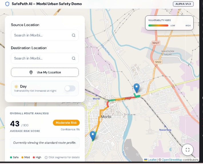
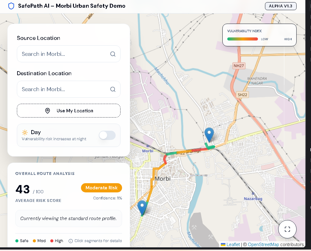
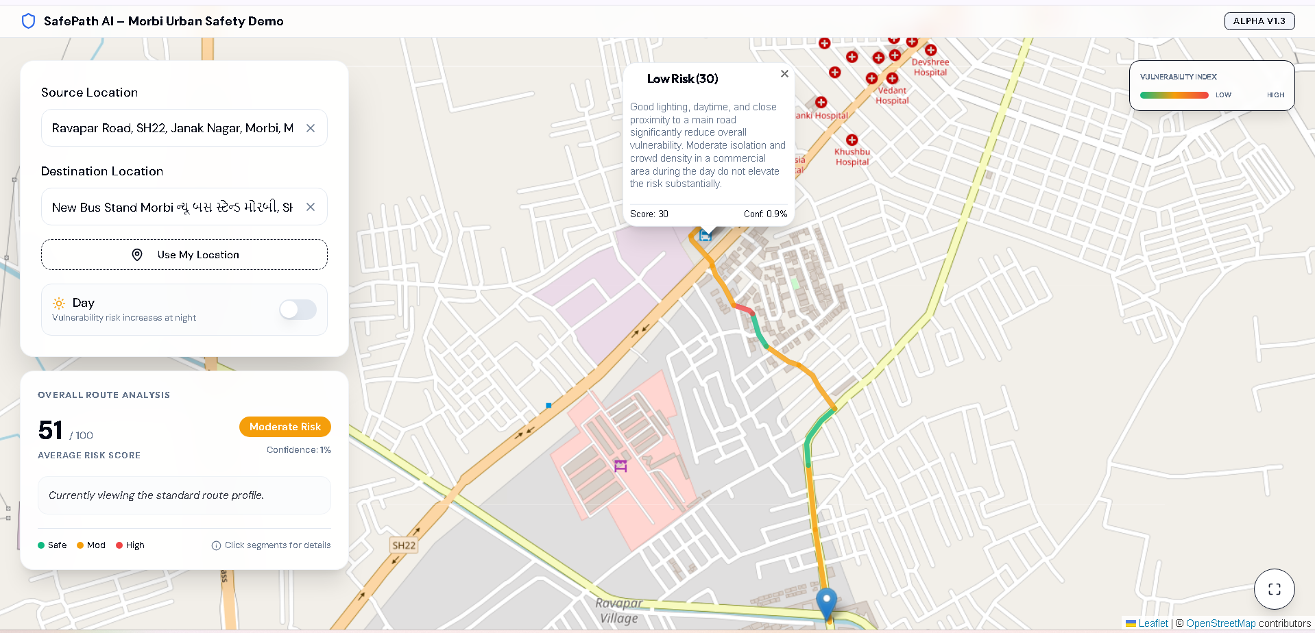
Day time Risk
-

Segment why risk
-

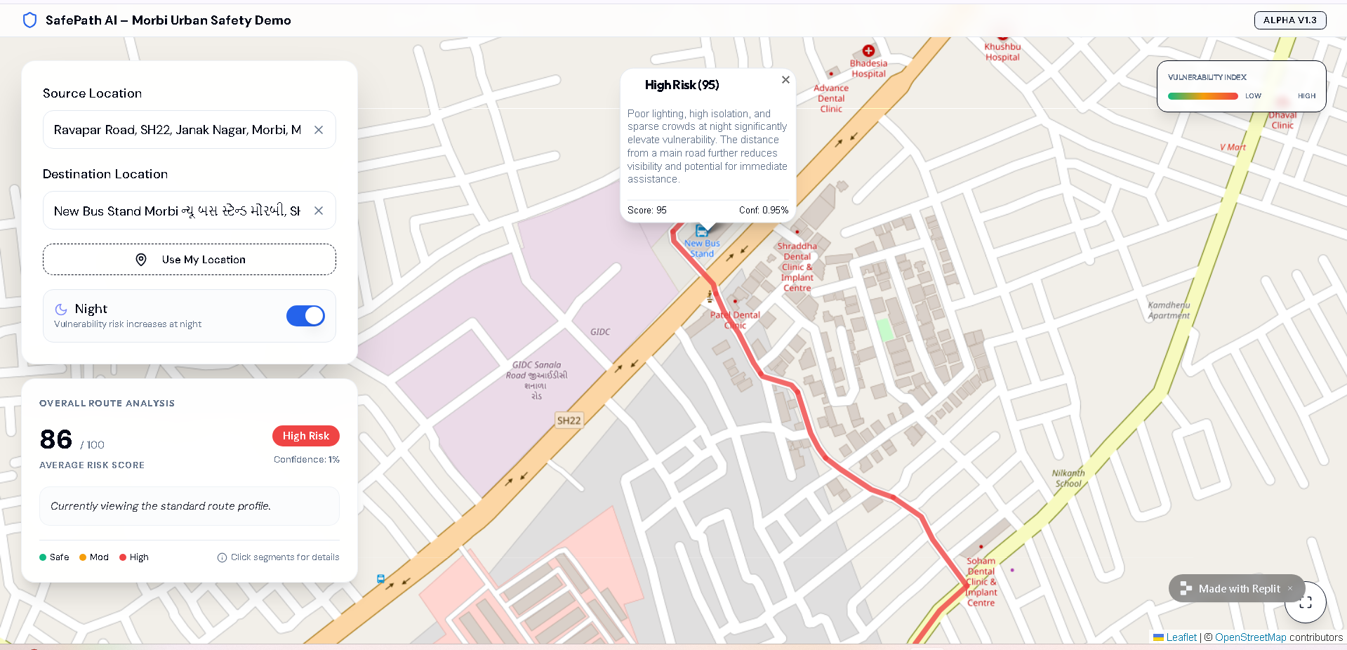
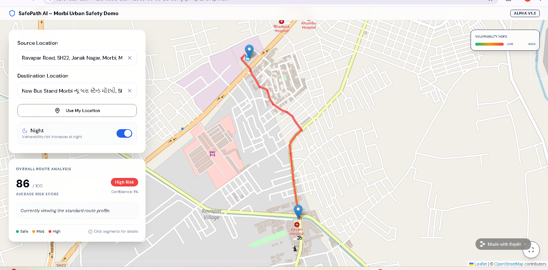
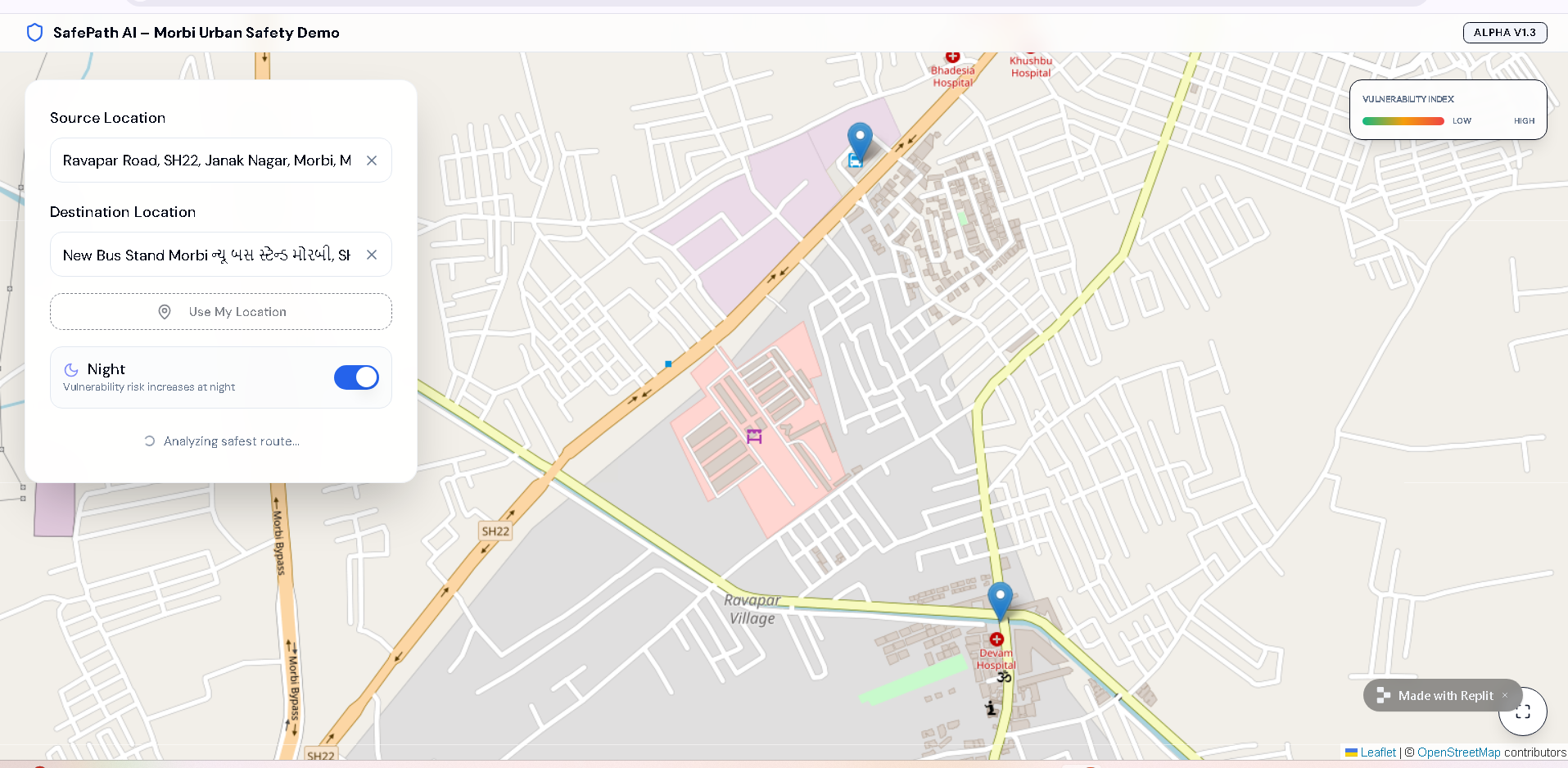
night time risk
-
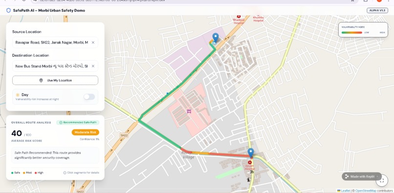
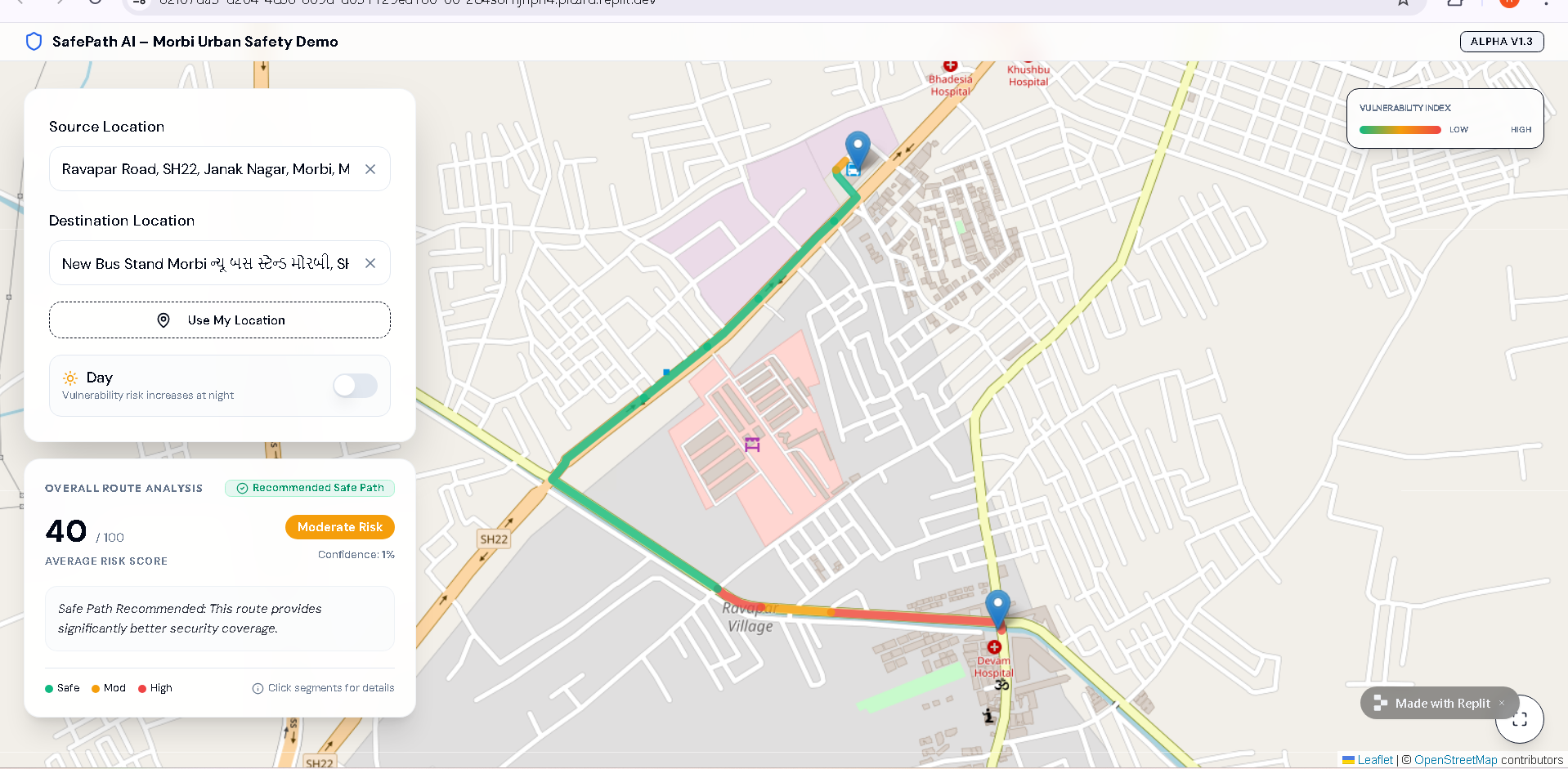
Safe path with color
-
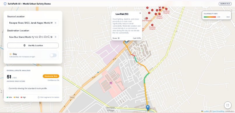
segment why high
-
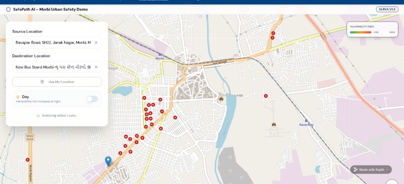
location selection
-

Analysis

🛡️ SafePath AI – Predict Danger. Prevent Crime. Protect Women.
💡 Inspiration
Navigation systems today optimize for speed and distance — not safety.
Women traveling through urban spaces often face environmental vulnerabilities such as poorly lit streets, isolated areas, and low pedestrian presence, especially at night. Yet modern navigation tools do not consider contextual safety when suggesting routes.
We asked a simple but powerful question:
What if maps could recommend the safest route instead of just the fastest?
SafePath AI was created to transform navigation into an AI-powered safety decision system.
We chose Morbi, Gujarat as a focused urban pilot to demonstrate practical and scalable real-world implementation.
🧭 What It Does
SafePath AI is an AI-powered urban safety routing assistant that:
- Allows users to select source and destination within Morbi
- Generates possible route options
- Calculates a vulnerability score (0–100)
- Classifies risk as Low, Moderate, or High
- Dynamically adjusts risk using Day/Night context
- Automatically recommends a safer alternative if available
- Provides explainable AI reasoning for each route segment
Instead of simply saying “go this way,” SafePath AI explains why a route may be vulnerable.
⚙️ How I Built It
SafePath AI combines mapping technology with AI-based contextual reasoning.
🗺️ Mapping Layer
- Leaflet.js for interactive maps
- OpenStreetMap (OSM) for geographic and routing data
- Route segmentation for granular safety analysis
🤖 AI Risk Modeling
We integrated Gemini AI to evaluate contextual vulnerability factors:
- Lighting conditions
- Isolation levels
- Crowd density
- Road type
- Time of day
Each route segment is analyzed by AI and returns:
- Risk score
- Risk category
- Confidence value
- Human-readable explanation
Overall route risk is calculated as:
$$ Route\ Risk = \frac{\sum_{i=1}^{n} Segment\ Risk_i}{n} $$
If an alternative route has significantly lower risk, it is highlighted as:
✅ Recommended Safe Path
The prototype is strictly restricted to Morbi’s urban boundaries to maintain realistic scope and deployment feasibility.
🚧 Challenges I Ran Into
1️⃣ Modeling Contextual Risk
There is no ready-made dataset that directly measures urban vulnerability.
We designed structured AI prompts to simulate contextual risk scoring responsibly.
2️⃣ Consistency in AI Output
Ensuring reliable and structured AI responses required careful prompt engineering and validation logic.
3️⃣ UX Clarity
Safety insights must be immediately understandable. We implemented:
- Color-coded routes (🟢🟡🔴)
- Overall risk score panel
- Segment-level explanation popups
- Night mode risk adjustment
4️⃣ Responsible AI Design
We ensured:
- No personal profiling
- No crime prediction
- No surveillance-based modeling
SafePath AI evaluates environmental vulnerability — not individuals.
🏆 Accomplishments That I'm Proud Of
- Built a fully AI-integrated routing prototype
- Implemented dynamic Day/Night risk modeling
- Enabled explainable AI at segment level
- Created automatic safer-route recommendation logic
- Designed a clean, intuitive, safety-focused UI
Most importantly, we demonstrated how AI can meaningfully improve women’s urban safety.
📚 What I Learned
- AI can enhance everyday infrastructure tools like navigation.
- Explainability is critical in safety-focused AI systems.
- Responsible AI requires transparency and clear boundaries.
- Local pilot implementations can demonstrate scalable global impact.
Safety modeling requires contextual reasoning — not just raw data.
🚀 What's Next for SafePath AI
SafePath AI is designed to scale.
Future directions include:
- Integration with real-time lighting datasets
- Smart CCTV density modeling
- Urban vulnerability heatmaps
- Government safety dashboards
- Multi-city deployment
- Mobile app development
- Community-reported risk updates
Our long-term vision:
Transform navigation from efficiency-first to safety-first.
SafePath AI is not just a routing tool —
it is a step toward intelligent, responsible AI-powered urban safety systems.
Built With
- ai
- api)
- apis
- cloud
- css3
- deployment)
- development
- es6+)
- express.js
- gemini
- generative
- html5
- javascript
- leaflet.js
- node.js
- openstreetmap
- replit
- rest


Log in or sign up for Devpost to join the conversation.