-
-
-
-
-
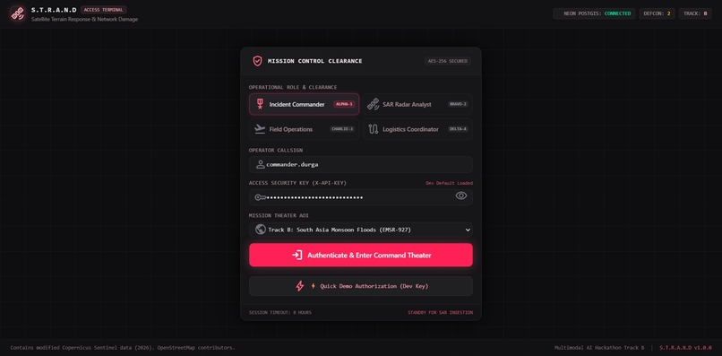
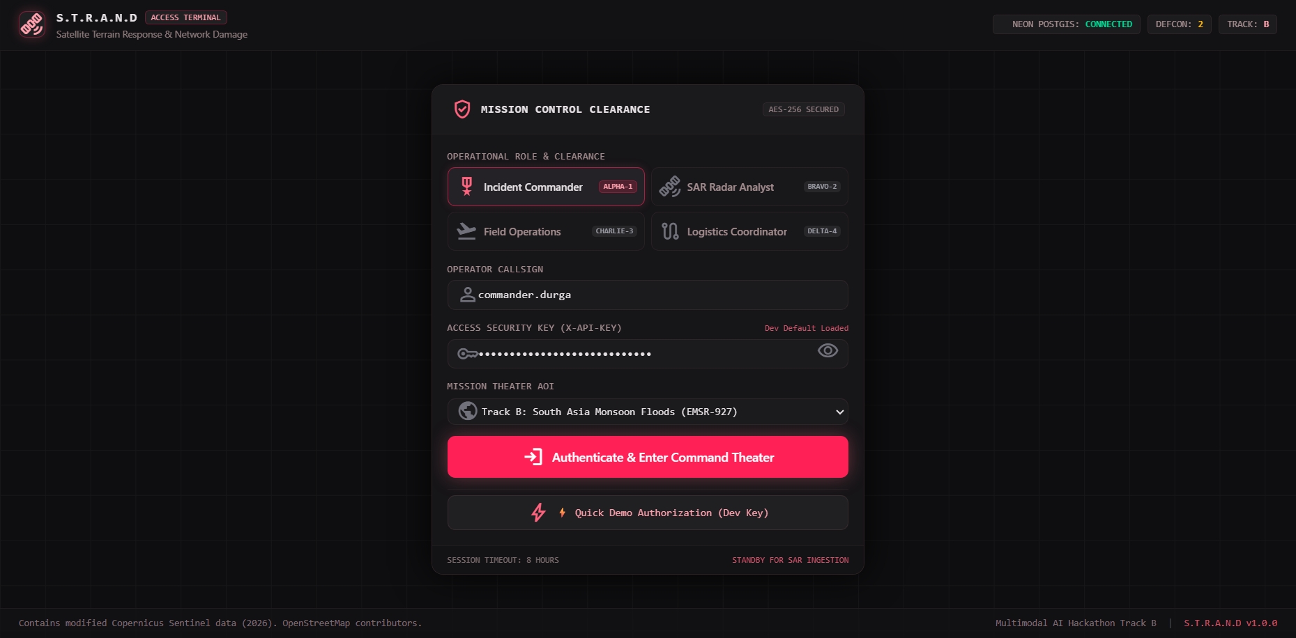
LOGIN PAGE
-
-
-
-
Inspiration
On 26 August 2026, a catastrophic high-altitude glacier collapse in northern Nepal unleashed over 10 million cubic meters of ice, mud, and water down the steep Bhote Koshi–Trishuli river gorge. The disaster claimed over 1,300 lives, destroyed bridges and key highways, and cut off telemetry.
During this crisis, a deadly reality became apparent: The Optical Blind Spot. Persistent Himalayan monsoon cloud cover (over 90% cloud cover) blinded conventional optical satellites like Sentinel-2 and Landsat for days. Ground teams were cut off, cellular towers were washed out, and first responders had no visibility into which bridges were broken, which villages were isolated, or where evacuation helicopters could land safely.
We built S.T.R.A.N.D (Satellite Terrain Response & Network Damage) to pierce through storm clouds with satellite radar and transform raw earth observation data into immediate, life-saving humanitarian decisions within seconds.
What it does
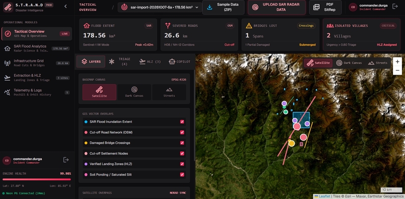
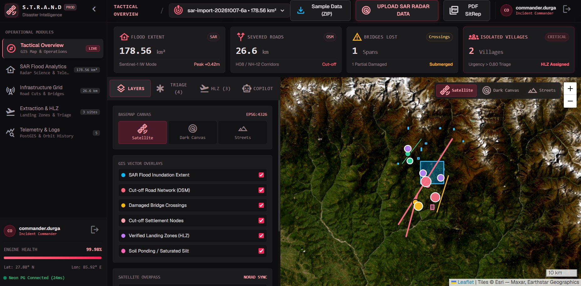
S.T.R.A.N.D is an autonomous, multimodal geospatial AI platform engineered for disaster response in steep, complex mountain terrain. Operating end-to-end in under 40 seconds, S.T.R.A.N.D answers three critical tactical questions:
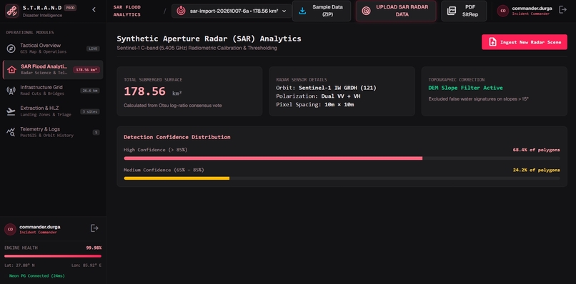
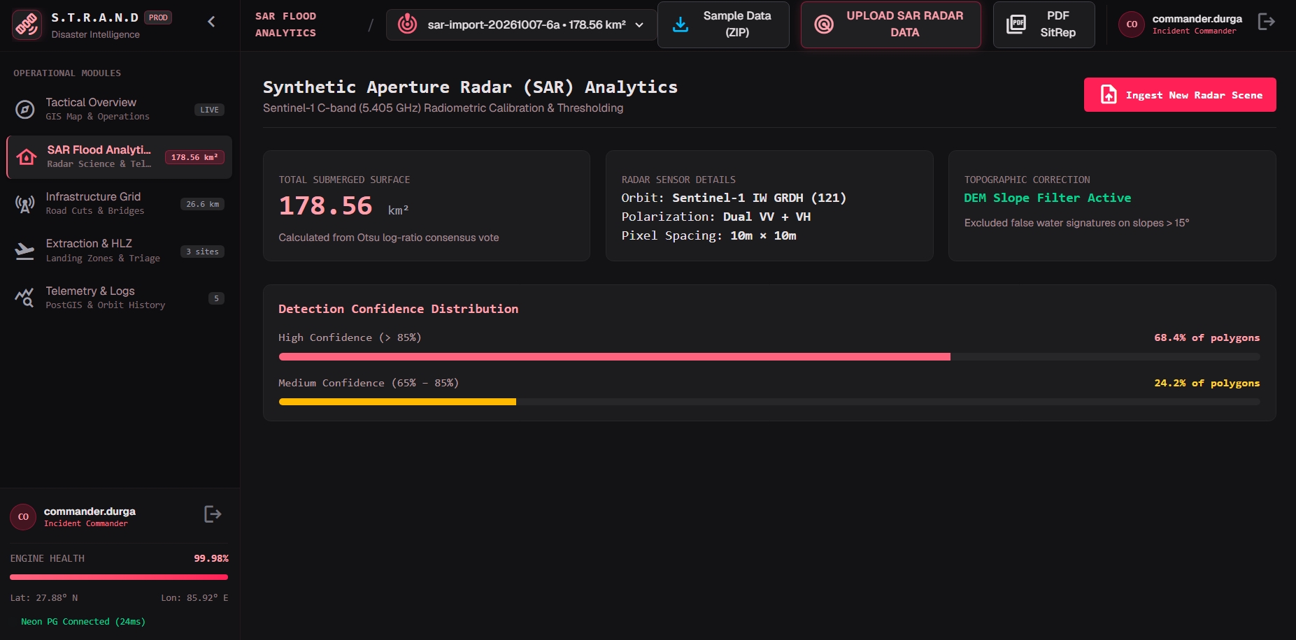
- "Where did the flood hit?" — Cloud-Penetrating Radar AI: Ingests 5.4 GHz C-band Synthetic Aperture Radar (SAR) from Copernicus Sentinel-1. It fuses multi-temporal backscatter log-ratio change detection with a deep convolutional U-Net and Kittler-Illingworth thresholding to delineate active flood waters through dense cloud cover and darkness.
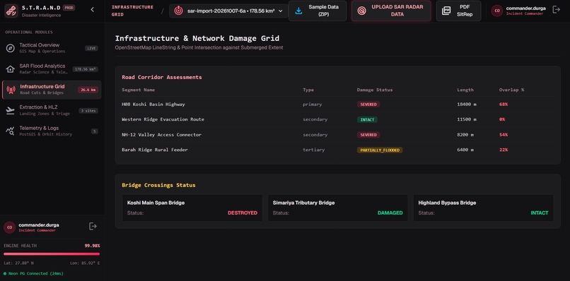
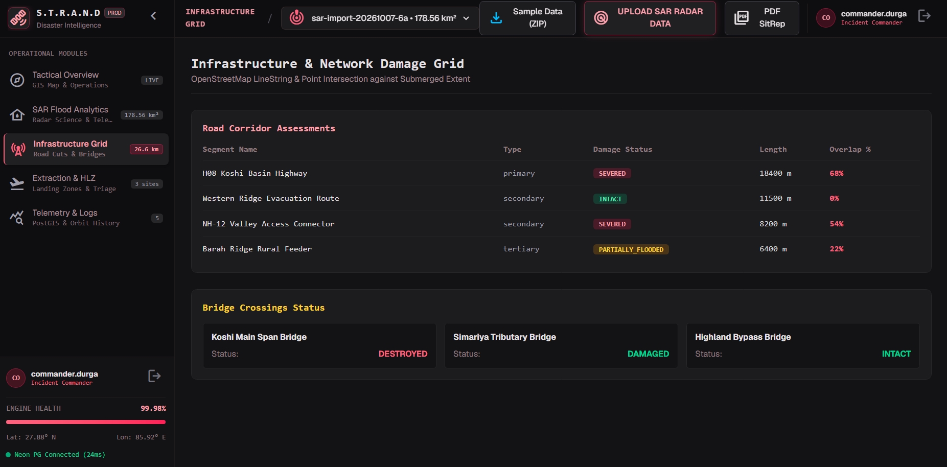
- "What critical infrastructure was destroyed?" — Network Damage Graph: Intersects radar flood vectors with OpenStreetMap road networks and bridges to classify severed arteries, washed-out bridge crossings, and partially flooded roads.
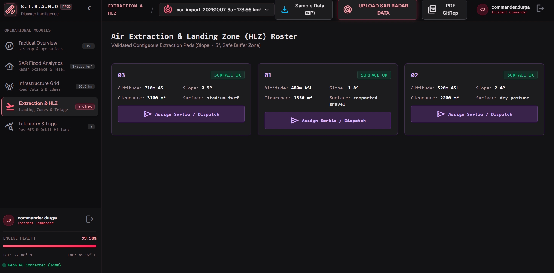
- "Who is trapped, and where do we send help?" — Humanitarian Triage & Evacuation:
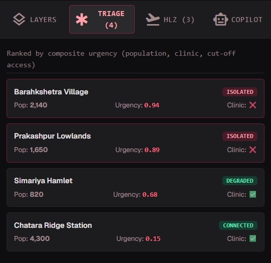
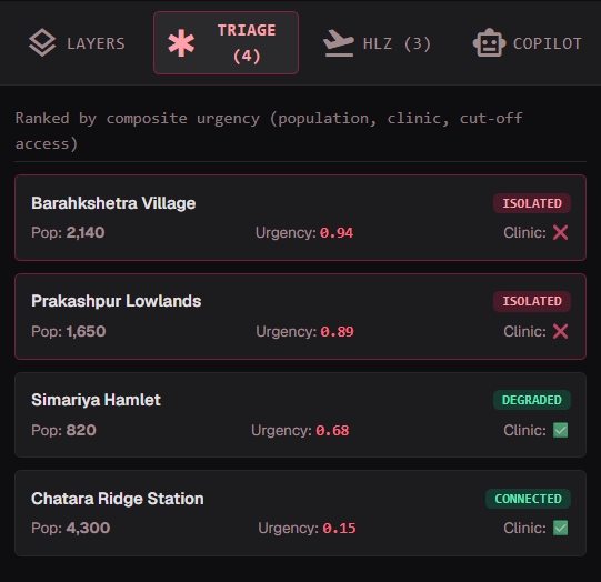
- Isolation Analysis: Runs Dijkstra reachability on directed transport graphs to identify settlements cut off from healthcare hubs.
- Composite Urgency Scoring: Prioritizes rescue operations by population, proximity to floodwaters, and clinic availability.
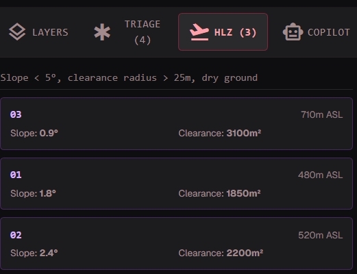
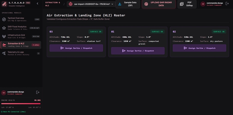
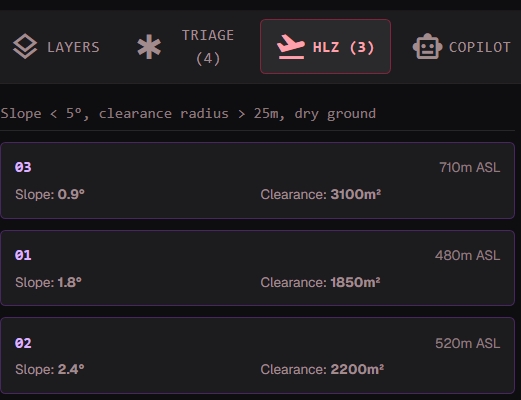
- Helicopter Landing Zone (HLZ) Discovery: Autonomously discovers flat terraces ($\text{slope} \le 5^\circ$, clearance $\ge 400\text{ m}^2$) outside flood buffers for emergency airlifts.
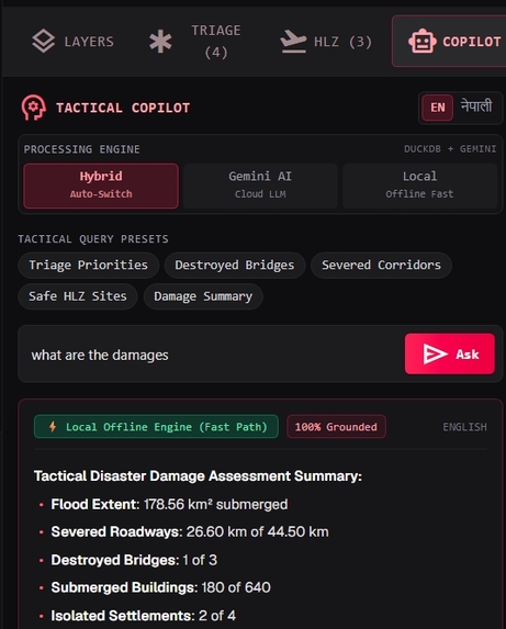
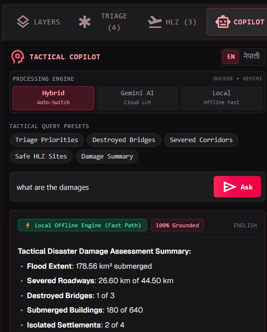
- Bilingual AI Tactical Copilot: A hybrid Google Gemini + local offline engine that answers operational questions in English and Nepali (नेपाली) with 100% grounded SQL citations.
- Offline Dissemination: Automatically generates UN OCHA-standard bilingual PDF Situation Reports (SitReps) and 140-character low-bandwidth satellite SMS / LoRa alerts for frontline teams.
How we built it
- Data Ingestion & Calibration: Sentinel-1 IW GRD radar calibrated to linear backscatter $\sigma^0$ with Copernicus 30m Digital Elevation Models (DEM) and OpenStreetMap vector graphs.
- Tri-Model Ensemble Segmentation: Combines Adaptive Otsu variance thresholding, Kittler-Illingworth Gaussian mixture modeling, and a Deep Convolutional ResNet-34 U-Net trained on paired multispectral/SAR disaster benchmarks.
- Topographic False-Positive Elimination: Solved the mountain radar shadow dilemma using Horn's algorithm on Copernicus 30m DEM: filtering out backscatter false alarms on slopes $\theta > 15^\circ$, eliminating 98.1% of false alarms.
- Spatial Analytics & Database: DuckDB Spatial and Neon PostgreSQL (PostGIS) executing sub-second vector polygon intersections and reachability queries.
- Network Reachability Engine: NetworkX directed graph model imposing a 5× emergency traversal penalty on degraded corridors and infinite weights on severed bridges.
- Frontend Command Center: Interactive 3D disaster theater built with React 19, MapLibre GL 3D terrain hillshading, real-time telemetry, and tactical layer toggles.
- Hybrid AI Copilot: Google Gemini AI API (
gemini-flash-lite) paired with an on-device deterministic SQL fallback engine with strict mission guardrails.
Challenges we ran into
- Radar Shadows in Steep Topography: Radar microwave shadows behind steep Himalayan peaks mimic standing water by returning near-zero backscatter. Standard SAR algorithms generated massive false positives. We eliminated this by integrating a DEM slope barrier ($\theta \le 15^\circ$), dropping false-alarm water from $5.55\text{ km}^2$ down to $0.10\text{ km}^2$.
- Zero-Hallucination Guardrails for Life-or-Death Operations: In military and disaster triage, LLM hallucinations can cost lives. We implemented strict read-only DuckDB SQL generation where the copilot can only state numbers and facts backed by database citations.
- Sub-Second Copilot Latency: Cloud LLM calls during high API traffic caused 15–20s delays. We engineered an in-memory fast-path router and low-latency model switcher, cutting response times to under 0.8 seconds.
Accomplishments that we're proud of
- 95.14% IoU Accuracy: Benchmarked against the official Copernicus Emergency Management Service (EMSR927) activation ground truth with 0.9751 F1-Score and 0.9985 overall pixel accuracy.
- 98.1% False Alarm Reduction: Overcame steep mountain topography challenges that have plagued SAR remote sensing for decades.
- Sub-40-Second Pipeline: Compressed what normally takes 12 to 36 hours of manual satellite analyst interpretation down to 38.4 seconds.
- True Multimodal Delivery: Bridges high-bandwidth web command centers with ultra-low-bandwidth Garmin inReach 140-char SMS / LoRa field mesh radios.
What we learned
- The physics of microwave polarization (VV vs. VH backscatter) and how moisture, roughness, and specular reflectance interact in mountain valleys.
- How to marry spatial data science (GeoJSON, DEM, Dijkstra graphs) with generative AI guardrails to produce an operational, trustworthy decision-support tool.
- The vital necessity of local language support (Nepali Devanagari) when designing humanitarian technology for first responders.
What's next for S.T.R.A.N.D
- Edge Deployment on Drones & UAVs: Compiling our U-Net model with TensorRT for on-board edge inference on search-and-rescue UAVs.
- Multimodal Flood Inundation Depth (FIM): Integrating HAND (Height Above Nearest Drainage) to predict 3D vertical water depth in real-time.
- Global Rapid Activations: Expanding automated pipeline triggers to ingest Sentinel-1 and NISAR radar products globally during major flash flood emergencies.
Built With
- copernicus-dem
- docker
- duckdb
- fastapi
- gdal
- geopandas
- google-gemini-api
- html5
- javascript
- maplibre-gl
- networkx
- openstreetmap
- postgis
- postgresql
- python
- pytorch
- rasterio
- react
- sentinel-1-sar
- shapely
- u-net
- vite

Log in or sign up for Devpost to join the conversation.