-
-
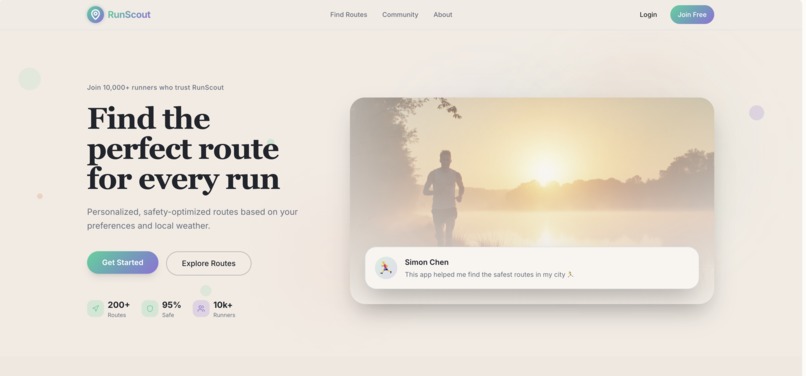
Main Page
-
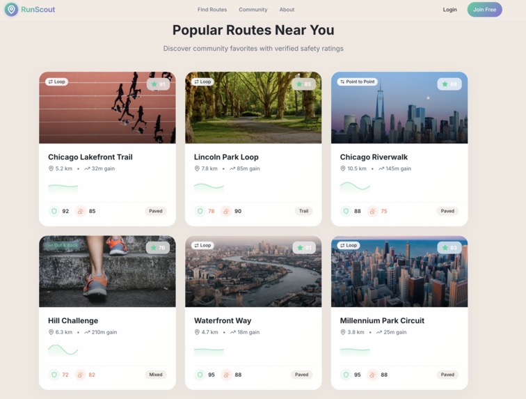
Community
-

Footpage
-
Function 1
-

Function 2
-
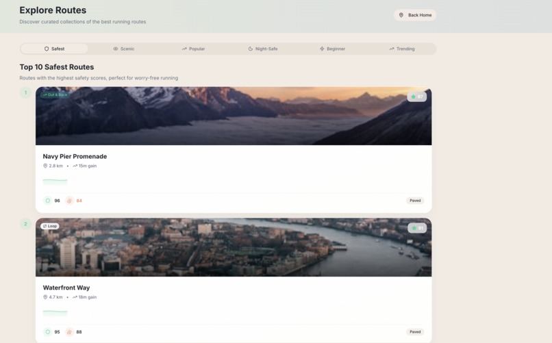
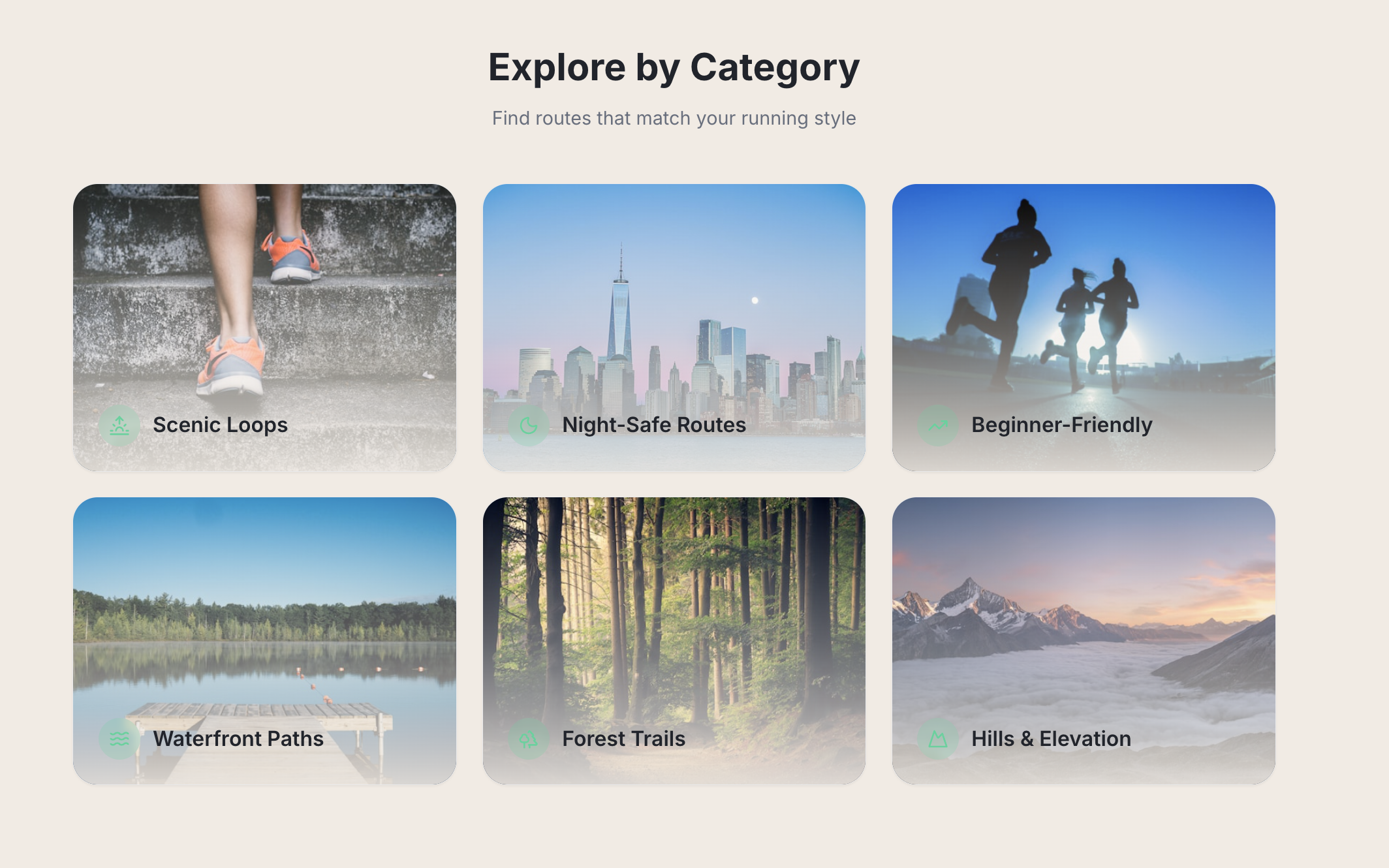
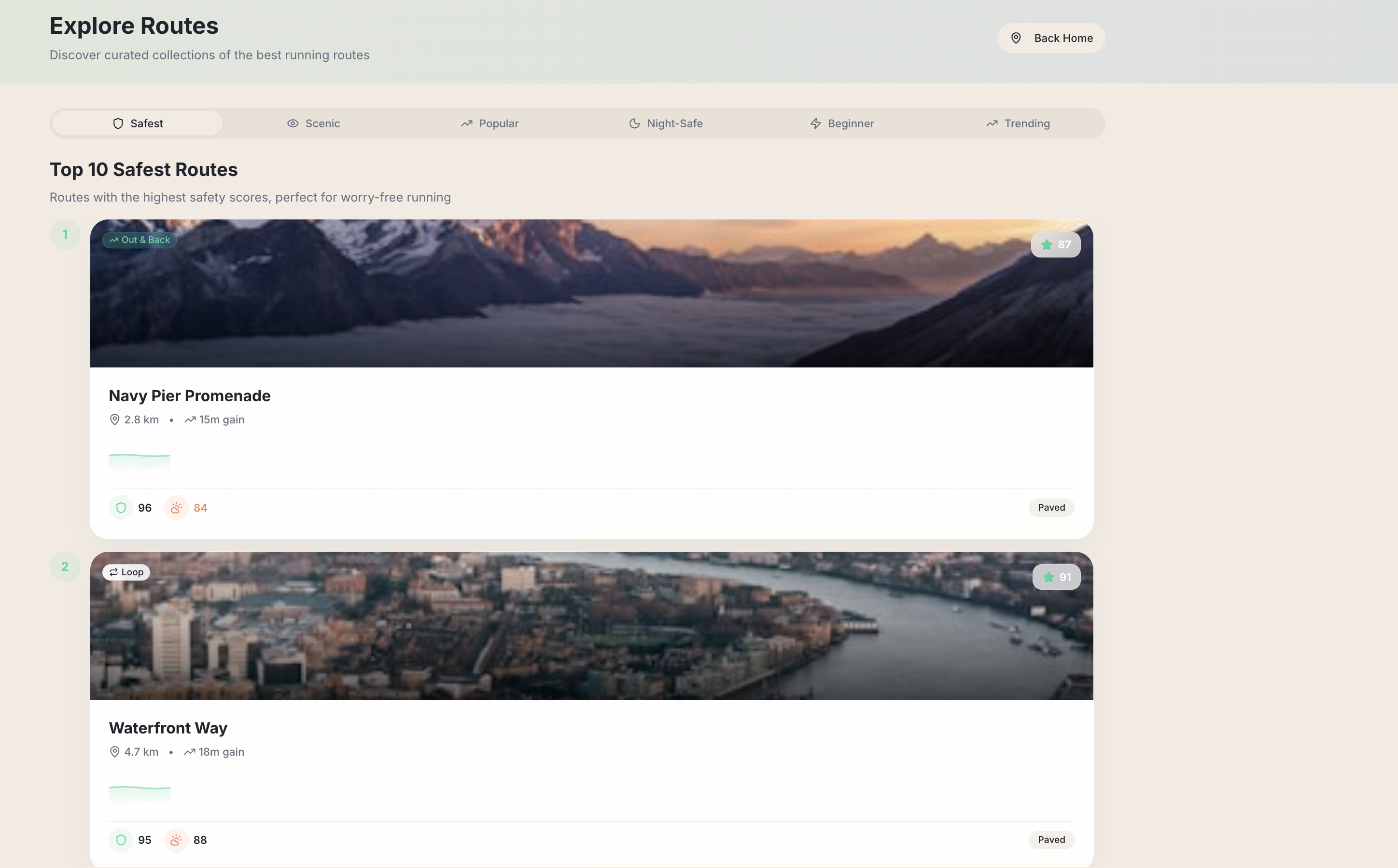
Explore
Inspiration
During countless early-morning and late-night runs in Chicago, we encountered a persistent issue: finding a running route that feels safe, well-lit, and suitable for the day’s fitness goals is surprisingly difficult. Traditional map apps only provide directions, failing to address the questions runners truly care about: Traditional map apps give directions—but they never answer the questions runners actually care about:
Is this route well-lit at night? Will there be enough people around to feel safe? Is the surface asphalt, gravel, or trail? Are there water fountains or restrooms nearby? How does today’s weather change which route is ideal?
That gap became the spark for RunScout—a smarter, safety-aware running companion built to help people run with confidence anywhere.
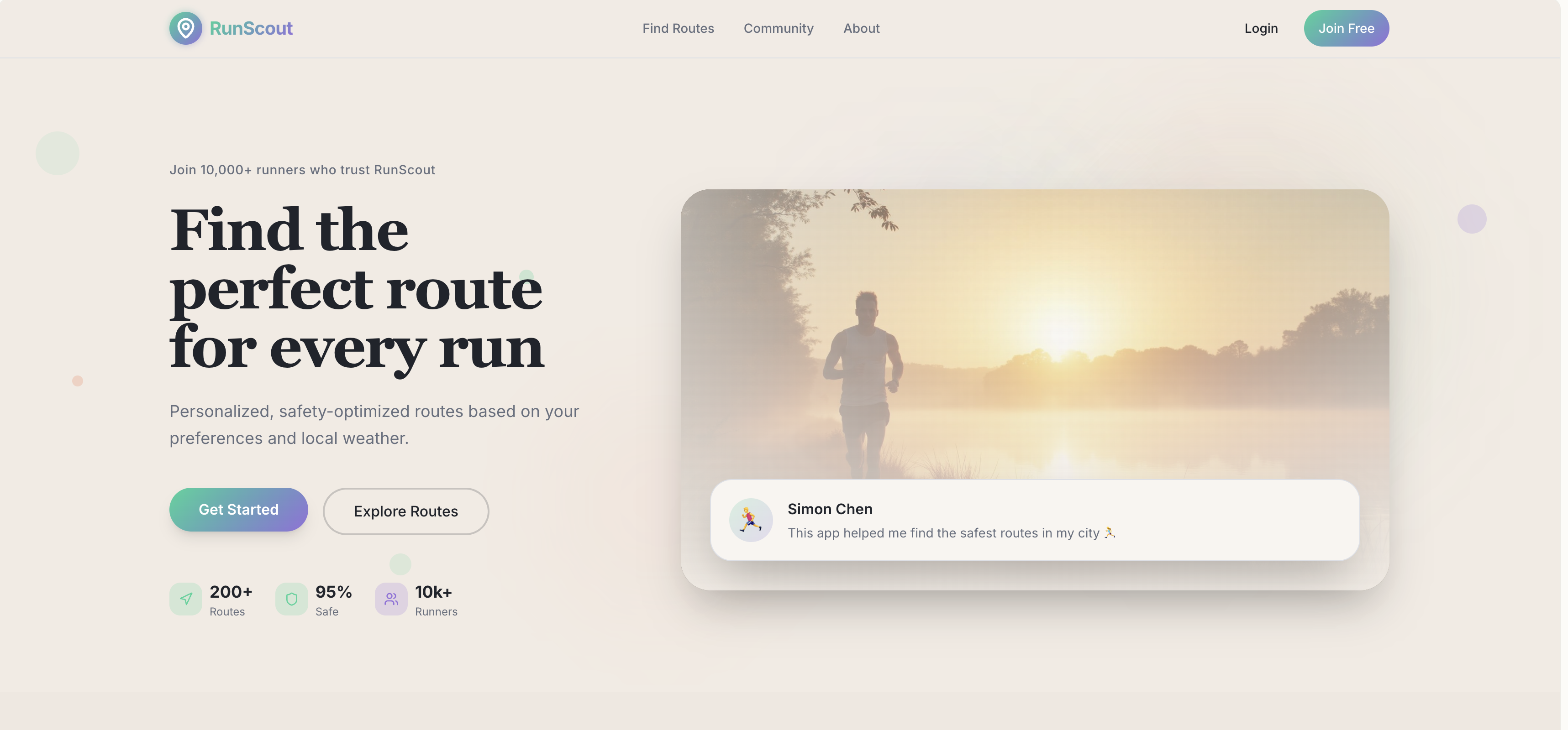
What it does
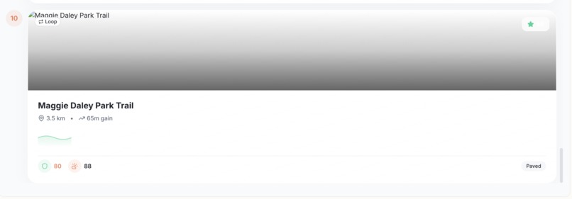
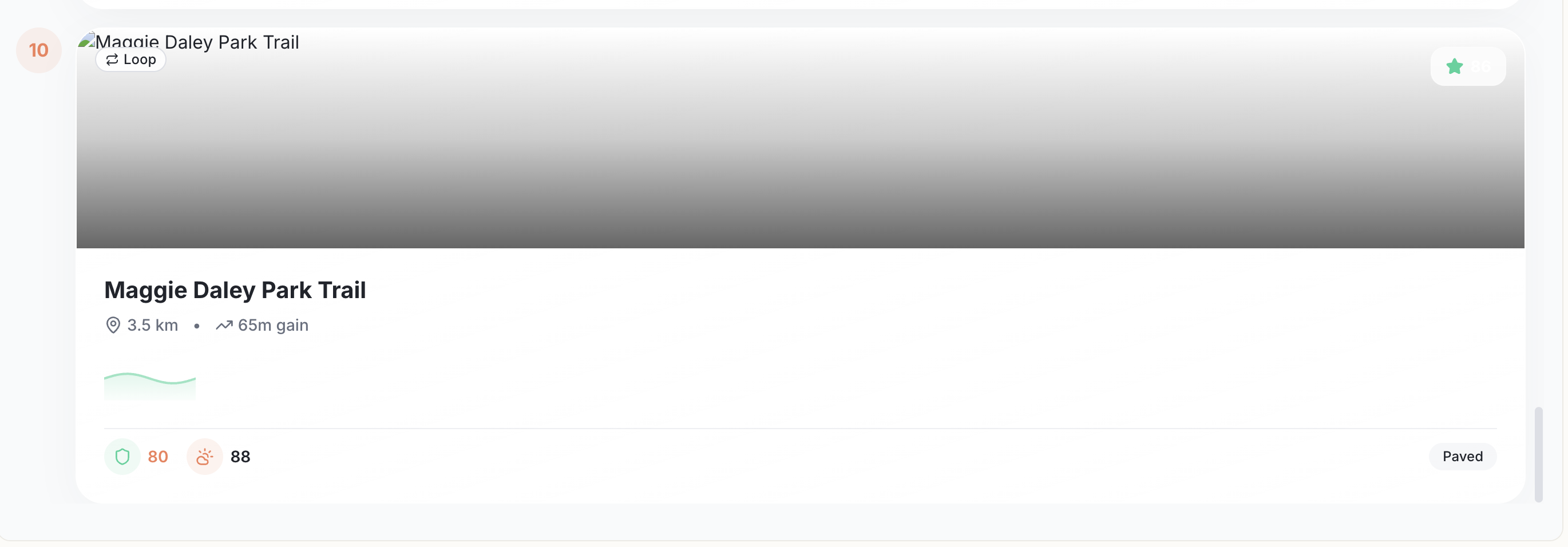
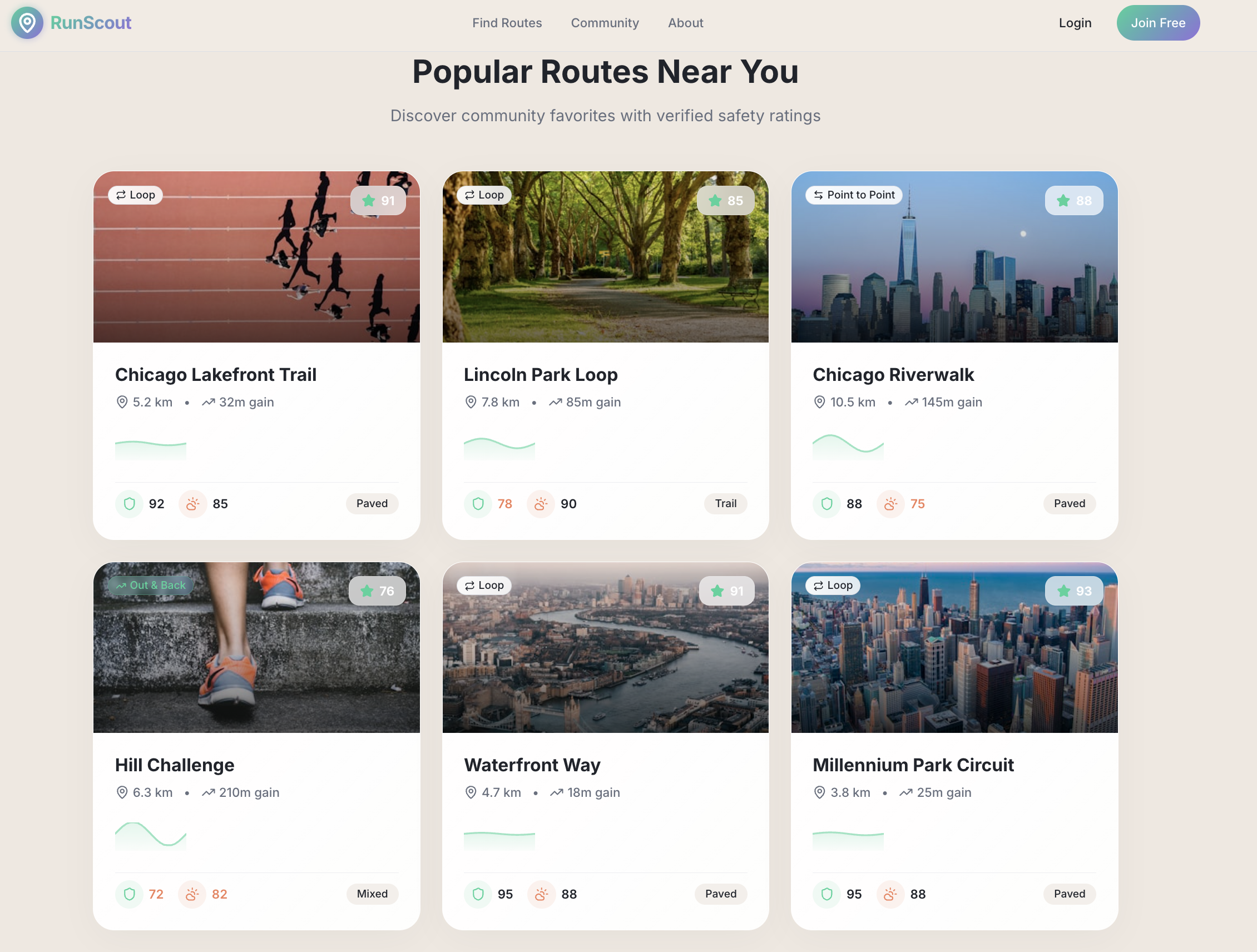
RunScout helps people discover the best possible running route for their needs by combining: Safety indicators (lighting, foot traffic, crime proxy signals) Weather-adjusted comfort scoring Terrain & elevation preferences Surface type (trail, paved, mixed) User-based community ratings & comments Beautiful visual route previews + photos One-tap navigation via Google/Apple Maps It’s designed for: Runners in new cities Night runners who need safe routes Training-focused runners who need specific elevation Travelers who want reliable, scenic paths Beginners who simply want a trustworthy route
How we built it
We built RunScout as a high-fidelity Lovable MVP with: Data & Intelligence OpenStreetMap + custom GIS filtering for runnable road segments
Weather API (Open-Meteo) for real-time comfort scoring
Custom scoring model blending distance fit, lighting, elevation, surface, and weather
Optional community layer for ratings & comments
Auto-suggested “Top Picks” and “Most Popular” routes
Frontend Responsive web UI built in Lovable
Apple-inspired aesthetic with soft gradients, smooth animations, interactive map
Photo-rich route cards with elevation curves & safety icons
Backend Logic Route scoring algorithm (linear interpretable model) Mock dataset + dynamic filtering based on user preferences Integrated Google Maps deep linking for navigation
Challenges we ran into
1.Designing realistic routes that looked natural on real maps 2.Making the UI visually premium while staying performant 3.Getting the scoring model to feel “human-like” rather than arbitrary 4.Making weather & safety components meaningful and intuitive 5.Creating photo-based previews representative of actual route types
Accomplishments that we're proud of
1.Built a fully interactive running-route assistant 2.Created a visually polished, fitness-inspired UI 3.Developed a clear, interpretable scoring model 4.Integrated safety, surface, terrain, and weather factors 5.Added community elements to build trust 6.Delivered a smooth flow from preferences → recommendations → navigation
What we learned
1.How to merge spatial data, weather data, and user preferences into one experience 2.How to design a consumer product that balances safety, usability, and delight 3.How to structure a data-driven recommendation model that users can trust 4.How important micro-interactions, photos, and visual clarity are for a running app 5.That even a simple MVP can feel magical with the right UX polish
What's next for RunScout – AI-Powered Safe & Personalized Running Routes
RunScout – AI-Powered Safe & Personalized Running Routes will grow into a full ecosystem:
- Real route generation (OSRM / Valhalla) Automatically build custom loops of exact length (3km/5km/10km).
- More advanced safety Crowdsourced hazard reports, real lighting density, real crime map APIs.
- Runner Profiles & Health Stats Weekly mileage, pace trends, recovery insights, and personalized route suggestions.
- Social features Local running clubs, group routes, achievement badges.
- AI Coach Chat-based running assistant that suggests routes + training plans.
- Mobile App A full iOS/Android version with offline mode for traveling runners.
Built With
- ai-powered
- api
- custom
- interactive
- lovable
- maps
- matching
- open-meteo
- openstreetmap
- python/js
- scoring


Log in or sign up for Devpost to join the conversation.