Inspiration
Bad roads cause thousands of accidents and vehicle damage every year in Indian cities. Reporting a pothole today means filing a manual complaint, and authorities rarely know which stretches are the worst. We wanted reporting to be automatic, so every commuter's camera becomes a road-inspection tool.
What it does
RoadSense AI turns dashcam or phone video into live road-damage reports:
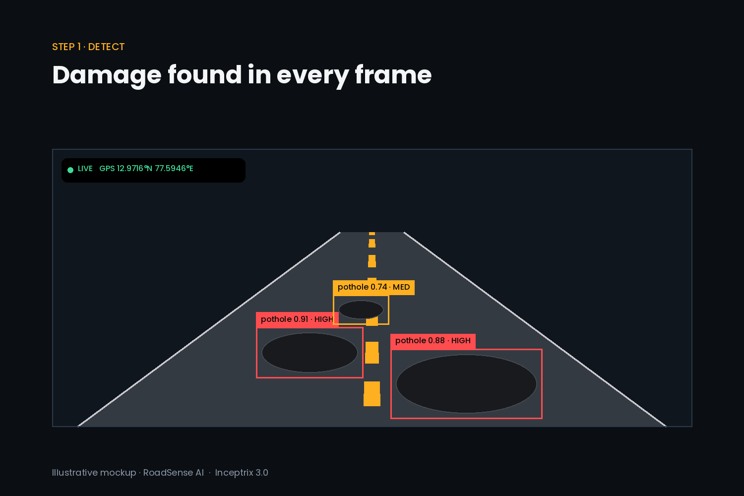
- Detects potholes, cracks and damaged road surfaces from video
- Tags each detection with GPS location and a severity score
- Removes duplicate reports of the same damage
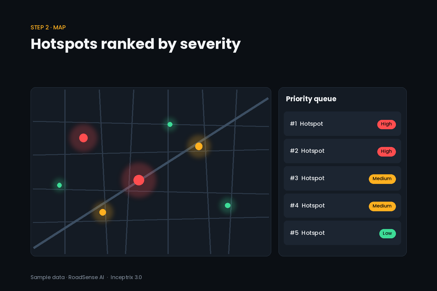
- Shows all reports on a live city map with hotspots ranked by priority
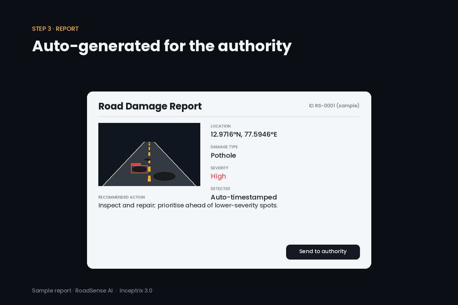
- Generates a ready-to-send report for the municipal authority
How we built it
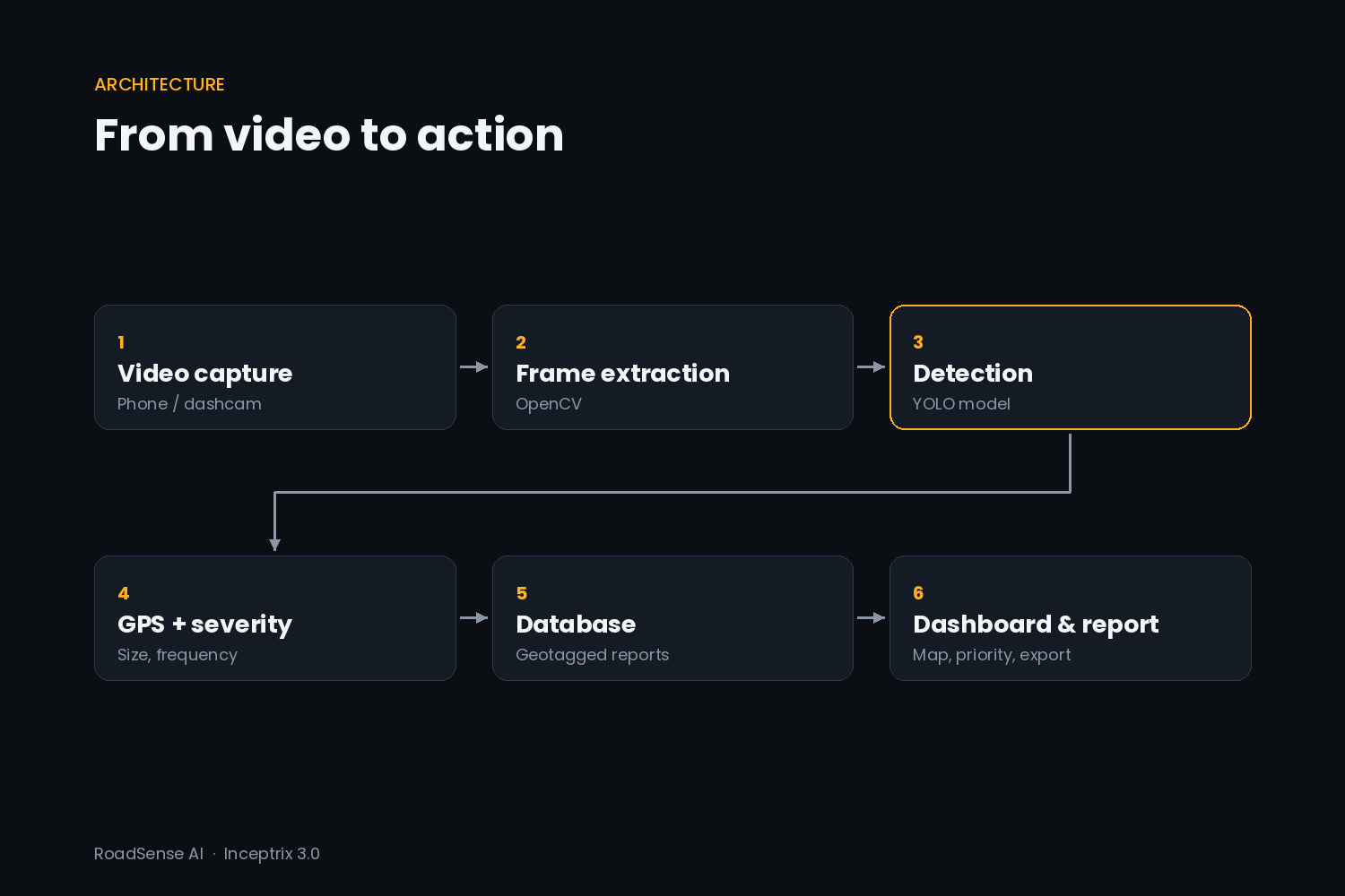
- A YOLO-based computer vision model trained on public road-damage datasets detects damage frame by frame
- A FastAPI backend processes uploads, attaches GPS data and calculates severity from damage size and frequency
- Reports are stored in a database and shown on a web dashboard with an interactive map
- A mobile-friendly capture page lets any user record and upload a drive
Challenges we ran into
- Detecting damage in low light, rain and shadows
- Avoiding duplicate reports when many vehicles pass the same pothole
- Keeping GPS locations accurate while the vehicle is moving
Accomplishments that we're proud of
A working end-to-end pipeline: video in, geotagged and ranked damage reports out.
What we learned
How to train and tune detection models on real-world data, and how much data quality matters more than model size.
What's next for RoadSense AI
- On-device detection that works offline
- Direct integration with city complaint portals
- Predicting which roads will deteriorate next so repairs can be planned early
