-
-
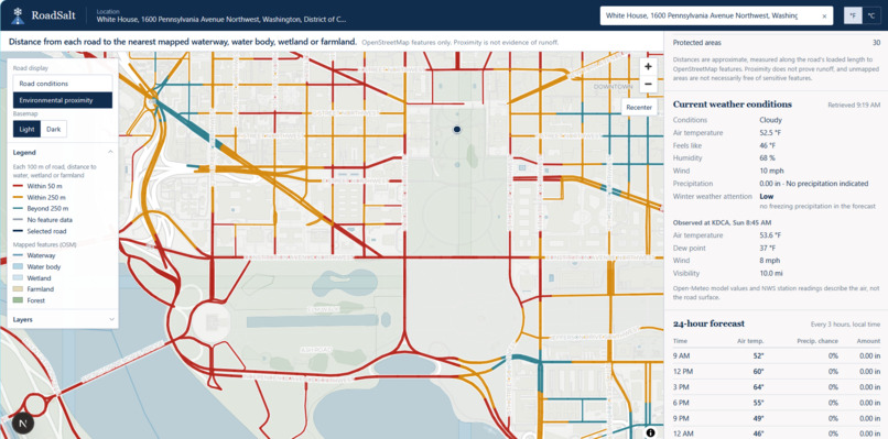
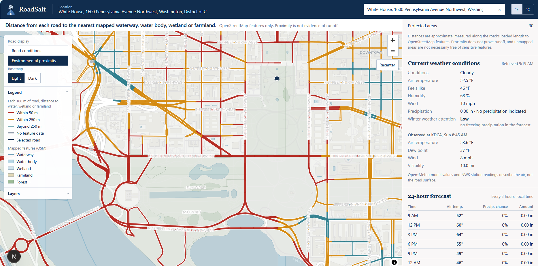
RoadSalt maps the roads around the White House and shows which ones run close to water and where winter salt runoff could end up.
Inspiration
Road salt doesn't disappear when it melts. It washes into streams, wetlands and farms. We wanted crews to see where it goes.
What it does
RoadSalt maps the roads closest to nature, so crews can keep people safe without hurting the water.
How we built it
A live web map that combines real weather, road alerts and nature data, plus AI tips for each road.
Challenges we ran into
Our first map data source kept failing, so we rebuilt it to read nature data straight from the map itself. The current government mapping systems had similar features where they assign runoff value to the road, but doesn't take into account the portions of the roads. We built a feature to break the roads into 100 meter segments for a clearer picture.
Accomplishments that we're proud of
Every number is real. No fake data, ever.
What we learned
Being near a creek isn't proof of harm, and wording matters as much as code.
What's next for RoadSalt
Testing it with a real road crew during a real storm.
Built With
- carto
- claude
- eslint
- gemini
- github
- google-search-grounding
- iowa-environmental-mesonet
- maplibre
- maptiler
- national-weather-service
- next.js
- node.js
- open-meteo
- openstreetmap
- photon
- playwright
- react
- sqlite
- tailwindcss
- tomtom
- typescript
- vercel
