-
-
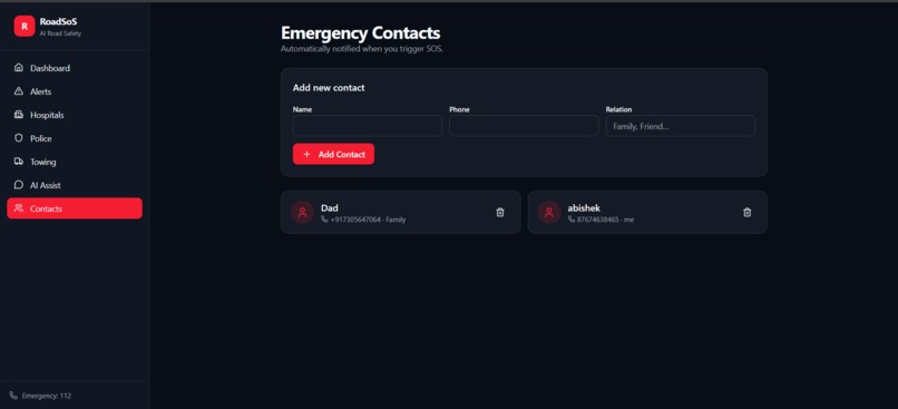
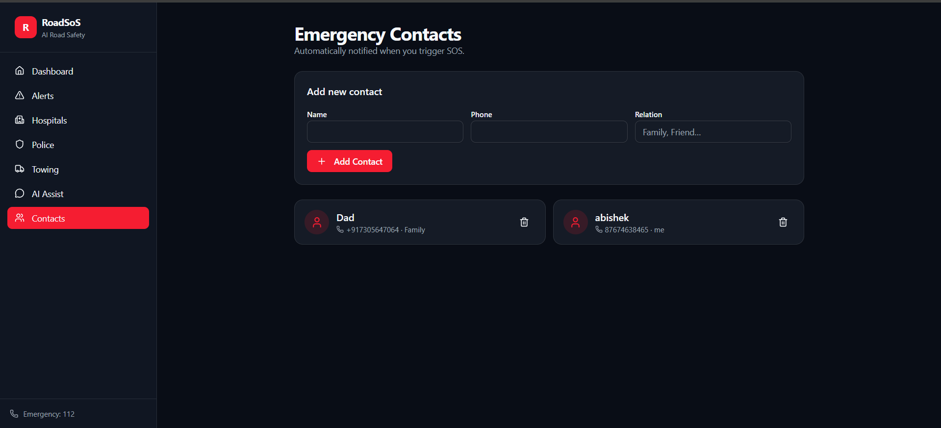
Emergency Contacts — family & friends auto-notified instantly when SOS is triggered. Add contacts by name, phone & relation.
-
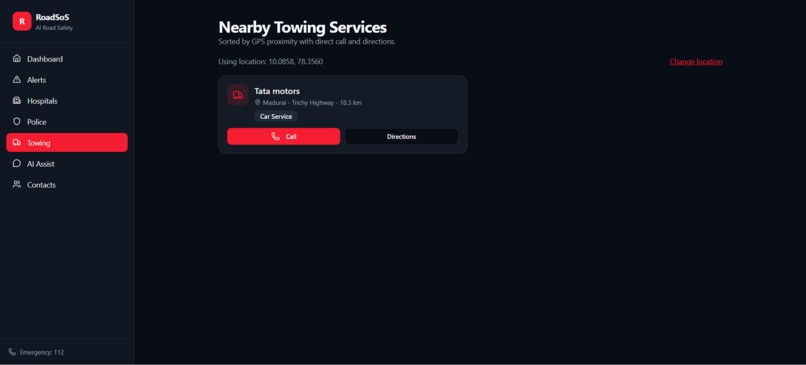
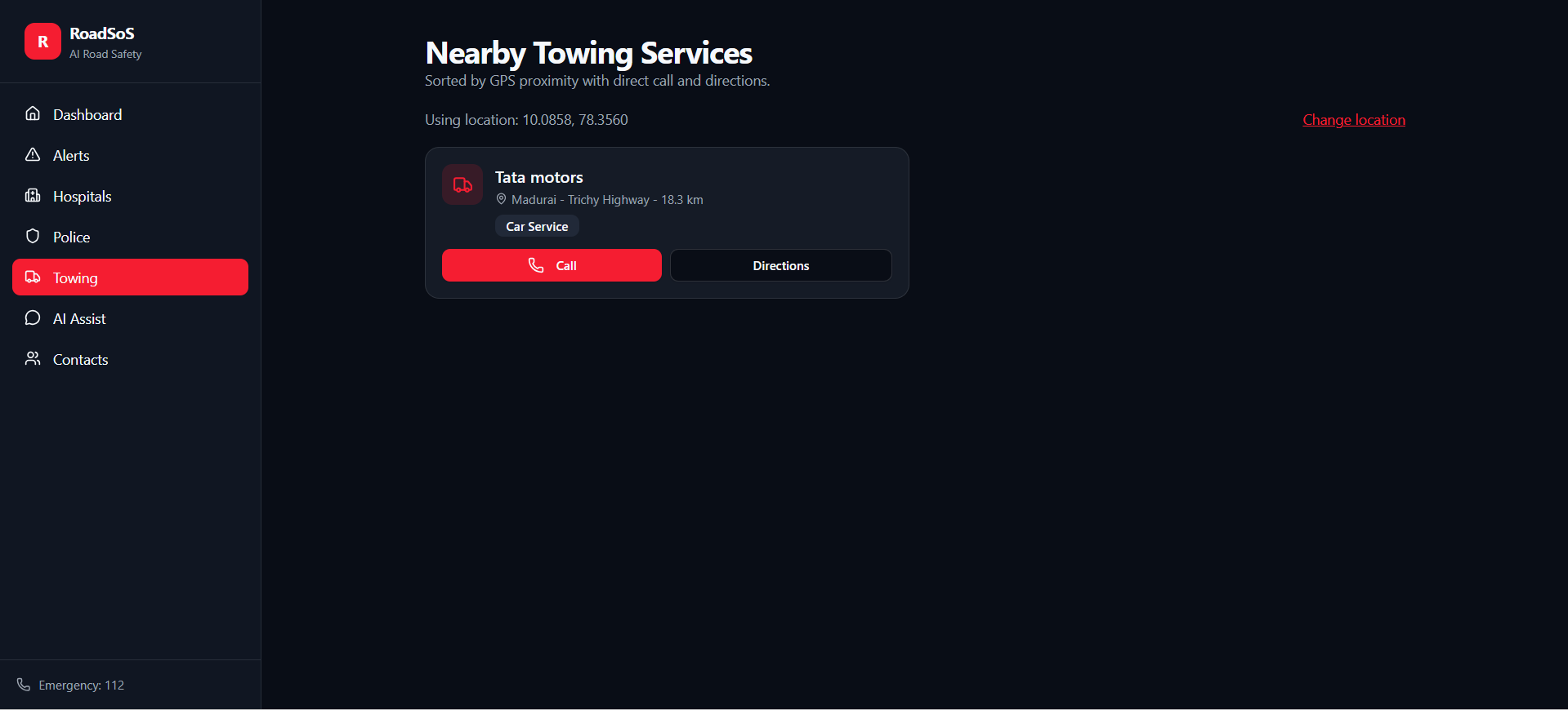
Nearby Towing Services sorted by GPS proximity — one-tap Call & Directions to the nearest car service when you're stranded.
-
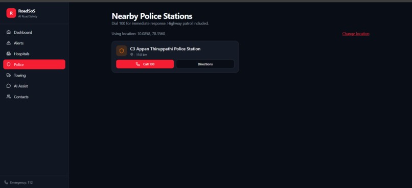
Nearby Police Stations with one-tap Call 100 & Directions — GPS-based instant police access including highway patrol.
-
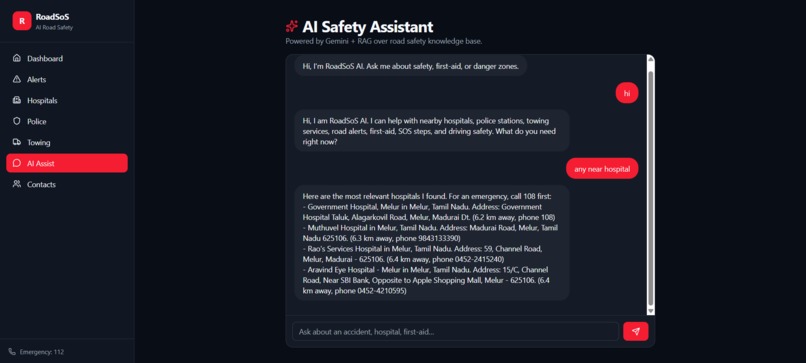
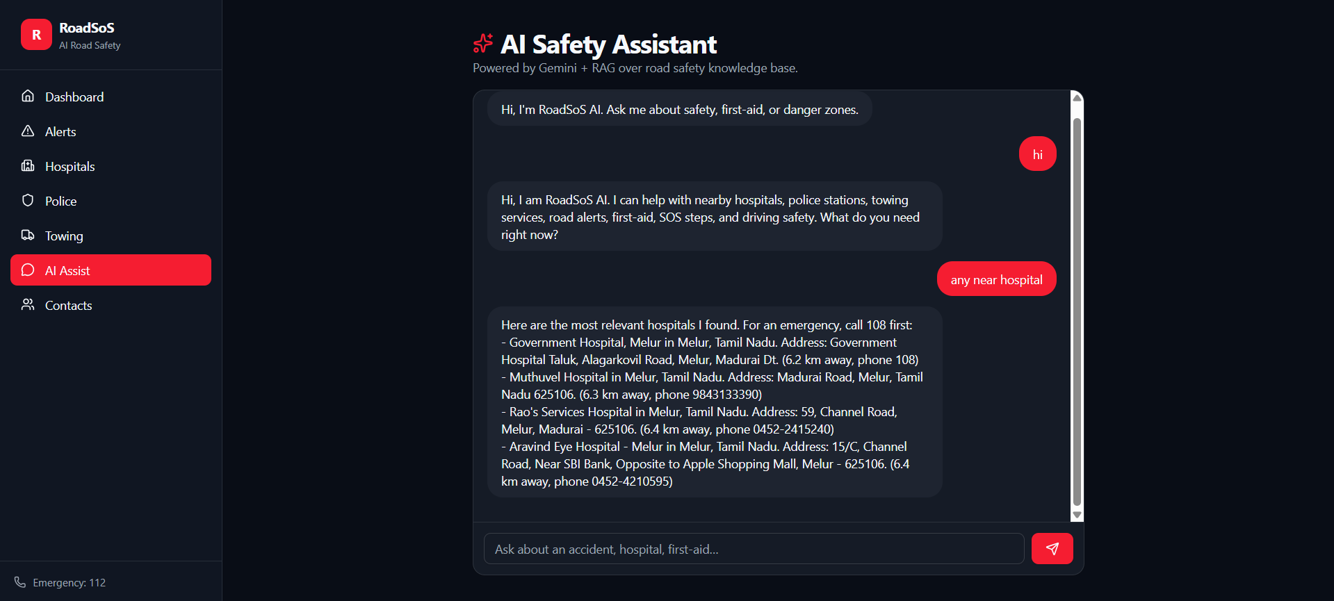
AI Safety Assistant powered by Gemini + RAG — instant answers for hospitals, first-aid, danger zones & SOS guidance.
-
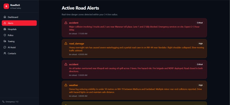
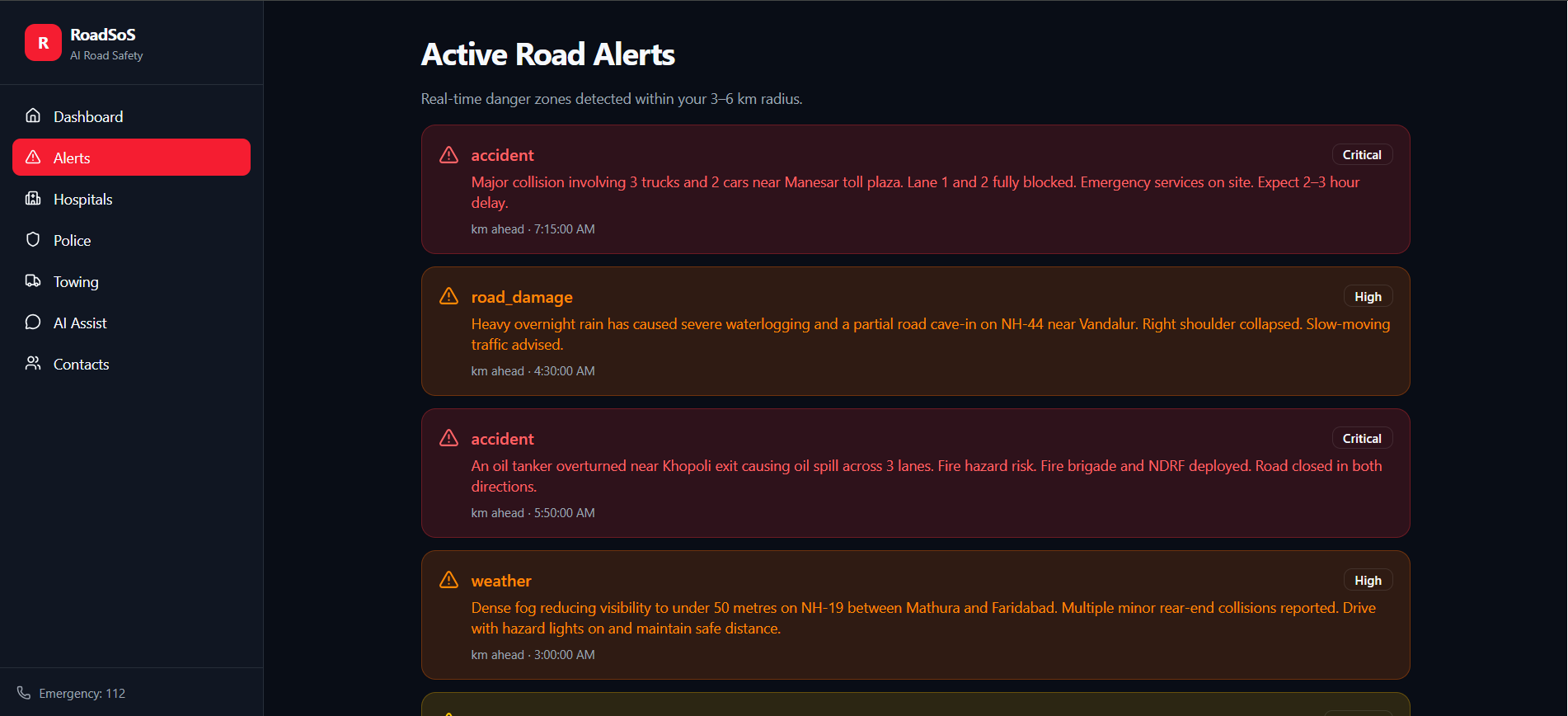
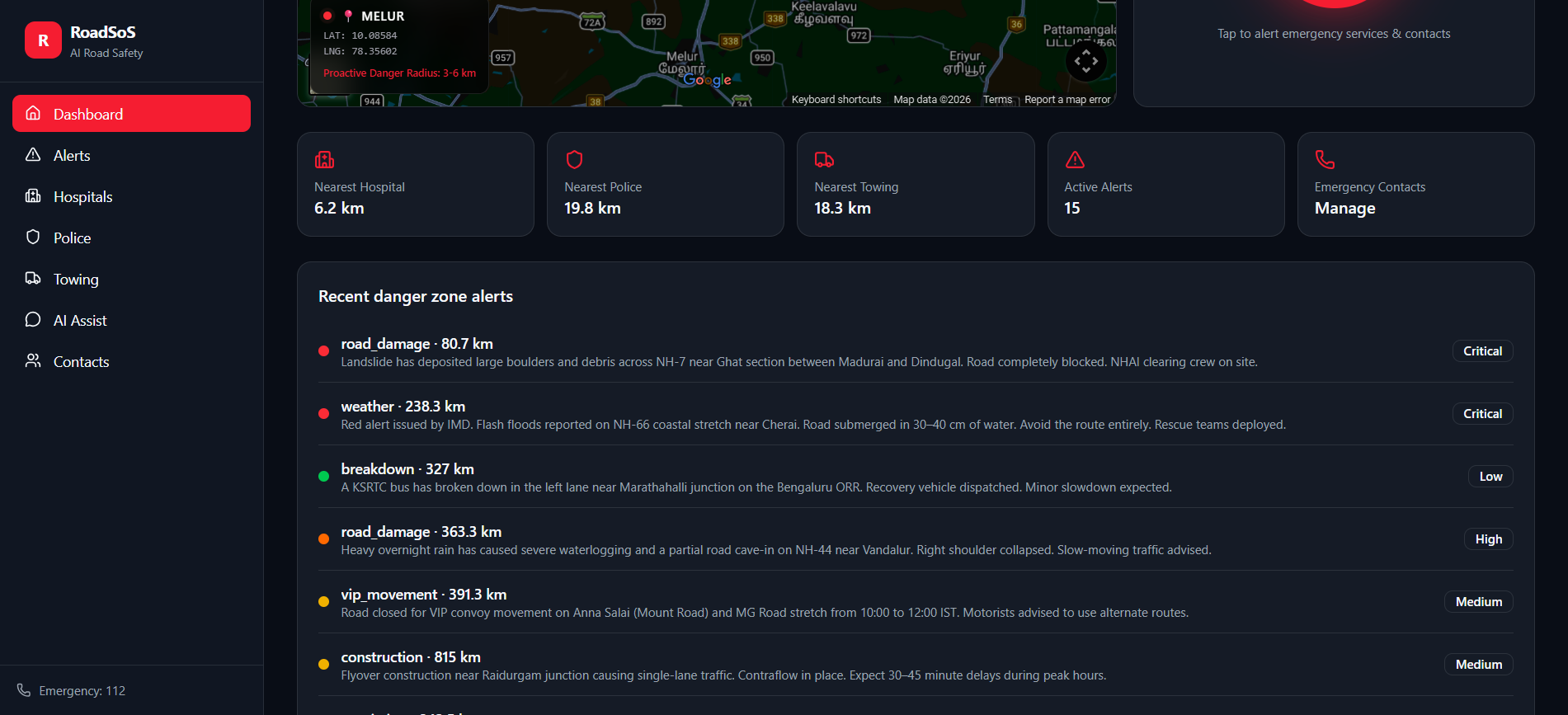
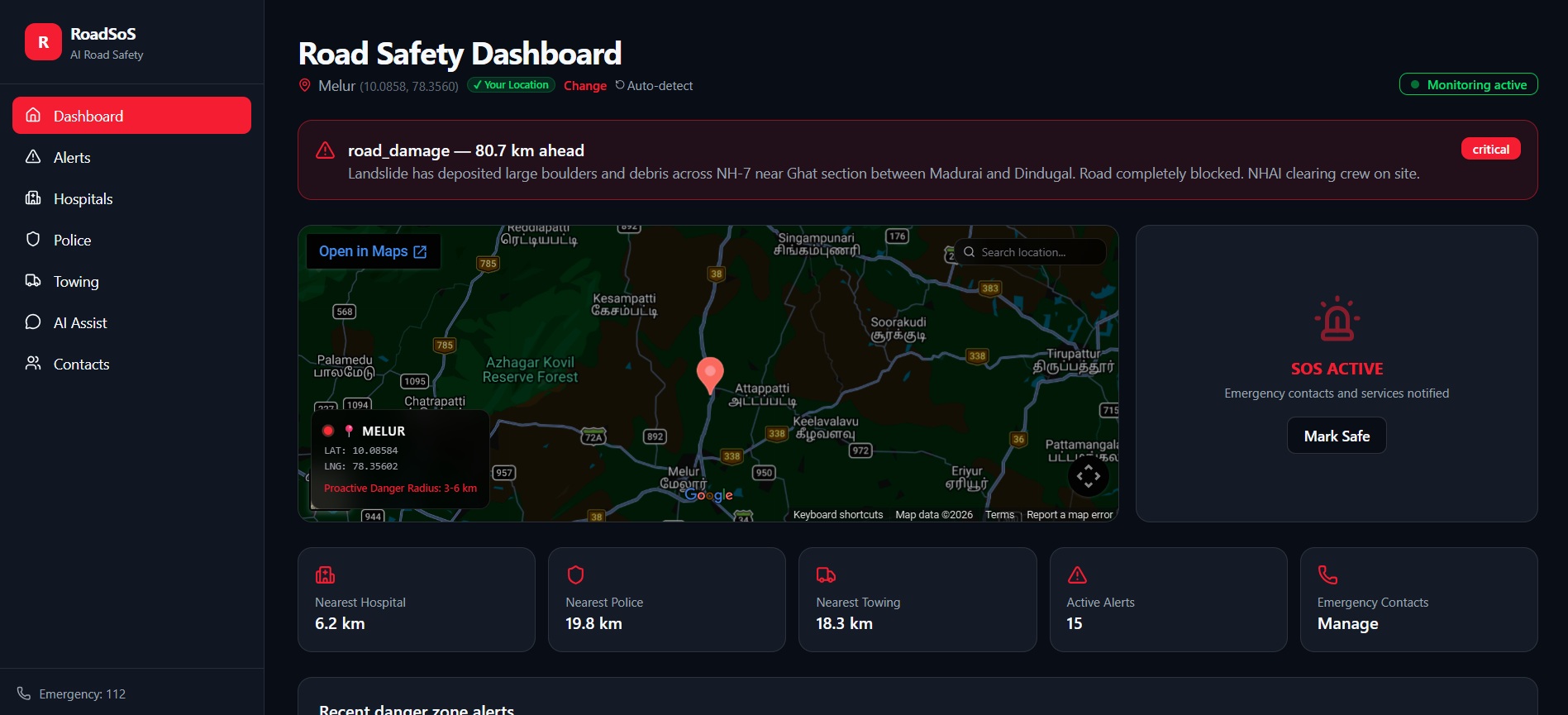
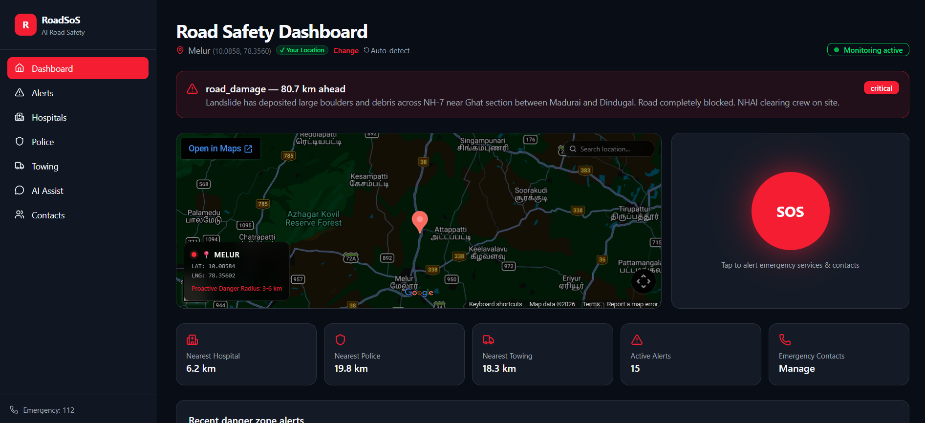
Active Road Alerts — Critical accidents, road damage & weather hazards detected in real-time within your 3–6 KM radius.
-

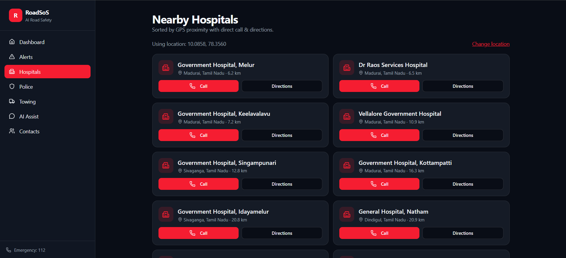
Nearby Hospitals sorted by GPS proximity — instant Call & Directions to the closest hospital when every second matters.
-

Recent danger zone alerts — Critical to low severity, real-time road hazards ranked by distance & risk. Stay warned, stay safe.
-
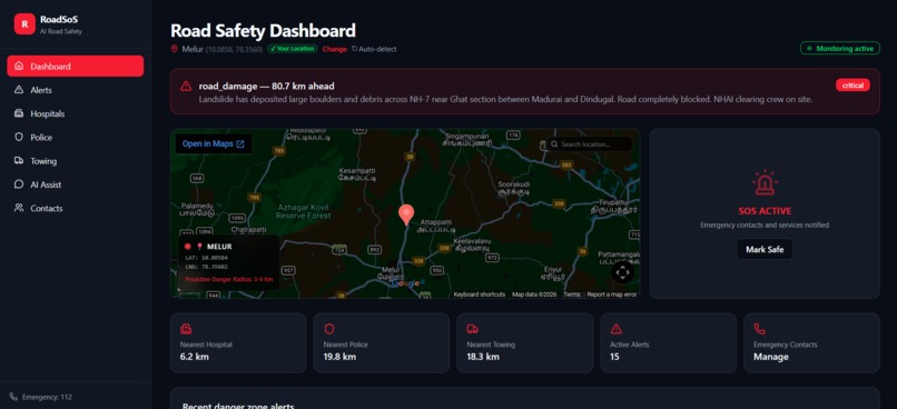
SOS ACTIVE — Emergency contacts & services instantly notified. Live location shared. One tap to safety when every second counts.
-
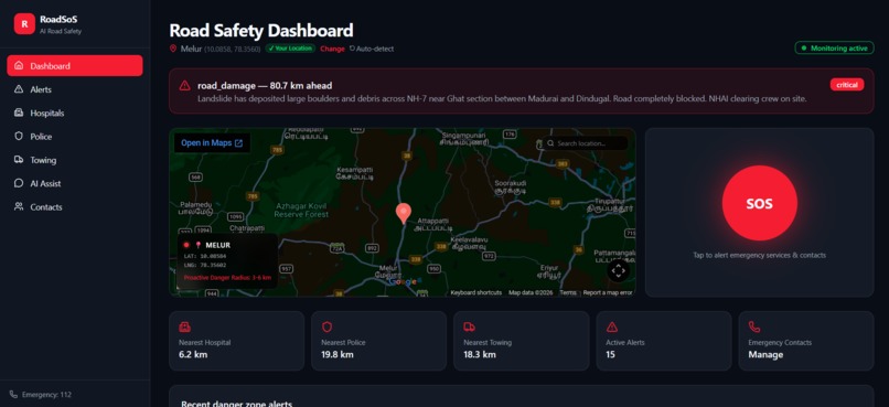
RoadSoS Dashboard — Live GPS tracking, critical danger alerts, 15 active warnings & one-tap SOS. Prevent First. Respond Fast.

Inspiration
Every year, millions of lives are lost on roads due to preventable accidents and slow emergency response. We witnessed how drivers unknowingly enter danger zones, how victims struggle to share their location during panic, and how emergency services remain disconnected from each other. The question that drove us was simple — what if technology could prevent accidents before they happen and save lives when they do? That question became RoadSoS.
What it does
RoadSoS is an AI-powered road safety and emergency coordination platform with two core modes:
- Prevention Mode — Continuously tracks the user's GPS location, detects danger zones using RAG + AI risk scoring, and sends proactive alerts 3–6 KM before entering high-risk areas. It also recommends the safest route in real time.
- Emergency Mode — A one-tap SOS instantly shares the user's live location and triggers automated alerts to family, hospitals, police, and nearby responders. Google Gemini AI provides real-time first-aid guidance. Quick-access buttons connect users to hospitals, ambulance, police, and towing services instantly.
How we built it
- Frontend: React.js with live map integration, real-time GPS tracking, SOS button, and alert notifications
- Backend: FastAPI with RESTful APIs handling authentication, location tracking, geofencing, and the SOS alert engine
- AI Layer: Google Gemini API for emergency guidance; File-based RAG engine for danger zone knowledge retrieval and risk scoring
- Database: PostgreSQL / SQLite for storing user data, incidents, and danger zone records
- Infrastructure: Cloud-hosted on AWS/GCP with secure, scalable architecture and multi-channel notifications (in-app, push, email, SMS)
Challenges we ran into
- Achieving accurate real-time geofencing and danger zone detection with low latency
- Integrating RAG with live GPS data for relevant and timely risk scoring
- Ensuring reliable operation in low-network and offline conditions for rural users
- Coordinating multiple emergency services through a unified alert pipeline
- Balancing user privacy with real-time location sharing
Accomplishments that we're proud of
- Built a fully functional Prevention + Emergency system in one unified platform
- Successfully integrated Google Gemini AI for real-time, context-aware emergency guidance
- Implemented a working RAG engine for intelligent danger zone detection and risk scoring
- Designed a one-tap SOS that simultaneously notifies multiple stakeholders with live location
- Created an offline-capable system ensuring essential features work in low-network areas
What we learned
- Real-time AI systems require careful optimization — speed and accuracy both matter when lives are at stake
- RAG is a powerful approach for domain-specific safety knowledge beyond generic AI responses
- Building for emergencies means designing for panic — UI/UX must be extremely simple and fast
- Integrating multiple external APIs demands strong error handling and fallback strategies
- Offline-first thinking is essential for safety-critical applications in diverse network conditions
What's next for ROAD SOS
- V2X & IoT Integration — Connect with vehicles, traffic signals, and smart city infrastructure
- Advanced AI & Prediction — Accident prediction, risk forecasting, and personalized safety recommendations
- Smart Devices & Wearables — Smartwatch integration for automatic crash detection and hands-free SOS
- Global Expansion — Multi-language support and local emergency service integration worldwide
- Data Analytics for Authorities — Dashboard for governments to improve road safety planning
- Open API & Partnerships — Third-party integrations and research collaborations
Built With
- amazon-web-services
- axios
- cloud-hosting
- css
- danger-zone-detection
- elasticsearch
- email-api
- fastapi
- firebase
- gcp
- geospatial-indexing
- google-gemini-api
- google-maps
- gps-&-geofencing
- html
- javascript
- jwt-authentication
- kibana
- live-location-tracking
- logstash
- microservices
- multi-channel-notification-system
- numpy
- offline-support
- openstreetmap
- pandas
- postgresql
- push-notifications
- python
- rag-(retrieval-augmented-generation)
- react.js
- real-time-analytics
- restful-apis
- risk-scoring-engine
- scalable
- scikit-learn
- sms-api
- sos-alert-engine
- sqlite
- tailwind-css
- websockets


Log in or sign up for Devpost to join the conversation.