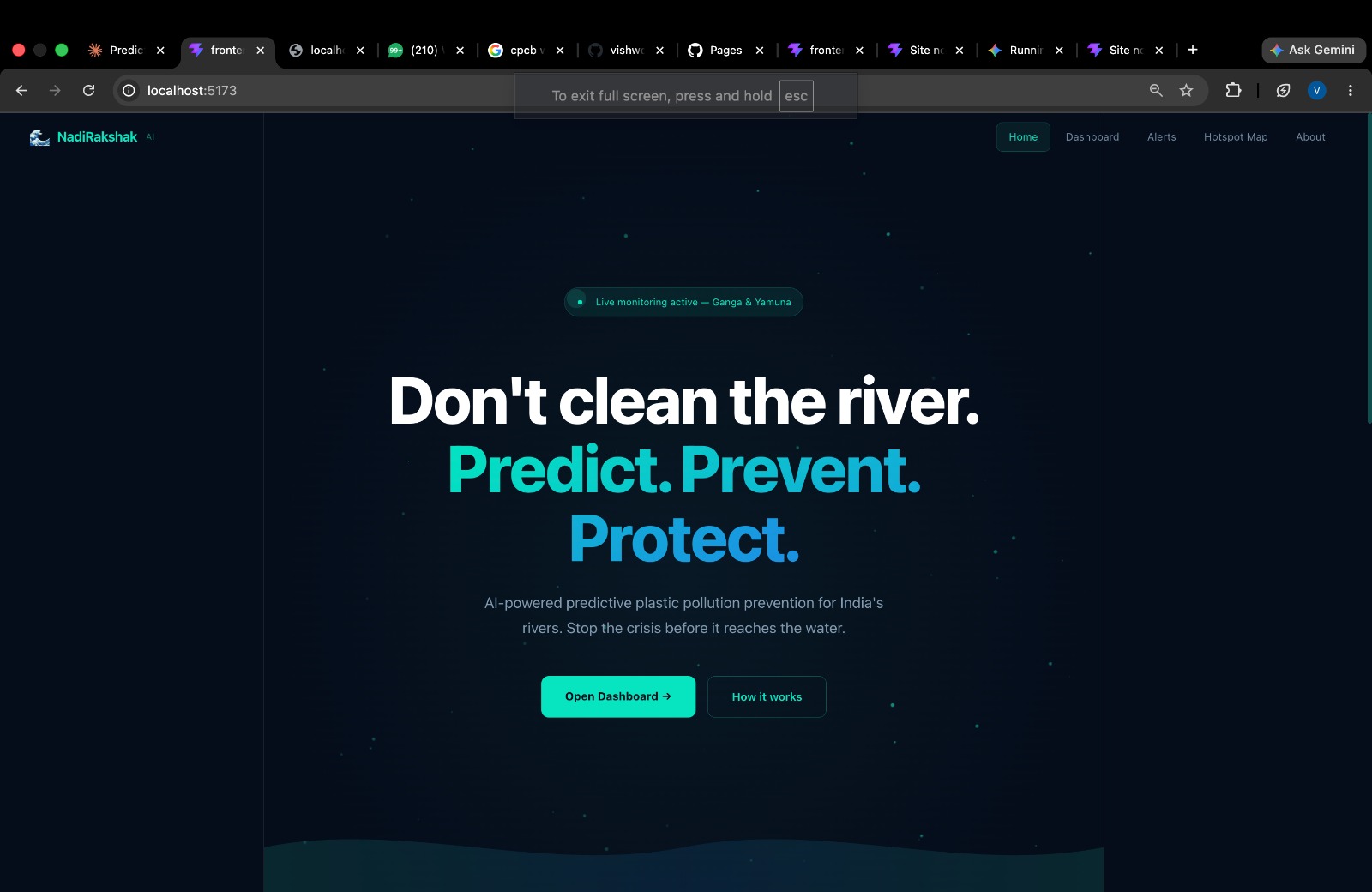
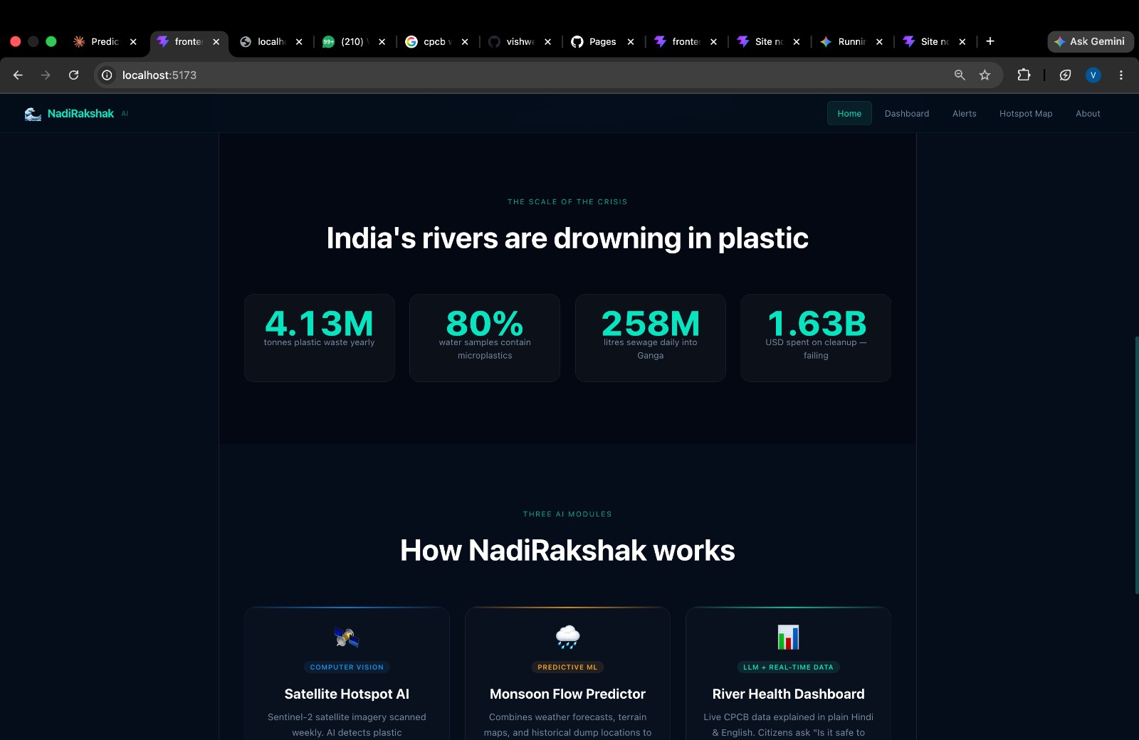
Inspiration Water pollution—especially plastic accumulation in rivers—is traditionally tackled through reactive cleanup drives after the damage is already done. Our rivers continue to choke because authorities often lack real-time visibility into where waste is accumulating before it washes downstream. We realized that to truly protect our water bodies, we needed to shift river conservation from reactive cleanup to predictive prevention.
With NadiRakshak AI (RiverSentinel AI), our vision is to leverage machine learning and government water quality data to pinpoint plastic hotspots on riverbanks early, empowering both municipal authorities and local citizens to take proactive, coordinated action.
What it does NadiRakshak AI is a dual-portal river monitoring and predictive prevention platform tailored for two primary user roles: Municipal Workers and General Citizens.
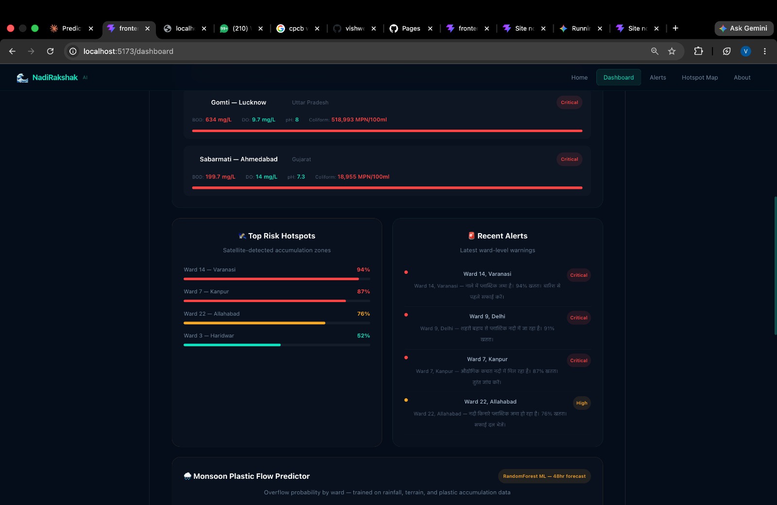
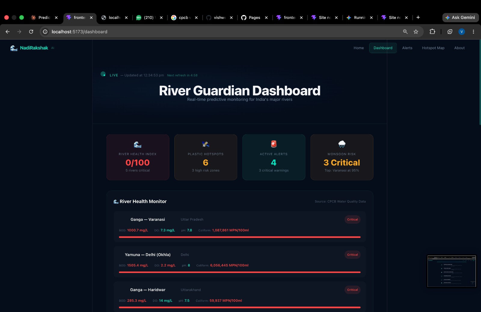
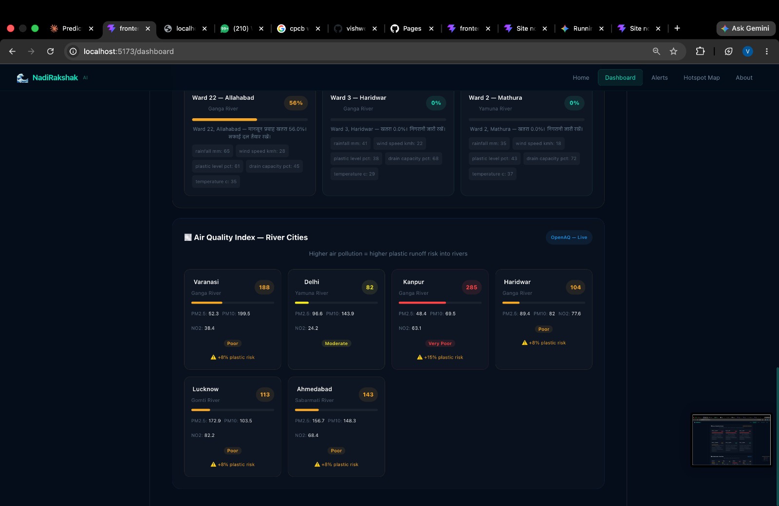
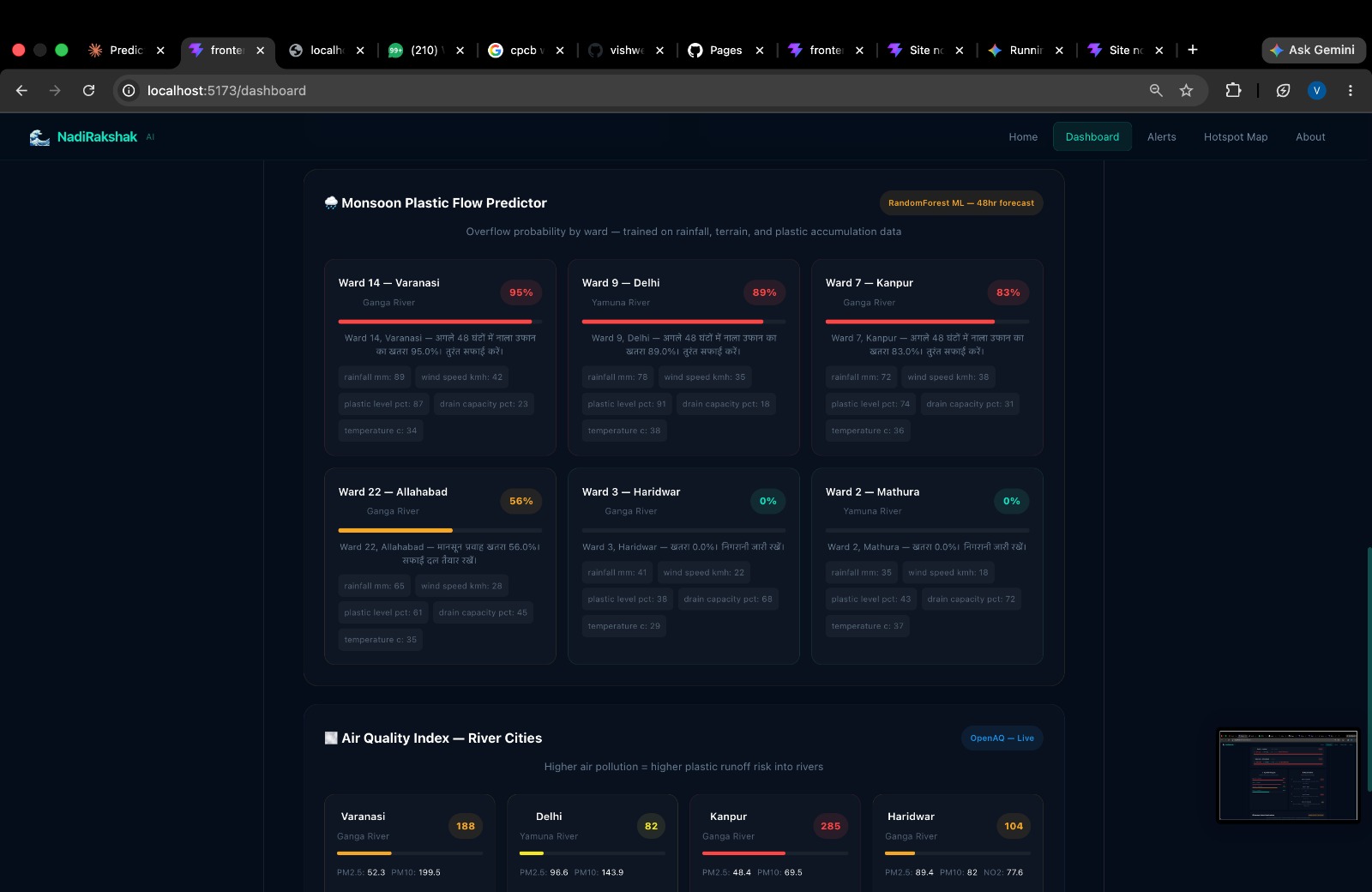
- Municipality Portal (Secured Login) Real-Time Health Dashboard: Displays live river health stats updated every 5 minutes using CPCB data. Key indicators like Biological Oxygen Demand (BOD), Dissolved Oxygen (DO), and pH levels are mapped across rivers. Rivers are ranked dynamically by pollution severity so authorities can prioritize urgent areas.
Top-Level KPI Cards: Provides a high-level view of overall regional river health, current plastic deposition levels, active alerts, and upcoming risk predictions.
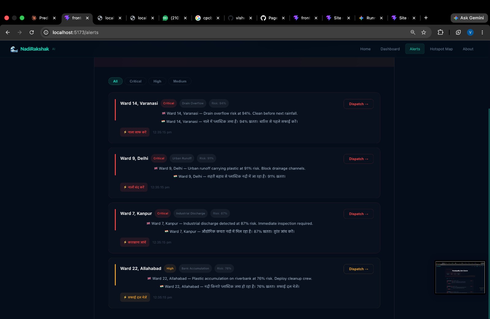
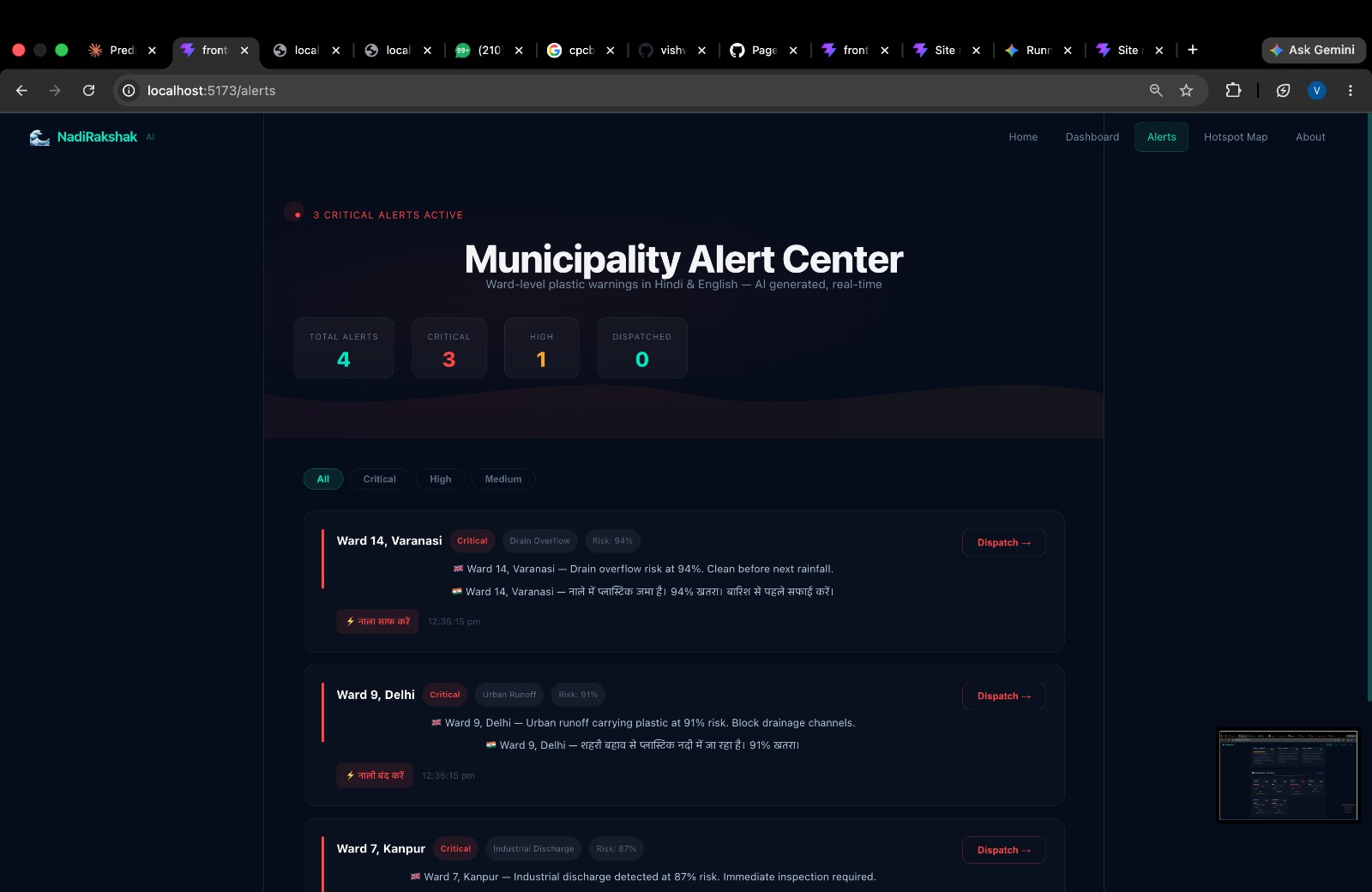
Alert Centre: Displays AI-predicted risk alerts. Municipal workers can review, clean, and dispatch (resolve) alerts.
SMS Alert System: A feature designed to broadcast location-based SMS warnings to citizens living near impending high-risk plastic flood or overflow zones.
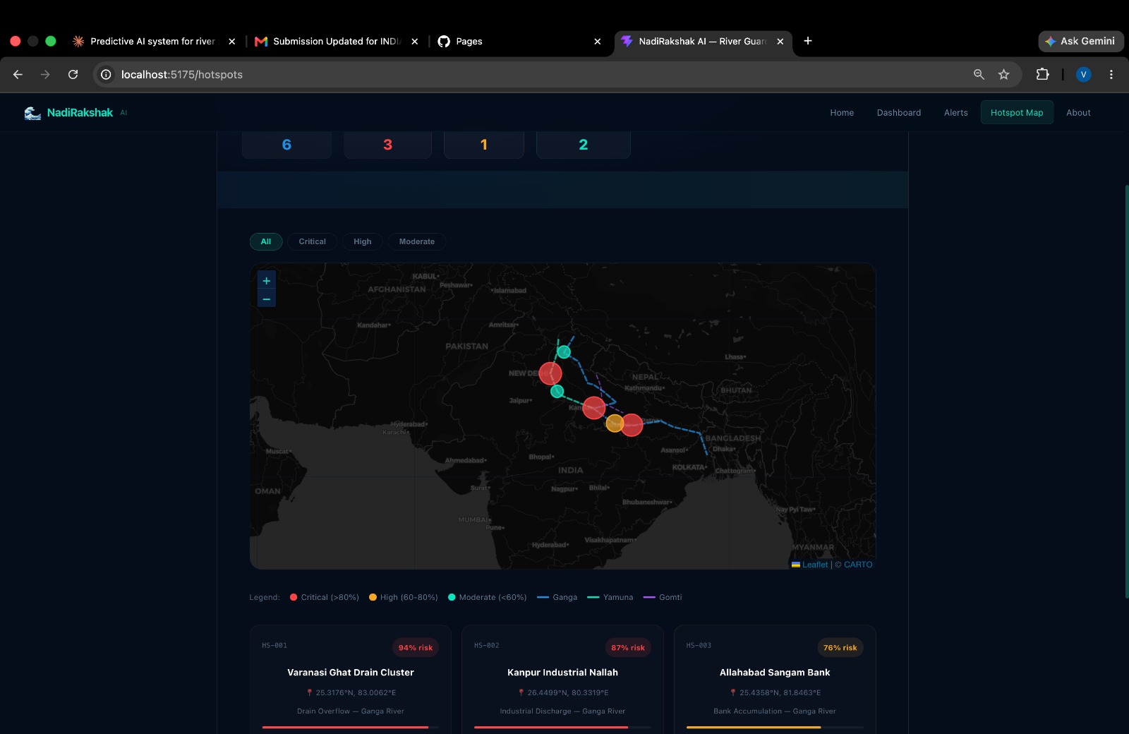
Hotspot Map: A visual GIS map depicting where plastic waste is clogging, color-coded by severity level.
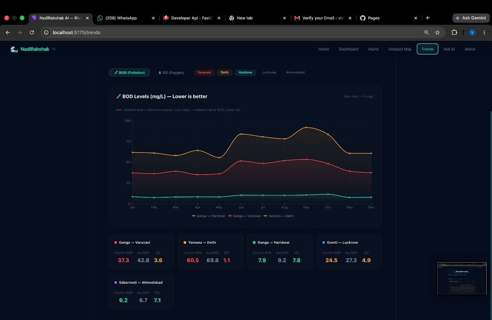
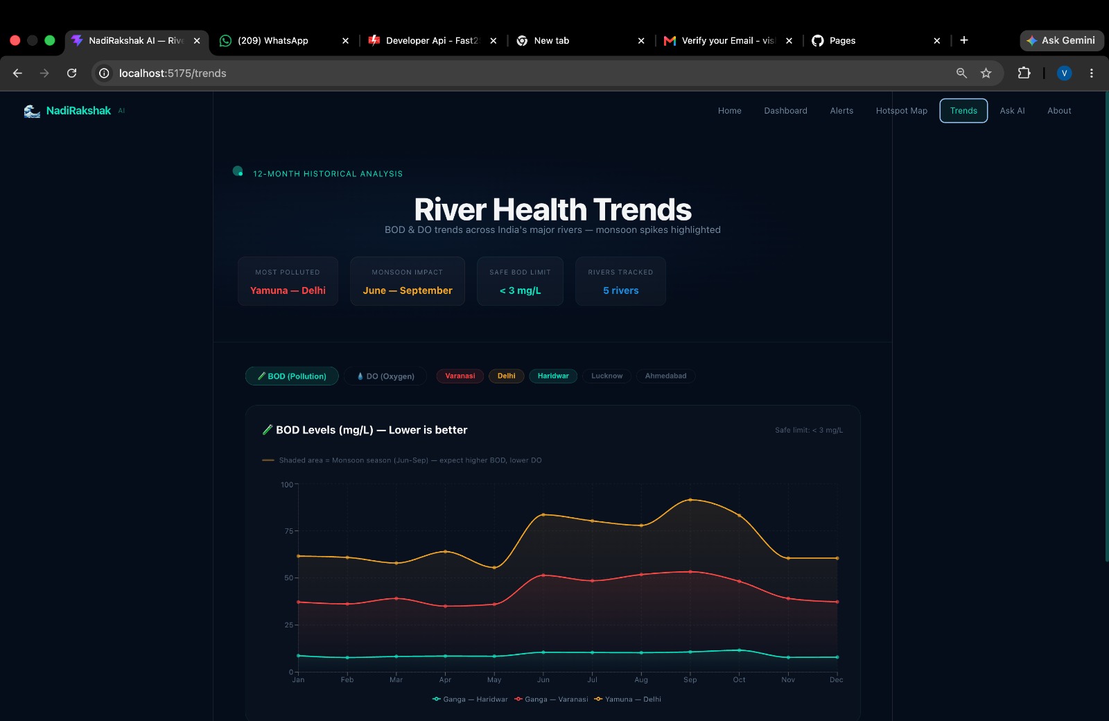
12-Month Trend Analytics: Historical graphs comparing pollution and oxygen levels across rivers over time to track long-term health and relative rankings.
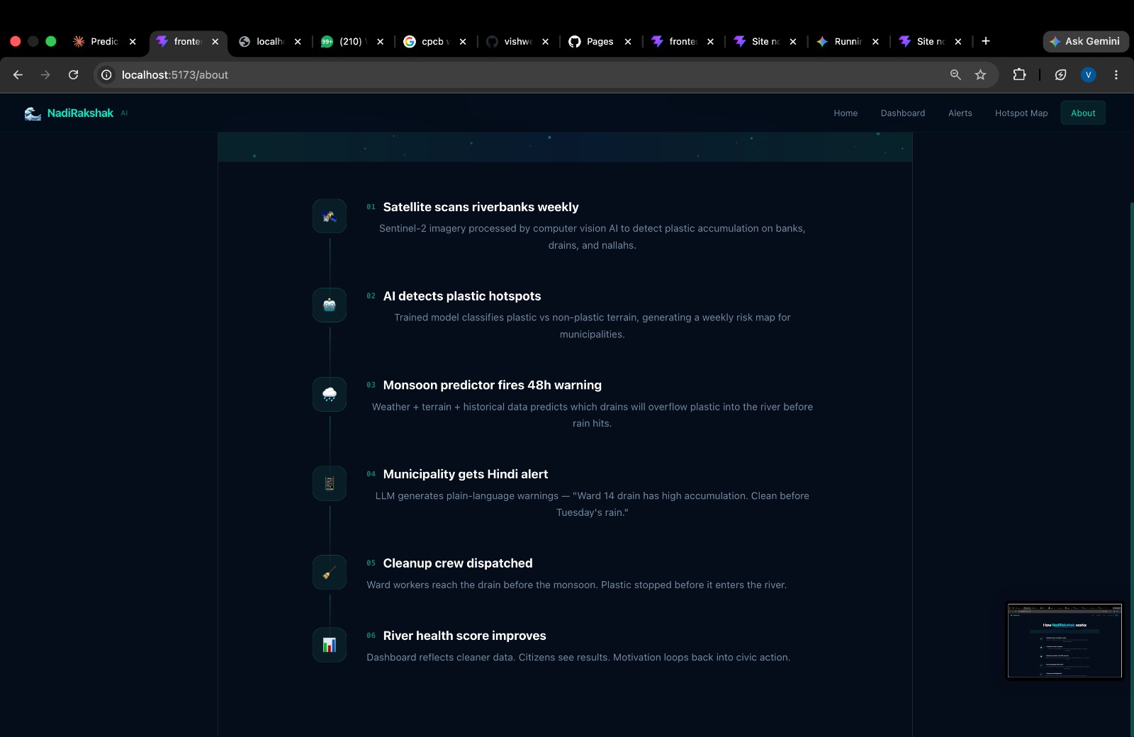
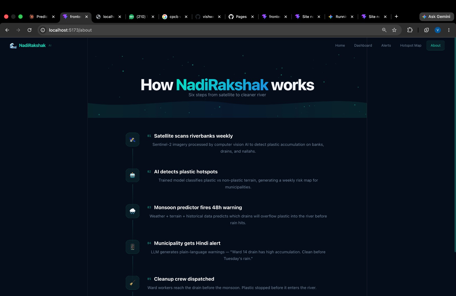
Process Flow Guide: An operational guide detailing the step-by-step workflow from report submission to resolution.
- Citizen Portal (Public Access) Simplified Dual Experience: Mirroring the municipal layout for simplicity, citizens can explore overall river health metrics, environmental insights, and historical trends without needing an account.
Crowdsourced Reporting & Incentivization: Citizens can upload pictures of illegal dumping or plastic accumulation, drop a pin on the location, set the severity, and submit a report.
Gamified Leaderboard ("My Impact"): Every verified report earns users reward points. Users can track their past complaints, monitor resolution progress by authorities, and climb a community leaderboard that encourages eco-friendly civic participation.
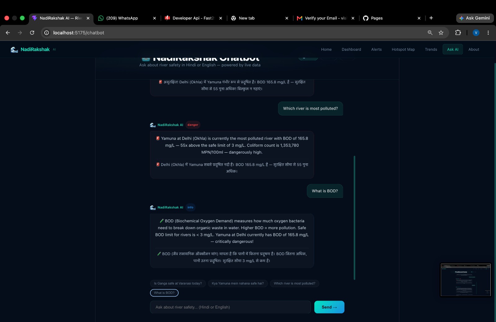
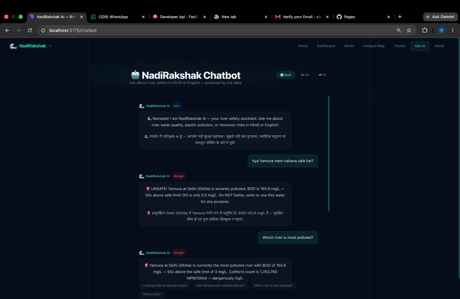
"Ask AI" Multilingual Assistant: An integrated AI chatbot that answers questions about local river health, water safety, and hygiene standards in both English and Hindi.
How we built it Data Pipeline: Integrated web scraping scripts to extract real-time environmental metrics (BOD, DO, pH) from the Central Pollution Control Board (CPCB) portal, refreshing every 5 minutes to maintain an active data flow without relying on direct API keys.
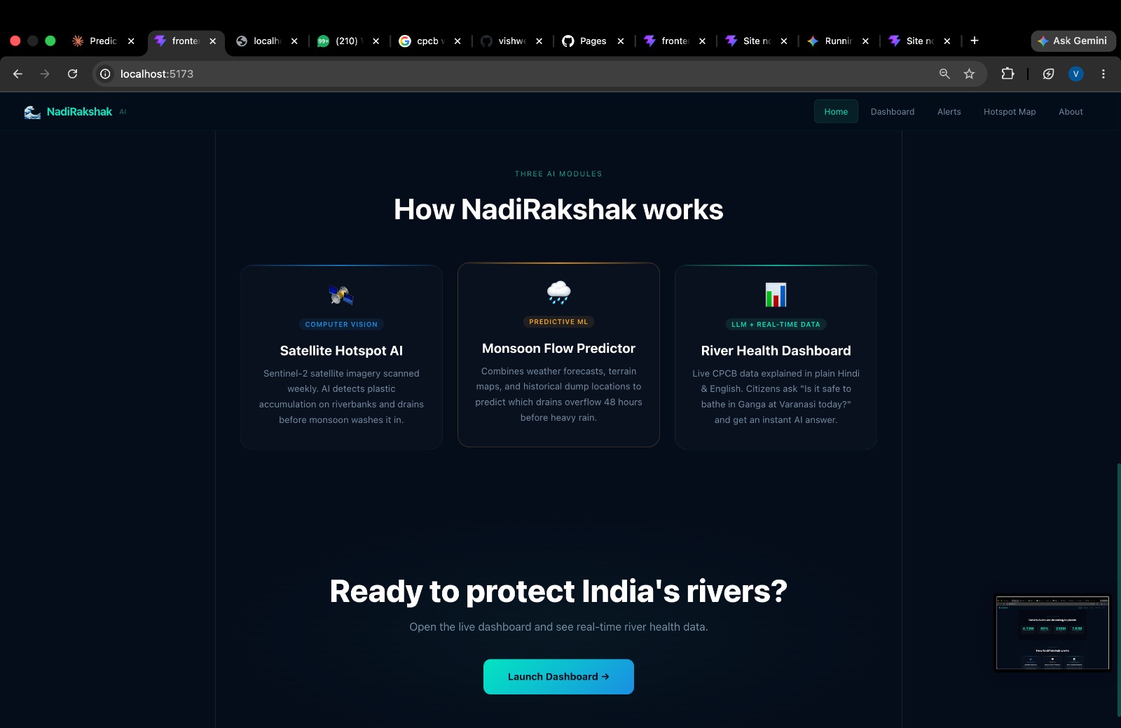
Predictive AI Engine: Machine learning models process water quality indexes, environmental factors, and monsoon forecasts to predict plastic accumulation hotspots and river flow risks.
Frontend & UX: Designed a unified, responsive interface with dual access pathways (Citizen vs. Official) featuring dynamic charts, interactive maps, and real-time alert cards.
AI Chatbot: Built an NLP-driven conversational bot capable of parsing complex water quality data and translating it into plain-language answers in Hindi and English.
Challenges we ran into Data Access & Refresh Constraints: Navigating the lack of official open APIs for real-time river metrics required us to build an automated 5-minute data ingestion pipeline from the CPCB website while keeping system overhead low.
Scoping Initial Datasets: Due to compute and data constraints during the build phase, we had to carefully curate a proof-of-concept dataset focused on 5 key rivers while maintaining scalable system architecture for future expansions.
Dynamic Ranking Logic: Designing an intuitive ranking algorithm that accurately factors in multiple volatile parameters (BOD, pH, DO, and predicted plastic runoff) to correctly mark rivers in "red" / critical status for immediate action.
Accomplishments that we're proud of Actionable Risk Visualizations: Successfully building an intuitive Hotspot Map that translates complex environmental data into clear visual markers for field workers.
Closing the Civic Loop: Bridging the gap between citizens and local governments through a gamified report-to-resolution pipeline.
Multilingual AI Accessibility: Implementing an AI chatbot capable of communicating critical water quality details in Hindi, making environmental data accessible to a broader audience.
What we learned Civic Gamification Dynamics: Community participation increases significantly when reporting is coupled with tangible impact tracking, transparent progress updates, and friendly leaderboard competition.
Interoperability Matters: Designing systems around real-world municipal workflows requires simple, accessible user interfaces so field teams can review and dispatch alerts quickly without technical friction.
What's next for RiverSentinel AI Photographic Verification Protocol: Upgrading the worker resolution pipeline to require "before and after" photos attached to dispatched alerts for absolute transparency.
Expanded Regional Language Support: Adding more Indian regional languages (e.g., Marathi, Bengali, Tamil, Telugu) to the "Ask AI" assistant to serve diverse communities across river basins.
Scaling River Coverage: Expanding data collection pipelines beyond the initial 5 rivers to cover national river basins.
Automated SMS Emergency Network: Rolling out location-targeted SMS warning systems to alert nearby residents ahead of severe monsoon plastic flows or chemical surges.
Built With
- ai
- api
- civic
- cpcb
- environmental
- express.js
- fast2sms
- fastapi
- gps
- language
- learning
- machine
- natural
- node.js
- openaq
- predictive
- processing
- python
- react
- real-time
- recharts
- rest
- vision
- vite

Log in or sign up for Devpost to join the conversation.