-
-
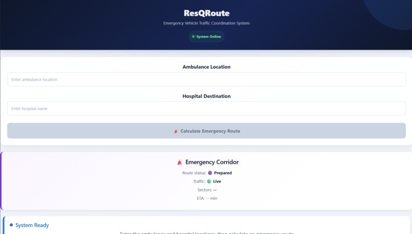
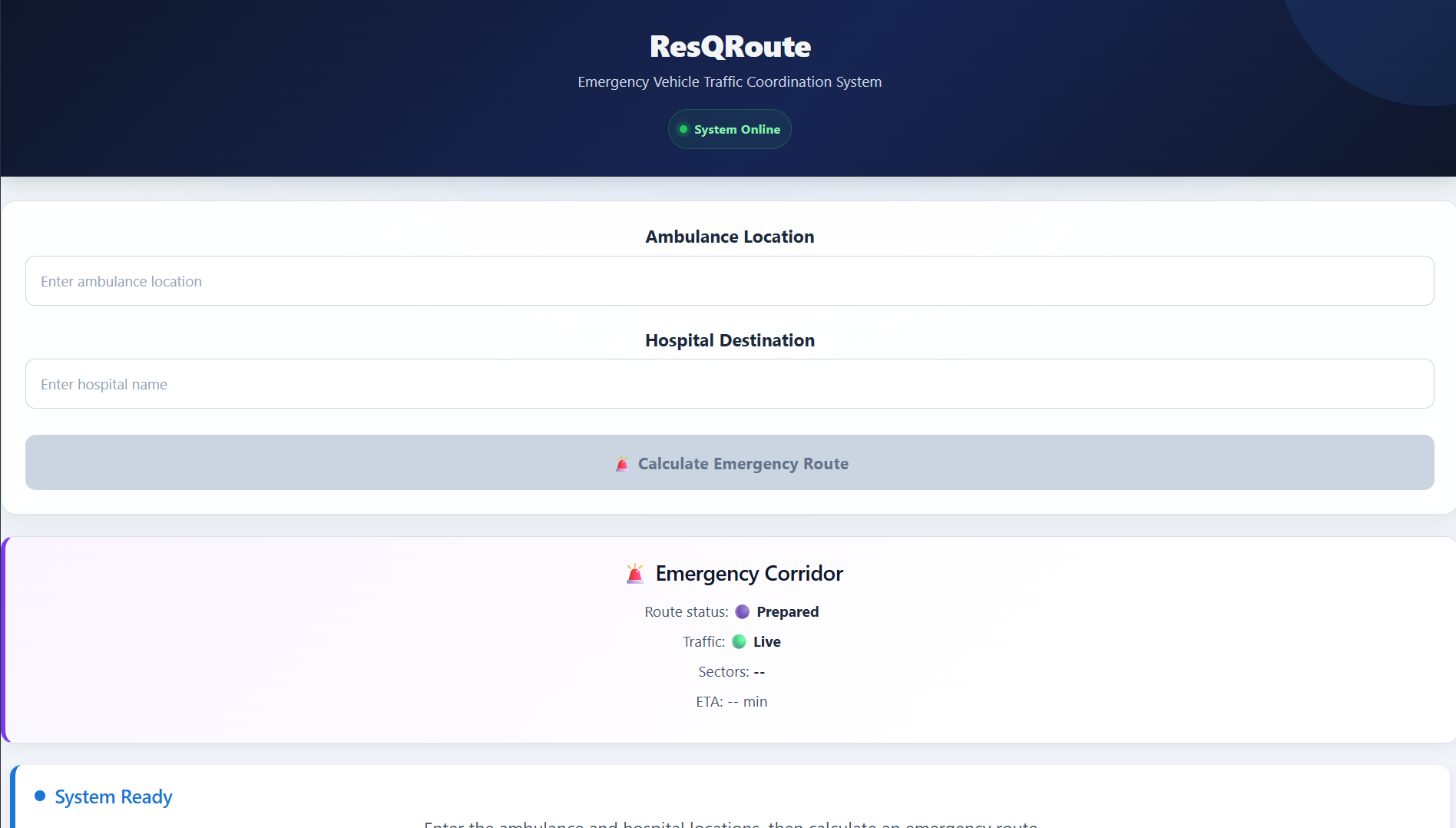
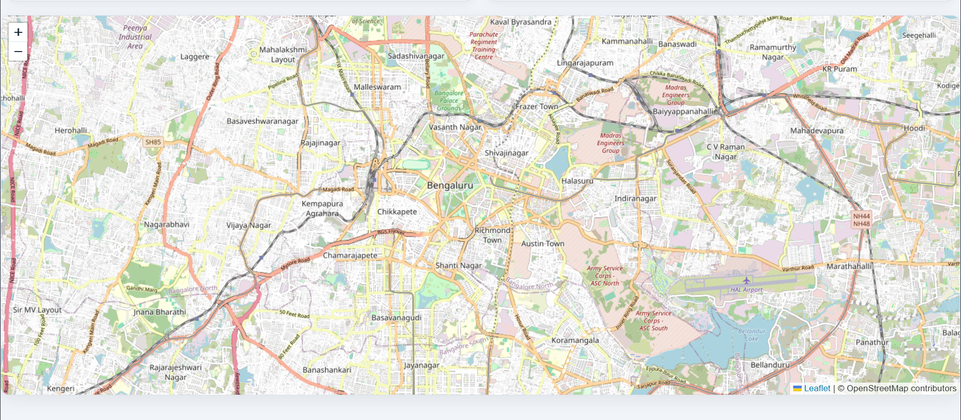
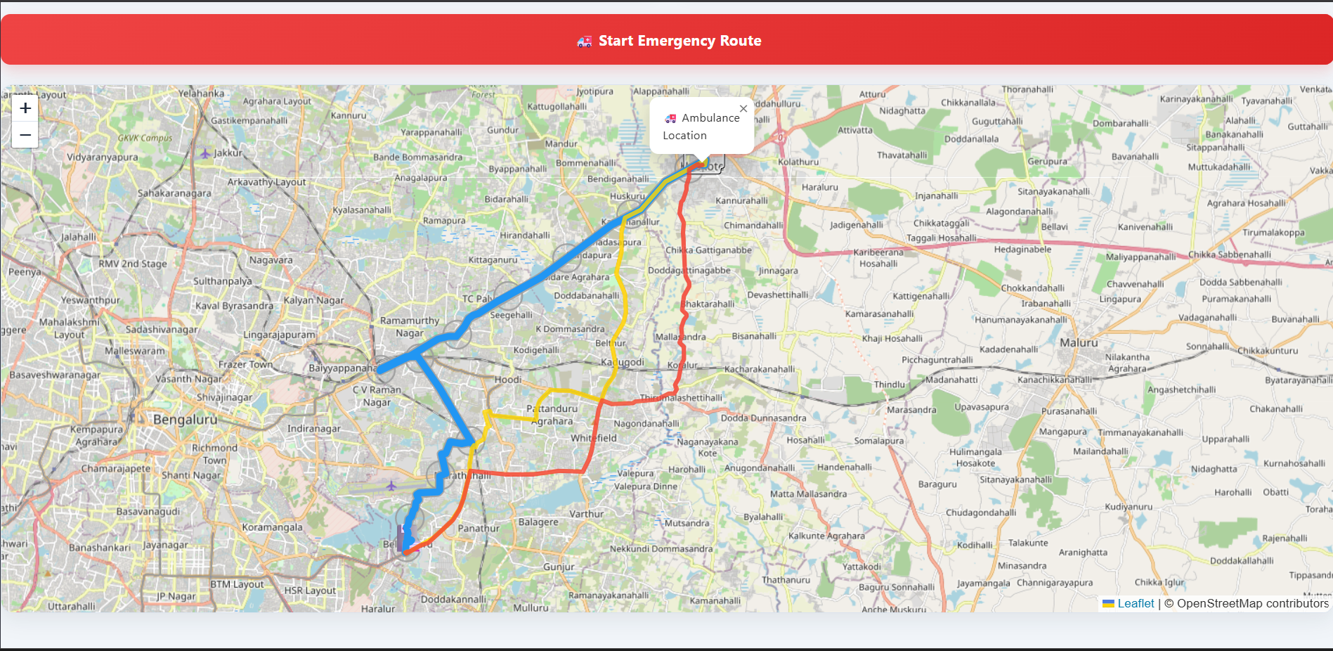
starting, when the locations are not entered
-
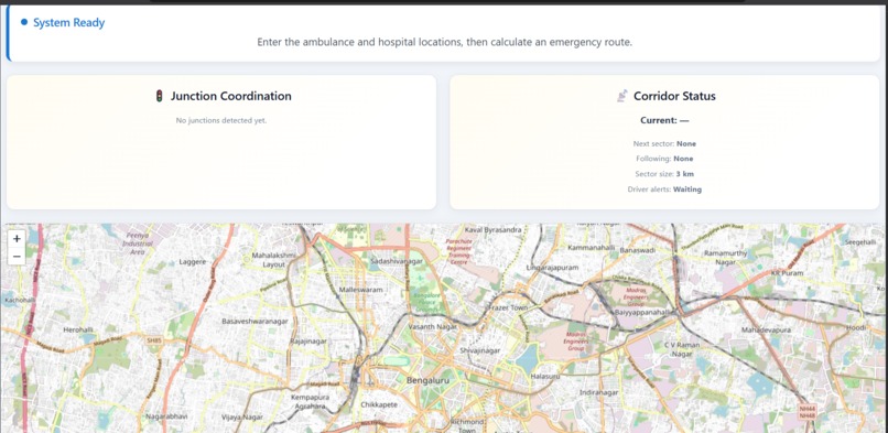
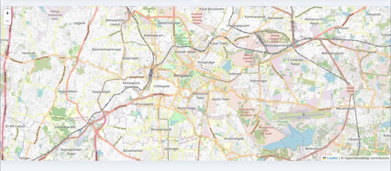
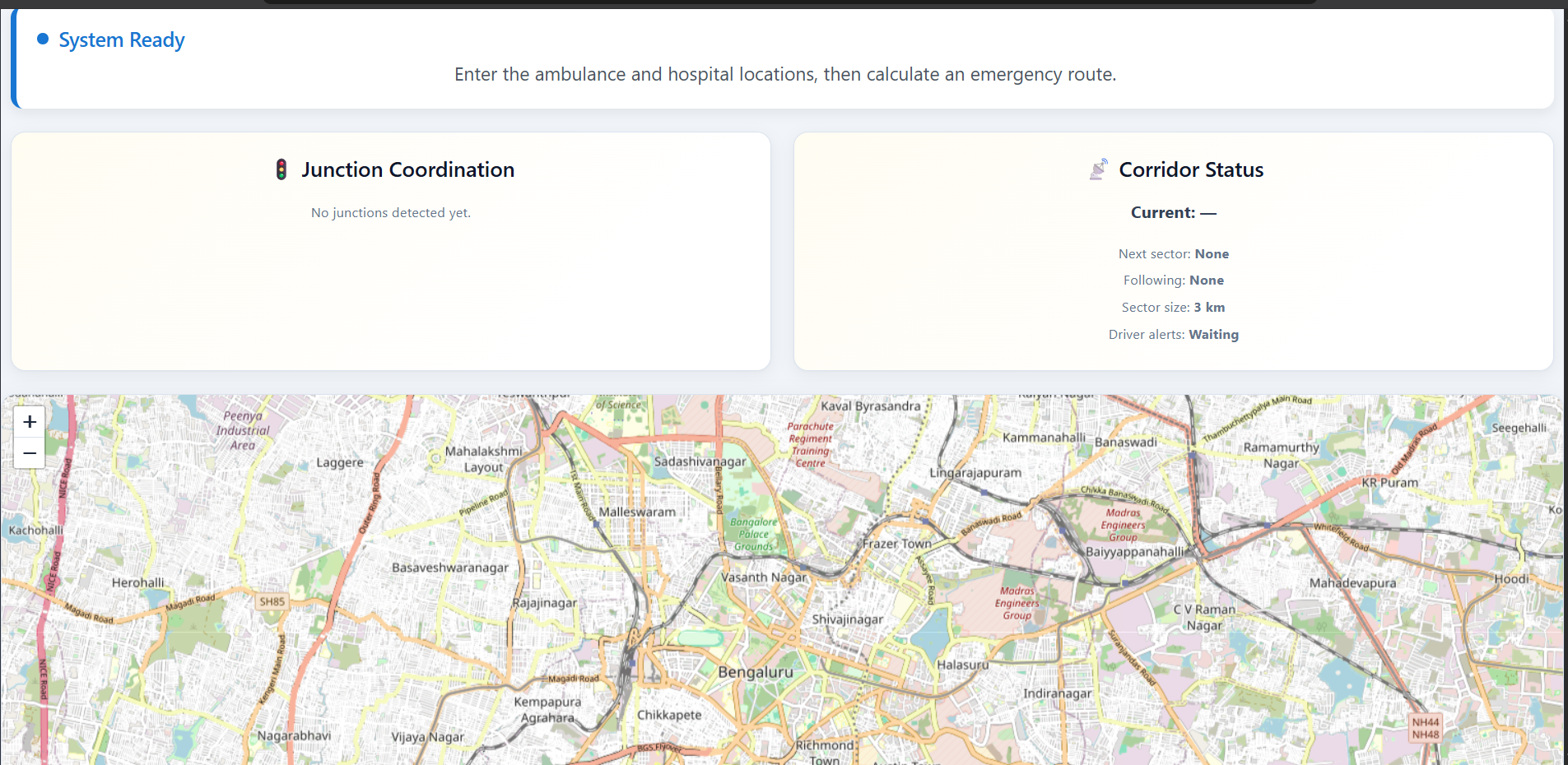
map before the locations are entered
-
-
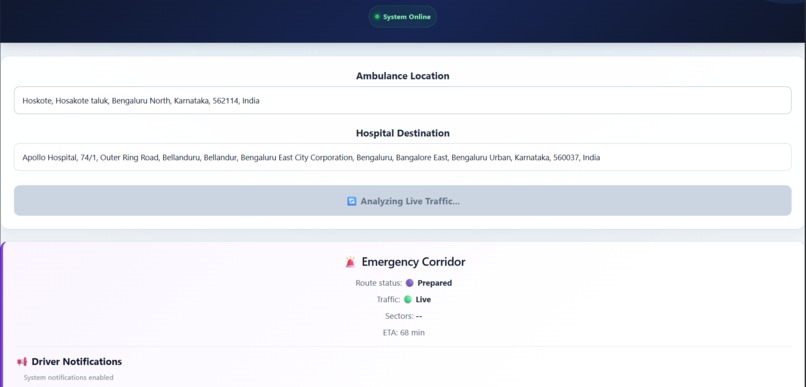
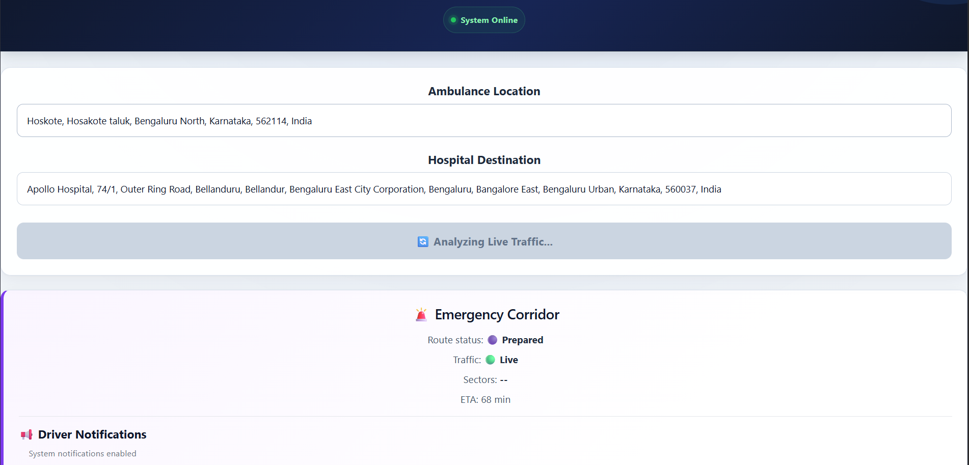
locations entered
-
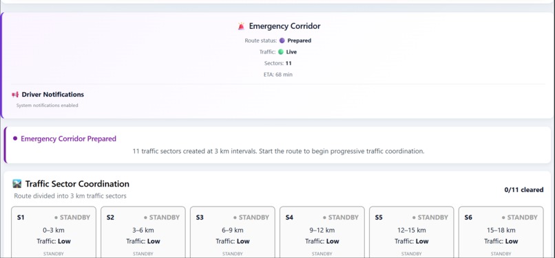
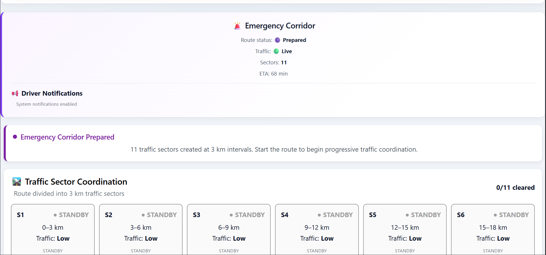
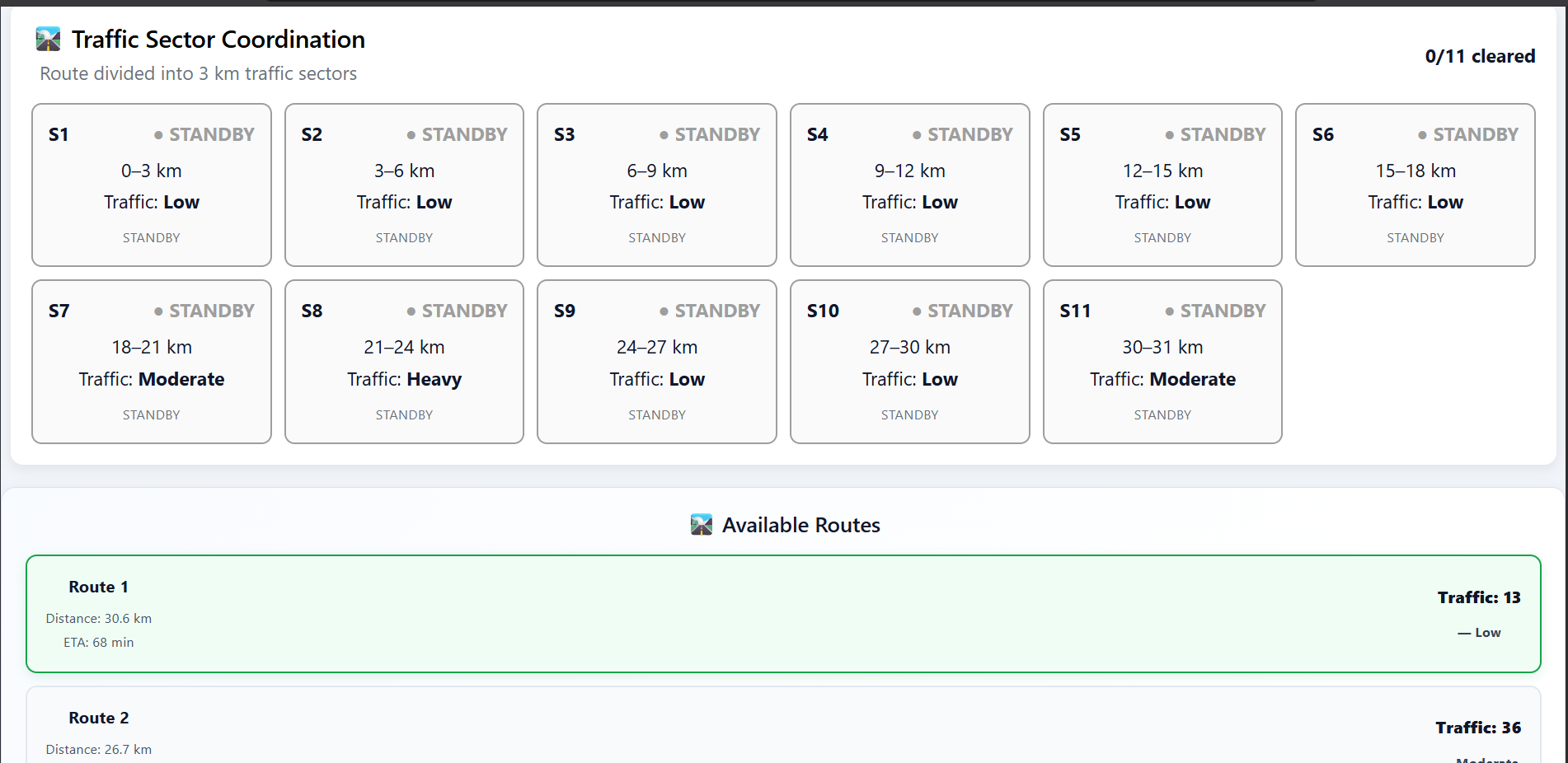
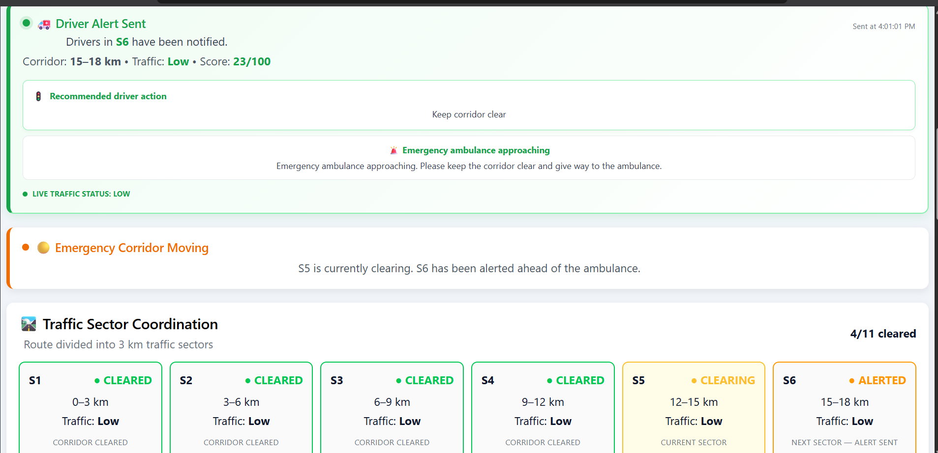
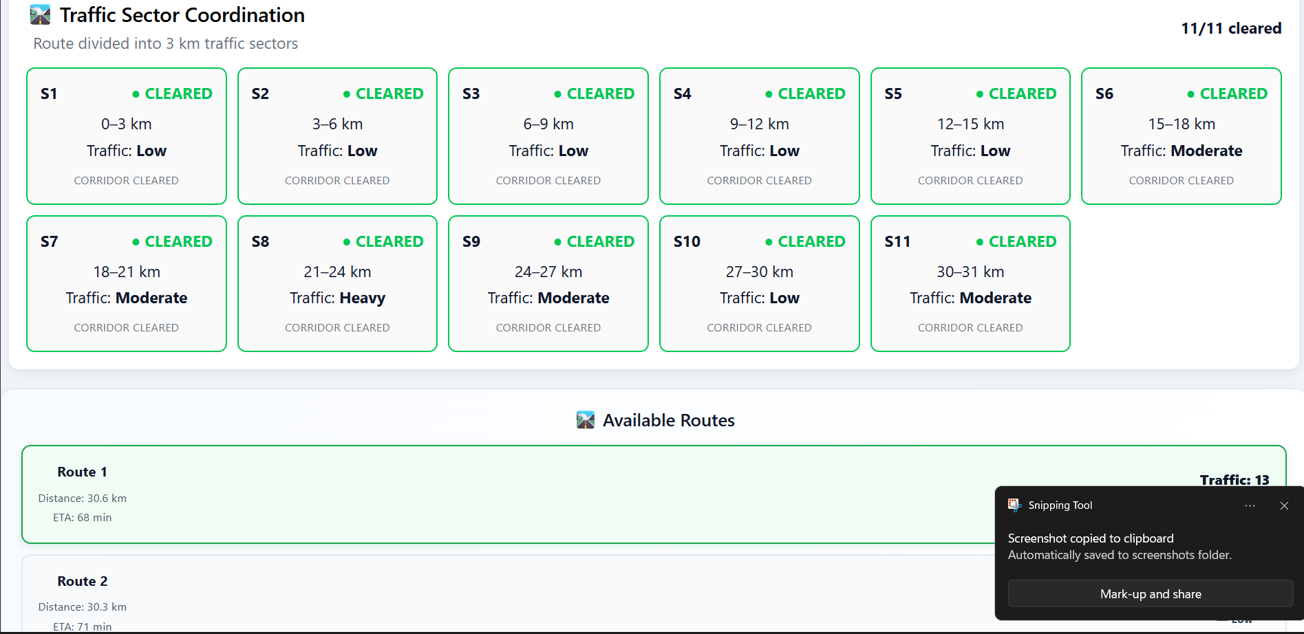
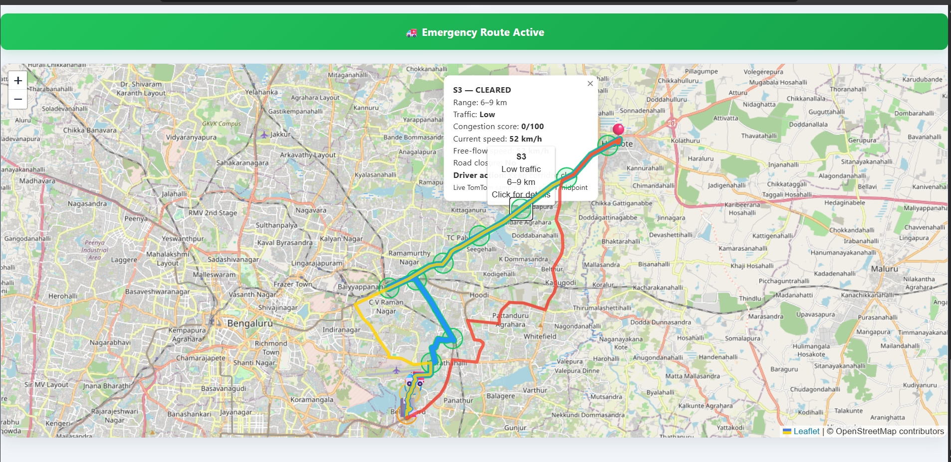
sectors that is been divided based on route length into 3km
-
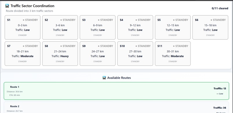
3 shortest routes calculated using tomtom traffic and routing api, 3 shortest routes are based on its time taken to reached the destination
-
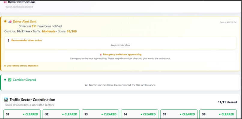
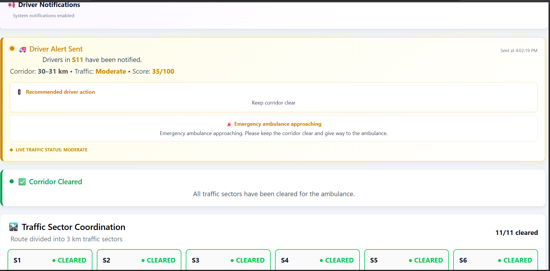
driver alert dashboard
-
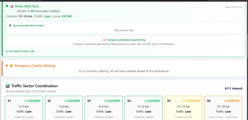
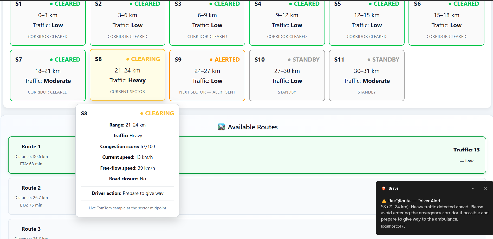
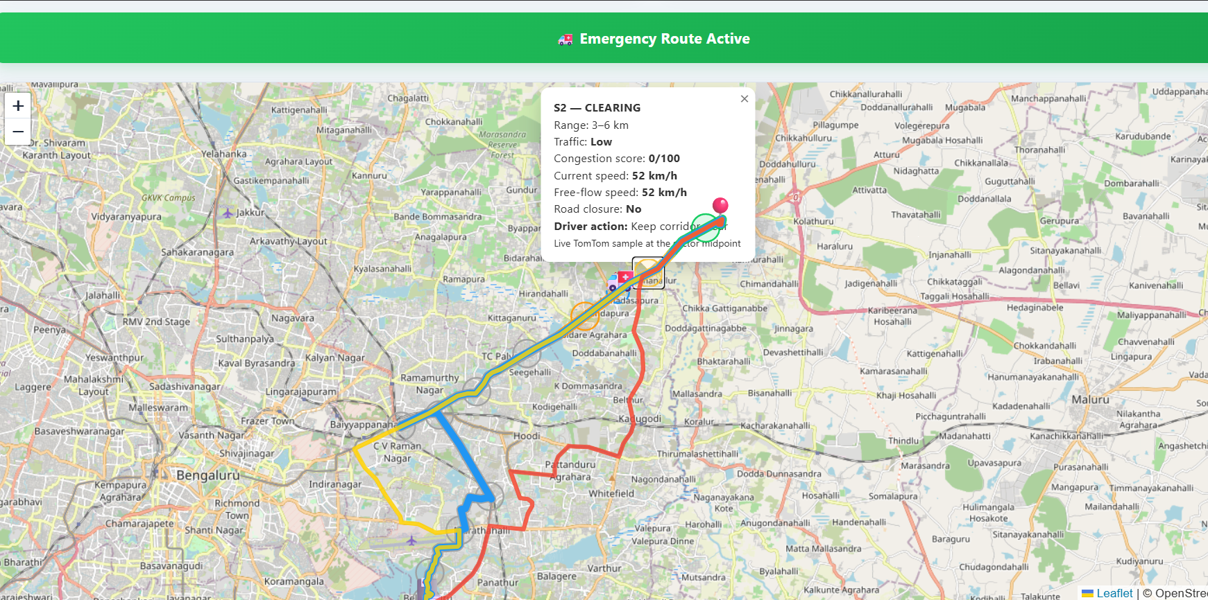
sectors getting updated with the data
-
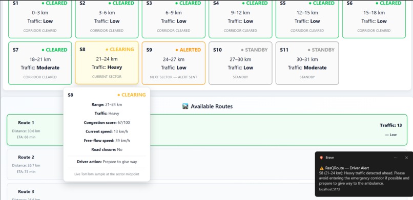
data in the sectors calculated using the live data from tomtom routing and traffic
-
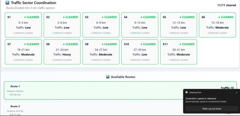
-
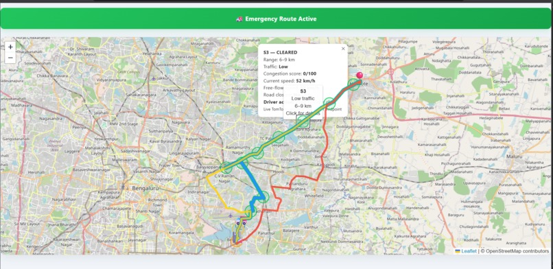
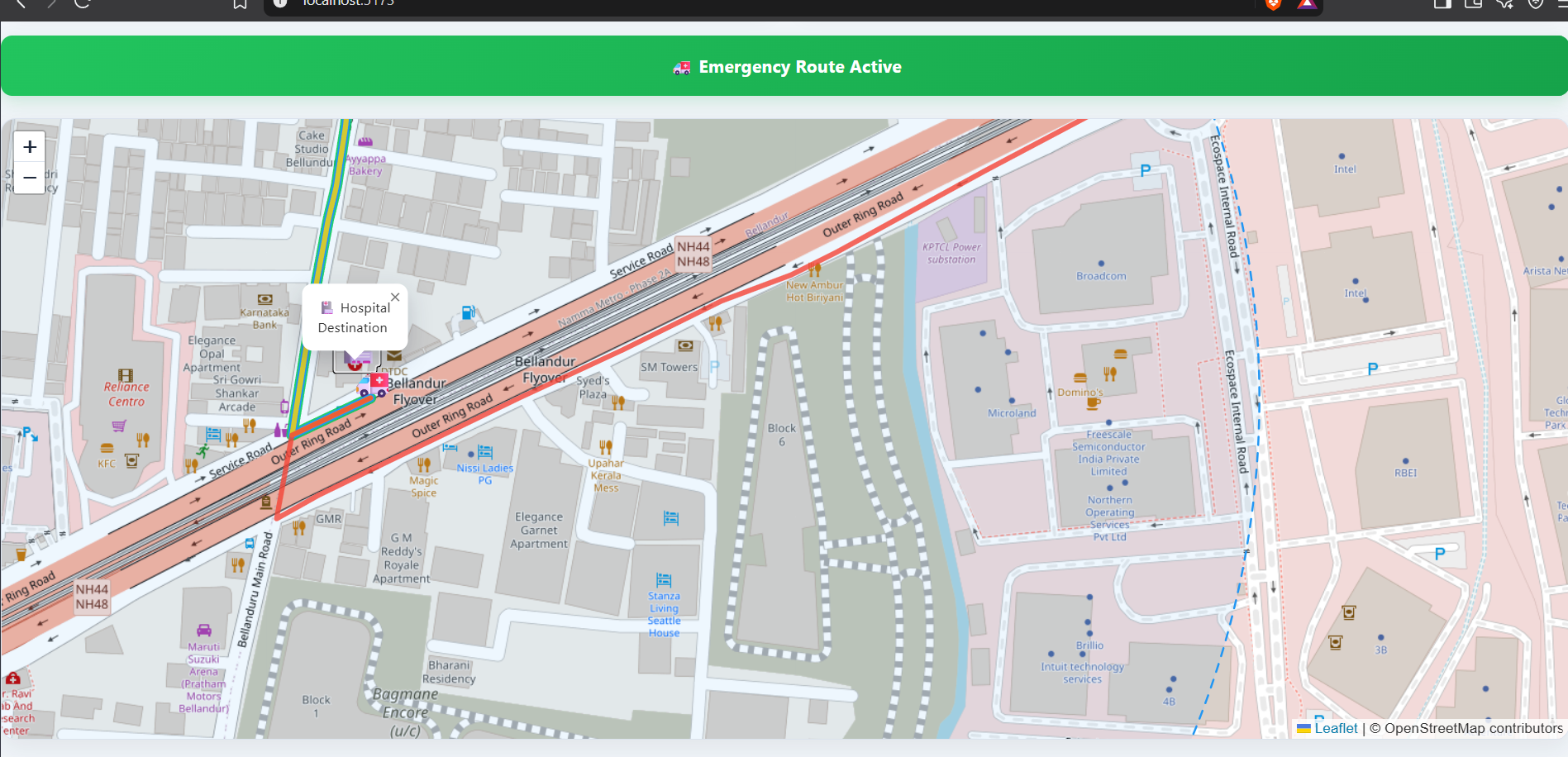
when emergency route active is pressed
-
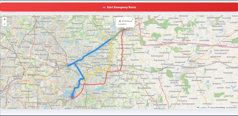
route1 represented with blue colour, route2 with yellow and route3 with red colour
-
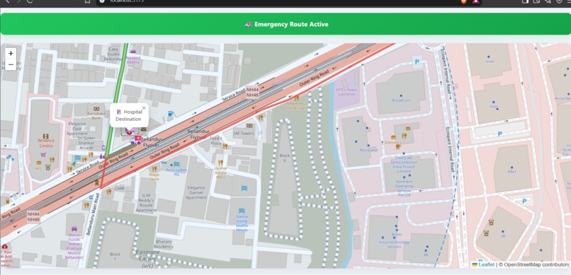
-
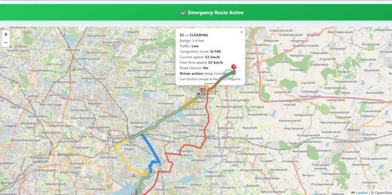
data in map of each sector can been seen
ResQRoute — Emergency Traffic Coordination System
Inspiration
The idea for ResQRoute came to me while I was travelling to college. I came across heavy traffic where an ambulance was stuck. I saw a traffic police officer trying his best to clear the traffic and make way for the ambulance, but it made me think about how difficult it can be to coordinate everyone on the road during an emergency.
I started wondering: What if the drivers themselves knew that an ambulance was approaching their route?
Instead of relying only on traffic police or people noticing the ambulance, what if drivers received an alert telling them that an emergency vehicle was approaching and suggesting that they clear the lane or temporarily take an alternate path until the ambulance passed?
That led to another question: What if the ambulance driver could also see the available routes to the destination and know which route was currently the fastest?
These ideas became the foundation of ResQRoute — a system that combines emergency route selection with traffic coordination. The goal is to help the ambulance find an efficient route while also informing and coordinating with the traffic ahead so that the route can be cleared before the ambulance reaches it.
What It Does
ResQRoute is an Emergency Vehicle Traffic Coordination System that combines emergency route planning, live traffic information, route segmentation, and sector-based driver alerts.
Instead of treating the entire ambulance journey as one continuous route, ResQRoute divides the route into approximately 3 km sectors. Each sector can have a coordination status:
- 🟢 Cleared
- 🟡 Clearing
- 🟠 Alerted
- 🔴 Congested
- ⚪ Standby
This provides a corridor-level view of the ambulance journey and helps identify which section of the route requires attention.
The system is designed around two important parts:
- Helping the ambulance driver identify an efficient route to the destination.
- Helping coordinate traffic ahead by providing alerts about the approaching emergency vehicle.
How We Built It
ResQRoute is built as a web application using React and Vite for the frontend and Node.js with Express.js for the backend.
The main technologies used are:
- React
- Vite
- JavaScript
- Node.js
- Express.js
- TomTom Routing API
- TomTom Traffic API
- Leaflet
- React-Leaflet
- OpenStreetMap
- Git & GitHub
System Workflow
- The user selects an ambulance location and hospital destination.
- The backend requests route information using the TomTom Routing API.
- The route is divided into approximately 3 km sectors.
- Traffic information is obtained using the TomTom Traffic API.
- The traffic conditions along the route are used to monitor the sectors.
- Each sector is assigned a coordination status such as Standby, Alerted, Clearing, Cleared, or Congested.
- Driver alerts are associated with the relevant part of the emergency corridor.
- The dashboard displays the ambulance route, traffic conditions, sector states, and alert information.
The frontend communicates with the backend rather than exposing the TomTom API key directly in the public frontend code.
Challenges We Ran Into
One of the biggest challenges was bringing together routing, traffic data, map visualization, and sector-based coordination into a single application.
Another challenge was deciding how to represent a long emergency route without making the dashboard difficult to understand. We solved this by dividing the route into approximately 3 km sectors, allowing the system to focus on the upcoming sections of the journey.
We also had to distinguish between traffic severity and the coordination state of a sector. A sector can have heavy traffic while still being in the process of being cleared, so these two pieces of information needed to be represented separately.
Integrating external APIs with the frontend through our backend was another challenge. We also needed to make sure that the API key remained secure and was not included in the public source code.
Accomplishments That We're Proud Of
We are proud that we were able to turn an observation from everyday traffic into a working prototype for emergency vehicle coordination.
Some of the key accomplishments include:
- Building a functional emergency vehicle route dashboard.
- Integrating the TomTom Routing API.
- Integrating TomTom traffic information.
- Visualizing emergency routes using Leaflet and OpenStreetMap.
- Dividing routes into approximately 3 km sectors.
- Creating sector-based coordination states.
- Implementing driver alert information.
- Creating a dashboard that brings routing, traffic, and coordination information together in one interface.
- Keeping the project source code publicly available through GitHub.
What We Learned
Building ResQRoute helped us understand how frontend applications, backend APIs, mapping libraries, routing services, and traffic data can work together to solve a real-world problem.
We learned that building a useful system is not only about connecting APIs. The information returned by those APIs has to be transformed into something that a person can understand and act on quickly.
Most importantly, we learned that emergency routing is not only about finding a path from point A to point B. Coordinating the traffic along that path can also be an important part of making the route useful during a real emergency.
What's Next for ResQRoute
The current prototype demonstrates the core emergency traffic coordination workflow. There are several directions in which ResQRoute could be developed further:
- More advanced real-time traffic prediction.
- Machine-learning-based congestion prediction.
- More detailed junction-level coordination.
- Integration with emergency service control rooms.
- Direct communication with connected vehicles.
- Historical traffic analysis.
- Integration with city traffic-management systems.
- More advanced route comparison and dynamic rerouting.
- Expansion from a prototype dashboard into a system that could support real emergency-response infrastructure.
Conclusion
ResQRoute aims to turn emergency routing into emergency traffic coordination.
The idea started with seeing an ambulance stuck in traffic and a traffic police officer trying to clear a path. We wanted to explore whether technology could help distribute that coordination across the road by informing drivers about an approaching emergency vehicle and helping the ambulance identify an efficient route.
By dividing an ambulance route into manageable sectors and monitoring the traffic conditions along those sectors, ResQRoute provides a clearer picture of the emergency corridor and creates a foundation for coordinating traffic before the ambulance arrives.
Built With
- api
- express.js
- git
- github
- javascript
- leaflet.js
- node.js
- openstreetmap
- react
- react-leaflet
- routing
- tomtom
- traffic
- vite


Log in or sign up for Devpost to join the conversation.