-
-
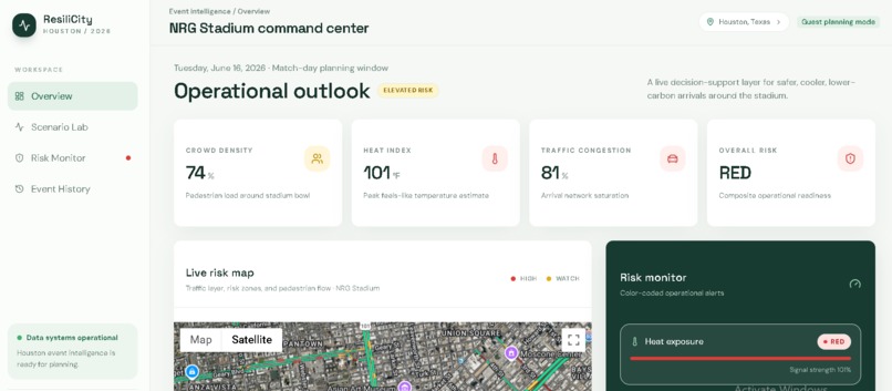
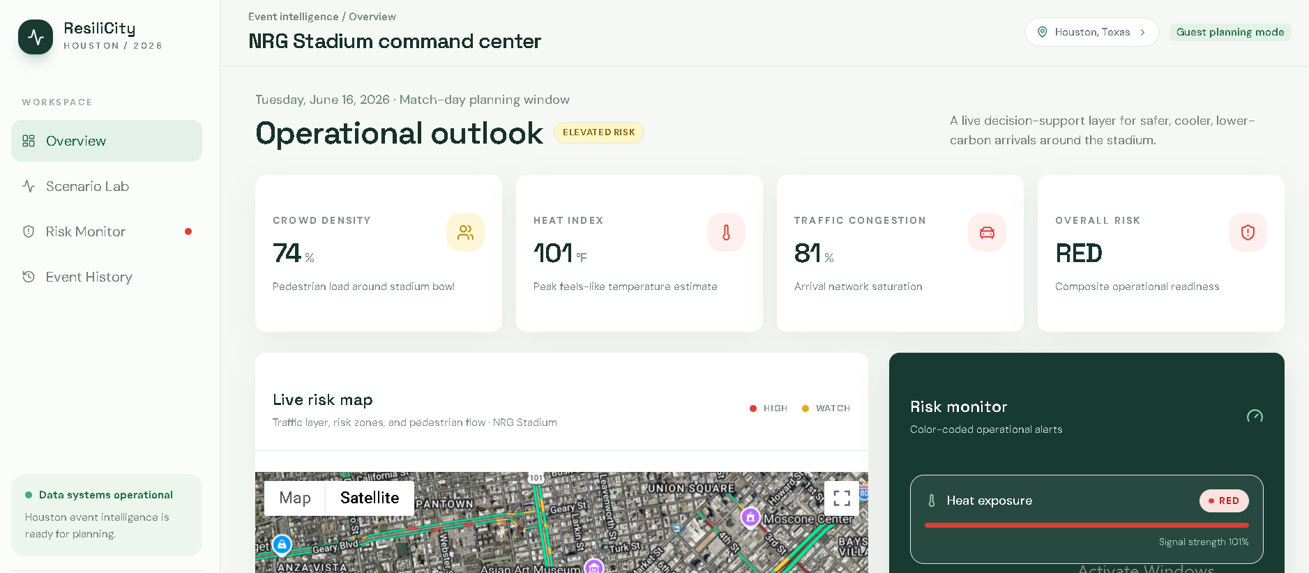
THIS IS A FROENTED PAGE
-
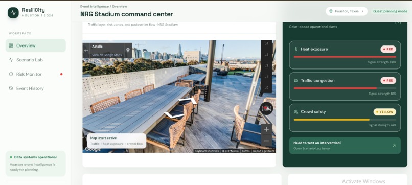
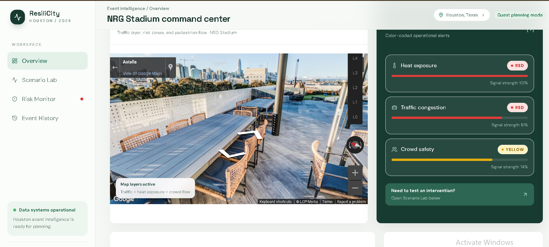
SEE ANY ROAD TREFIC ANY PLACE AND ANY SATE IN USEING THIS MAP
-
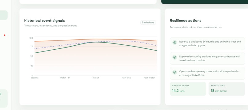
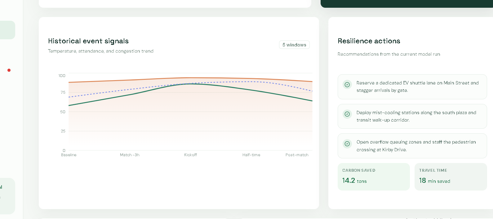
Historical event signals CHART
-
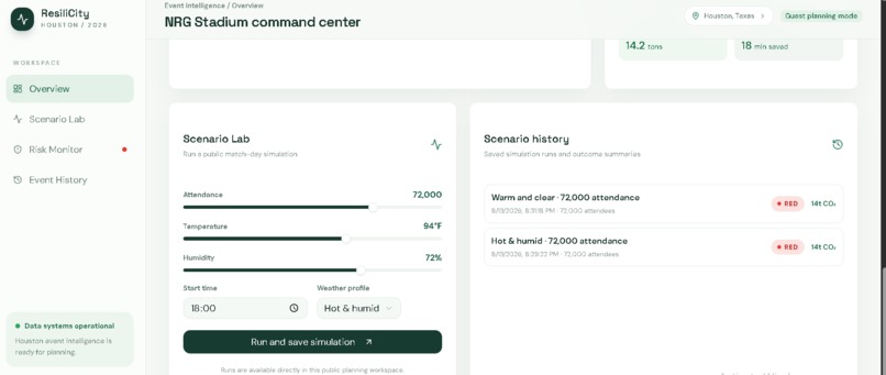
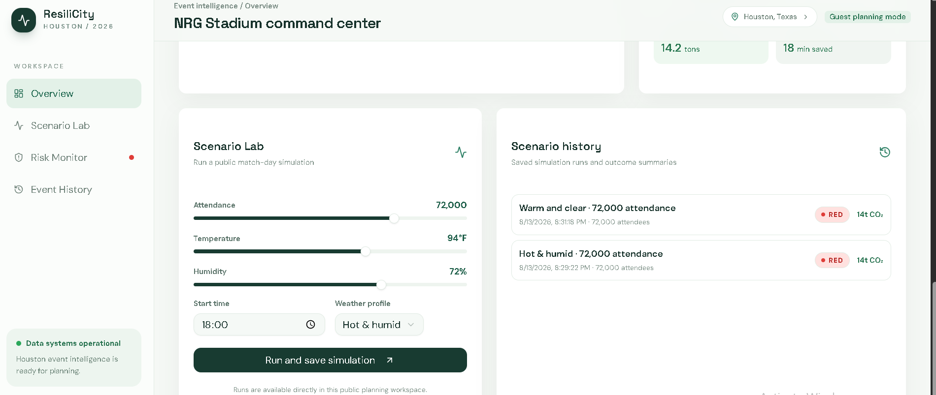
Scenario Lab AND Scenario history SHOW A LAB AND HISTORY
What's next for ResiliCity 2026
Inspiration
Hosting a mega-event like the FIFA World Cup 2026 brings millions of fans to U.S. host cities, but it also creates severe urban challenges. In cities like Houston, Texas, high vehicular traffic leads to major gridlocks, severe carbon emissions, and triggers dangerous Urban Heat Islands (UHI) during hot summer months.
Inspired by the UNLEASH Innovation Methodology and Rice University’s sustainability vision, we wanted to create a tool that transitions cities from passive baseline monitoring to active, data-driven decision making. ResiliCity 2026 was born to help city planners simulate real-time traffic flows, predict climate risks, and optimize interventions before match day arrives.
What It Does
ResiliCity 2026 is an interactive Spatial Digital Twin and Decision Support Platform designed for FIFA World Cup 2026 host cities. Focusing on Houston (NRG Stadium & Downtown) as our primary case study, the platform provides:
- Interactive 3D Spatial Twin: Visualizes traffic bottlenecks, first/last-mile transit gaps, and land surface temperatures in 3D using Mapbox GL JS.
- Predictive Risk Mapping: Overlays real-time transit congestion with Urban Heat Island (UHI) indices to identify heat-stroke and crowd-safety risk corridors.
- Interactive "What-If" Scenario Engine: City planners can dynamically adjust sliders—such as dedicating EV shuttle lanes, deploying shaded cooling corridors, or installing off-grid solar microgrids.
- Instant Impact Metrics: Real-time feedback models calculate exact savings: $$\text{Impact Score} = f(\Delta \text{CO}_2, \Delta \text{Heat Index}, \Delta \text{Transit Delay})$$
How We Built It
We integrated multi-layered open datasets and built a responsive web-based digital twin:
- Frontend & 3D Maps: Built with React and Mapbox GL JS / Deck.gl for high-performance 3D spatial rendering.
- Data Pipelines: Extracted road network graphs using
OSMnx, route/schedule data via public GTFS transit feeds, and climate baselines using EPA/NASA satellite thermal overlays. - Simulation Engine: Developed Python-based analytical scripts (
geopandas,pandas) to compute mathematical relationships between vehicle density, idle emissions, and temperature spikes: $$\Delta T = \alpha \cdot (\text{Traffic Density}) - \beta \cdot (\text{EV Mitigation Share})$$
Challenges We Faced
- Multi-Source Data Fusion: Aligning spatial GIS data (road networks) with temporal data (transit schedules and real-time match day schedules) while keeping performance smooth in the web browser.
- Balancing Real-Time Rendering: Rendering complex 3D heatmaps and traffic layers without causing UI lag during live slider interactions.
- Translating Complex Models to Intuitive UI: Ensuring complex climate and mobility data could be easily understood by non-technical decision-makers within 3 clicks.
Accomplishments That We're Proud Of
- Fully functional 3D Digital Twin specifically centered around Houston's NRG Stadium area.
- Real-time calculation engine that updates CO2 reductions, transit delays, and heat drops instantaneously as users move sliders.
- Seamlessly bridging Track 1 (Transportation & Access) and Track 3 (Public Health & Built Environment) into a unified decision tool.
What We Learned
- Applying the UNLEASH Innovation Methodology to frame user-centric urban sustainability problems.
- Combining spatial network analysis with urban heat modeling to solve multi-dimensional municipal challenges.
- The critical importance of designing scalable tools that leave a long-term post-event legacy for smart cities.
What's Next for ResiliCity 2026
- Multi-City Expansion: Scaling the platform architecture to cover all 11 U.S. FIFA World Cup host cities.
- Live IoT & Sensor Integration: Connecting municipal traffic camera feeds and weather station sensors for automated real-time calibrations.
- Legacy Reuse: Adapting the framework for future major civic events such as the Olympics, Super Bowls, and disaster evacuation management.
Built With
- 3d-graphics
- climate-tech
- data-visualization
- deck.gl
- fifa-world-cup-2026
- geopandas
- gis
- gtfs
- javascript
- mapbox-gl-js
- openstreetmap
- pandas
- python
- react
- simulation
- sustainability
- urban-planning


Log in or sign up for Devpost to join the conversation.