-
-
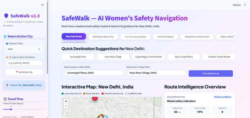
SafeWalk (RaahSaathi) — AI-grounded women's safety navigation.
-
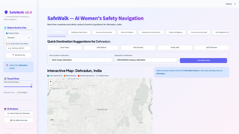
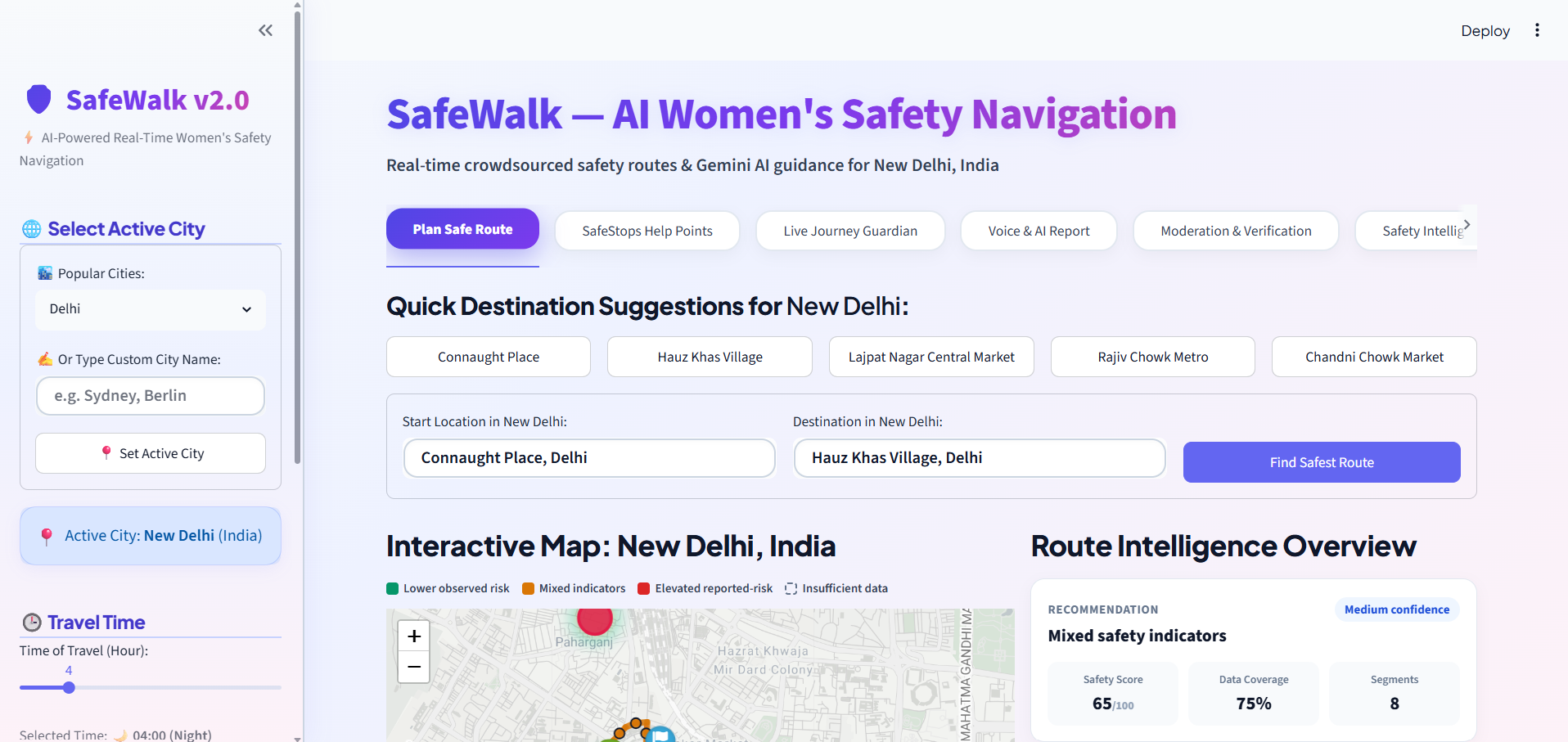
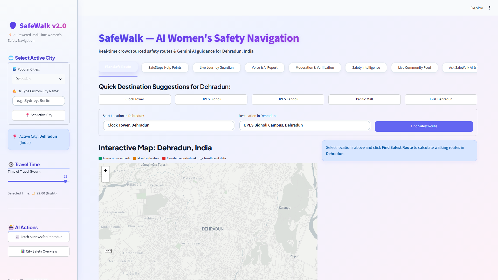
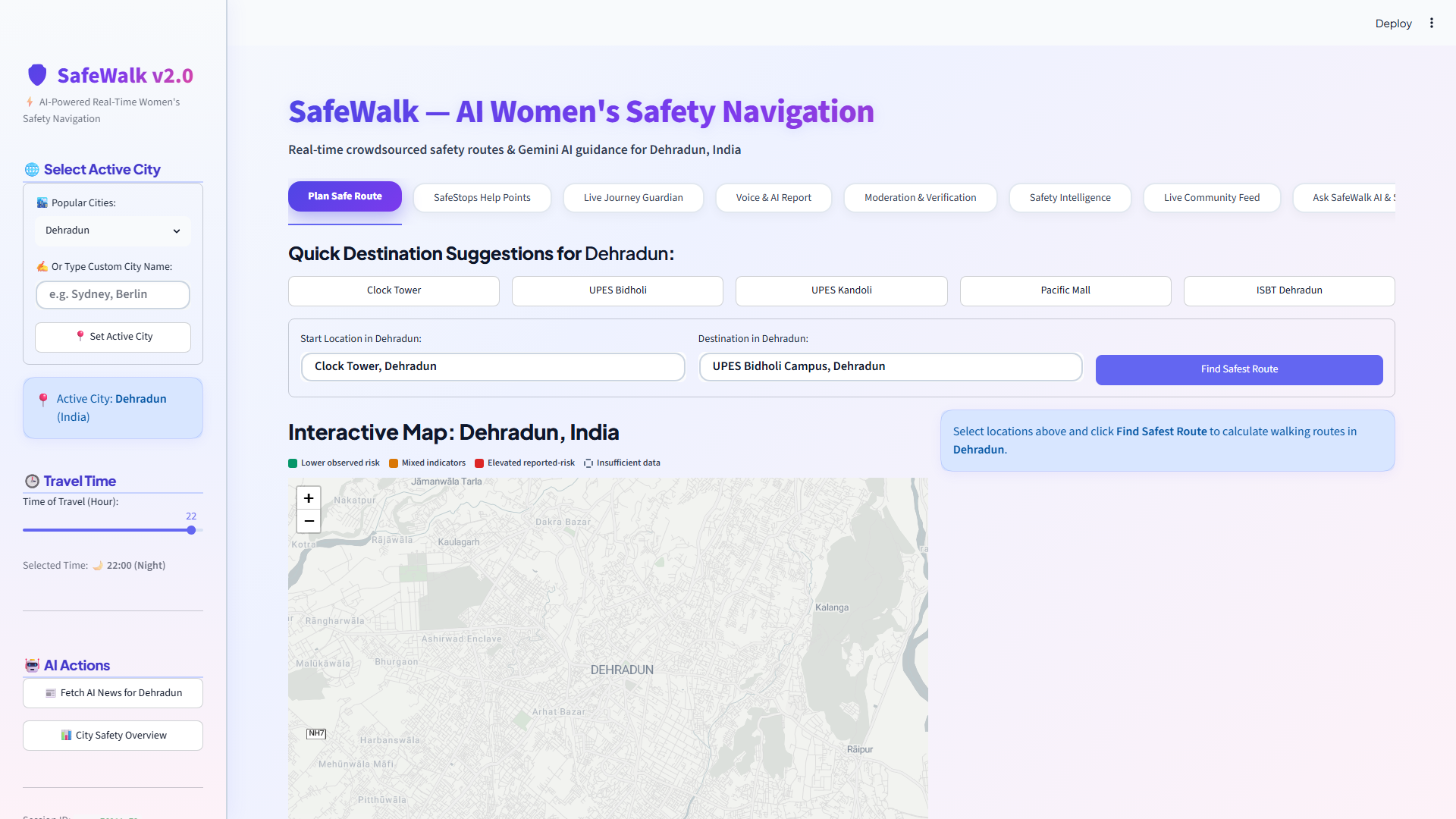
Dual-Route Safe Navigation: Real-time Safest Route (Emerald Green) vs. Shortest Route (Coral Red).
-
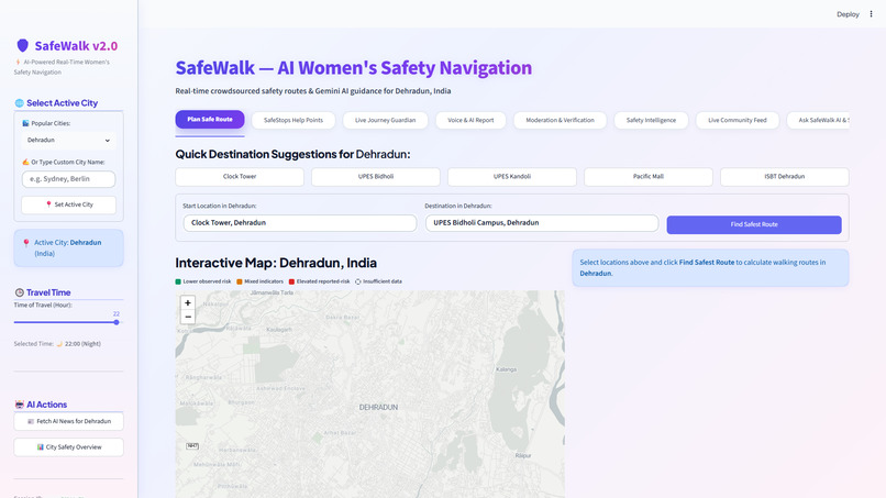
Explainable Segment-Level Route Intelligence: 100m–200m road section safety breakdown and confidence audit.
-
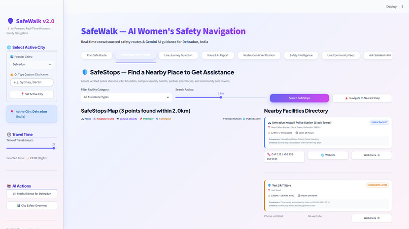
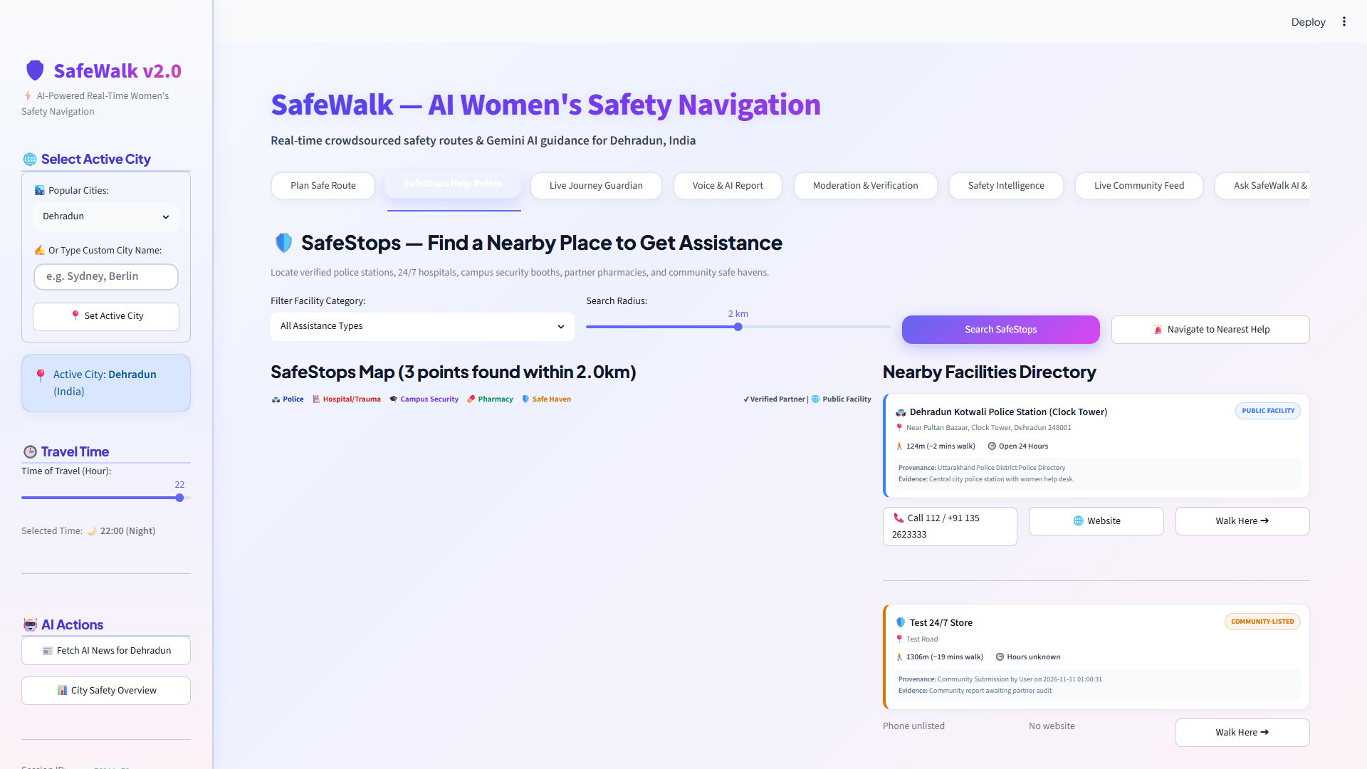
SafeStops Verified Assistance Havens: 1-Tap emergency rerouting to 24/7 police stations, hospitals, and campus security booths.
-
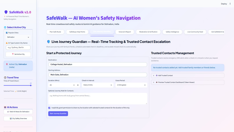
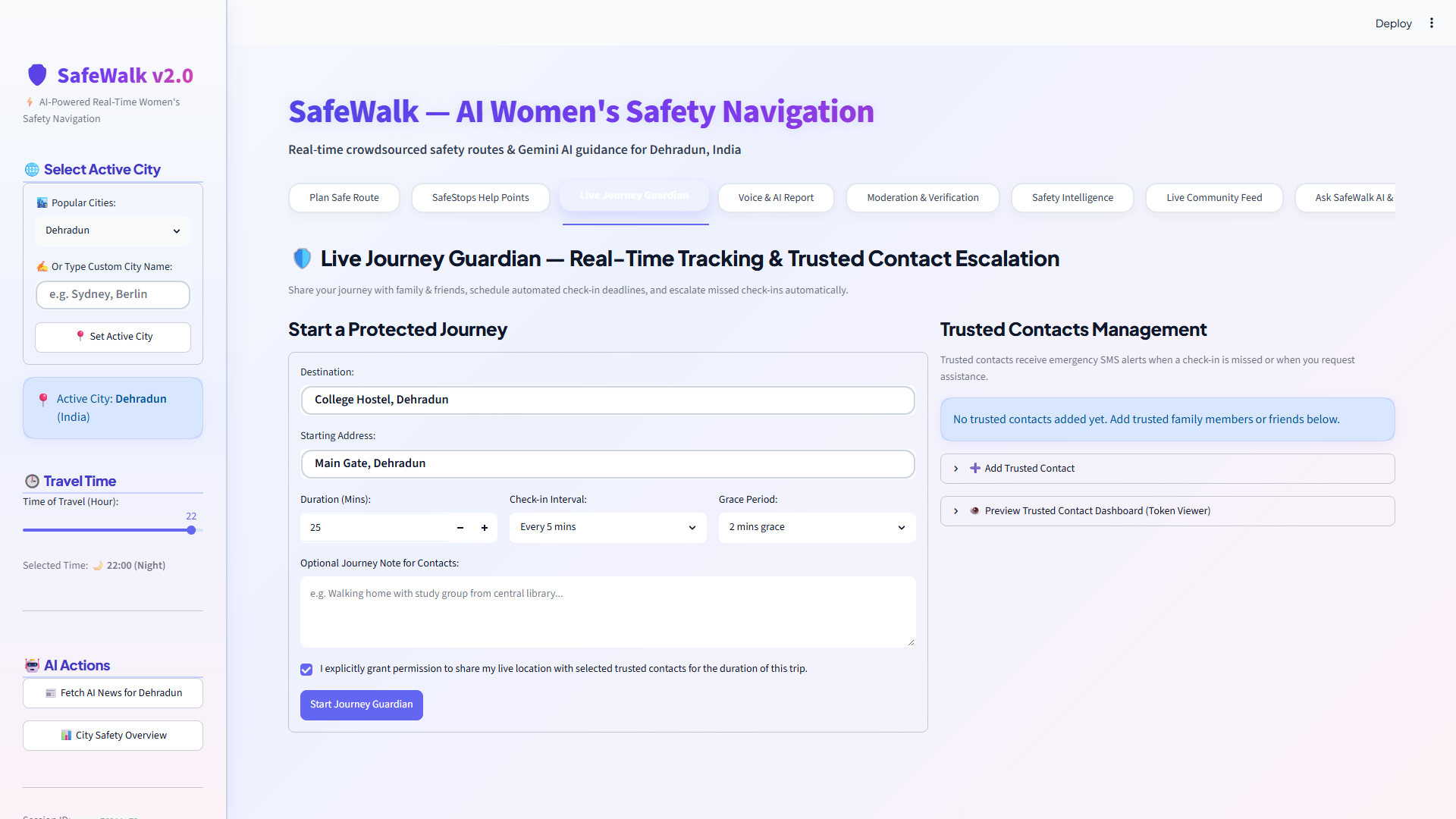
Live Journey Guardian: Cryptographic journey tracking, periodic "Are you okay?" check-ins, and automated SMS escalation.
-
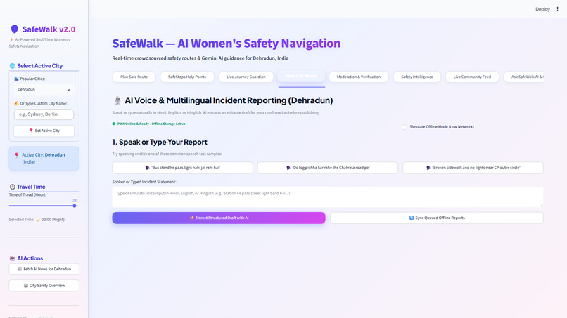
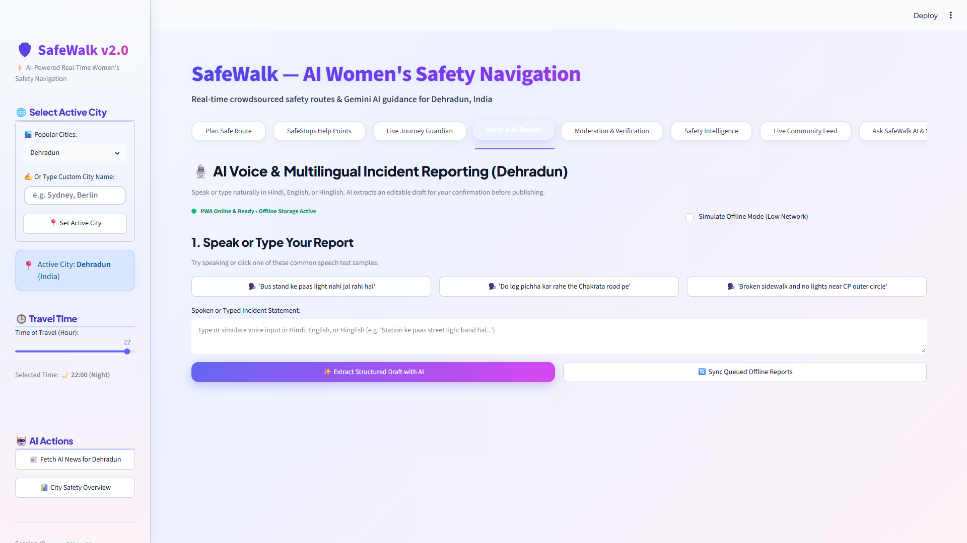
Multilingual AI Voice Reporting: Natural Hinglish/Hindi speech-to-incident extraction with PWA offline queue.
-
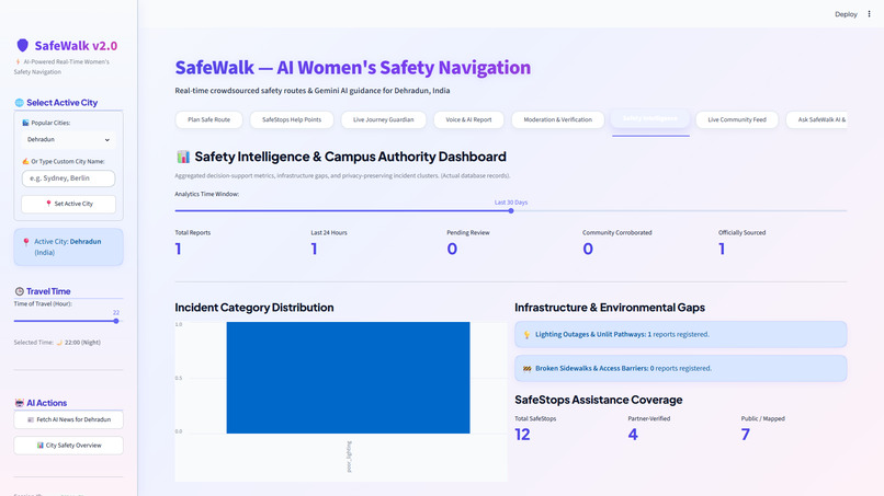
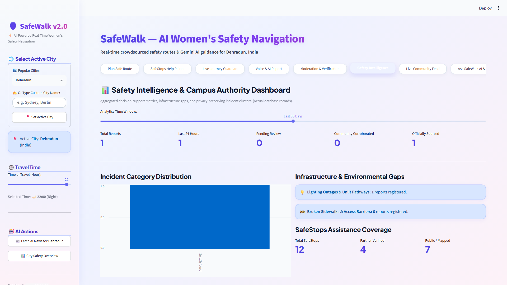
Institutional Safety Intelligence Dashboard: 1.1km privacy-preserving incident clusters and infrastructure gap analytics.
Inspiration
Every single day, millions of women commute home from universities, corporate workplaces, and public transit hubs. Yet, every mainstream navigation system—from Google Maps to Apple Maps—optimizes for exactly one mathematical metric: speed ($\text{Distance} \div \text{Time}$).
These algorithms will gladly direct a woman walking alone late at night through an unlit back-alley, an abandoned underpass, or an unmonitored backroad just to shave 90 seconds off her commute. We built SafeWalk (RaahSaathi) to challenge this blindspot: re-engineering urban navigation to prioritize human safety and survival over raw transit time, backed by verifiable road geometry, vetted physical havens, and explainable spatial intelligence.
What it does
SafeWalk (RaahSaathi) is a production-grade, privacy-first women's safety platform offering seven interconnected capabilities:
- Dual-Route Navigation & Explainable Segment Intelligence: Simultaneously computes the conventional shortest path (Fastest Route in Coral Red) and the algorithmically optimized Safest Route (Emerald Green). Routes are segmented into 100m–200m atomic sections, showing explicit evidence for streetlights, commercial footfall, diurnal decay, and data confidence.
- SafeStops Verified Assistance Havens: A curated directory of vetted 24/7 physical shelters (police stations, trauma centers, campus security desks, and late-night pharmacies) with 1-tap instant emergency rerouting.
- Live Journey Guardian: Cryptographically signed tracking using 32-byte high-entropy tokens (SHA-256 hashed). Periodic "Are you okay?" check-ins automatically escalate if missed, dispatching simulated SMS alerts to trusted contacts who can acknowledge that help is on the way.
- Multilingual AI Voice Reporting: Conversational incident reporting in Hindi, English, and Romanized Hinglish ("Bus stand ke paas light nahi jal rahi hai"). Google Gemini NLP extracts structured JSON drafts for mandatory user review before publishing.
- Trustworthy Community Corroboration: Dual-dimension moderation that separates community votes from official provenance, preventing brigading while maintaining transparent audit trails.
- Offline PWA & Idempotent Sync: Client-side caching and cryptographic idempotency keys ensure uninterrupted navigation and local incident queueing in low-connectivity transit zones.
- Institutional Safety Intelligence Dashboard: Real-time geospatial risk clustering using 1.1km generalized privacy cells, empowering campus authorities and municipalities to target infrastructure audits (e.g., fixing streetlight outages) without tracking individual movements.
How we built it
- Routing & Road Geometry: Open Source Routing Machine (OSRM) pedestrian engine paired with OpenStreetMap Overpass API for real-time extraction of streetlights, commercial POIs, and police stations.
- Explainable 4-Pillar Scoring: A deterministic mathematical model factoring in verified lighting (25%), active storefront footfall (30%), a continuous diurnal time penalty peaking at 02:00 AM (25%), and dynamic community incidents decayed using a 48-hour half-life exponential formula.
- AI & NLP Intelligence: Google Gemini AI grounded in WHO and NCRB safety guidelines for natural language parsing, Hinglish entity extraction, and contextual safety briefings.
- Frontend & Mapping: Streamlit with customized Folium and Leaflet.js components, supporting dual polylines, custom marker clusters, and responsive PWA service workers.
- Security & Database: SQLite in WAL mode, zero-knowledge token generation (32-byte cryptographic secrets), and OWASP-hardened state handling.
Challenges we ran into
- Separating Safety from Data Confidence: Early on, roads with zero incident reports scored artificially high. We resolved this by building a dual-dimensional evaluation engine: a road with no reports is marked as "Low Confidence" rather than falsely assumed to be safe.
- Real Road Polyline Splitting: Slicing continuous walking routes into accurate 100m–200m atomic sections following actual road geometry (rather than straight-line Euclidean shortcuts) required custom geospatial interpolation and bearing calculations.
- Hinglish Syntax Parsing: Users naturally report incidents using mixed code languages. Tuning prompt templates to accurately extract categories and severities from Romanized Hindi required rigorous few-shot grounding.
- Streamlit State Reactivity: Managing state across eight interconnected tabs without re-triggering unnecessary route recalculations was solved through custom session buffers.
Accomplishments that we're proud of
- Achieving 100% test pass rate across all 13 core unit tests covering route segmentation, state machine triggers, and idempotent offline queues.
- Generating a complete Explainable Route Intelligence breakdown where every road segment tells the user why it received its score in plain language.
- Designing an end-to-end cryptographic journey tracker that requires zero third-party account creation for trusted contacts to view live progress.
- Producing a production-ready system with clean git history, Docker readiness, and comprehensive documentation.
What we learned
- Real human safety in navigation cannot be reduced to a single black-box score; explainability and data provenance are non-negotiable for building user trust.
- In emergencies, UI cognitive load must be near zero: 1-tap emergency rerouting to SafeStops proved far more effective than traditional directory searching.
What's next for RAAHSAATHI
- Hardware Beacon & Wearable Integration: Pairing with BLE panic buttons and smartwatch heart-rate monitors to automate emergency escalation.
- Municipal API Integrations: Direct integration with smart-city streetlight management portals (SCADA) to automate repair work-orders for reported outages.
- Multimodal Video & Audio Sensing: Edge-AI audio detection on mobile devices to automatically flag signs of distress in real time.
Built With
- folium
- google-gemini
- leaflet.js
- natural-language-processing
- openstreetmap
- osrm
- pwa
- python
- rag
- sqlite
- streamlit

