-
-
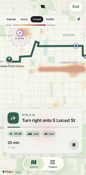
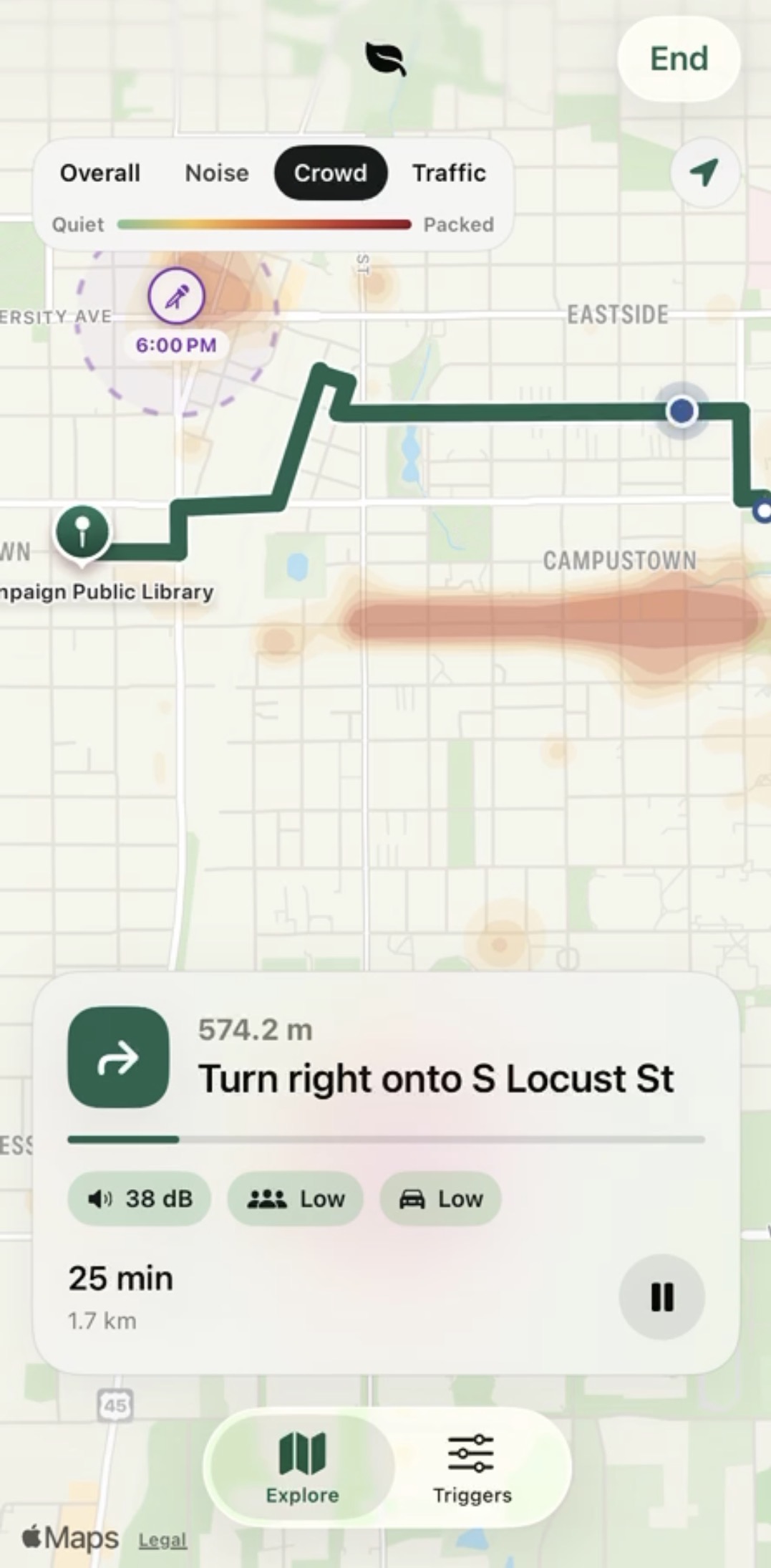
Crowd Heatmap
-
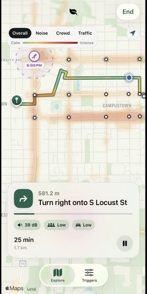
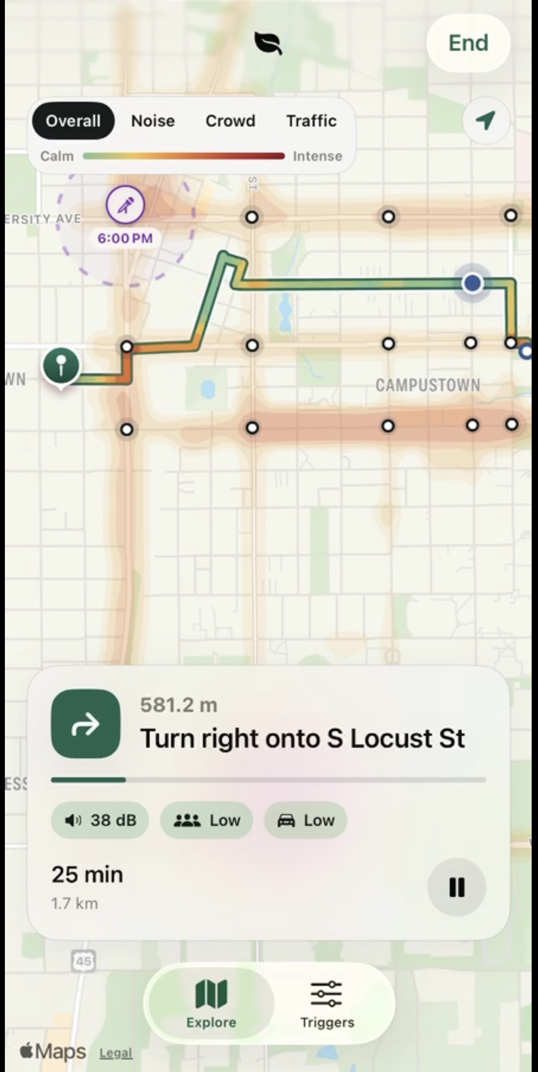
Overall Heatmap combining noise, crowd, and traffic data
-
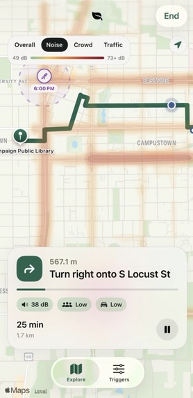
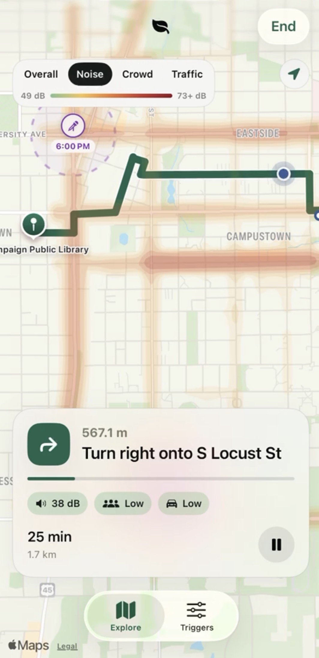
Noise Heatmap
-
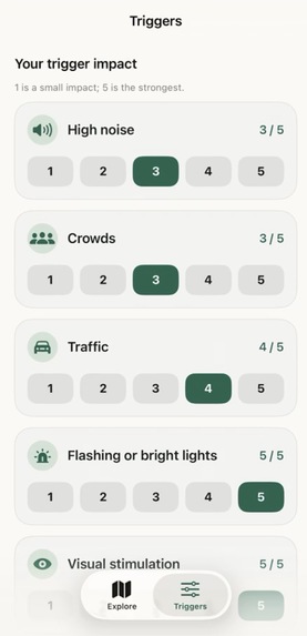
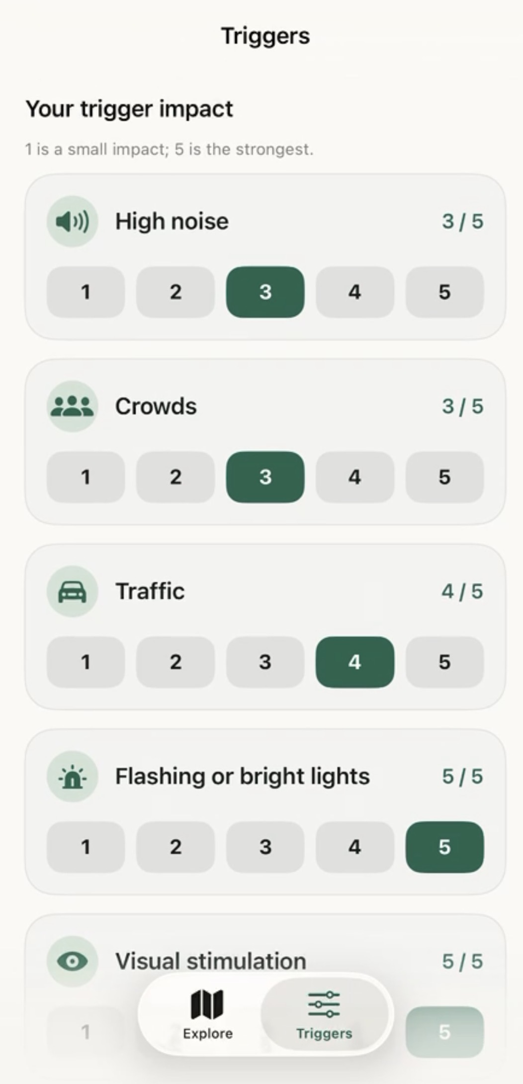
Customizable interface for the user to customize what triggers affect them the most.
-
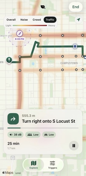
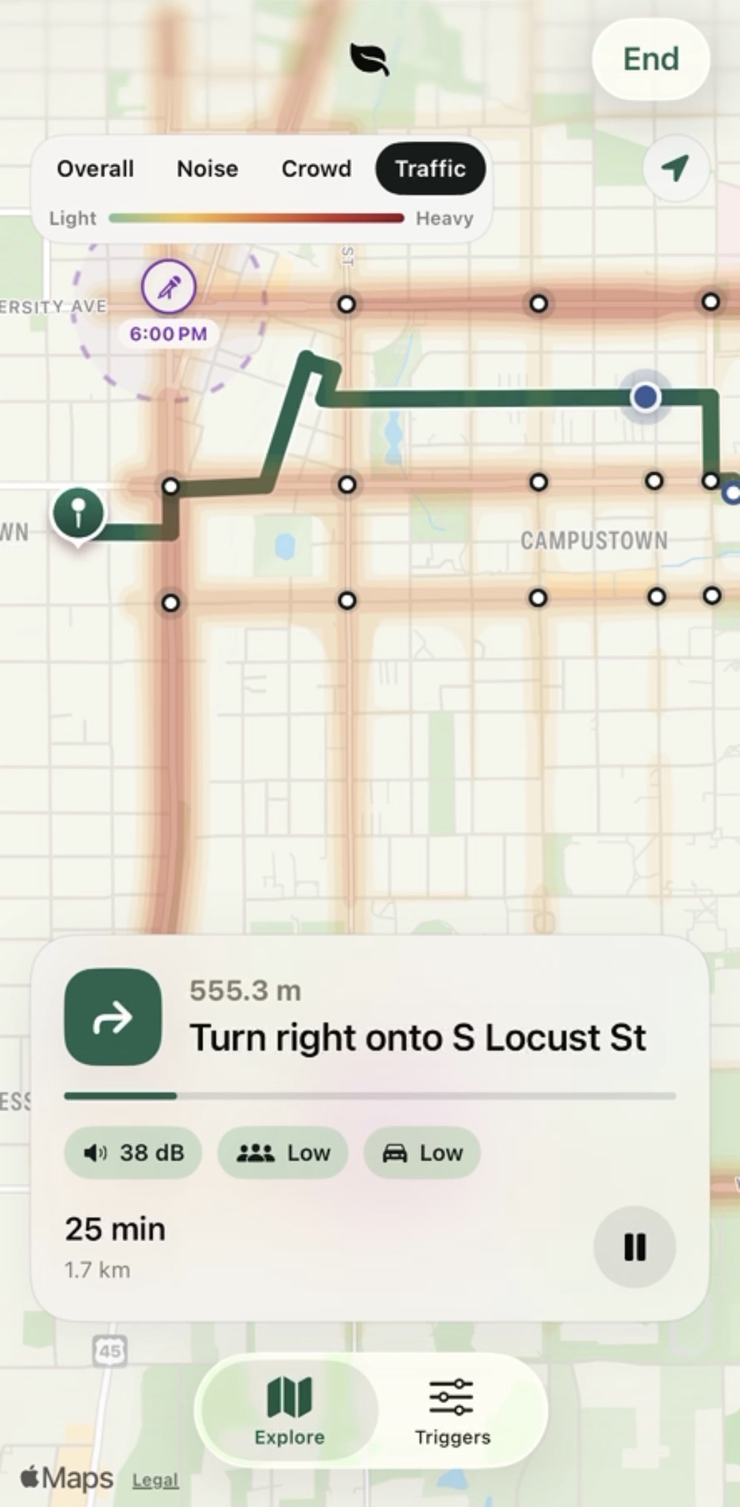
Traffic + Street Lights Heatmap
Inspiration
Quietside divides Campustown into a grid and estimates the noise and sensory intensity of each area using traffic, crowd, venue, and event data. Finding a destination through natural language, it weights these conditions according to the user’s sensitivities, then uses Dijkstra’s algorithm to find a low-stimulation corridor. Apple Maps converts that corridor into walkable directions, and Quietside selects the calmest route that does not require an unreasonable detour.
Navigation is a system that a meaningful group of people struggle to use: for people with anxiety disorders, autism and sensory sensitivities, the fastest route is often the one they can't take, which makes standard maps an accessibility barrier hiding in plain sight. Quietside is a digital product that redesigns navigation around their needs, substantially expanding who can successfully use a map to get where they need to go, calmly and on their own.
A friend of ours can find ordinary walks overwhelming because of noise, crowds, traffic, and harsh lighting. This isn’t an isolated problem. An Oxford study found that sensory burden is cumulative: several individually tolerable stimuli can combine until a public space becomes difficult to enter or remain in. Meanwhile, the NIMH estimates that 19.1% of U.S. adults experience an anxiety disorder in a given year (though sensory overload is only one narrower, overlapping problem).
What it does
So we made Quietside, a iOS navigation app (SwiftUI, MapKit) that finds the calmest, least-stimulating route. Users can set their sensitivity to noise, crowds, traffic, and lighting, and then describe the kind of place they need in natural language (or search for a destination).
How we built it
We divide Campustown into a 12-meter grid. Each cell receives an estimated sensory cost from official traffic-volume data, past open-source collected data, nearby roads and venues, pedestrian hubs, intersections, and active campus events. These inputs produce separate noise, crowd, traffic, and visual-stimulation layers.
The user’s profile determines how heavily each layer is weighted. Dijkstra’s algorithm then searches the grid for the lowest-cost corridor based on distance and sensory exposure. A loud or crowded block therefore becomes computationally “longer,” even when it is physically shorter.
We use points along that corridor to request real walking directions from Apple Maps. Each candidate route is sampled roughly every eight meters and scored using \route cost = travel time × (1 + personalized sensory penalty)\
It then returns two choices: Fastest and Calmest. It also explains the result (i.e. “4 dB quieter,” “avoids Green Street,” or “two fewer signalized crossings”).
Challenges we ran into
The hardest part was bridging two different representations of the city. Our sensory model operates on a continuous grid, while Apple Maps operates on real streets and sidewalks. We solved this by using Dijkstra’s algorithm to discover a calm corridor, selecting safe intermediate waypoints, and letting MapKit generate the final walkable geometry.
The other challenge is uncertainty. Environmental data is incomplete and changes constantly. We therefore treat readings as comparative estimates, discard raw audio, show limited-confidence data honestly, and never promise that a route is medically safe or perfectly quiet.
Accomplishments that we're proud of
Quietside began with trying to help our friend navigate Campustown more comfortably, and now we’re helping to give him more control over how they move through the world.
What we learned
We learned that the mathematically lowest-cost path is not automatically a usable path. A route must respect real sidewalks, crossings, and street geometry, which required us to combine our own algorithm with an existing navigation system.
We also learned that responsible accessibility software must represent uncertainty instead of hiding it. In a changing environment, a useful estimate with clear limitations is more honest than a false guarantee.
What's next for Quietside
Currently, we primarily rely on open-source data. We wanted to institute a crowd-sourcing effort through survey on stimuli where users can rate the stimuli around them (perhaps using iPhone in-build sensors). We also plan on expanding to more urban areas and for supporting bikers and drivers to reduce stimulation for as many people as possible.
Built With
- claude
- codex
- gis
- mapkit
- openstreetmap
- swift
- xcode

Log in or sign up for Devpost to join the conversation.