Project Story: The Genesis of Mundus_sub_Oculo (Point Zero)

🧭 The Inspiration

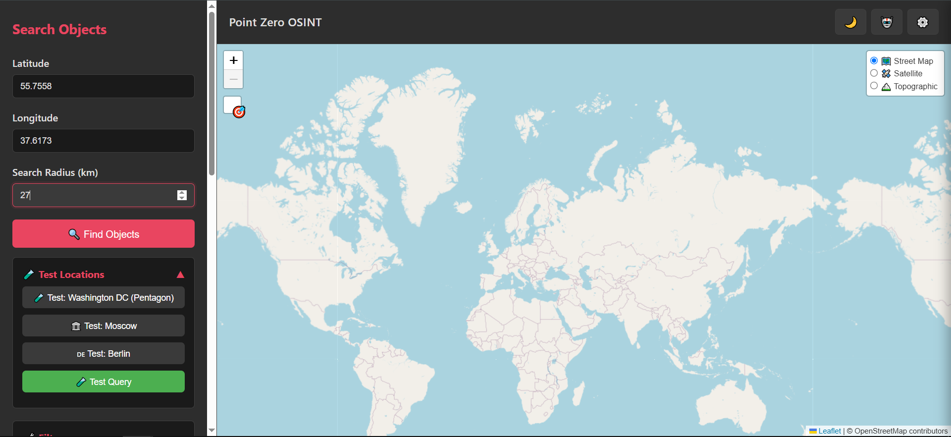
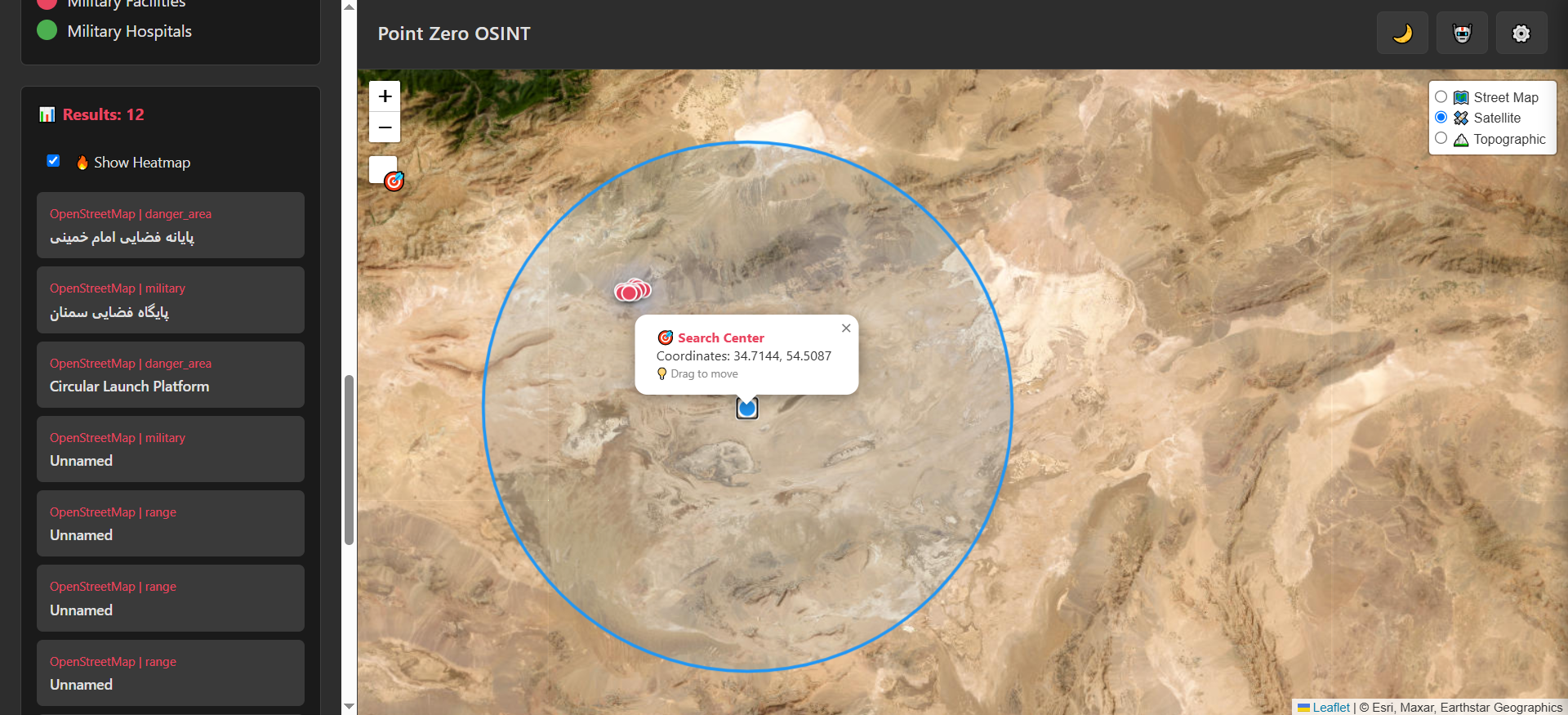
The inspiration for Mundus_sub_Oculo (internally known as Point Zero) came from the intersection of two rapidly evolving fields: Open-Source Intelligence (OSINT) and AI-driven development. I noticed that while geodata is abundant, tools for quickly filtering strategic infrastructure (like military and medical facilities) are often either too complex or hidden behind paywalls. I wanted to create a "zero-point" — a minimalist, fast, and 100% client-side entry point for spatial researchers.

🛠 How I Built It (The "Vibe Coding" Way)

This project is a testament to the AI Vibe Coding philosophy. Instead of manual boilerplate, I acted as an architect, directing a suite of advanced AI models:

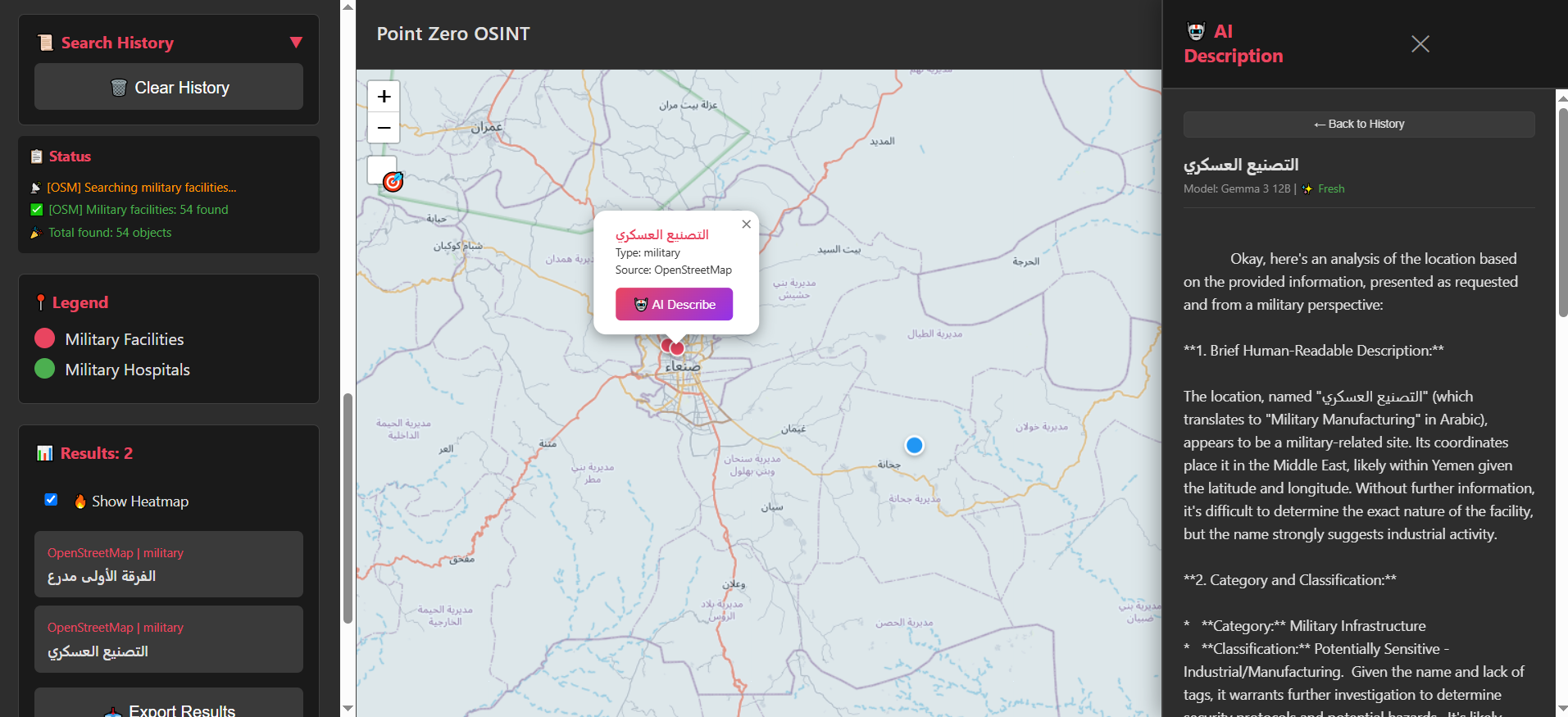
  • Claude 4.5 (Sonnet): Served as the primary engine for the core logic, implementing the complex Overpass API queries and the data export system.
  • Gemini & ChatGPT: Used for refining the UI/UX and ensuring the dark-mode ergonomics were perfect for long research sessions.
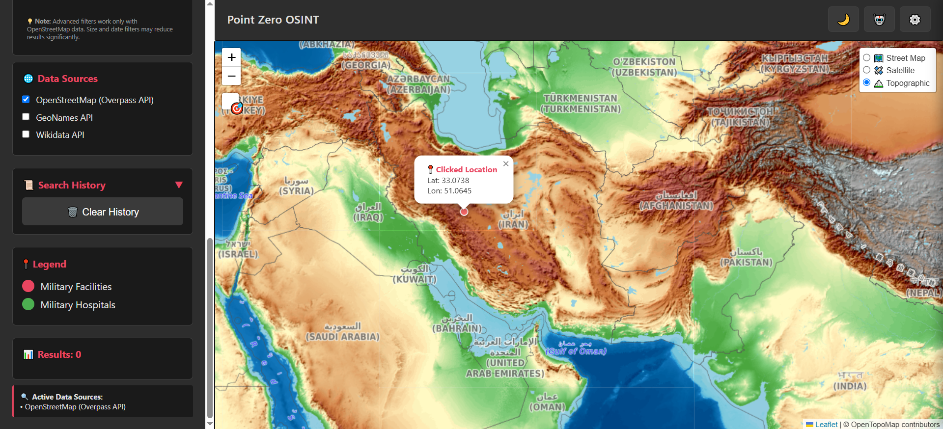
  • Tech Stack: We went for a "Serverless OSINT" approach—using Vanilla JS, Leaflet.js for mapping, and OpenStreetMap/Overpass API for real-time data fetching. No backend, no tracking, just pure data.

🧠 Challenges I Faced

  • Data Precision: Validating coordinates and managing radius-based searches (from meters to 10,000 km) without breaking the browser's performance was tricky.
  • Export Diversity: Implementing 7 different export formats (from GeoJSON to ZIP archives) entirely in the browser required fine-tuning the data serialization logic.
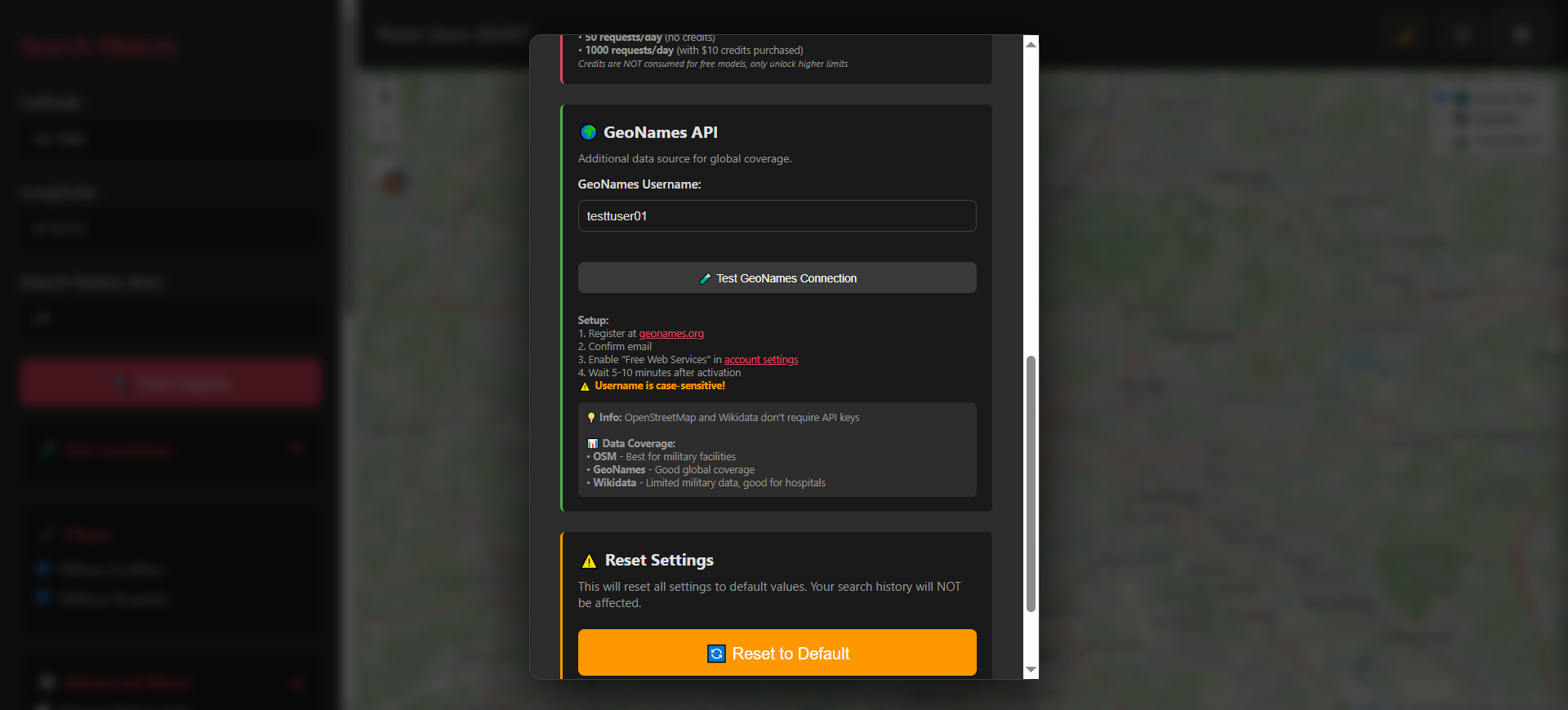
  • API Security: Ensuring users could bring their own API keys for services like GeoNames while keeping the app static and secure.

📖 What I Learned

Through this project, I mastered the art of Prompt Engineering for Geospatial Systems. I learned that building complex OSINT tools is no longer about writing every line of code—it's about understanding the underlying data structures (OSM tags) and effectively communicating that vision to AI. I also deepened my understanding of privacy-first software design; keeping everything client-side is the ultimate form of user protection.

📈 Future Roadmap

Mundus_sub_Oculo is designed to be extensible. My next steps include:

  • Integrating Satellite Imagery analysis via AI.
  • Adding more specialized filters (logistics, energy infrastructure).
  • Implementing LaTeX-based reports for professional intelligence documentation.

Rapid Prototyping: Initial MVP developed in just 20 minutes using a single HTML file and OpenCode


Created with ❤️ for AI Vibe Hackathon 2026.

Built With

  • chatgpt
  • claude-4.5
  • css3
  • csv
  • geojson
  • geonames-api
  • github
  • google-gemini-3-flash
  • google-gemma
  • google-nano-banana(image)
  • html
  • html5
  • javascript(es6+)
  • json
  • leaflet.js
  • md
  • openrouter-api
  • openstreetmap-api
  • overpass-api
  • txt
  • wikidata-api
  • zip
Share this project:

Updates

posted an update

Point Zero — Strategic Expansion Roadmap

This roadmap outlines 10 progressively more impactful future features for Point Zero. Each step is intentionally more powerful than the previous one, moving from UX improvements to ecosystem‑level capabilities that can drive exponential growth of the platform over time. The items below are designed as forward‑looking additions for the author to implement in future iterations of the project.


1. Address & Place Name Geocoding

Goal: Remove the need for manual coordinate input.

What to add:

  • Input field for addresses, city names, landmarks.
  • Automatic conversion to coordinates using geocoding services.

Impact: Immediate usability improvement for all users.


2. Expansion of Open Data Sources (beyond existing Wikidata support)

Goal: Increase data coverage and reliability beyond the already integrated OpenStreetMap and Wikidata sources.

What to add:

  • Regional GIS / Cadastre APIs where available.
  • Public datasets for airports, ports, energy facilities, telecom hubs.
  • Country‑specific open registries and infrastructure datasets.

Impact: Broader, richer dataset that extends beyond current OSM + Wikidata coverage.


3. Critical Infrastructure Layer

Goal: Expand from "military & hospitals" to full critical infrastructure mapping.

What to add filters for:

  • Power plants and substations
  • Telecom nodes
  • Transport hubs (rail, ports, airports)
  • Fuel depots and logistics centers

Impact: Turns Point Zero into a full infrastructure intelligence map.


4. OSINT Task Presets (Threat / Use‑Case Profiles)

Goal: Allow users to select predefined investigative goals.

Examples:

  • Military analysis
  • Humanitarian / medical support
  • Logistics analysis
  • Critical infrastructure overview

Impact: Users get relevant results without manual filter tuning.


5. Interactive Density Heatmap

Goal: Visualize clusters instead of individual points.

What to add:

  • Heatmap overlay for result density.
  • Adjustable radius and intensity.

Impact: Enables spatial pattern recognition and cluster analysis.


6. Public REST API with API Keys

Goal: Enable automation and external tool integration.

What to add:

  • Documented REST API
  • API key system and usage quotas
  • JSON/GeoJSON response formats

Impact: Makes Point Zero usable in scripts, tools, and pipelines.


7. Confidence Score & Source Validation

Goal: Show how trustworthy each object is.

What to add:

  • Confidence score per object
  • Source origin (OSM, Wikidata, other)
  • Last update timestamp

Impact: Improves analytical credibility and decision making.


8. Historical Change Tracking & Object Timeline

Goal: Allow users to see how objects and areas changed over time.

What to add:

  • Snapshot comparison using historical OSM/Wikidata states where possible.
  • Timeline slider to view additions, removals, and edits of objects.
  • Visual highlight of recently modified or newly appeared infrastructure.

Impact: Enables temporal analysis, not just spatial — users can detect patterns, growth, or suspicious changes over time.


9. Scenario Analysis Module

Goal: Move from searching to scenario‑based analysis.

What to add:

  • Scenario selector (e.g., evacuation, logistics, safety)
  • Prioritized object ranking based on scenario

Impact: Transforms Point Zero into a decision‑support tool.


10. Plugin & Extension Ecosystem

Goal: Enable exponential growth via third‑party modules.

What to add:

  • Plugin architecture
  • SDK for extensions
  • Examples: image geolocation, demographic overlays, vulnerability assessment

Impact: Turns Point Zero into a platform, not just a tool.

Log in or sign up for Devpost to join the conversation.