-
-
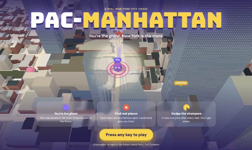
pac-manhattan!
-
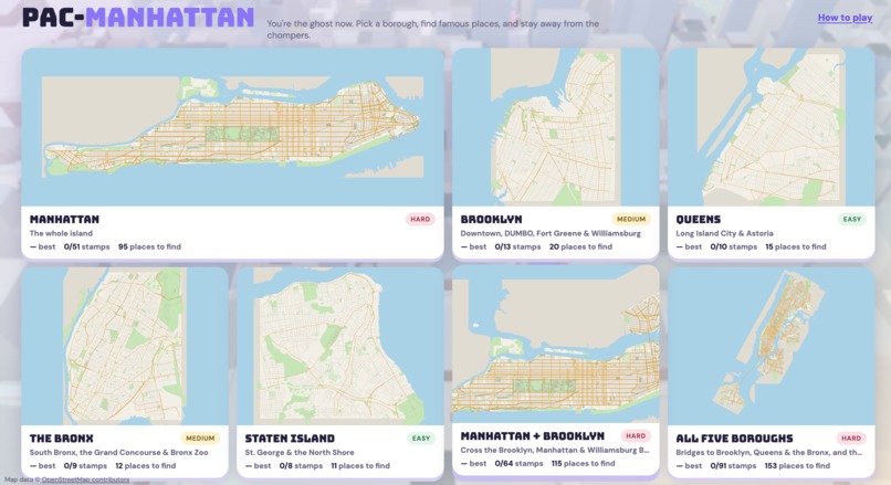
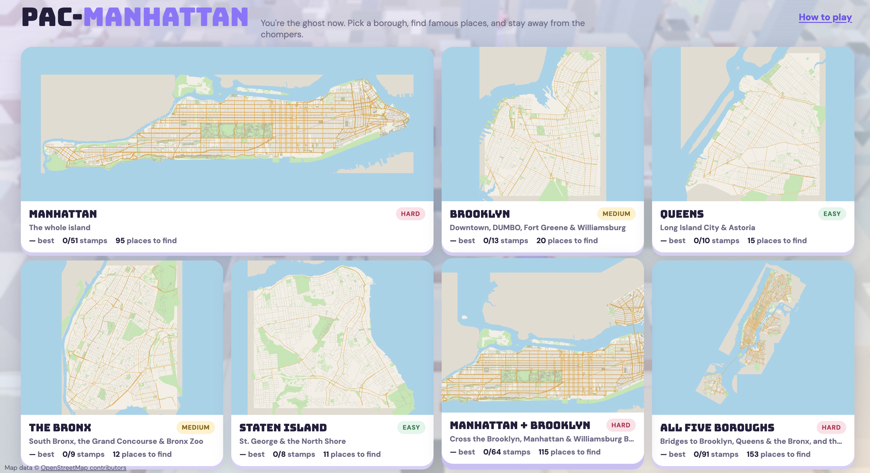
game levels!
-
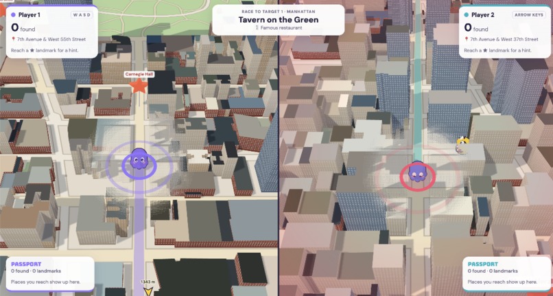
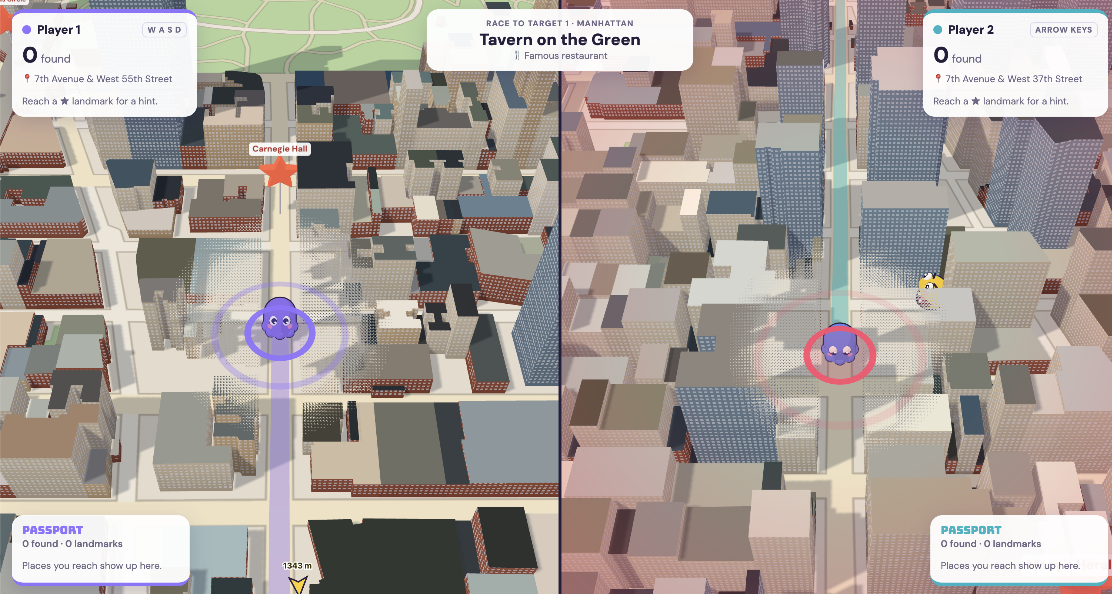
2-player mode
-
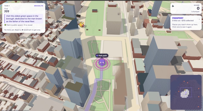
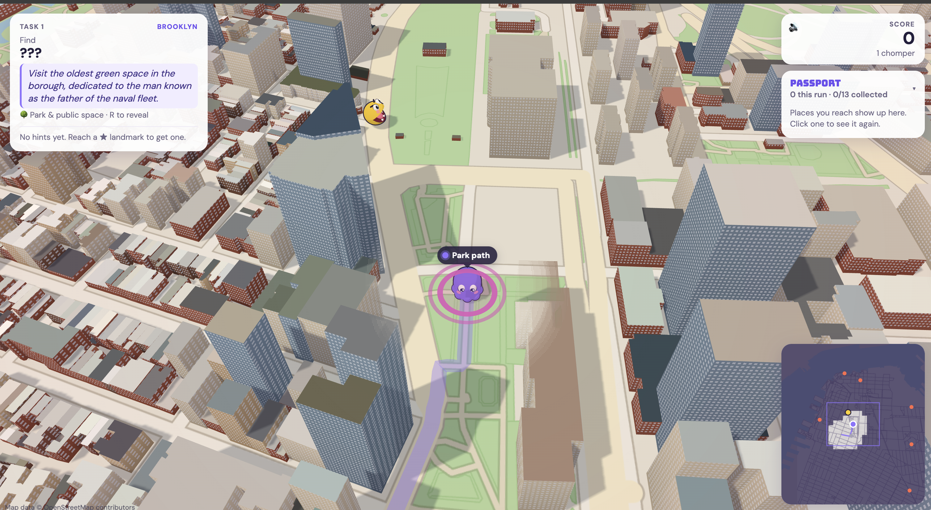
solo player game
-
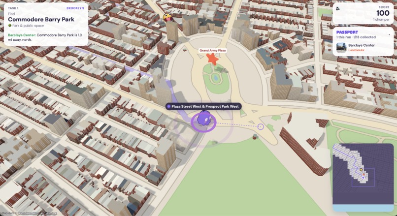
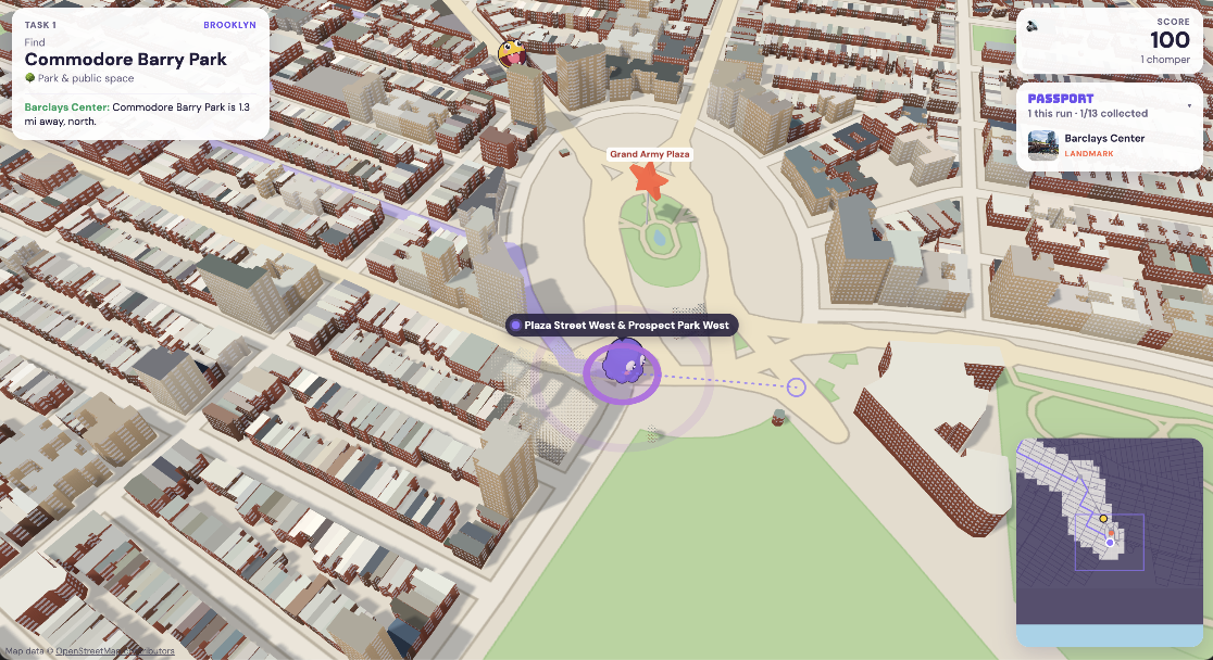
finding the landmark
-
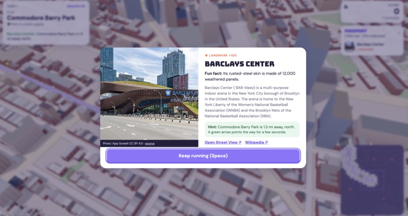
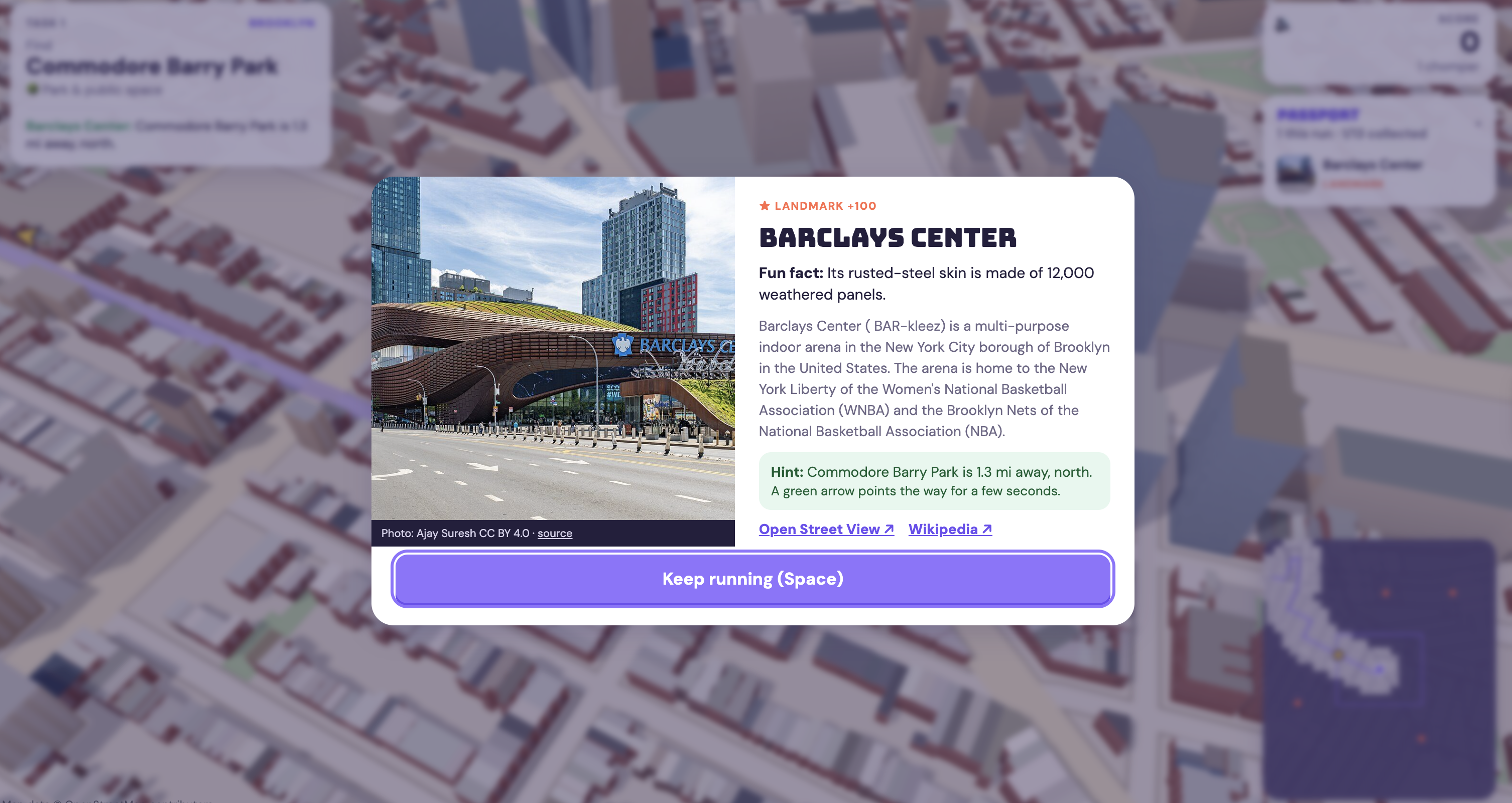
when a ⭐︎ is found
-
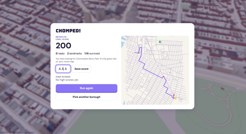
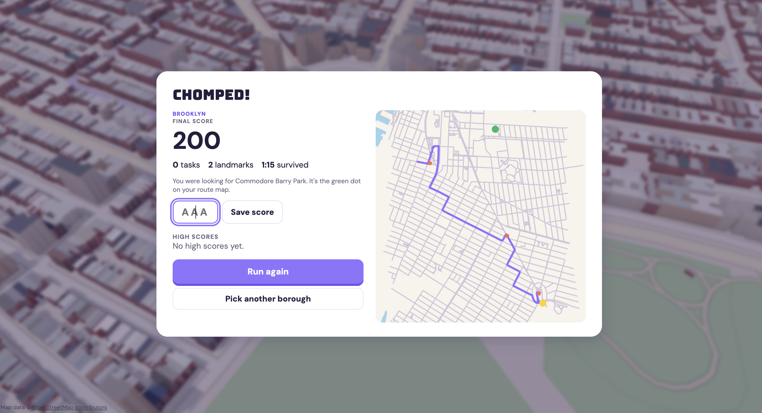
summary of the game when you got eaten
Inspiration
New Yorkers live in borough bubbles. 86% of New Yorkers who moved stayed in the same borough (StreetEasy, via amNY). We ride the same train to the same few blocks, and the rest of the city stays a name on a subway map.
We don't even see our own landmarks. In a survey of 2,000 Americans, 1 in 4 had never been to the biggest attraction in their own city, and 55% said they want to visit a local landmark but haven't (OnePoll for Zipcar).
And we've handed our sense of direction to our phones. People with more lifetime GPS use have worse spatial memory when they navigate on their own, and heavier GPS use over three years went with a steeper decline in hippocampus-dependent spatial memory (Dahmani & Bohbot, Scientific Reports, 2020). A navigation game played by 397,162 people in 38 countries found that people navigate best in street layouts like the ones they grew up in (Coutrot et al., Nature, 2022). Your mental map is shaped by the streets you actually walk.
Meanwhile, New York drew 65 million visitors in 2025 (NYC Tourism + Conventions), and most of them, like most of us, see the same handful of blocks.
Games can move people. Pokémon Go's most engaged players walked 1,473 more steps a day, over a 25% jump (Althoff et al., JMIR, 2016). So we asked: what if the game board were the real map of New York, and every run left you knowing where things actually are?
What it does
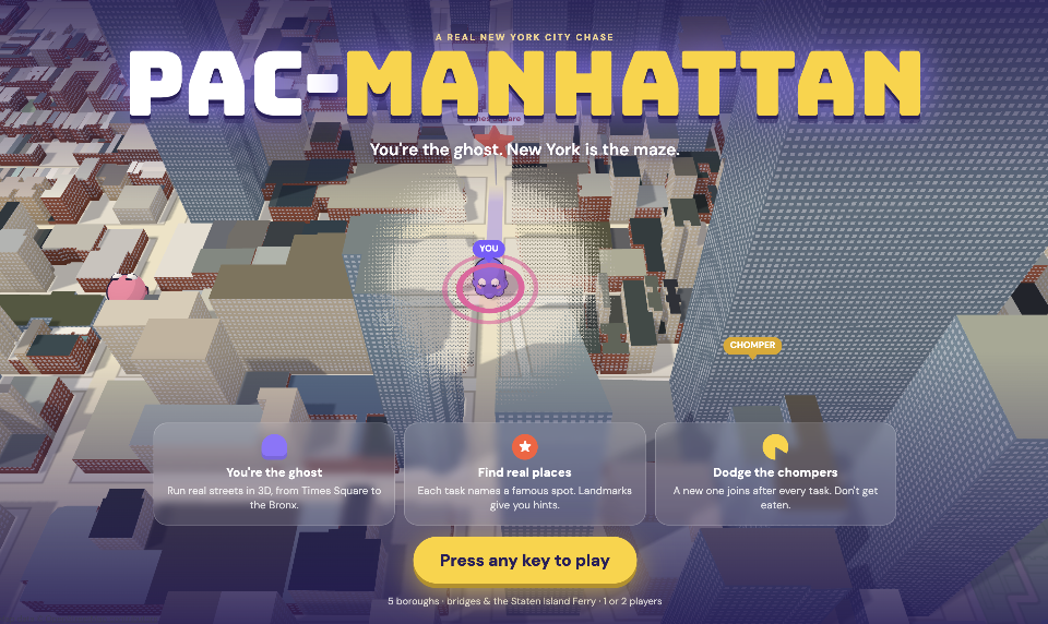
Pac-Manhattan flips Pac-Man. You're the ghost, and hungry chompers hunt you through real New York streets in 3D.
- Solve a riddle, find the place. Each task is a riddle about a real spot ("Simon and Garfunkel sang of this cantilever path spanning the East River..."). Figure it out before the name is revealed for a 50% bonus. The name appears after 30 seconds, at a landmark, or when you press R.
- Themed runs. Type a theme like "food spots", "movie locations" or "first date in Brooklyn", and Gemini picks that run's places, only from the places in the game. It works in 1 and 2 player, so judges can type their own.
- Visit landmarks for a card with an HD photo, a fun fact, a Wikipedia summary, and a hint with the target's walking distance and direction. Every place you reach is stamped in your Passport.
- Know the block. Every place card shows the streets around it, live from a 767,563-building NYC residential database: "151 residential buildings within a block or two, typically built around 1879; the oldest dates to 1819."
- Riddle stats. After you solve one, see how everyone else did: "12 of 17 finds solved this riddle before the name appeared, in 41 s on average."
- What you just learned. Eight places add a short lesson to their card, written with Grok.
- Dodge three kinds of chompers. Chomps chases you, Sneaky cuts you off on the way to your target, and Snooze wanders until you get close. A new one joins after every task.
- Seven maps: all of Manhattan; neighborhoods of Brooklyn, Queens, the Bronx and Staten Island; Manhattan + Brooklyn over the East River bridges; and all five boroughs on one map, joined by the Brooklyn, Manhattan, Williamsburg, Queensboro, Macombs Dam and Third Avenue Bridges, and the Staten Island Ferry. The ferry carries you five times faster than running, and chompers can't swim, so they wait at the terminal.
- A real city, in real colors. 171,710 buildings at their real heights. Roofs are colored from NYC's 2018 aerial photos and walls from each lot's year built and building class, so Brooklyn shows brownstone and red brick and Midtown shows glass and limestone.
- A postcard from your run. When you get caught, Gemini writes a funny recap of what actually happened ("You barely left One Court Square before Chomps tagged you on Jackson Avenue"), and the narrator reads it aloud.
- A narrator cheers you on, warns you when a chomper is behind you, and calls out every bridge you cross.
- A global leaderboard, and Passport stamps that follow you between visits.
- 2-player split screen: race a friend to the same places on one keyboard.
- A live title screen: the game plays itself behind the menu, so you see what it is before you read a word.
How we built it
The game
| Piece | How |
|---|---|
| 3D game | Three.js with plain HTML and JavaScript, no build step. Movement snaps to a real street graph, and chompers use A* pathfinding. Buildings are built in chunks near the camera, and a see-through shader keeps the ghost visible behind skyscrapers. |
| Map data | OpenStreetMap streets, parks, water, buildings and coastline via the Overpass API, turned into a routable graph per borough with Python and Shapely. Brooklyn and Queens sit on Long Island, so their land comes from NYC's shoreline-clipped neighborhood boundaries (NTA 2020). |
| Five boroughs on one map | Every borough is reprojected into Manhattan's frame (rotated 29° so avenues run up the screen), and the street graphs are joined at the real landing points of each bridge. The ferry is its own kind of edge: you can ride it, chompers can't. |
| Real building colors | About 3,000 NYC aerial photo tiles, sampled at up to 10 points inside each footprint for the roof color. NYC PLUTO lots are matched to footprints for wall materials. |
| Photos | 189 Wikimedia Commons photos, with the author and license on every card. |
| Hosting | A Vercel static site plus serverless functions, at pac-manhattan.tech. |
Sponsor tools
| Sponsor | What it does in the game | How we kept it honest |
|---|---|---|
| Gemini API (3.1 Flash-Lite) | Writes a riddle for every place, picks the places for themed runs, and writes your end-of-run postcard | Riddles are rejected if they use a word of the name or a number that isn't in the Wikipedia source. Theme picks are limited to the map's exact place names. Postcards are rejected if they name a place or number that didn't happen in your run. |
| ElevenLabs | The narrator, voice "Laura": 16 English lines recorded at build time (Multilingual v2 model), plus each postcard read aloud live (Flash v2.5 model) | Everything runs on the server, so no API key ever reaches the browser. |
| Tiger Data (TimescaleDB) | "Know the block" on every place card, from 767,563 NYC residential buildings (PLUTO + HPD). Riddle stats across every player | Every riddle outcome goes into a hypertable. A real-time continuous aggregate rolls it up into each place's solve rate and average solve time. |
| MongoDB Atlas | Global high scores, Passport stamps, and every finished run with its theme | Saved through Vercel functions, with a browser fallback if the database can't be reached. |
| Grok (built in Cursor) | The "What you just learned" lessons and their pictures on eight place cards | Written from each place's own facts. The Wikimedia photo stays next to it. |
| .Tech domain | pac-manhattan.tech |
Challenges we ran into
- The map thought New York Harbor was land. Our coastline method works for an island like Manhattan, but Brooklyn and Queens are part of Long Island. We switched those to NYC's official shoreline-clipped boundaries.
- The bridges disappeared. Cutting streets to land also cut every bridge deck over the river. We rebuilt each crossing from its real landing points and snapped them to the nearest street (all within about 200 m).
- 170,000 buildings in a browser tab. We build geometry only near the camera and skip open-water ground tiles, so the five-borough map loads in a few seconds.
- Keeping an LLM honest, three times over. Early riddles invented dates, and early postcards called 0.3 miles "just yards." Every Gemini output is now checked against its source before a player sees it.
- Four people, four versions. We had two 2D prototypes and two 3D versions on separate branches, and merged them into one game on the last night. Two of us even built themed runs at the same time; we kept the version that works in both 1 and 2 player.
- Free-tier rate limits during riddle generation, fixed with backoff and saving after every riddle.
Accomplishments that we're proud of
- All five boroughs in one playable map, including a real ferry ride.
- Every one of the 244 places on the five-borough map is reachable by street from Times Square. We checked, and Staten Island is reachable only by ferry, just like real life.
- Every building is colored from real city data, the feeling of being able to walk near my dorm or school building is just WOAH-ing.
- Every sponsor tool does a real job in the game: Tiger Data for the city data and riddle stats, MongoDB for the leaderboard and Passports, Gemini for riddles, themes and postcards, ElevenLabs for the voice, and Grok for the lessons.
- A title screen that shows the game instead of explaining it.
What we learned
- Real maps are messy. Islands, bridges and shorelines each needed their own fix.
- An LLM is useful for writing when you give it a source and check its output against that source.
- Showing beats telling: a game that plays itself on the title screen explains more than any instructions.
What's next for Pac-Manhattan
- Walk mode: earn real Passport stamps when your phone's GPS reaches a place.
- Then vs. now: archival photos from NYPL and the NYC Municipal Archives next to today's view on every landmark card.
- The subway as fast travel, like the ferry.
- Whole boroughs, not just neighborhoods, including the Rockaways and City Island.
- A daily riddle and a shareable Passport card.
- Ghost skins unlocked with Passport stamps.
Built with: three.js, javascript, html5, css3, node.js, python, shapely, pillow, openstreetmap, overpass-api, nyc-open-data, tiger-data, timescaledb, postgresql, mongodb, gemini, elevenlabs, grok, cursor, wikipedia, vercel, tech-domains
Built With
- css3
- cursor
- elevenlabs
- gemini
- grok
- html5
- javascript
- mongodb
- node.js
- nyc-open-data
- openstreetmap
- overpass-api
- pillow
- python
- shapely
- three.js
- tiger-data
- timescaledb
- vercel
- wikipedia


Log in or sign up for Devpost to join the conversation.