Inspiration
Orber was inspired by a recurring problem: we don´t have a way of clearly see and estimate the human impact on one of our most critical resources: water at a large scale. Although we have extraordinary access to satellite data, yet most people can't use it. Land and water decisions — from soil health to urban planning — often rely on outdated maps or manual assessments because the tools built to interpret Earth data are too slow, too complex, or too expensive. I wanted to make satellite insights fast, useful, and accessible for anyone who works with territory.
What it does
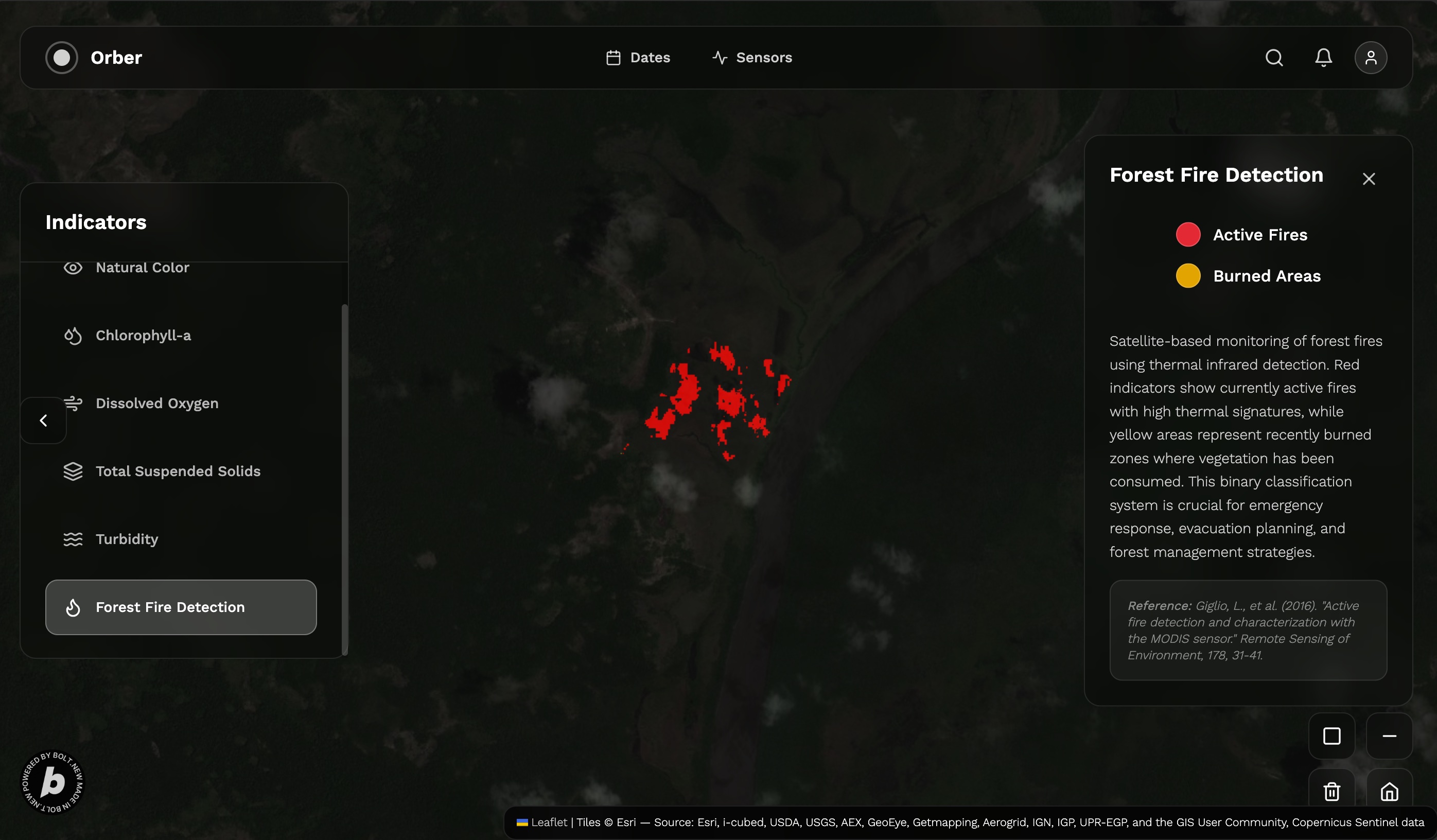
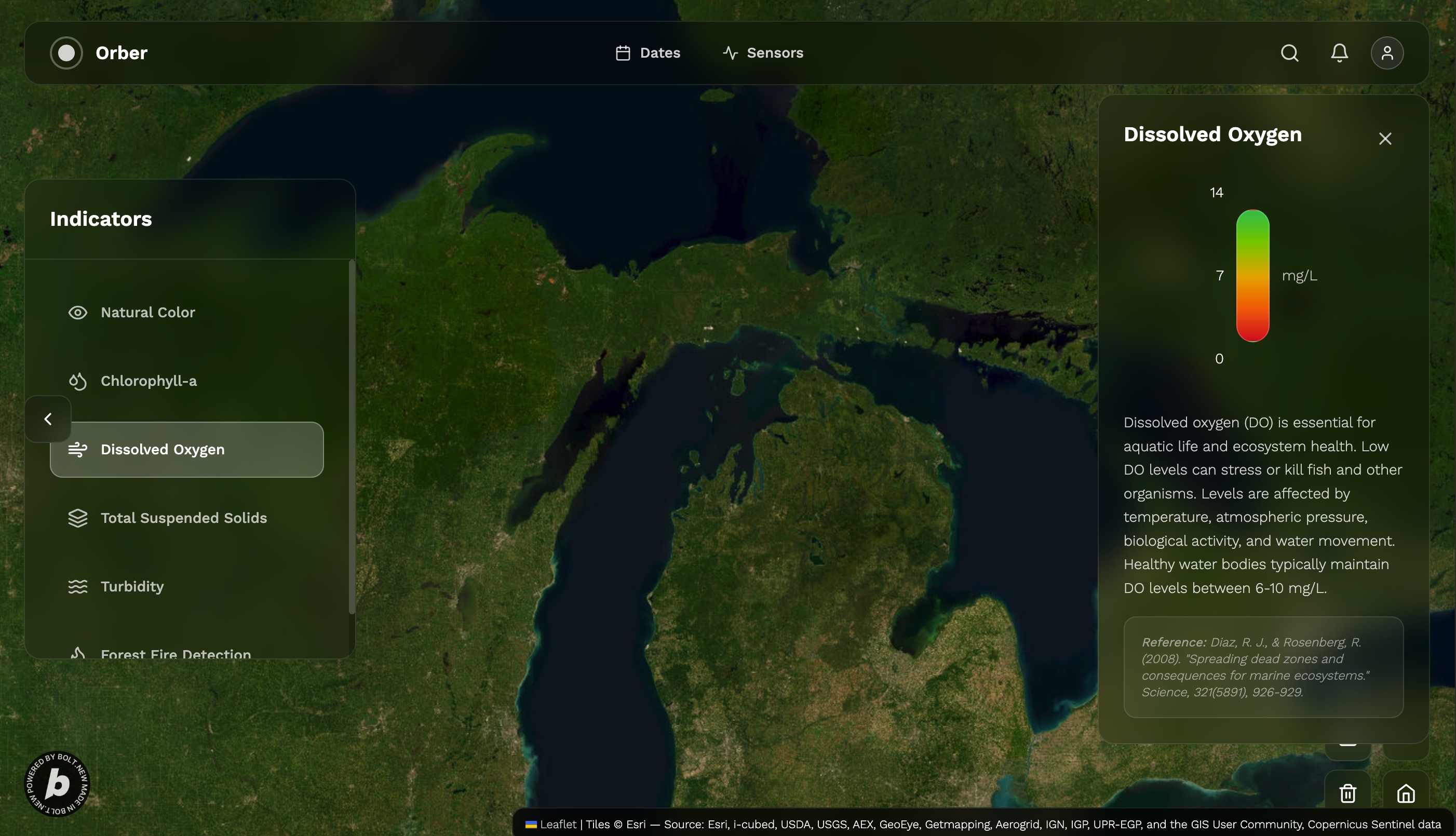
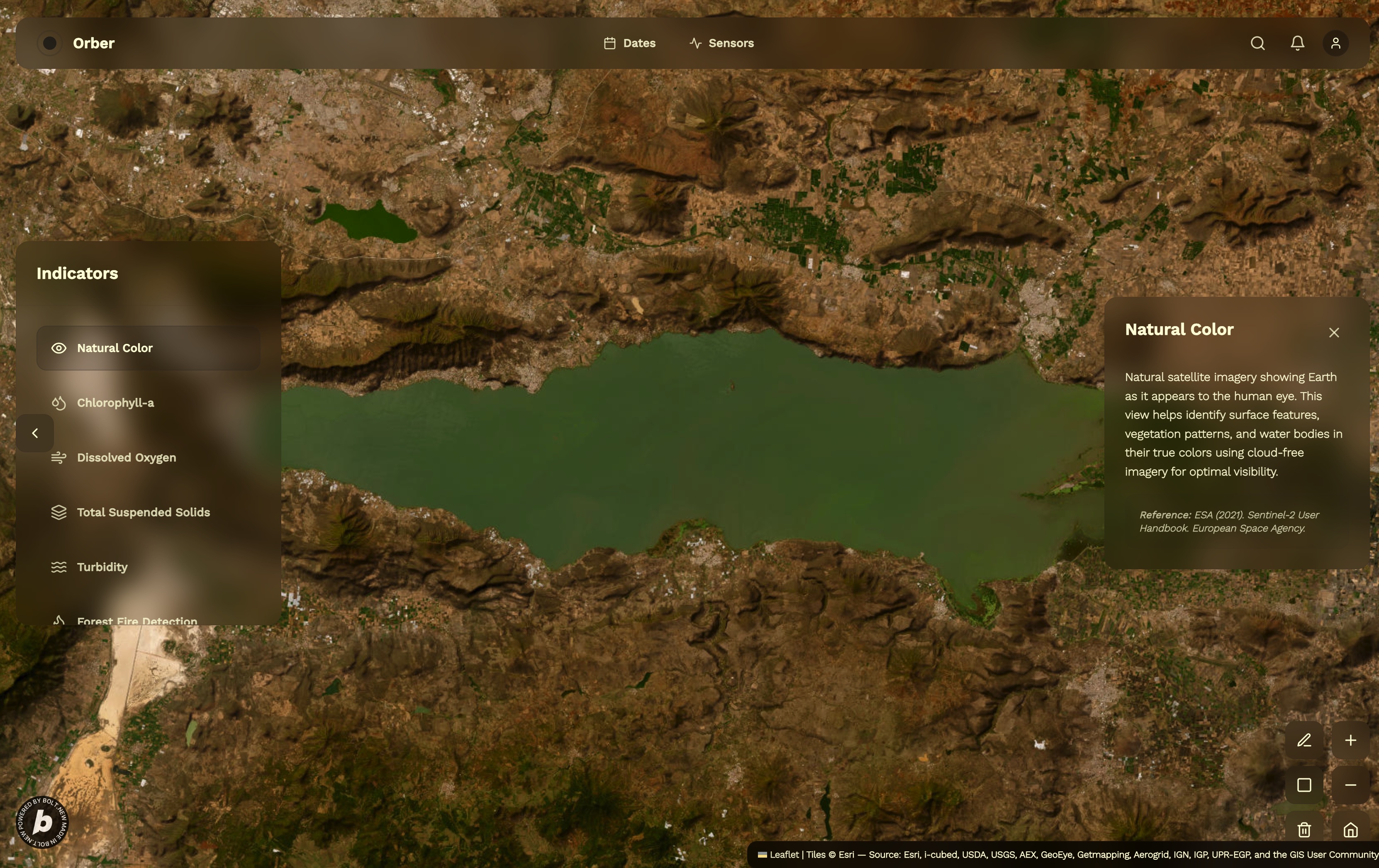
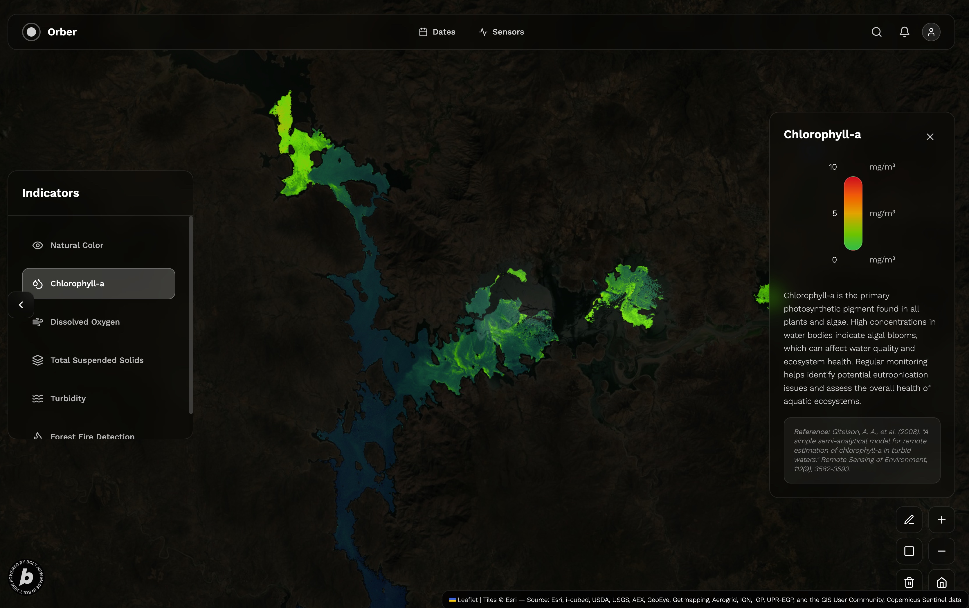
Orber transforms satellite imagery into instant land and water intelligence. It estimates soil moisture, water quality (e.g. turbidity, trophic states), land use, burned areas, and catastral conditions using multispectral and radar data. Users can export results as GeoJSON or KML, or simply visualize key indicators directly in the browser — no GIS experience required.
Key Benefits
Real-Time Environmental Intelligence
Orber delivers fast, satellite-based insights on land and water conditions — helping users make informed decisions in seconds, not days.No GIS Expertise Required
Designed for usability, Orber translates complex remote sensing data into clear, actionable visuals and exports — accessible to any stakeholder.Cost-Efficient Monitoring at Scale
By leveraging open Copernicus data and cloud-based processing, Orber reduces the need for fieldwork or expensive GIS consultants.Supports Sustainable and Data-Driven Planning
With accurate, transparent, and reproducible indicators, Orber enables smarter land use, environmental compliance, and long-term resilience strategies.
How I Built It
I built Orber around the idea that satellite data should be immediate, meaningful, and accessible. At its core, Orber uses data from ESA’s Copernicus program — primarily Sentinel-2 for multispectral imagery and Sentinel-1 for radar — accessed via Sentinel Hub’s WMS services. These data streams power the remote sensing backend, where I apply my own algorithms to extract parameters like water turbidity, chlorophyll presence, suspended solids, and soil moisture directly from the raw imagery.
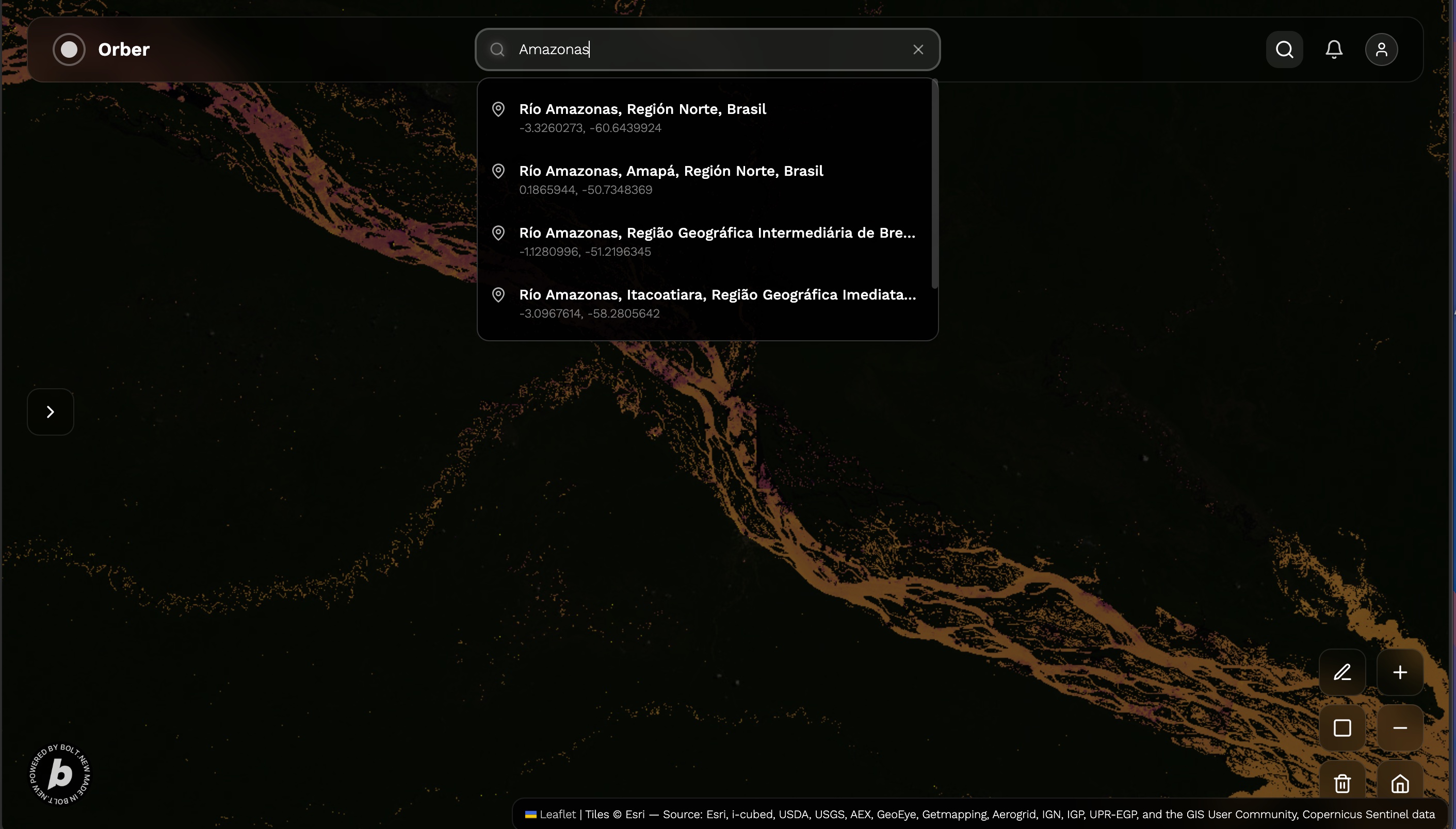
The frontend is built in React with Vite, keeping the interface lightweight, fast, and focused on clarity. Users don’t need to understand spectral bands — they just get actionable insights. To handle the geospatial side, I streamed the WebMap Services and once a region is selected with a single button the algorithms are applied over the map and return the results of the multispectral ooperations, which allows for performant spatial queries and clean separation of raster/vector layers. This setup supports everything from land use overlays to custom KML/GeoJSON exports.
The application is deployed on Netlify, and backend orchestration — including request handling, image formatting, and report generation — is powered by a Node.js service layer.
Building Orber has been a constant balancing act between performance and usability. Working with raw satellite imagery is heavy, but the goal was always speed and simplicity — and the current setup lets users generate high-value insights in just a few clicks.
Challenges we ran into
Working with satellite data is no small feat. Optimizing tile requests, controlling payload sizes, and simplifying visual outputs while maintaining every environmental parameter scientifically valid were all challenging. Another key challenge was designing a UI that’s not just simple, but self-explanatory for people who’ve never used Earth observation tools before.
Accomplishments that we're proud of
I’m proud that Orber can deliver results in seconds for things that normally take days — and that non-expert users can understand what they’re seeing. Bringing together spectral analytics and usability was hard, and it’s rewarding to see it click when people use it. Orber doesn’t just look at the Earth — it helps people understand it.
What we learned
I learned how much design matters when working with technical tools. Making the insights easy to grasp was just as important as making them accurate. I also deepened my understanding of working with geospatial APIs, spatial indexes, and how to build a reactive frontend that can handle async tile rendering gracefully.
What's next for Orber
Next, I’m expanding Orber’s dataset support (e.g. historical trends, vegetation dynamics), and building tailored interfaces for sectors like agriculture, water utilities, and land governance. I will add the capability of choosing date ranges, more water quality indicators or oil spill detection. I’d also like to create a MCP to use it as a tool. The long-term goal is to become the go-to satellite platform for land and water decision-making.
Built With
- copernicus
- geojson
- netlify
- node.js
- react
- sentinelhub
- tailwind
- typescript


Log in or sign up for Devpost to join the conversation.