Project Story — NeuraCity: The City That Sees, Feels, and Hears
Inspiration
I have always been interested in how cities operate beneath the surface. Every moment, cities experience thousands of micro-events—accidents, noise spikes, street issues, emotional shifts in neighborhoods—yet most city systems only react slowly, if at all.
That inspired a question:
What if a city could actually see what people see, feel what communities feel, and hear what neighborhoods hear?
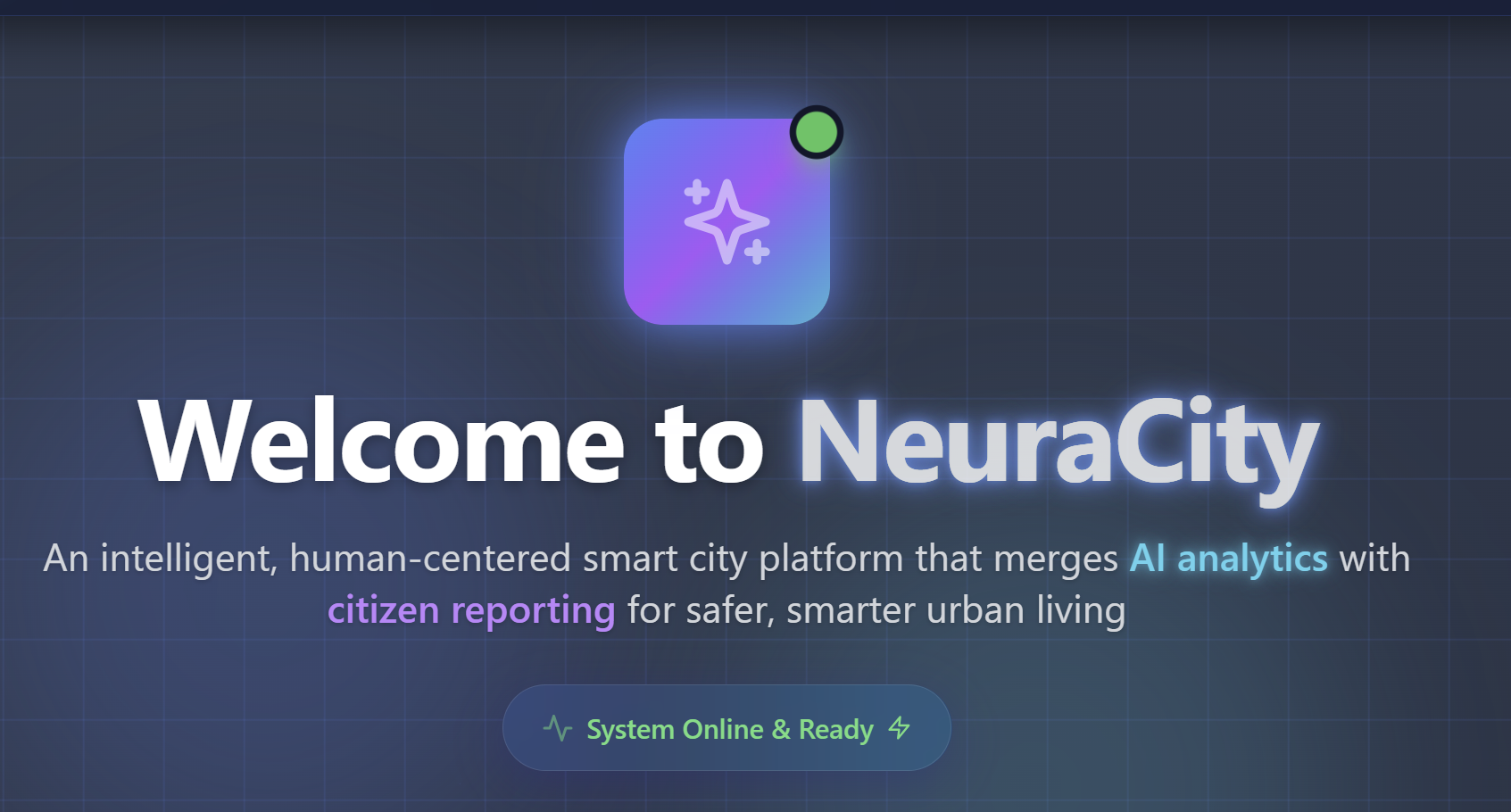
From that question, I built NeuraCity, a city platform designed to “perceive” and respond in real time.
About the Project
NeuraCity is a smart-city system that connects:
- Seeing: Citizens upload an image of an issue, and their device’s GPS provides the exact location.
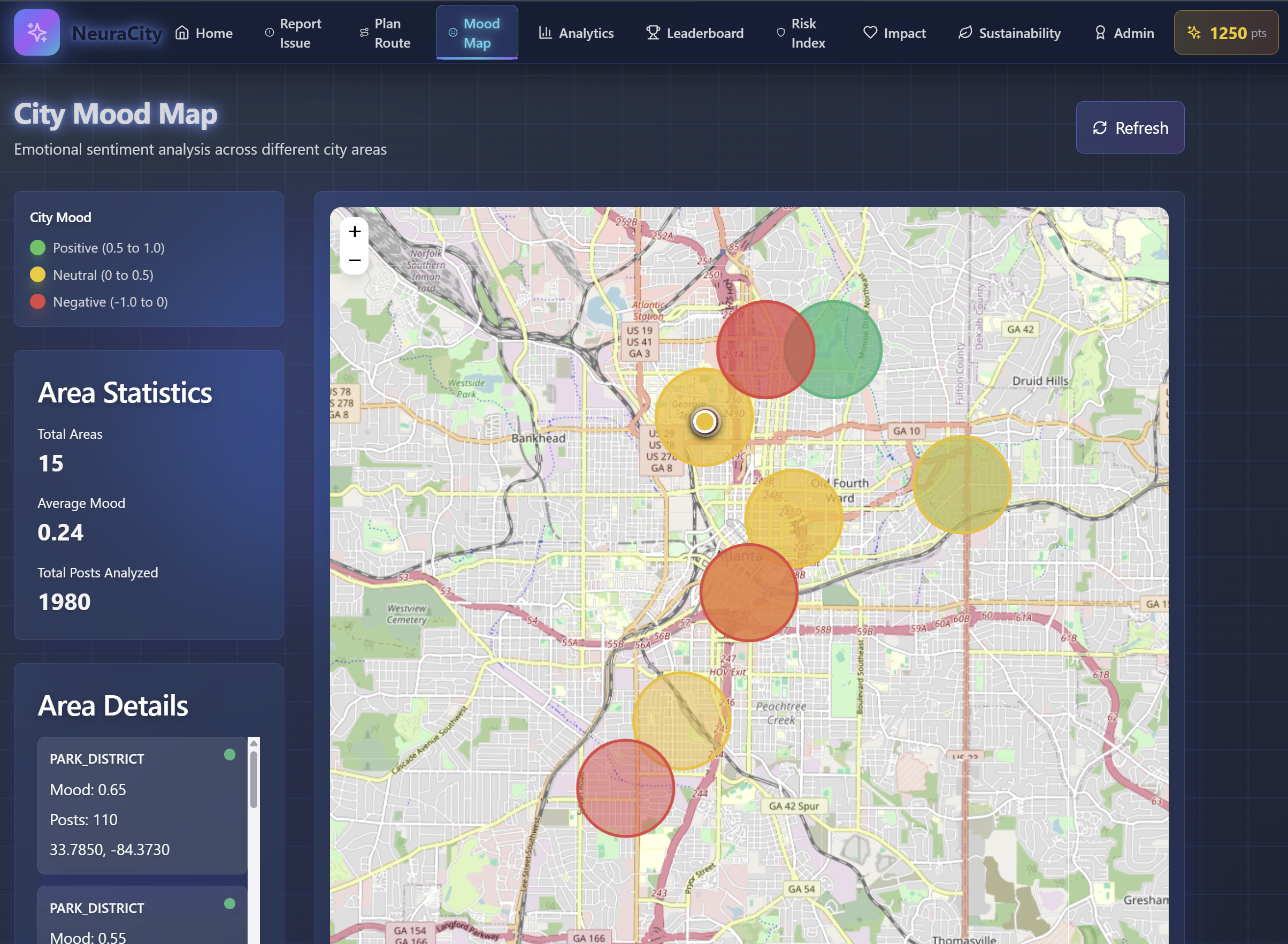
- Feeling: I analyze synthetic posts using NLP to compute a city-wide emotional mood map.
- Hearing: Noise data is simulated per road segment to enable quiet walking routes.
- Thinking: AI generates emergency summaries, repair suggestions, and contractor recommendations.
- Acting: The platform provides intelligent driving, eco, and quiet-walking routes.
All components work together to make the city more responsive and human-aware.
How I Built It
Frontend (React, Tailwind, Leaflet)
I built a clean, fast interface that supports:
- A mandatory image-first reporting flow
- Automatic GPS location access
- Interactive maps for issues, mood, noise, and routes
- A simple admin panel for emergency and work-order review
Backend (FastAPI + Supabase)
I used FastAPI to handle:
- Upload processing
- Severity + urgency scoring
- Routing (drive, eco, quiet walk)
- Noise modeling
- Mood aggregation
- Automatic action generation
Everything is stored in Supabase Postgres, including issues, contractors, mood scores, noise data, and work orders.
AI Systems
NeuraCity uses two AI systems:
HuggingFace sentiment model
- Processes synthetic posts
- Computes neighborhood mood scores
Google Gemini
- Generates emergency summaries for accidents
- Suggests repair materials
- Identifies contractor specialties
- Helps classify “other” issues
Synthetic Data
I generated synthetic datasets for:
- Traffic
- Noise
- Emotional posts
- Event-driven spikes
This allowed me to simulate a functioning city without real APIs.
What I Learned
- Cities have emotional patterns, which can affect routing and stress levels.
- Image + GPS reporting improves accuracy dramatically.
- Noise matters, especially for walking comfort and sensory-friendly routing.
- AI can support real infrastructure decisions, not just summarize text.
- Synthetic data can be extremely realistic with the right constraints.
Challenges I Faced
- Getting browser-based geolocation to behave consistently.
- Designing a fast image upload/storage flow.
- Building realistic noise models for routing.
- Combining traffic, noise, urgency, and emotional data into a single routing engine.
- Making Gemini output structured, reliable responses.
Final Reflection
NeuraCity is my attempt to imagine a city that interacts with people in a more human way. Through geospatial modeling, AI reasoning, and careful data design, I built a system where the city can:
- See (through images)
- Feel (through emotions)
- Hear (through noise)
- Think (through AI)
- And act (through routing and work-order suggestions)
The project reinforced something important to me:
The future of smart cities isn’t bigger dashboards or more sensors.
It’s cities that understand people.
Built With
- fastapi
- gemini
- huggingface
- javascript
- leaflet.js
- numpy
- openstreetmap
- pandas
- postgresql
- python
- react
- router
- storage)
- supabase
- tailwindcss
- transformers
- uvicorn
- vite

Log in or sign up for Devpost to join the conversation.