Inspiration
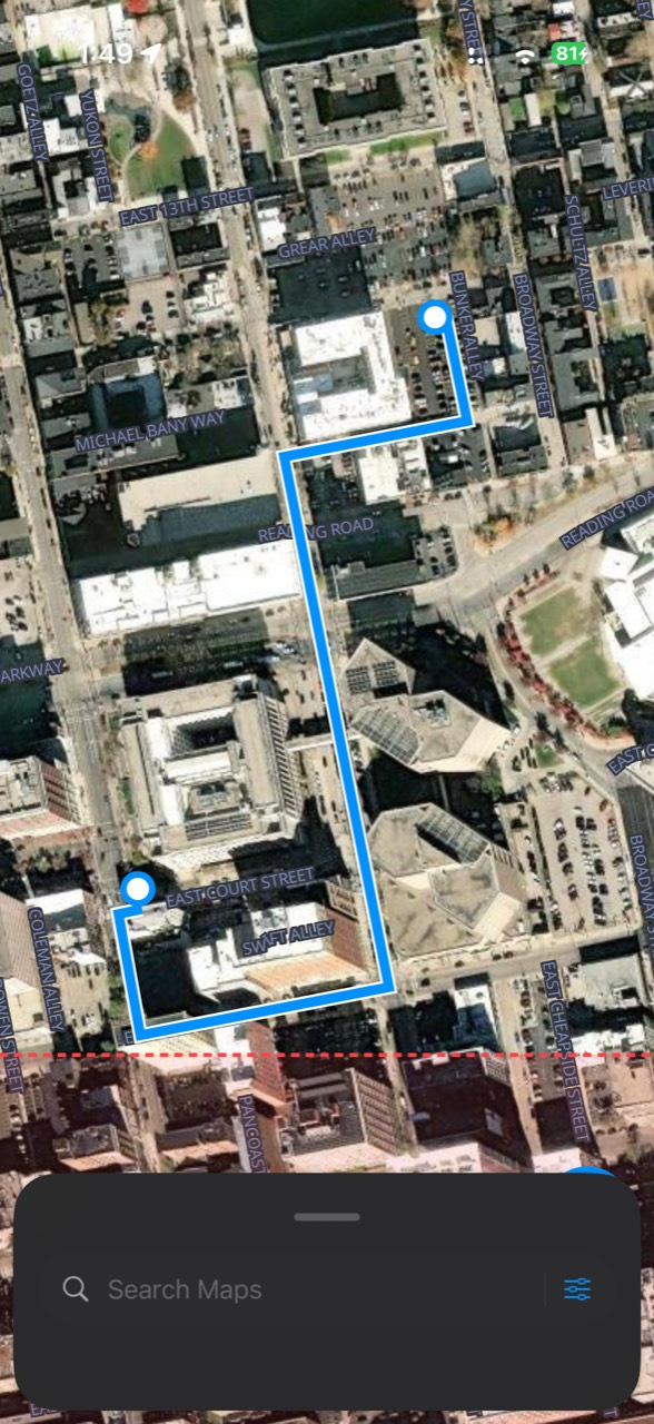
A road can still be on the map after it’s blocked on the ground. After a flood or an earthquake, a navigation app can send people down a street that no longer gets them where they need to go. We built Gaslight Maps to bring new aerial imagery and observations from people on the ground into the same map they use for directions.
What it does
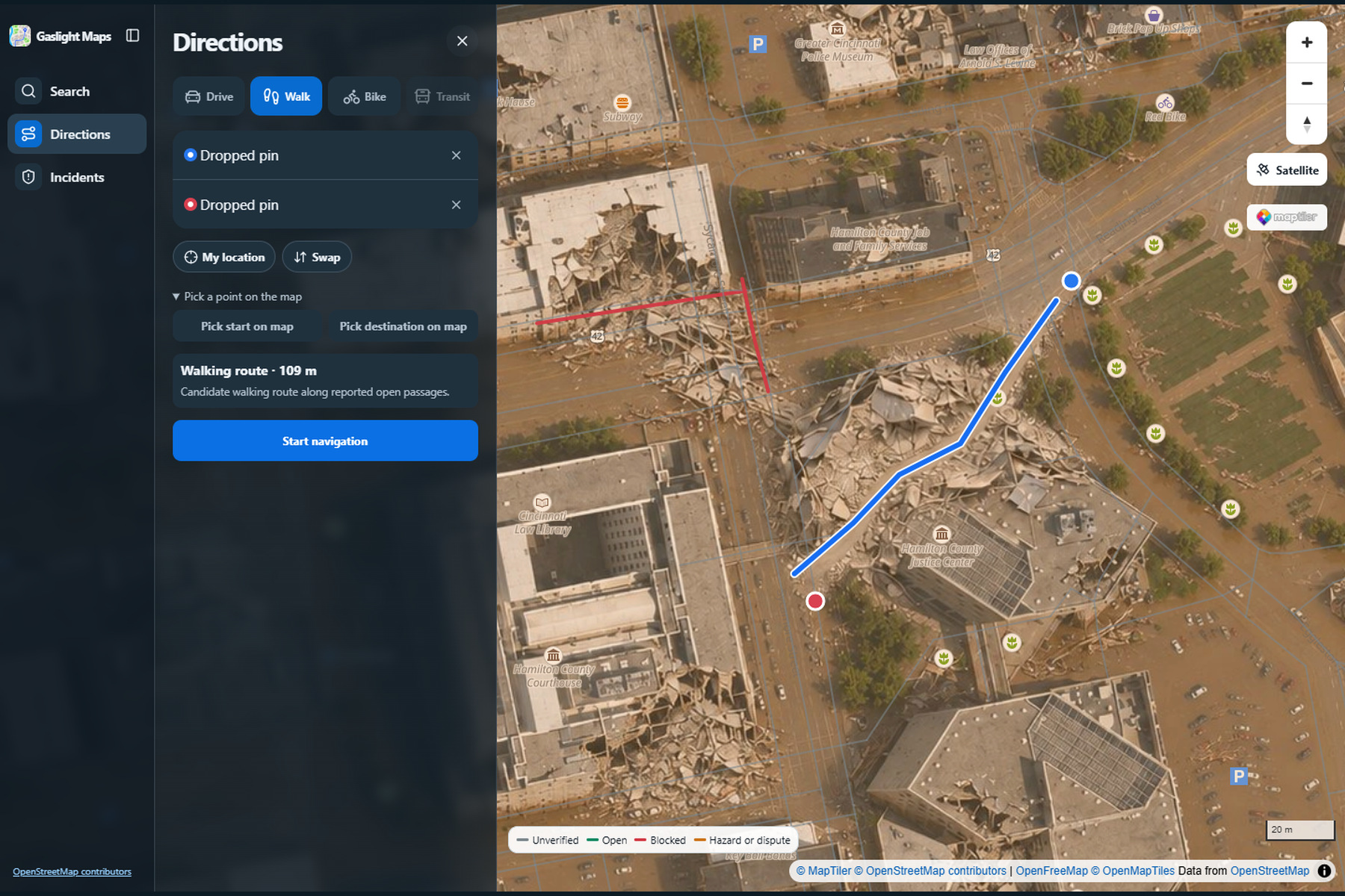
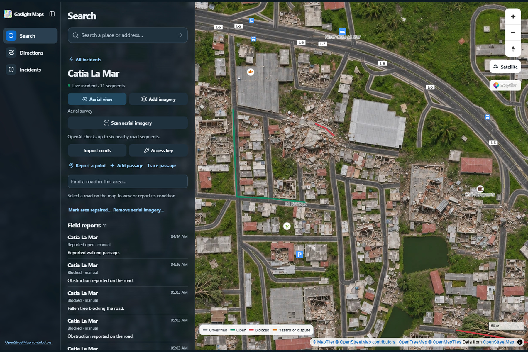
Report an incident, upload aerial imagery, and see it replace the satellite view over the area it covers. Street names and landmarks stay visible so you can still orient yourself. People on the ground can report a blocked street, mark a passage open, or add a connection that the original map never showed.
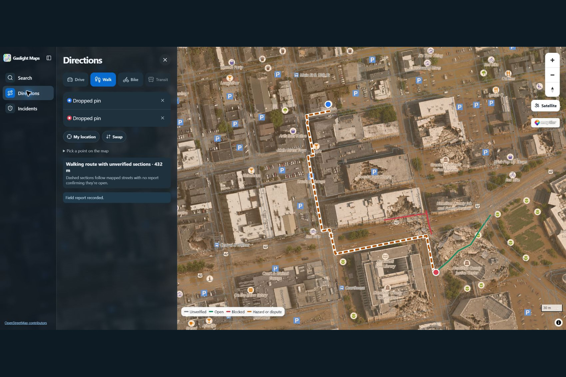
Pick a start and destination, and Gaslight Maps uses those reports to plan a walking route around known closures. It distinguishes reported open passages from sections whose condition is still unknown. The web and iOS apps use the same incident data, so a report from the field can inform a route someone is planning on a laptop.
How we built it
We built a Next.js web app and a native SwiftUI iOS app with MapLibre and a shared API. We align georeferenced aerial imagery with the satellite basemap and use OpenStreetMap roads and footpaths as the starting network. Field reports update that network, and the walking router can use newly reported connections as well as existing streets.
Challenges and what we learned
Getting an image onto the map was only half the problem. The harder part was connecting what people saw in the image to the exact road segment the router would use. A route could look fine on the old street grid while crossing rubble in the new imagery. We learned to track imagery, road geometry, and reported conditions separately so the app can show where its directions come from and where information is still missing.
Built With
- auth0
- coolify
- geotiff.js
- maplibre-gl-js
- maplibre-native
- maptiler
- next.js
- nodeodm
- openstreetmap
- osrm
- react
- road-geometry
- sqlite
- swift
- swiftui
- typescript
- vercel
