-
-

appicon
-
weather
-
marlog-ai
-
academy
-
main-page
-
atlas

Inspiration
MARLOG began at a desk that faced away from the sea.
I was working at a software and design agency, thinking about what my future should look like — and what kept surfacing was an old love: the sea. I decided to act on it. I enrolled in a captain's course, applied for my seaman's book, and started studying navigation the way you study when it actually matters.
I wanted to review what I'd learned on the road, in stolen moments — but I didn't take that need seriously until my internship came. Out on the water, it hit me with real fear: in a sudden situation I would have to remember everything at once — how to read the wind, the charts, the rules that keep people alive at sea. I caught myself wishing for a companion that would always be in my pocket: an assistant that knew the weather, the waters, and the coursework, and could answer me right then.
I looked for it. What I found instead was a scattering of separate, expensive apps — one for weather, one for charts, one for learning, each behind its own paywall. So the designer and the developer in me made a decision the mariner in me needed: I would gather it all in one place, and it would be free.
That's where MARLOG's voyage began — my software background, my design background, and AI as my crew.
What it does
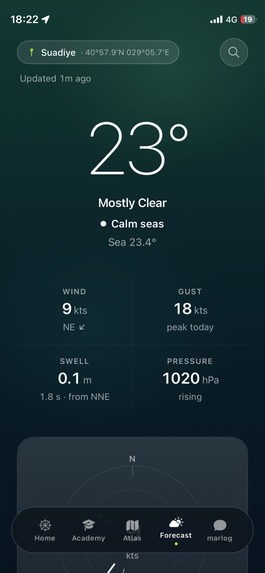
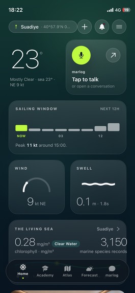
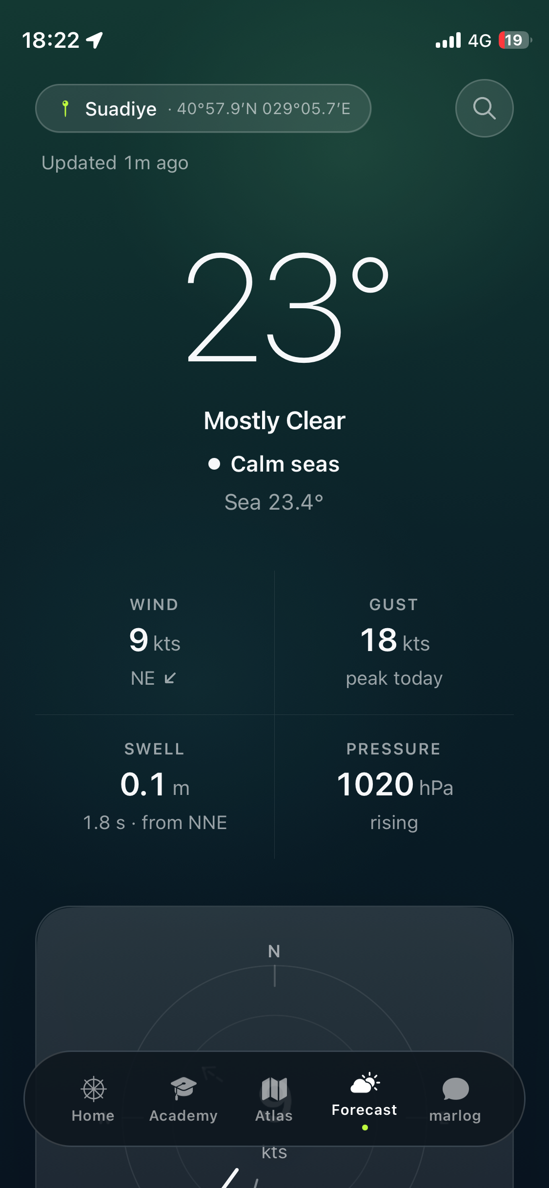
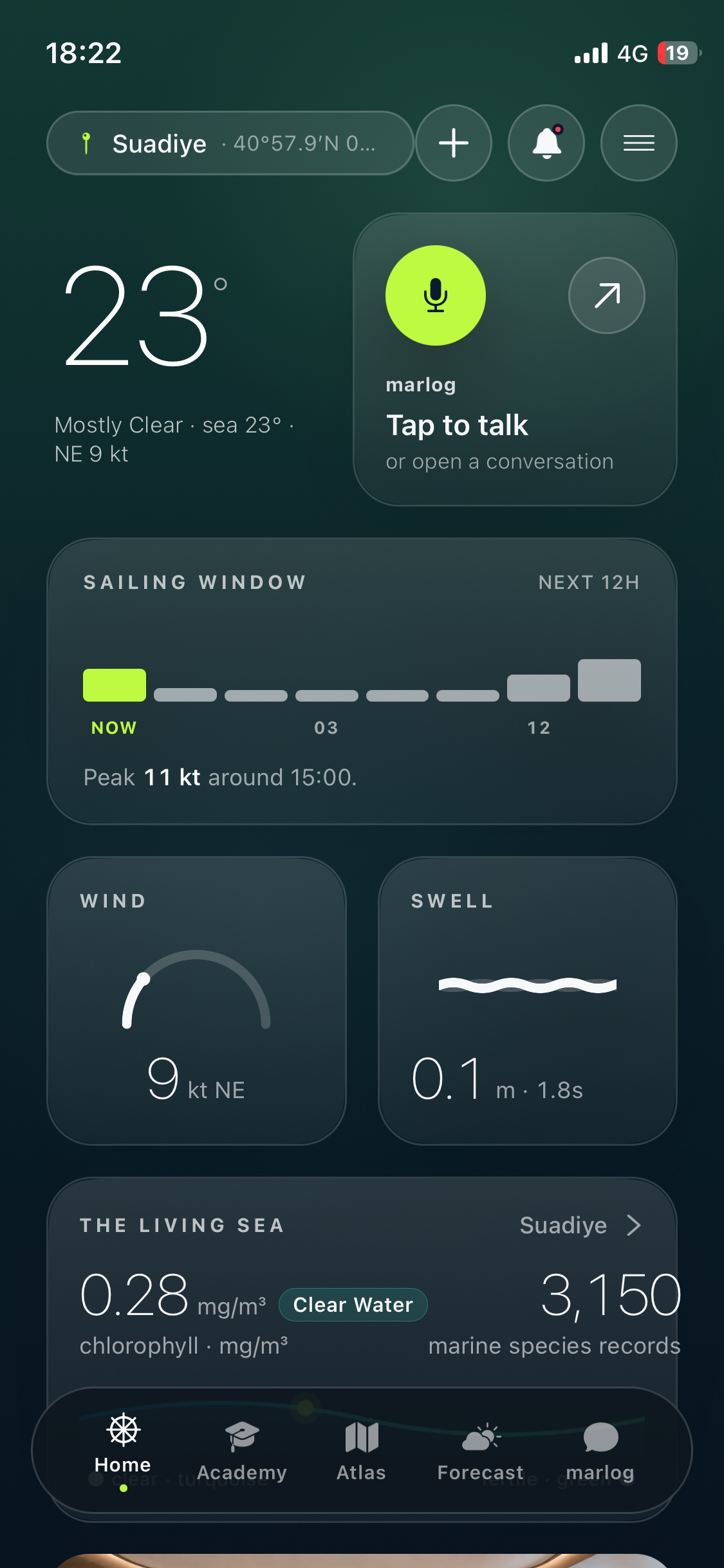
- Sea weather anywhere — global wind and forecasts via Apple WeatherKit; waves, sea temperature and currents from Copernicus Marine. The hardest proving ground: Türkiye's four seas, where no single model suffices — MARLOG routes each point to the right regional model (Mediterranean, Aegean, a 500 m Marmara nest, Black Sea).
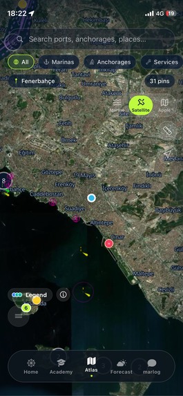
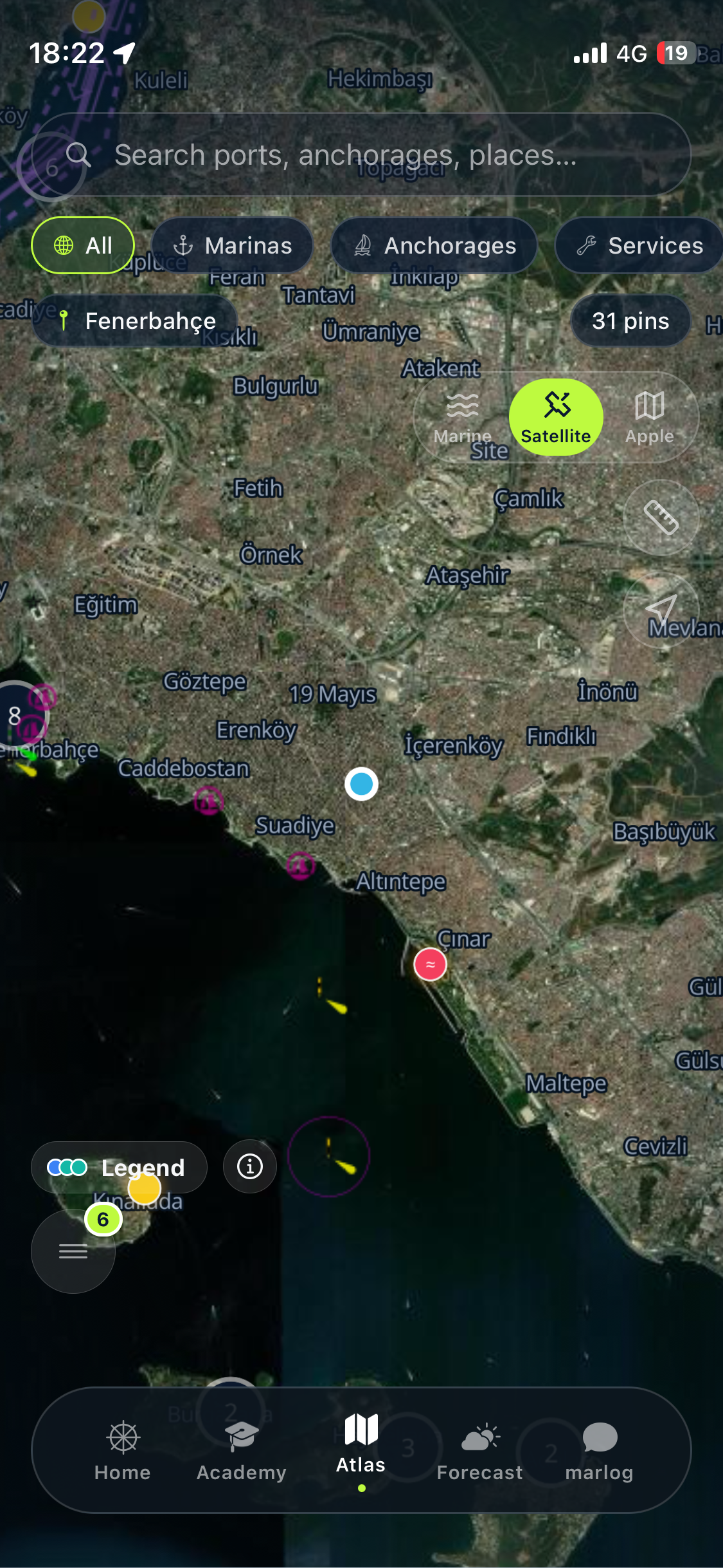
- An atlas of 8,600+ places and growing — marinas, anchorages, lighthouses, ruins, beaches — from OpenStreetMap, enriched, bilingual, with visit logging.
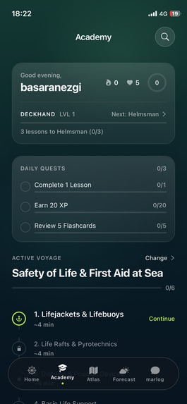
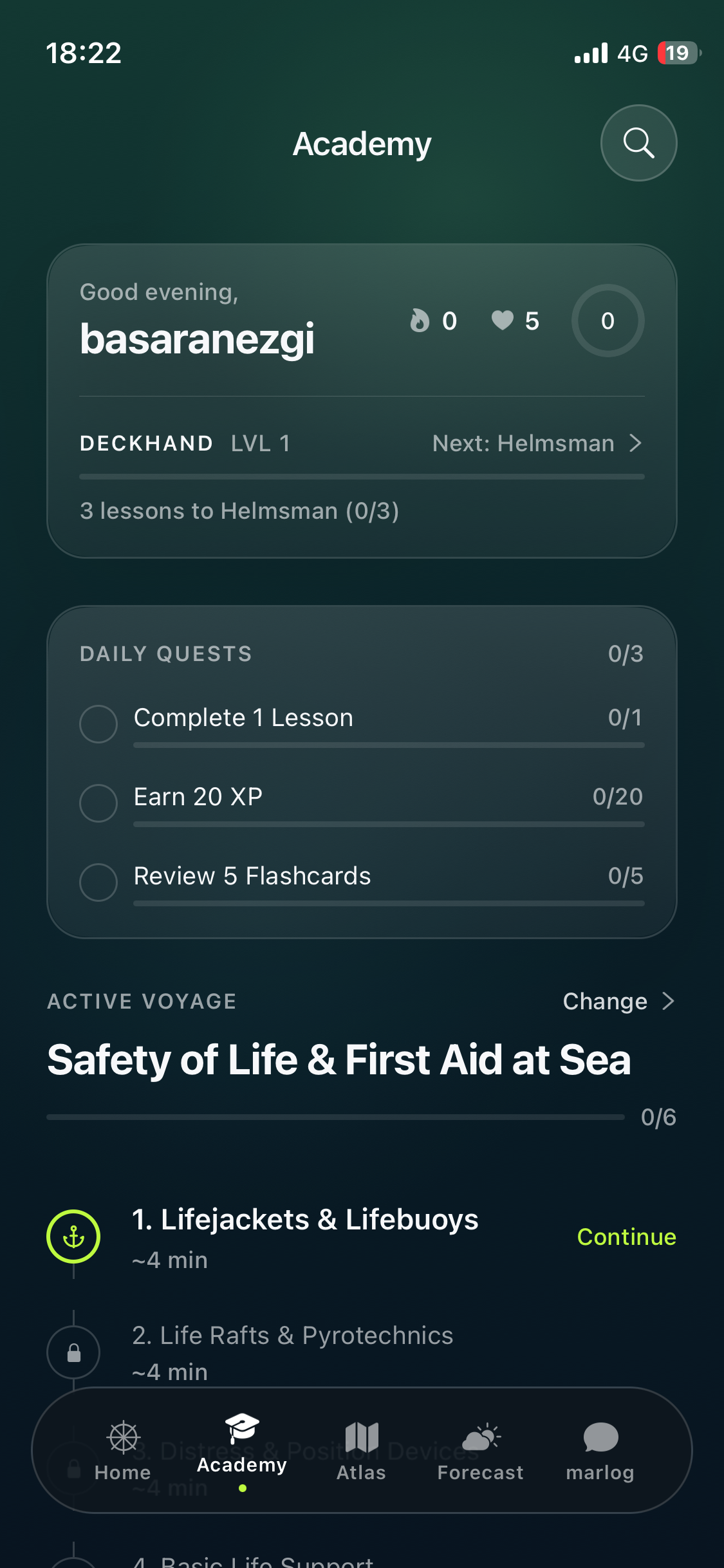
- A maritime academy — courses, exercises, flashcards and a nautical dictionary, with server-side grading and an XP ladder: the study companion I wished for on the way to my own exams.
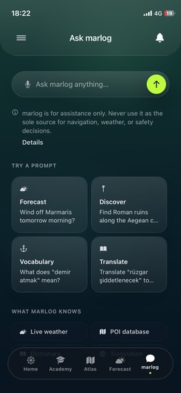
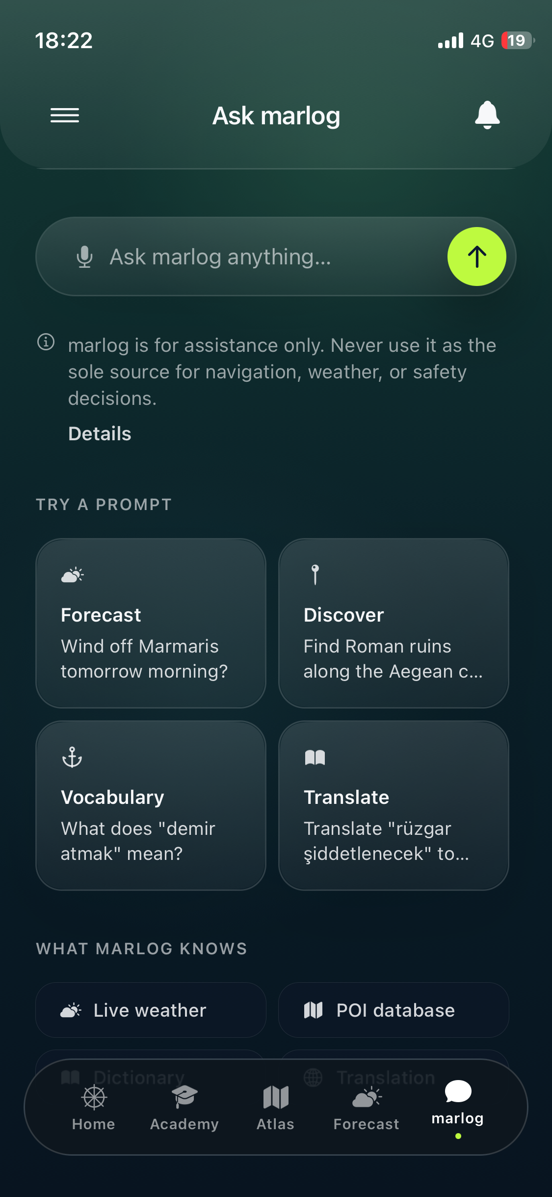
- Compass — an AI assistant with maritime tool-calling that answers in the context of live weather and places, and refuses to play navigator.
- 100% free. No feature is gated. The only purchase is the optional MARLOG Supporter subscription — "Rüzgarımız Ol" (Be Our Wind) — which buys recognition, not features: a profile badge, an avatar mark, and your name on the in-app Supporters honor roll.
How we built it
Expo + React Native + TypeScript on the client; Supabase (Postgres + PostGIS, RLS everywhere, server-side grading RPCs, 11 edge functions) on the backend. RevenueCat powers the entire monetization path: the SDK drives the custom paywall and entitlements, and a RevenueCat webhook feeds a Supabase edge function that maintains the public Supporters roll server-side — so recognition works even when the supporter's phone is off. App Store Connect and RevenueCat were both configured end-to-end via their APIs, including per-territory subscription pricing.
Challenges we ran into
- Building MARLOG taught me why the apps I'd priced out as a student cost so much: marine data is expensive and hard to obtain. Free, open sources exist — but they fight you: we route each coordinate to the right Copernicus model family, with a ring-search past the land mask so harbours actually return data.
- A support-not-paywall model under App Review rules: framing matters (membership with benefits, never donations), and the first IAP must ride with an app version.
- Turkish as a first-class language: locale-aware casing (İ/ı), vowel-harmony-correct suffixes generated at runtime ("2026'dan beri"), and line heights that don't shear diacritics.
Accomplishments that we're proud of
- The complete purchase→recognition loop verified end-to-end before submission: a real TestFlight purchase moved a production row within seconds via the RevenueCat webhook, and the supporter's name appeared on the honor roll.
- A paywall that people can close — and that says so, in its first line.
- 8,600 places that all carry real names and localities, in two languages.
What we learned
I learned the economics of the sea the honest way: the data underneath every marine app is paid, licensed, and difficult — that's why everything I couldn't afford as a student cost what it did. I chose the other path anyway: keep MARLOG free, and let the people who love it keep it afloat. That's why the Supporter membership exists, built on RevenueCat — not a gate, but a way to become our wind.
What's next
MARLOG Social — structured maritime posts (passage cards, weather snapshots, port entries) for the sailing community; atlas depth and coverage growing worldwide with supporter funding; Android when the community asks loudly enough. And one day, the chart table of a boat I captain myself.
What it does
- Sea weather anywhere — global wind and forecasts via Apple WeatherKit; waves, sea temperature and currents from Copernicus Marine. The hardest proving ground: Türkiye's four seas, where no single model suffices — MARLOG routes each point to the right regional model (Mediterranean, Aegean, a 500 m Marmara nest, Black Sea).
- An atlas of 8,600+ places and growing — marinas, anchorages, lighthouses, ruins, beaches — from OpenStreetMap, enriched, bilingual, with visit logging.
- A maritime academy — courses, exercises, flashcards and a nautical dictionary, with server-side grading and an XP ladder: the study companion I wished for on the way to my own exams.
- Compass — an AI as-calling that answers in the context of live weats to play navigator.
- 100% free. No featchase is the optional*MARLOG Supporter* subscription — "Rüzgarımız Ol" (Be Our Wind) — which buys recognition, not fen avatar mark, and yourname on the in-app Supporters honor roll.
How we built it
Expo + React Native + Typabase (Postgres + PostGIS, RLS everywhere, 11 edge functions) on the backend. RevenueCat poon path: the SDK drives the custom paywall and eCat webhook feeds a Supabase edge function tupporters roll server-side — so recognition works even when the supporter's phone is off. App Store Connect and RevenueCat w-end via their APIs,including per-territory subscription pricing.
Challenges we ran int
- Building MARLOG taughtced out as a student cost so much: marine data is in. Free, open sources exist — but they fight yte to the right Copernicus model family, with a ring-search past the land mask so harbours actually return data.
- A support-not-paywall model under App Review rules: framing matters (membership with benefithe first IAP must ridewith an app version.
- Turkish as a first-clacasing (İ/ı), vowel-harmony-correct sue ("2026'dan beri"), and line heights that don't
Accomplishments that
- The complete purchase→recognition loop verified end-to-end before submission: a real TestFduction row within seconds via the RevenueCat webhook, and the supporter's name appeared on the honor roll.
- A paywall that people so, in its first line.
- 8,600 places that all ities, in two languages.
What we learned
I learned the economics the data underneath every marine app is paid, licensed, and difficult — that's why everything I couldn't afford as a student cost what it did. I chose the other path anyway: keep MARLOG freeove it keep it afloat.That's why the Supporter membership exists, built on RevenueCat — not a gate, but a way to become our wind.
What's next
MARLOG Social — structured maritime posts (passage cards, weather snapshots, port entries) for the sath and coverage growingworldwide with supporter funding; Android when the community asks loudly enough. And one day, theaptain myself.
Built With
- apple-weatherkit
- copernicus-marine
- deno
- expo.io
- gemini
- openstreetmap
- postgis
- postgresql
- react-native
- revenuecat
- sentry
- supabase
- typescript


Log in or sign up for Devpost to join the conversation.