-
-
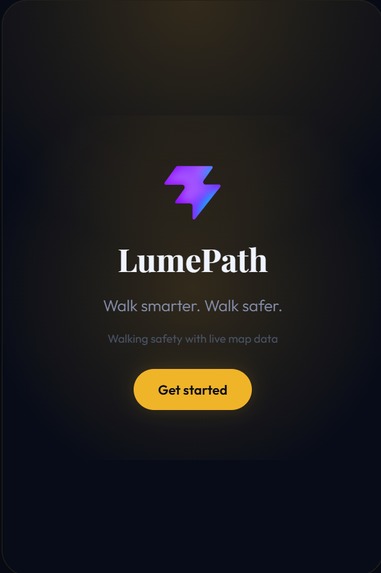
Startup Screen
-

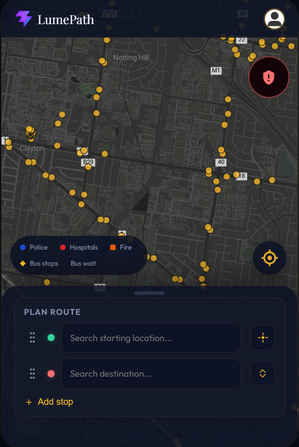
LumePath UI
-
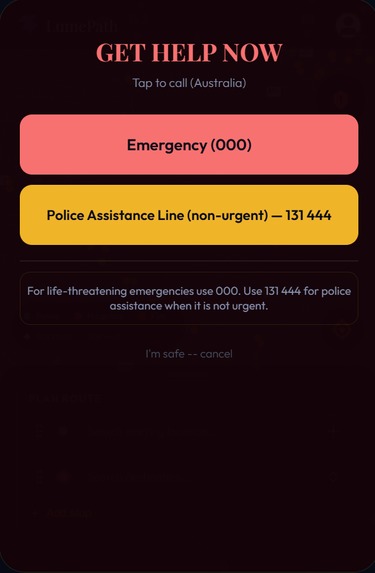
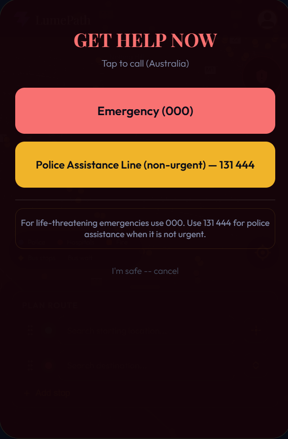
Emergency Call Feature
-
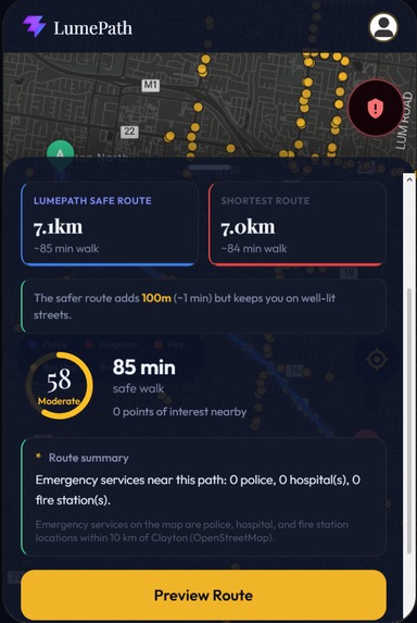
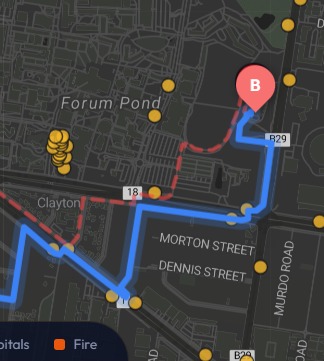
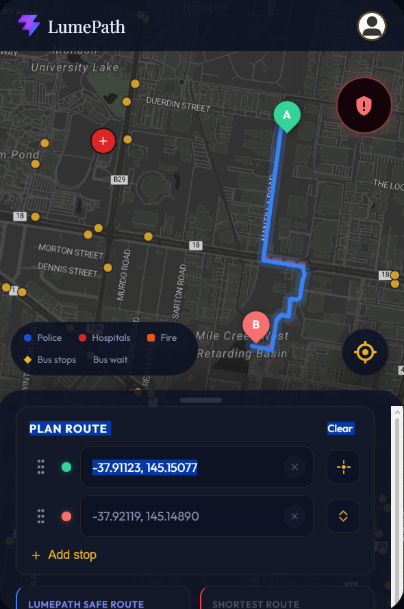
Live Route Comparision
-
Route Preview
-

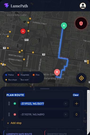
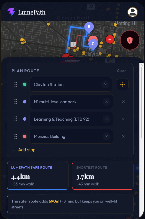
On-Campus Travel + Multi-stop functionality!
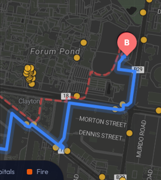
-
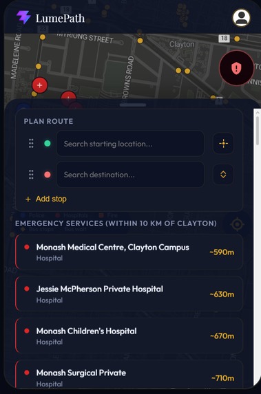
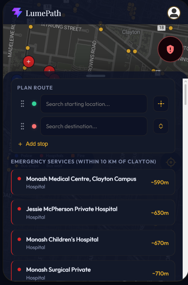
Find the Nearest Emergency Services Near You!
-
Sitck to Known Well Lit Paths

THE PROBLEM WE SET OUT TO SOLVE
Every day, students living near Monash University drive short distances they could easily walk or cycle, not for convenience, but because walking alone at night feels unsafe. Without any reliable way to know which routes are well-lit and frequently travelled, there is a quiet but significant barrier preventing people from living healthier, cheaper, and more sustainable lifestyles. Existing navigation apps offer no answer. Google Maps finds you the fastest route, but has no concept of whether that route is lit, busy, or avoided by other students after dark.
OUR PROPOSED SOLUTION
Lumepath is a pedestrian navigation app that directly addresses this safety gap, giving students a tool that tells them not just how to get somewhere, but how to get there safely. Lumepath makes the safe route the default route, so every student leaving campus after a late lecture or walking home from the station has a path they can actually trust, built from real-world data about lighting and foot traffic.
HOW WE BUILT IT
We built Lumepath on top of Mapbox as our core mapping and routing engine, powered by crowdsourced streetlight and infrastructure data from OpenStreetMap. A clustering and de-identification pipeline aggregates historical user travel patterns into a dynamic heatmap, reflecting which streets people consistently choose to walk at night. The algorithm prioritises well-lit, high-traffic streets and demotes residential back-streets unless no safer alternative exists. For the hackathon, we delivered a working prototype covering Monash Clayton and surrounding suburbs.
CHALLENGES WE FACED
Our biggest challenge was converging on the right idea, our team kept each other accountable and stress-tested every concept before committing. On the technical side, council streetlight data had significant coverage gaps due to privately operated infrastructure, which we solved by turning to OpenStreetMap's crowdsourced illumination data instead.
Built With
- css
- firebase
- javascript
- overpass-openstreetmap
- python
- render
- stadiamaps
- vercel


Log in or sign up for Devpost to join the conversation.