-
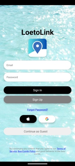
Login/Signup Screen
-
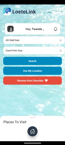
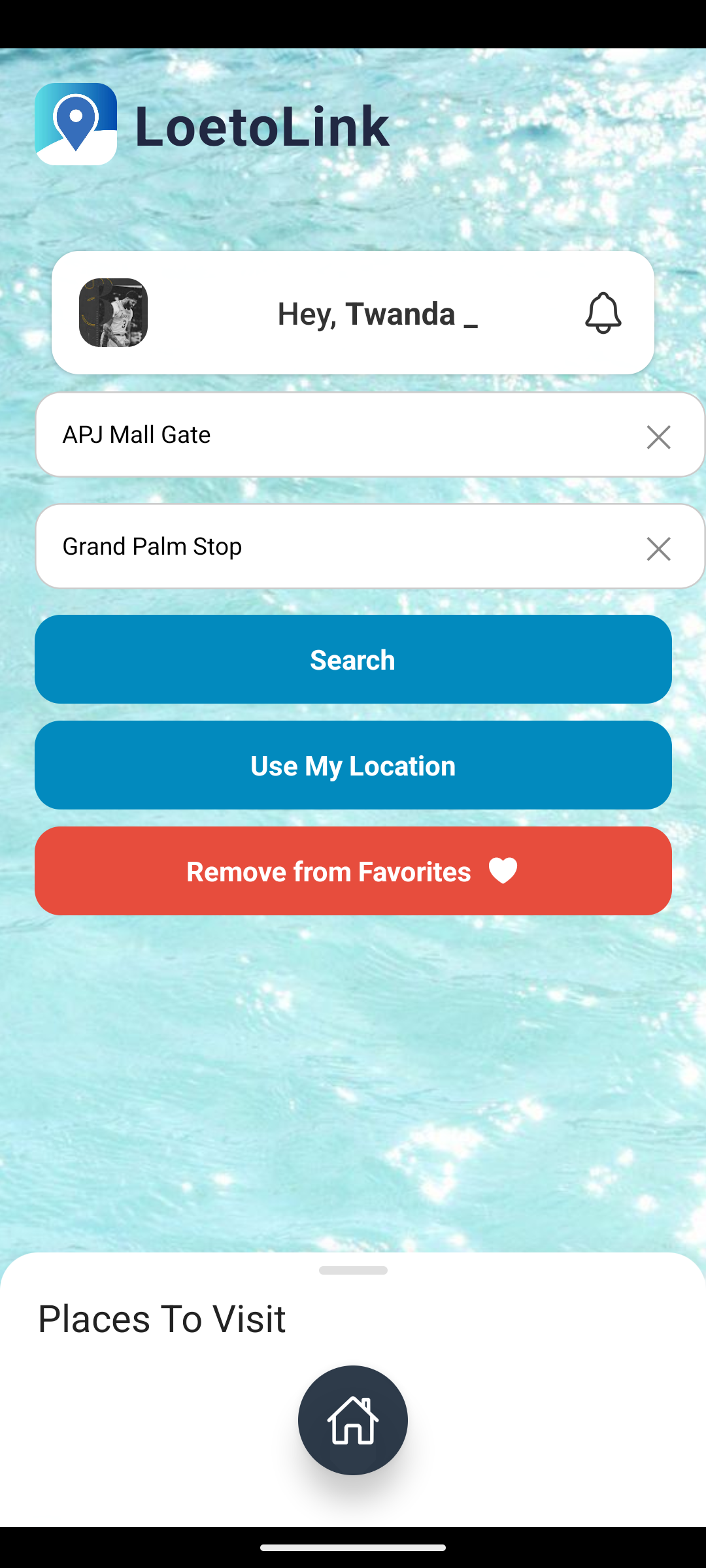
Home screen, with departure and destination
-

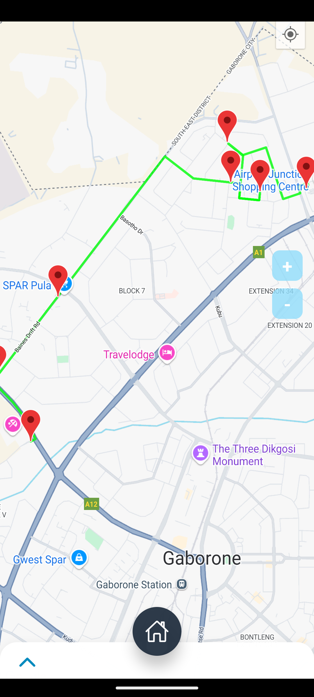
Map Screen with route and all stops along the route
-
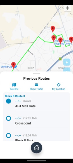
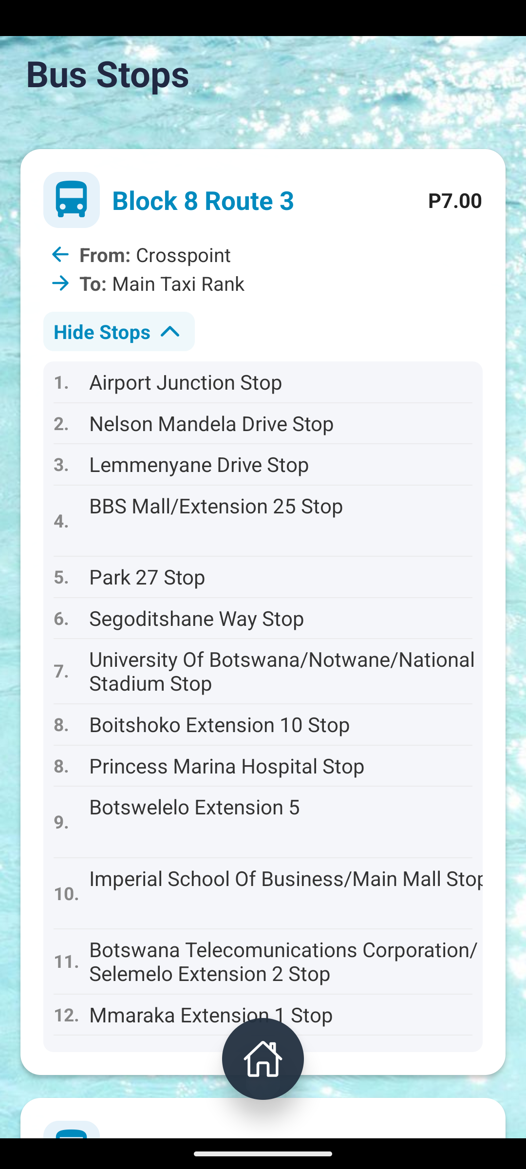
Stop list with ETA to each stop
-

Bus stop screen, with each combi name and all stops it passes
-

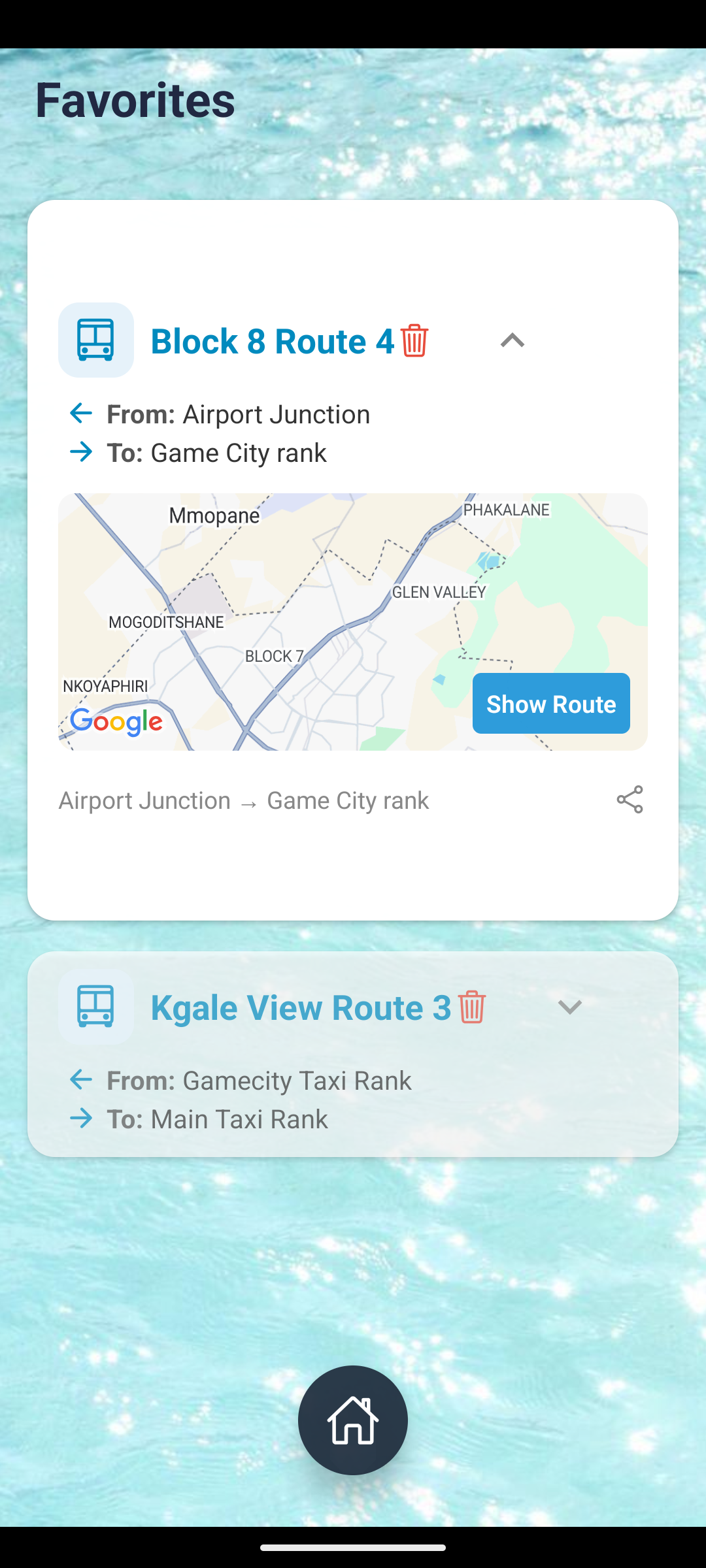
Favorites screen with a mini map view to show the route of favorited combi
-
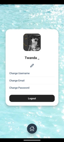
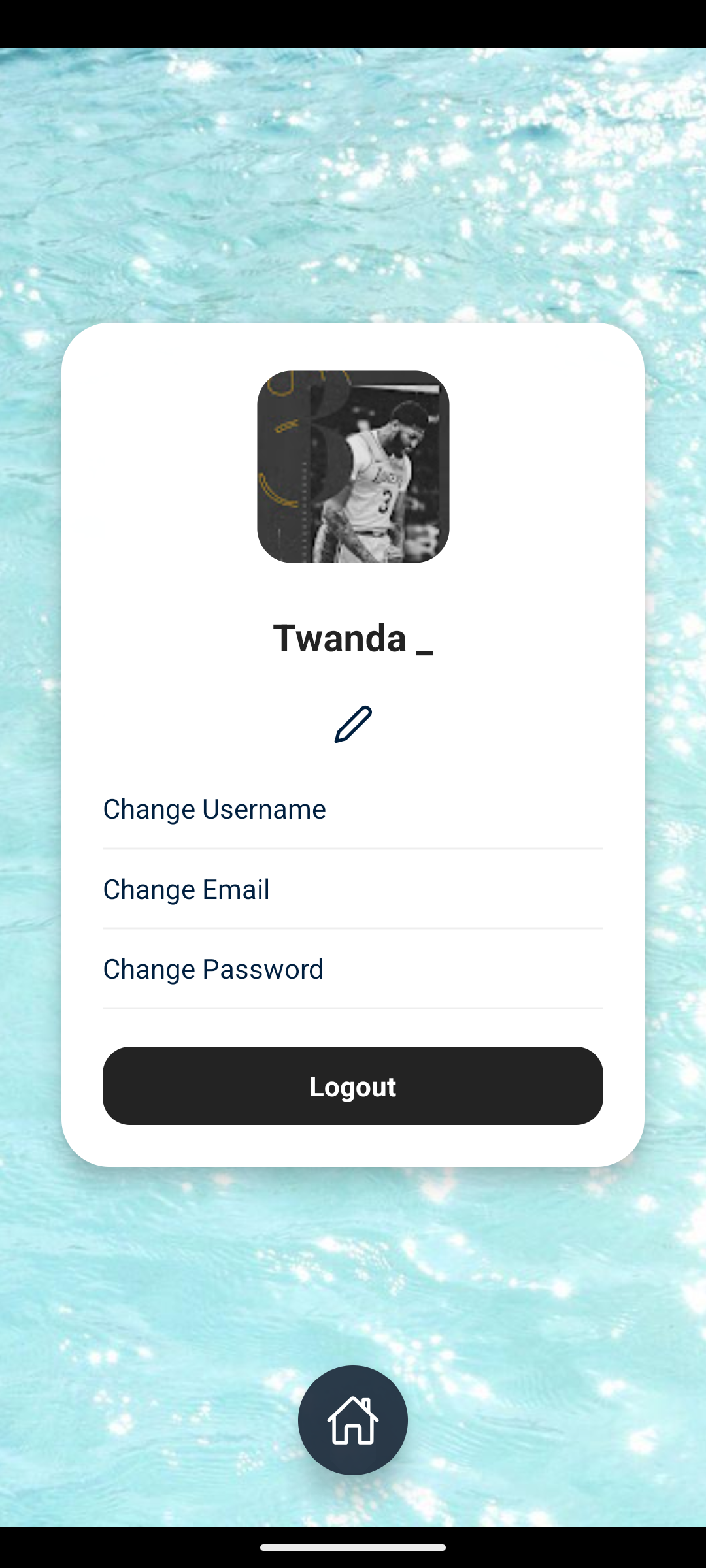
Profile screen, where users can edit their information


Loeto Link: Enhancing Public Transportation in Botswana
Inspiration 🌍
Public transport in Botswana, especially the minibus taxi system (combis), remains largely informal, inefficient, and inaccessible to many commuters. In cities like Gaborone, long wait times, lack of route information, and safety concerns are daily challenges for the average commuter. Loeto Link was born from the desire to solve this national problem using digital innovation—creating a smart solution for both passengers and drivers.
What it does 📱
Loeto Link is a mobile-first, location-aware app designed to digitize Botswana’s public transportation system. Key features include:
- Live GPS Tracking of combis for commuters.
- Digital Fare Payments via mobile money or QR code.(in progress)
- Driver Dashboards with route stats and daily earnings.(in progress)
- Route Discovery and Estimated Travel Time for commuters.
- Offline Mode and Low-Data Mode to ensure accessibility.(in progress)
- Safety Tools like emergency contact sharing and real-time location sharing.
It connects commuters with verified combi operators, improving reliability, safety, and transparency in public transportation.
How we built it 🛠️
- Frontend: Built with React Native (Expo) for cross-platform mobile support.
- Backend: Powered by Supabase for user authentication, route data storage, and real-time updates.
- Navigation: Integrated Google Maps API to provide road-following route guidance and travel estimates.
- Payment Integration: Supports mobile wallets like Orange Money and MyZaka (in progress).
- Database Schema: Optimized to handle stops, routes, user favorites, and location logs with minimal latency.
We used an agile approach, with sprints focused on developing key modules like user authentication, route tracking, and map view rendering.
Challenges we ran into 🚧
- Data Availability: Mapping informal combi routes with no official records was time-consuming.
- Driver Onboarding: Convincing combi drivers to embrace technology required extensive field engagement.
- Offline Capability: Making sure the app functions with limited or no internet was technically demanding.
- Google Maps API Cost Management: We had to optimize API calls to keep usage within budget.
- Device Compatibility: Ensuring the app runs smoothly on low-end smartphones common in the market.
Accomplishments that we're proud of 🏆
- Developed a working MVP with real-time GPS tracking and route matching.
- Onboarded a small group of combi drivers in Gaborone for a live pilot.
- Integrated Supabase with geolocation and authentication successfully.
- Reduced average commute planning time from 15 minutes to under 1 minute.
- Created a fully localized app that supports both English and Setswana.
What we learned 📚
- The value of designing for inclusivity—offline access, low data usage, and intuitive UI are essential.
- How to work effectively with location-based APIs and build scalable database architectures.
- The importance of stakeholder interviews, especially with drivers, commuters, and city transport officials.
- How public policy can support or hinder digital transformation in transit.
What's next for Loeto-Link :Enhancing Public Transportation in Botswana 🚀
- Full Gaborone Rollout: Launching across all major combi routes in the capital.
- Fare Integration: Launching cashless fare payments with local mobile money partners.
- Tourism Mode: Adding a “Tourist View” that guides international visitors using combis.
- Cross-City Expansion: Scaling to Francistown, Maun, and border towns like Kazungula.
- Government Partnerships: Collaborating with the Department of Road Transport and Safety (DRTS) to support smart city goals.
- AI-Driven Route Suggestions: Using commuter feedback and GPS patterns to suggest better route planning.


Log in or sign up for Devpost to join the conversation.