-
-
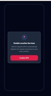
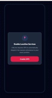
GPS permission screen
-
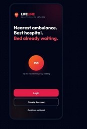
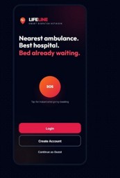
Start page with SOS, login and guest options
-
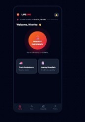
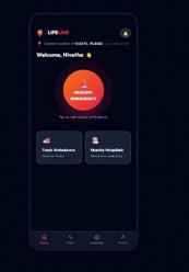
Home screen with Request Emergency and current location
-
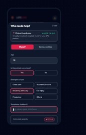
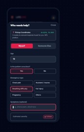
SOS form: patient details and estimated severity
-
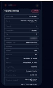
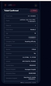
Ticket confirmed: ticket code, trip ID, severity and hospital reservation
-
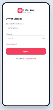
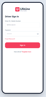
Driver sign-in
-
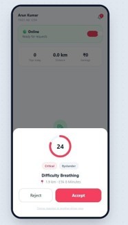
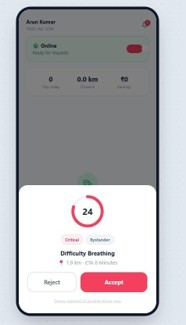
Incoming request offer with countdown
-
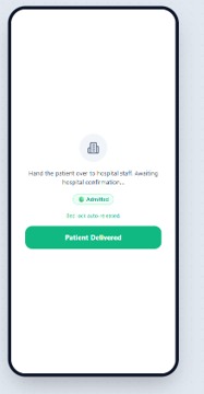
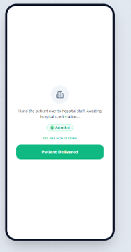
Patient handed over to hospital staff
-
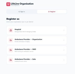
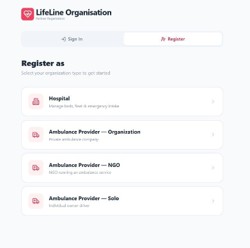
Organisation Registration
-
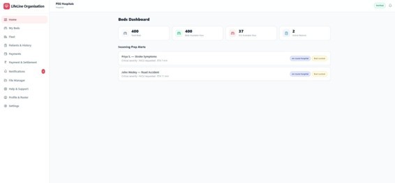
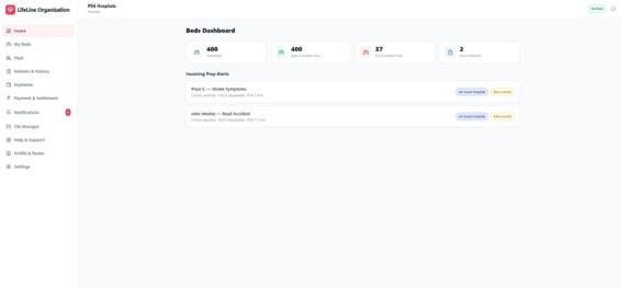
Beds dashboard: total beds, available beds, ICU beds and incoming prep alerts
-
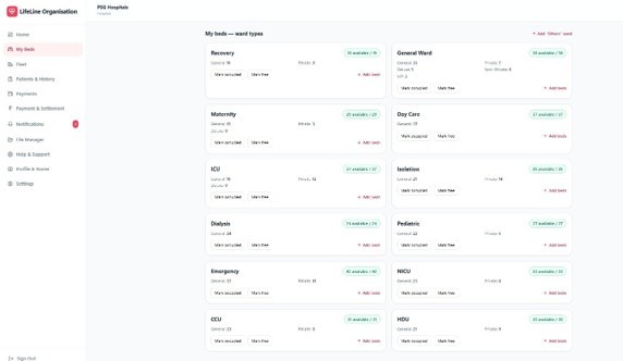
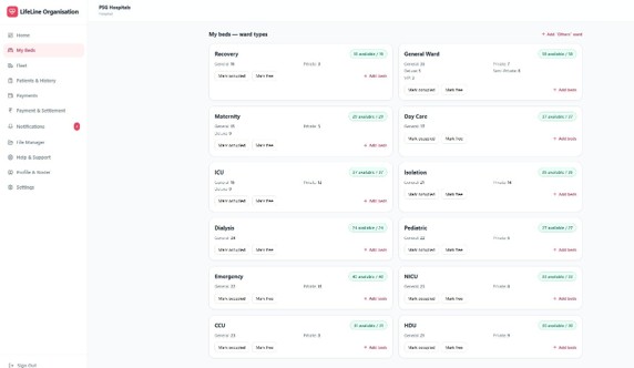
Beds: ward-wise bed availability with mark occupied / mark free
-
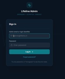
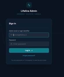
Admin sign-in
-
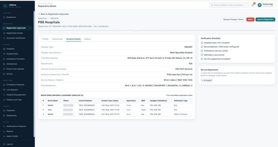
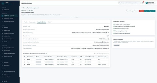
Admin :registration approvals
-
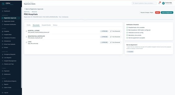
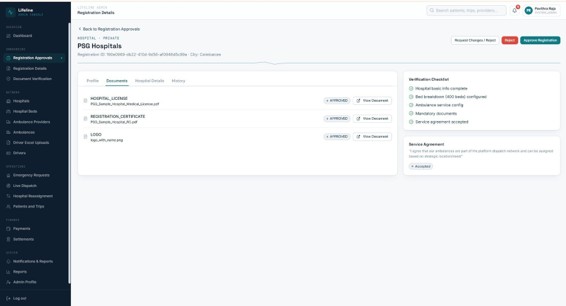
Registration details: uploaded document with approval status
InspirationInspiration
During medical emergencies, every second counts. The "Golden Hour"—the first 60 minutes after a traumatic injury or sudden medical crisis—is critical to survival. Unfortunately, emergency response systems worldwide suffer from fragmented communication between patients, ambulance operators, and emergency room staff. Patients struggle to track dispatch status, drivers face navigation delays without dedicated emergency routing, and hospitals are often caught unprepared for incoming critical cases.
We built LIFELINE to bridge this vital gap: an end-to-end, intelligent emergency response ecosystem that seamlessly coordinates patients, ambulance drivers, and hospital emergency departments in real time.
What it does LIFELINE is an integrated emergency response platform designed to eliminate communication delays during critical medical crises. It connects patients, ambulance drivers, and hospital emergency teams through a synchronized real-time system:
Patient SOS & Tracking App: Enables one-touch emergency dispatch requests, captures exact GPS coordinates, and displays live tracking of the assigned ambulance arriving in real time. Driver Navigation & Workflow App: Provides drivers with instant emergency dispatch alerts, driver availability toggles (Online/Offline/Busy), step-by-step trip workflow management, and self-hosted MapLibre vector map navigation. Admin & Hospital Command Portal: Offers hospital administrators and system managers complete oversight of active emergency tickets, driver fleet status, hospital department readiness, and emergency bed allocations. Self-Hosted GIS & Mapping Engine: Renders high-performance vector maps and route geometry without relying on third-party map providers (Google Maps, Mapbox, CARTO), avoiding rate limits, API costs, and downtime during critical emergencies. How we built it Frontend Applications: Built three dedicated web applications (Patient, Driver, Admin) using React and Vite, styled with Tailwind CSS, and powered by MapLibre GL JS for fast vector map interactions. Microservice Backend Architecture: Developed modular, production-ready Java 21 / Spring Boot microservices: Auth Service (Port 8080): Handles JWT authentication, user registration, role-based access control, and secure session management. Lifeline Core Service (Port 8081): Manages emergency request creation, driver dispatch algorithms, trip state synchronization, hospital bed management, and WebSockets. AI & Routing Client: Interacts with local routing services for route calculation and dynamic trip geometry. Self-Hosted GIS Pipeline: OpenMapTiles & PostGIS: Processed OpenStreetMap data into custom street-level .mbtiles vector archives (z0–z14). TileServer GL: Hosted local vector tile endpoints, glyphs, and sprite layers inside Docker containers. OSRM (Open Source Routing Machine): Hosted a local routing engine for instant route calculation. Database Layer: Managed data persistence using Aiven Cloud MySQL alongside PostGIS spatial geometry tables. Challenges we ran into Offline Vector Tile Generation: Building a self-hosted vector map pipeline down to street-level zoom (z14) required generating hundreds of thousands of vector tiles from raw OpenStreetMap PBF files. Optimizing bounding boxes (BBOX) to balance tile generation speed and disk space was a major technical hurdle. Low-Latency Real-Time GPS Tracking: Coordinating continuous driver location broadcasts over WebSockets while keeping map rendering smooth at 60fps required optimizing state updates, marker re-renders, and MapLibre camera bounds fitting. Multi-State Emergency Lifecycle Management: Designing a strict state machine across backend services to handle complex trip transitions (requested → assigned → en_route_patient → arrived_patient → patient_onboard → en_route_hospital → arrived_hospital → handover → completed) without state drift or race conditions. Accomplishments that we're proud of 100% Independent Map Infrastructure: Successfully created a completely self-hosted map rendering pipeline using OpenMapTiles, TileServer GL, and MapLibre GL JS with zero dependency on paid third-party tile services. Seamless Three-Way Coordination: Built a synchronized ecosystem where a single emergency SOS trigger seamlessly updates the patient, alerts the nearest driver, and prepares the target hospital. High-Performance Architecture: Delivered a responsive microservices system with low-latency REST endpoints, WebSockets, and lightweight vector tiles. What we learned Advanced GIS & Map Mechanics: Mastered vector tile schemas, TMS/XYZ tile coordinate transformations, MapLibre GL layer styling, and custom PBF generation pipelines. Resilient Microservices Communication: Deepened our understanding of spring security JWT flows, multi-service database transactions, and real-time WebSocket topic messaging. Human-Centered Emergency Design: Learned to build focused, high-contrast user interfaces tailored for users under extreme stress. What's next for LIFELINE – Smart Ambulance & Hospital Coordination Real-Time Traffic Rerouting: Integrate live traffic congestion feeds into the OSRM routing engine to dynamically adjust navigation routes during peak hours. En-Route Vital Telemetry: Enable drivers to stream patient vital signs (heart rate, SpO2, blood pressure) directly from ambulance sensors to emergency room staff prior to arrival. Automated Smart Signals (Green Wave): Connect ambulance GPS tracking with municipal smart traffic signals to grant automatic green lights along emergency routes. Native Mobile Apps: Package the web portals into native Android and iOS mobile applications using React Native for background location services and push notifications.
Built With
- css3
- docker
- dockercompose
- html5
- java
- javascript
- jwt
- maplibregljs
- maven
- microservices
- mysql
- node.js
- openmaptiles
- openstreetmap
- osrm
- playwright
- postgis
- python
- react
- restapi
- springboot
- tailwindcss
- tileservergl
- vite
- websockets

Log in or sign up for Devpost to join the conversation.