-
-
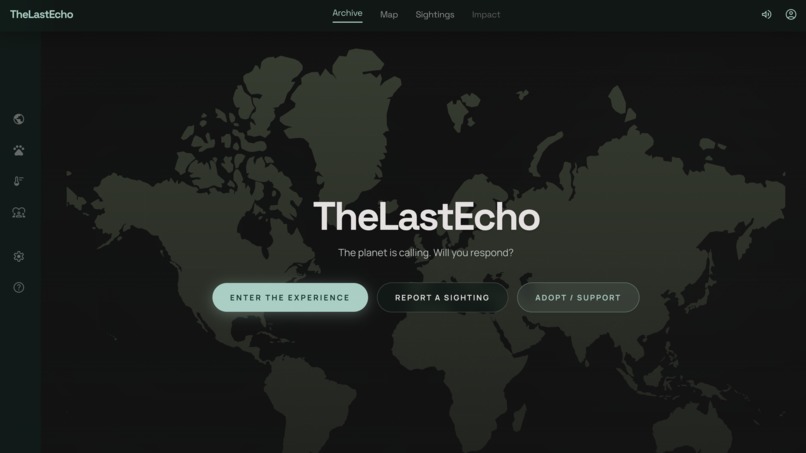
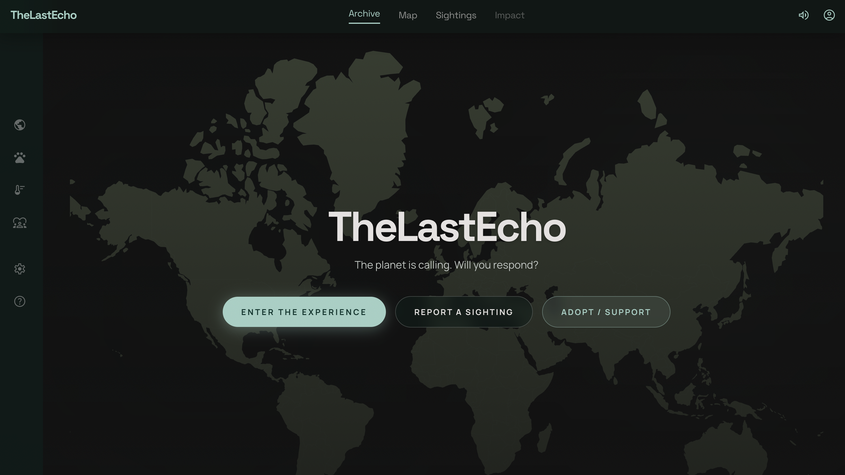
Home/Landing Page
-
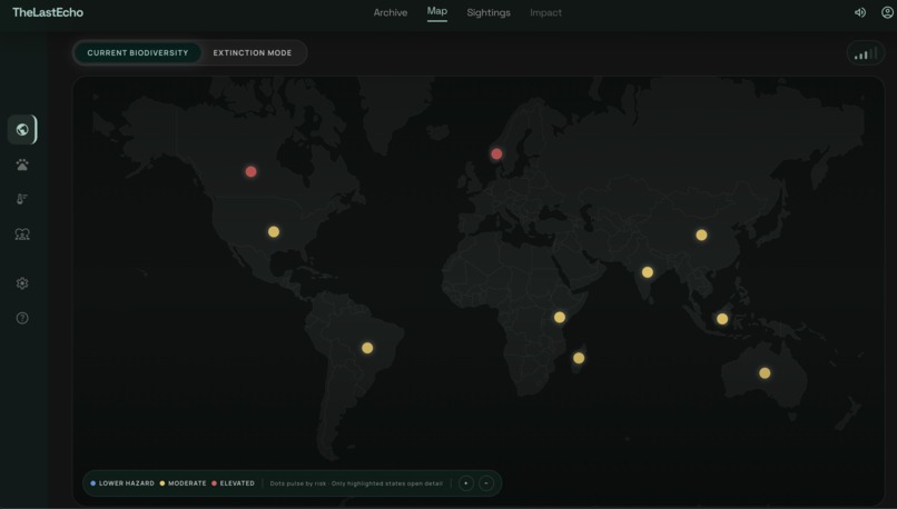
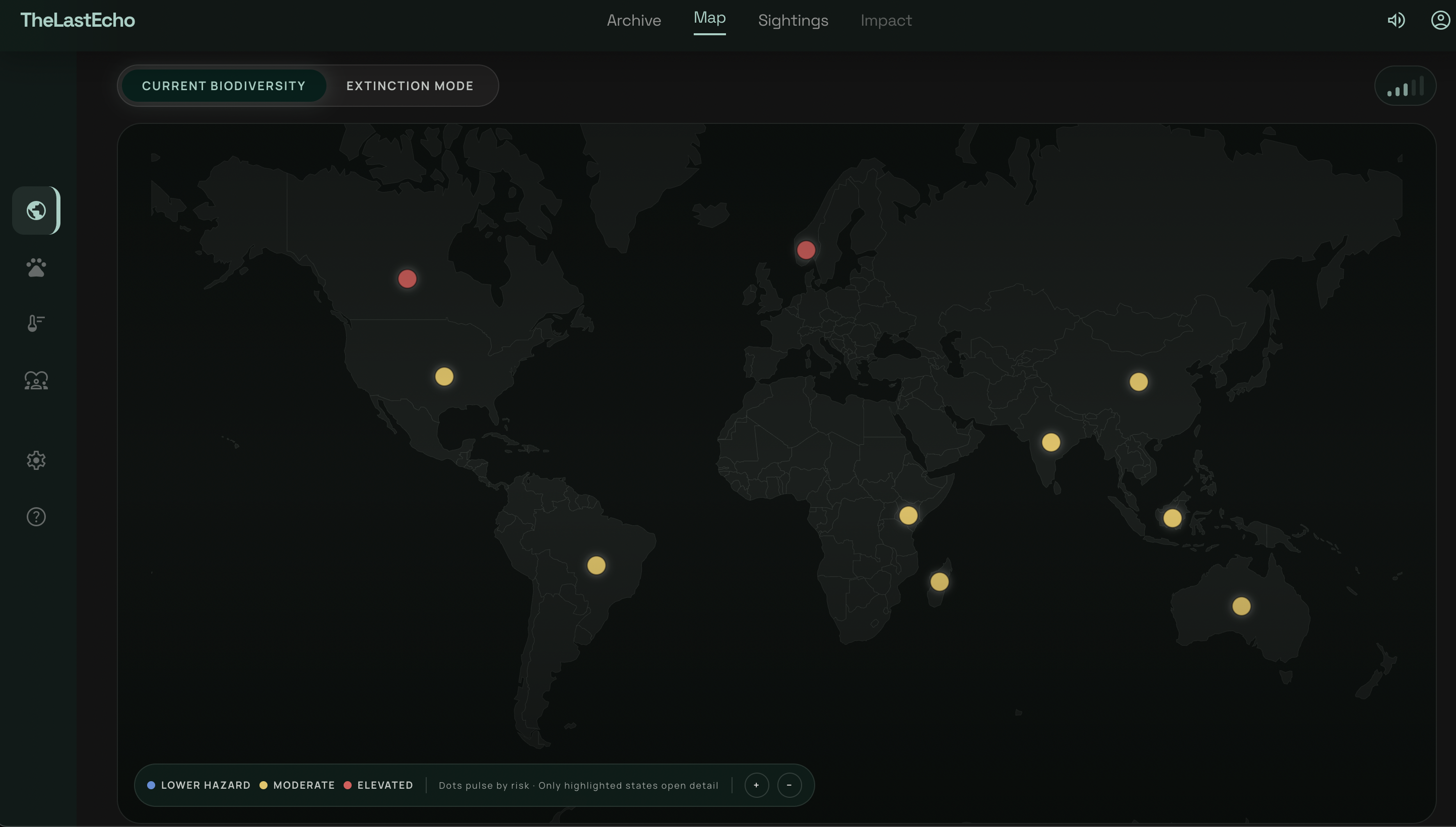
Map
-
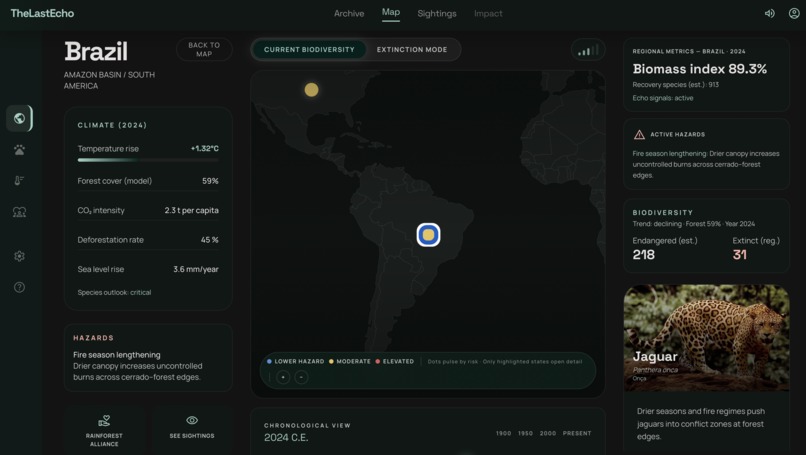
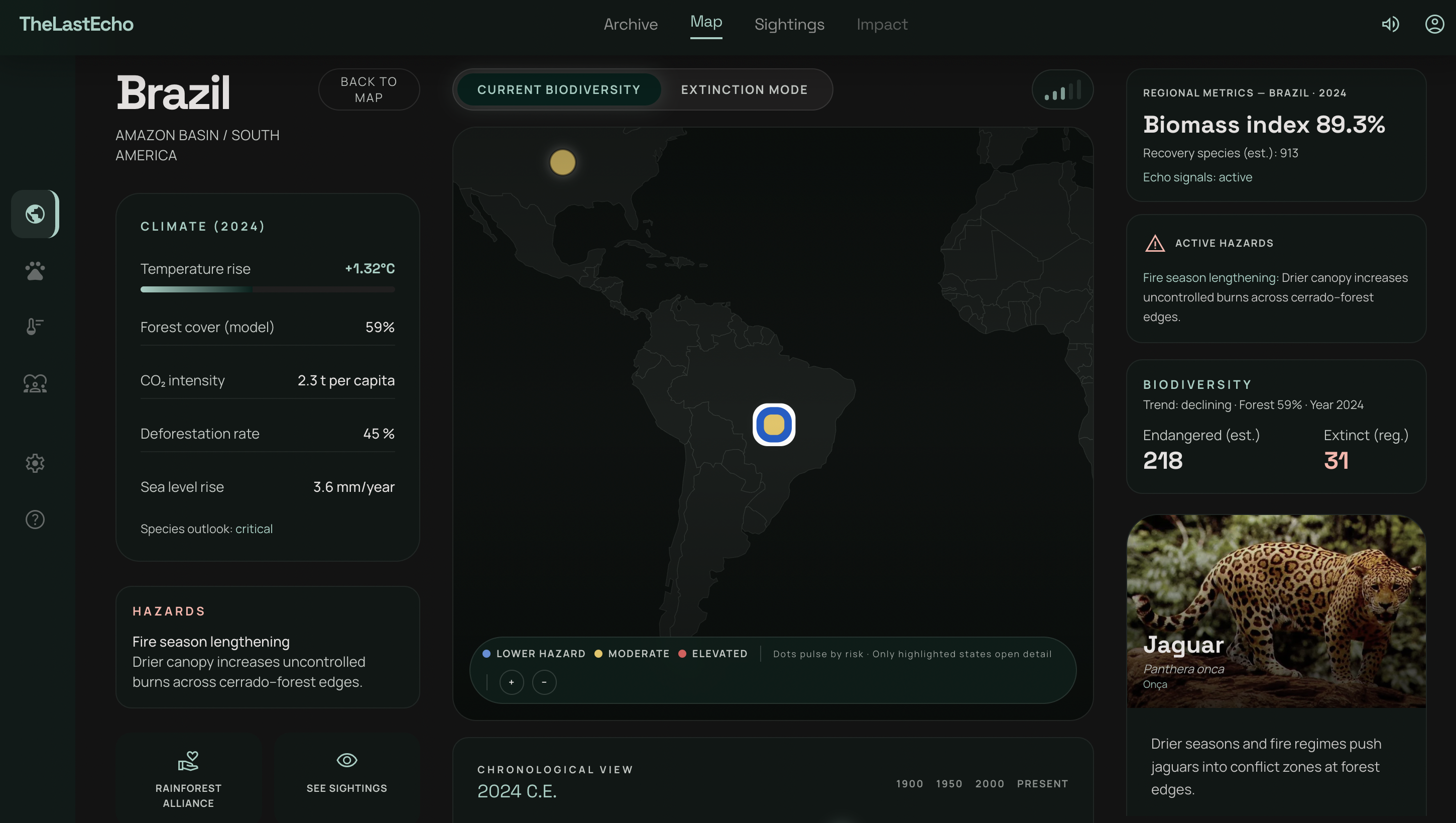
When u click on a country this pops up
-
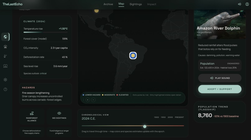
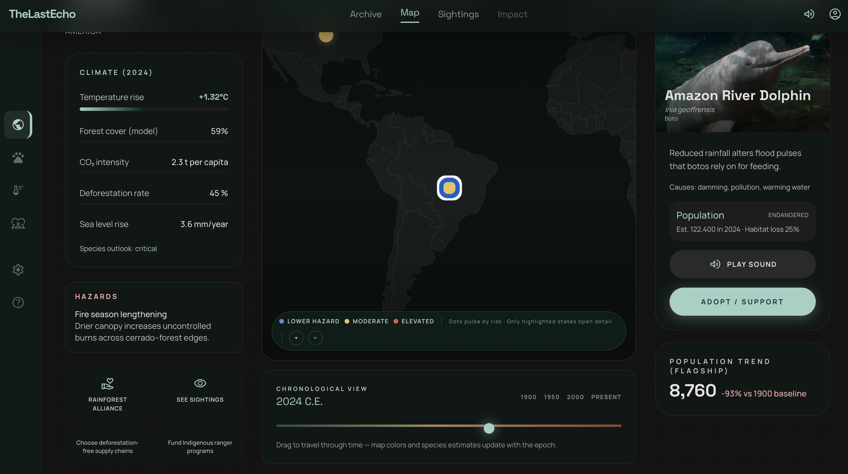
You can even slide through to see the change in population of the animal
-

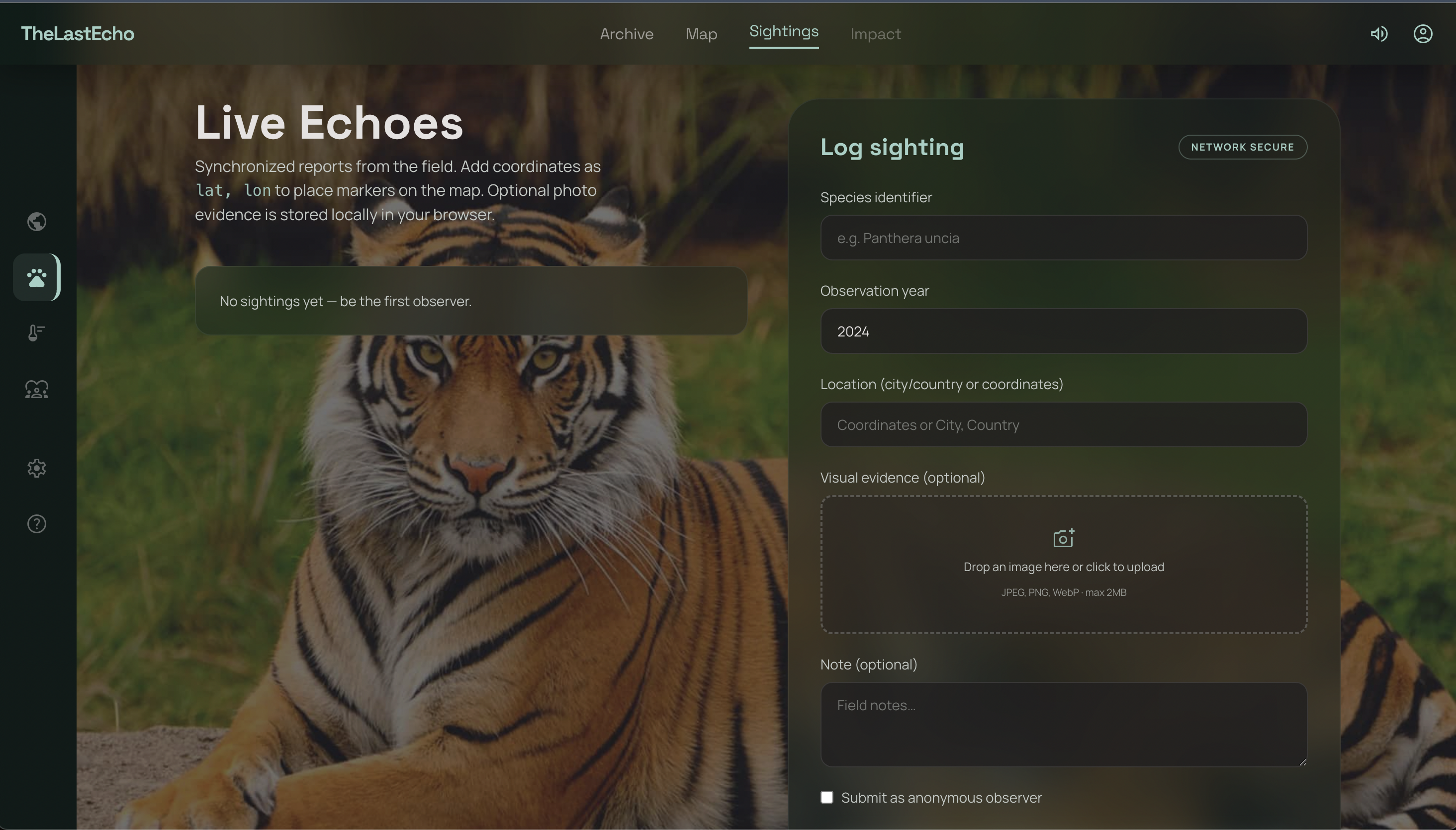
Crowdsourcing Platform
TheLastEcho — Project Story
About the Project
TheLastEcho is an interactive web experience that transforms climate and biodiversity data into something people can feel, not just read.
Instead of presenting climate change as abstract statistics, we built a living, interactive map of Earth where each country tells a story through the species it is losing. Users can explore a century-spanning timeline (1900 → 2100), observe how ecosystems evolve under climate stress, and experience biodiversity loss through visual transitions, population decline graphs, and real-world animal sounds.
At its core, TheLastEcho is not a dashboard — it is a digital archive of a disappearing world.
Each interaction answers a simple but urgent question:
What is being lost, where, and why?
We also integrate a crowdsourced “Last Seen” system, allowing users to log sightings of species in their local environments. Over time, this builds a collective memory of disappearance — turning individual observations into global awareness.
Inspiration
We were inspired by a critical gap in how climate change is communicated.
Today, people are aware of the crisis — they hear numbers like:
- “1.5°C warming”
- “1 million species at risk”
But these numbers rarely translate into emotional understanding or urgency.
We asked:
What if people could experience climate change the way they experience stories — visually, spatially, and emotionally?
Maps show where.
Sound makes it real.
Time shows what’s coming.
The idea of LastEcho came from this — the thought that many of the sounds we hear today in nature may soon become the last echoes of species that no longer exist.
How We Built It
We built TheLastEcho as a modern, interactive web application focused on performance, modularity, and immersive user experience.
Core Stack:
- Next.js (React) — scalable frontend architecture
- Tailwind CSS — consistent and efficient styling
- Framer Motion — smooth animations and transitions
- react-simple-maps / D3-geo — interactive world map with country boundaries
- LocalStorage — storing user-contributed sightings
- Custom JSON dataset — powering climate, biodiversity, and timeline data
Key Features:
Interactive Climate Map
- Countries dynamically colored based on temperature rise
- Click to open detailed country-level insights
Biodiversity Storytelling
- Each country features 1–2 key species
- Includes population decline, habitat loss, and climate impact explanations
Timeline Simulation (1900 → 2100)
We simulate environmental change over time using interpolation:
$$ c(t) = c_0 + (c_1 - c_0)\cdot t $$
Where:
- ( c(t) ) represents climate variables over time
Population change is calculated as:
$$ \Delta\% = \frac{P_{initial} - P_{current}}{P_{initial}} \times 100 $$
Extinction Mode
- UI desaturates to reflect ecological loss
- Species marked extinct based on projected data
Sound Layer
- Each species includes real animal calls or ambient habitat sound
- Reinforces the idea of experiencing disappearance, not just reading about it
Crowdsourced “Last Seen”
- Users log species sightings with location, year, and optional note
- Stored locally to simulate a shared biodiversity memory
What We Learned
- Data alone doesn’t create impact — storytelling does
- Design plays a crucial role in climate communication
- Interactivity improves engagement and understanding
- Performance optimization is essential when working with maps and media
Challenges We Faced
- Balancing realistic data with simplicity for smooth interaction
- Handling GeoJSON country boundaries and map interactions
- Creating smooth and believable timeline transitions
- Managing audio without affecting performance or overwhelming users
- Ensuring consistency across different browsers and devices
Impact & Vision
TheLastEcho connects strongly with key climate themes:
- Biodiversity and ecosystem awareness
- Encouraging collective action through participation
- Highlighting regions vulnerable to climate change
- Using technology to improve climate understanding
Closing
The climate crisis is not just a scientific problem — it is a perception problem.
People don’t act on what they don’t feel.
TheLastEcho is an attempt to bridge that gap.
To turn invisible change into visible stories.
To turn data into something people remember.
What we hear today may not exist tomorrow.
Additional Markers
Feasibility & Technological Scalability
- What we have implemented is a prototype to show how interactive and aware the website is. The platform can scale globally by integrating real-time biodiversity and climate APIs (e.g., IUCN Red List, GBIF).
- Cloud storage and CDN-based media delivery can support large-scale data and audio assets.
- Modular dataset design allows easy expansion from 10 countries to full global coverage.
Sustainability & Real-World Use
- The platform can be used in schools, climate awareness programs, and interactive museum exhibits.
- Potential partnerships with NGOs and conservation organizations can provide verified data and real-world impact pathways.
- The "adopt an animal" and action features can be extended into fundraising or conservation support models.
Positioning in Existing Landscape
- Existing climate platforms primarily present data and statistics.
- TheLastEcho differentiates itself by combining data with emotional storytelling through sound, visuals, and interaction.
- It focuses on making climate change personally relatable rather than purely informational.
Equity & Justice Considerations
- Highlights regions and communities most affected by biodiversity loss and climate change.
- Incorporates local and indigenous species naming to acknowledge diverse knowledge systems.
- Can be extended to include localized language support for broader accessibility.
Systems Thinking
- Demonstrates the interconnected relationship between climate change, habitat loss, biodiversity decline, and human impact.
- Encourages users to understand climate change as a systemic issue rather than isolated events.
Future Enhancements
- Real-time crowdsourced global sightings database with verification mechanisms.
- AI-based habitat loss and extinction risk prediction models.
- Integration with policy datasets and conservation tracking systems.
Built With
- framer
- geojson
- github
- javascript
- next
- react
- tailwind
- vercel


Log in or sign up for Devpost to join the conversation.