Inspiration
What it does
How we built it
Challenges we ran into
Accomplishments that we're proud of
What we learned
What's next for KisanOne
🌾 KisanOne — Smarter Farming, Better Decisions
💡 Inspiration
Farmers make hundreds of decisions throughout a growing season: Which crop should I grow? Is my soil suitable? How much water is needed? What happens if a heat wave arrives? What should I do during a flood or drought?
We realized that agricultural information is often scattered across different sources and presented in ways that can be difficult to understand and act upon.
We wanted to build something different.
Instead of creating another farming information website, we wanted farmers to experience the decision-making process.
That idea became KisanOne — an interactive farming platform where users can explore locations, understand land conditions, select crops, experience climate challenges, make decisions, and immediately see the consequences.
🌱 What is KisanOne?
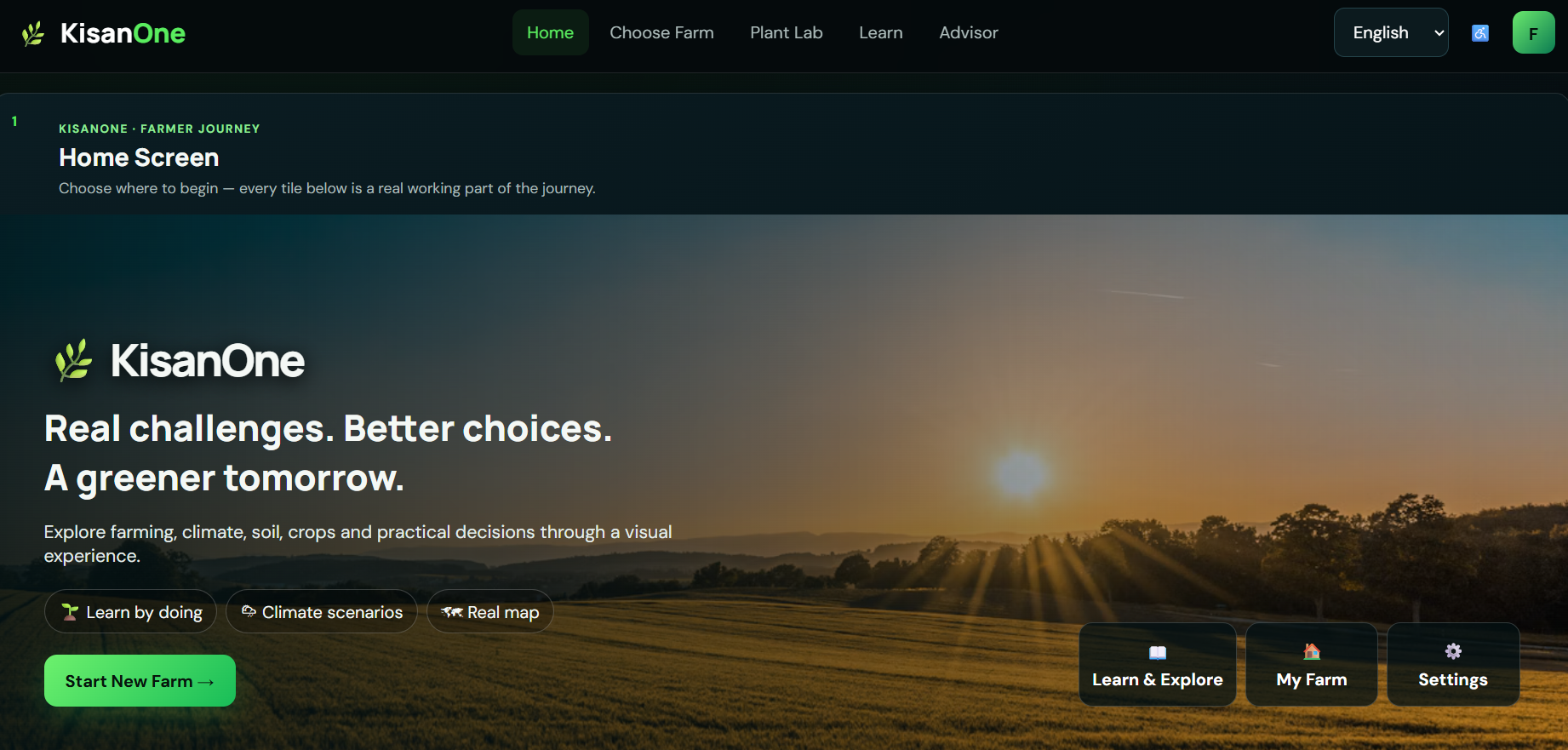
KisanOne is an interactive farmer-support and agricultural learning platform that connects location, crops, soil, climate risks, decision-making, and education in one experience.
A farmer can:
- 🗺️ Explore a real interactive map
- 📍 Select a location and explore regional agricultural information
- 🌱 Discover crops suitable for different environments
- 🌾 Explore a large crop library
- 🌦️ Understand climate and environmental risks
- 🔥 Experience heat-wave scenarios
- 🌊 Experience flood scenarios
- ☀️ Experience drought scenarios
- 🐛 Learn about pest outbreaks
- 💧 Understand water requirements
- 🧪 Explore soil characteristics
- 🤖 Ask the farming advisor questions
- 📚 Complete interactive farming lessons
- 📊 See the consequences of farming decisions
- ♿ Use accessibility features
- 🎮 Learn through interactive challenges
The goal is simple:
Don't just tell farmers what to do. Help them understand why a decision matters.
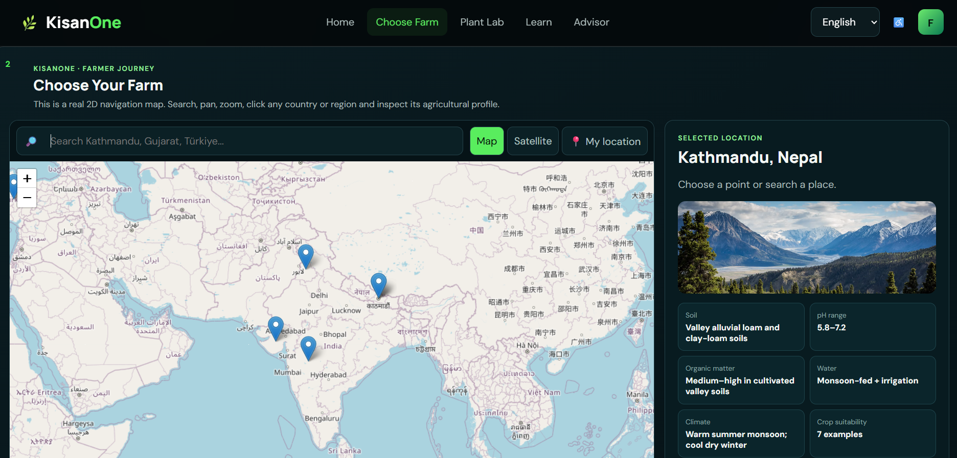
🗺️ Location-Aware Farming
One of the core ideas behind KisanOne is that farming recommendations should depend on location.
A farmer in Kathmandu should not receive the same information as a farmer in Gujarat or Türkiye.
KisanOne therefore provides a location-driven experience where users can explore different regions through an interactive map.
For example:
Kathmandu → Nepal-specific agricultural context
Gujarat → India-specific agricultural context
Türkiye → Türkiye-specific agricultural context
The selected location influences the agricultural information shown to the user, including crops, soil characteristics, climate context, water considerations, and potential farming opportunities.
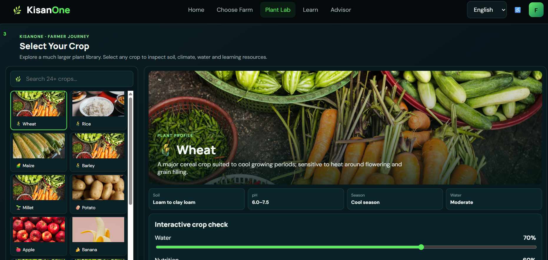
🌾 A Large Crop Library
Farmers don't grow only wheat and corn.
KisanOne is designed around a broader agricultural library covering different categories of crops.
Cereals
- Wheat
- Rice
- Maize
- Barley
- Millet
- Sorghum
- Oats
Fruits
- Apple
- Banana
- Mango
- Orange
- Grape
- Pomegranate
- Papaya
Vegetables
- Potato
- Tomato
- Onion
- Cabbage
- Cauliflower
- Chilli
- Carrot
- Okra
Pulses
- Chickpea
- Lentil
- Peas
- Pigeon pea
- Black gram
Oilseeds
- Groundnut
- Soybean
- Sunflower
- Mustard
- Sesame
Plantation & Specialty Crops
- Tea
- Coffee
- Coconut
- Cocoa
- Olive
- Hazelnut
Each crop can be explored through information such as environmental requirements, water needs, soil preferences, risks, and learning resources.
🌦️ Turning Climate Change Into an Experience
Climate change can be difficult to understand when it is presented only as statistics.
KisanOne turns climate risks into interactive scenarios.
For example:
🔥 Heat Wave
The farmer receives a heat-wave warning.
They must decide:
- Irrigate now
- Wait for cooler weather
- Reduce irrigation
- Change their strategy
The system then calculates the consequences of the decision and shows changes in:
- Crop health
- Water usage
- Expected yield
- Cost
- Sustainability
The same concept can be applied to:
🌊 Floods
☀️ Droughts
🐛 Pest outbreaks
🌡️ Extreme temperatures
This transforms agricultural education from reading information into making decisions.
🤖 Farmer Advisor
KisanOne also includes a farmer-focused advisor that allows users to ask questions in simple language.
Instead of requiring technical agricultural terminology, users can ask questions such as:
"Why is my crop health decreasing?"
"Which crop should I grow here?"
"How can I save water?"
"What should I do during a heat wave?"
The advisor uses the current farming context to make the experience more relevant to the selected crop, location, and scenario.
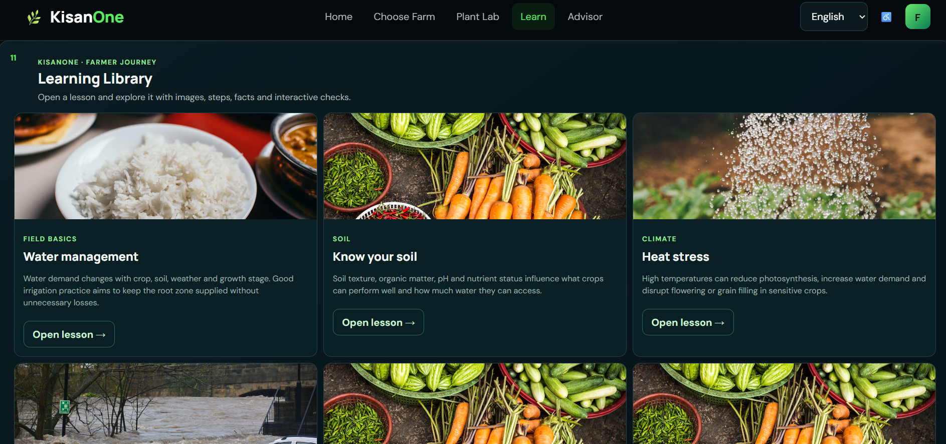
📚 Interactive Learning
We also wanted KisanOne to work as a learning platform.
Lessons are not simply long blocks of text.
Users can explore:
- Crop management
- Soil
- Water management
- Climate risks
- Sustainable farming
- Crop selection
- Environmental challenges
Lessons include visual resources, explanations, questions, and interactive activities so that users can learn by doing.
This makes KisanOne useful not only for farmers, but also for:
- 👨🌾 Farmers
- 🎓 Students
- 👨👩👧 Families
- 👩🏫 Teachers
- 🌱 Anyone interested in agriculture
🧠 What We Learned
Building KisanOne taught us that creating an agricultural application is not simply about displaying agricultural data.
The real challenge is turning information into understandable decisions.
We learned how to:
- Build an interactive map-based experience
- Create location-aware interfaces
- Design agricultural decision flows
- Build scenario-based simulations
- Organize a large crop information system
- Design accessible interfaces
- Combine visual storytelling with technical information
- Make complex agricultural concepts understandable through interaction
Most importantly, we learned that good technology should reduce complexity rather than add more complexity for the user.
🛠️ How We Built It
KisanOne was built as a modern web application.
Frontend
- React
- Vite
- JavaScript
- HTML/CSS
- Responsive UI
Mapping
- Leaflet
- React Leaflet
- OpenStreetMap
The map allows users to zoom, pan, search locations, select regions, and explore agricultural information.
Application Logic
KisanOne uses structured agricultural and location data together with a decision engine to connect:
Location → Soil → Crop → Climate → Scenario → Decision → Result
This creates a personalized interactive farming journey instead of a collection of disconnected pages.
Visual Experience
We designed the interface around real agricultural environments, natural landscapes, farms, vegetation, mountains, weather conditions, and climate events.
The intention was to make the application feel like an experience, rather than a traditional dashboard.
🚧 Challenges We Faced
One of our biggest challenges was deciding how to represent agriculture without overwhelming the user.
Agriculture contains an enormous amount of information:
- Soil types
- Weather
- Crops
- Water
- Seasons
- Diseases
- Pests
- Geography
- Climate
- Farming techniques
Trying to display everything at once would make the application difficult to use.
We solved this by organizing the experience into a journey:
Choose Location → Choose Crop → Understand Farm → Experience Scenario → Make Decision → See Result → Learn
Another challenge was making location information meaningful.
We didn't want every location to display the same generic farming information. We therefore designed the system around location-specific agricultural profiles so different regions can produce different crop and environmental contexts.
We also had to balance visual quality with functionality. The application needed to look engaging while still behaving like a real product.
🚀 What's Next?
KisanOne is designed as a foundation that can grow into a much larger agricultural platform.
Future versions could integrate:
- Live weather APIs
- Satellite imagery
- NDVI vegetation analysis
- Real-time soil datasets
- Government agricultural schemes
- Crop disease detection
- Local market prices
- Agricultural experts
- Voice-first interaction for farmers
- Multilingual support
- Personalized crop recommendations
- IoT soil sensors
- Farmer communities
- Agricultural marketplace integration
Our long-term vision is to make KisanOne a digital companion for farmers, combining agricultural knowledge, location intelligence, climate awareness, and practical decision support in one place.
🌍 Our Vision
Agriculture is not only about growing crops.
It is about making the right decision at the right time with the information available.
KisanOne aims to make that information easier to understand and easier to act upon.
KisanOne — Better Decisions. Healthier Crops. A Stronger Future.
Built With
- agriculture
- agritech
- ai
- application
- climate
- data
- geospatial
- interactive
- javascript
- leaflet.js
- learning
- mapping
- openstreetmap
- react
- tech
- visualization
- vite
- web

Log in or sign up for Devpost to join the conversation.