-
-
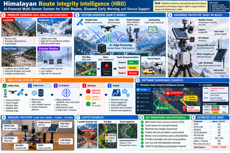
Himaliyan Multi sensor Route and rescue Intelligence System
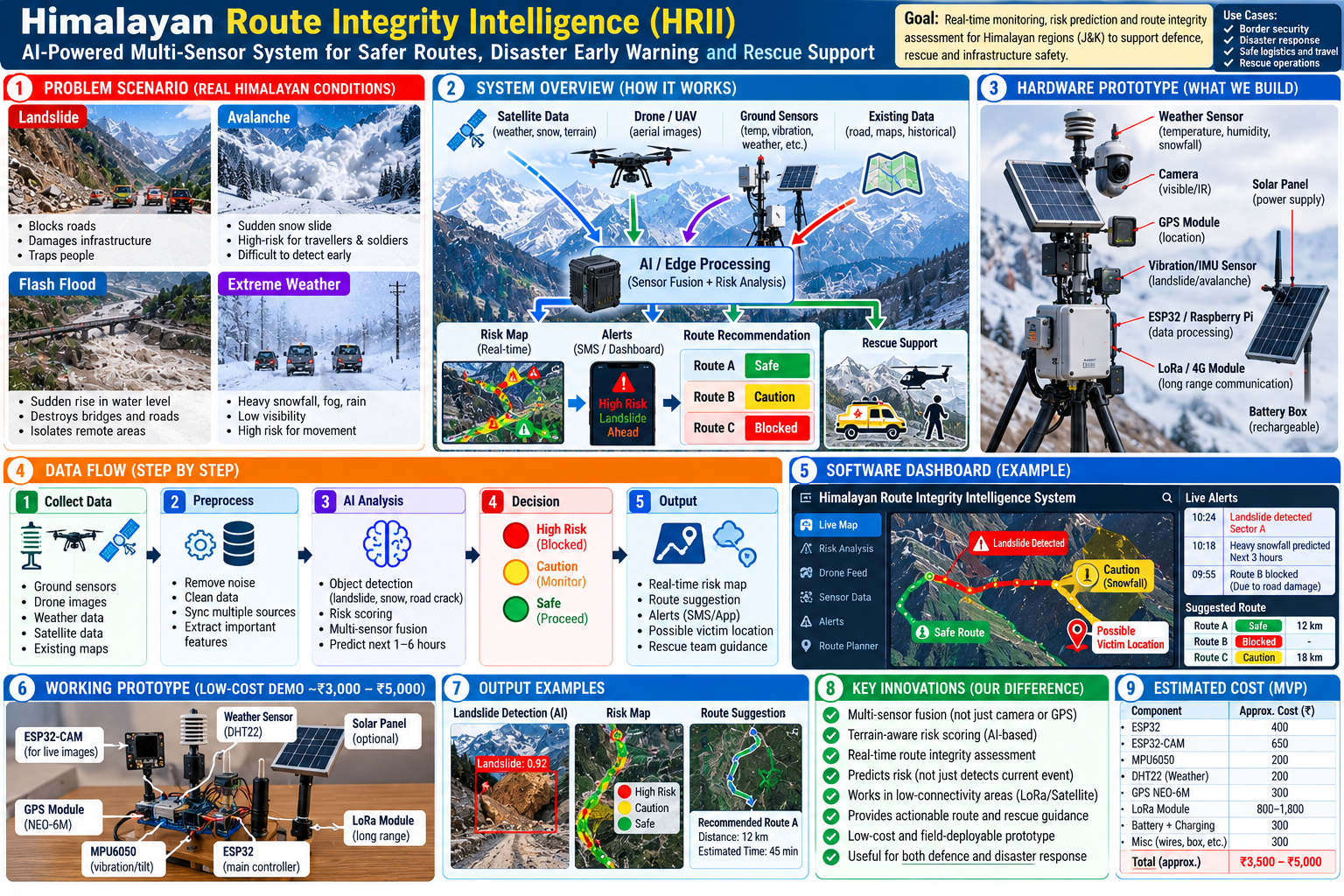
Himalayan Multi-Sensor Route & Rescue Intelligence System
The Himalayan region faces frequent landslides, avalanches, flash floods, and sudden weather changes that can block roads and delay rescue operations. Our project combines IoT sensors, GPS, weather data, and AI to detect potential hazards, assess road conditions, and recommend safer routes for rescue teams. Our mission is to improve disaster response, reduce rescue delays, and save lives in mountainous regions.
Built With
- arduino
- artificial-intelligence
- climate
- computer-vision
- data-analytics
- disaster-management
- edge-ai
- emergency-response
- esp32
- geospatial-intelligence
- gps
- internet-of-things
- iot
- iot-sensors
- lora
- machine-learning
- multimodal-ai
- opencv
- predictive-analytics
- python
- real-time-monitoring
- robotics
- route-optimization
- sensor-fusion
- smart-mobility

Log in or sign up for Devpost to join the conversation.