-
-
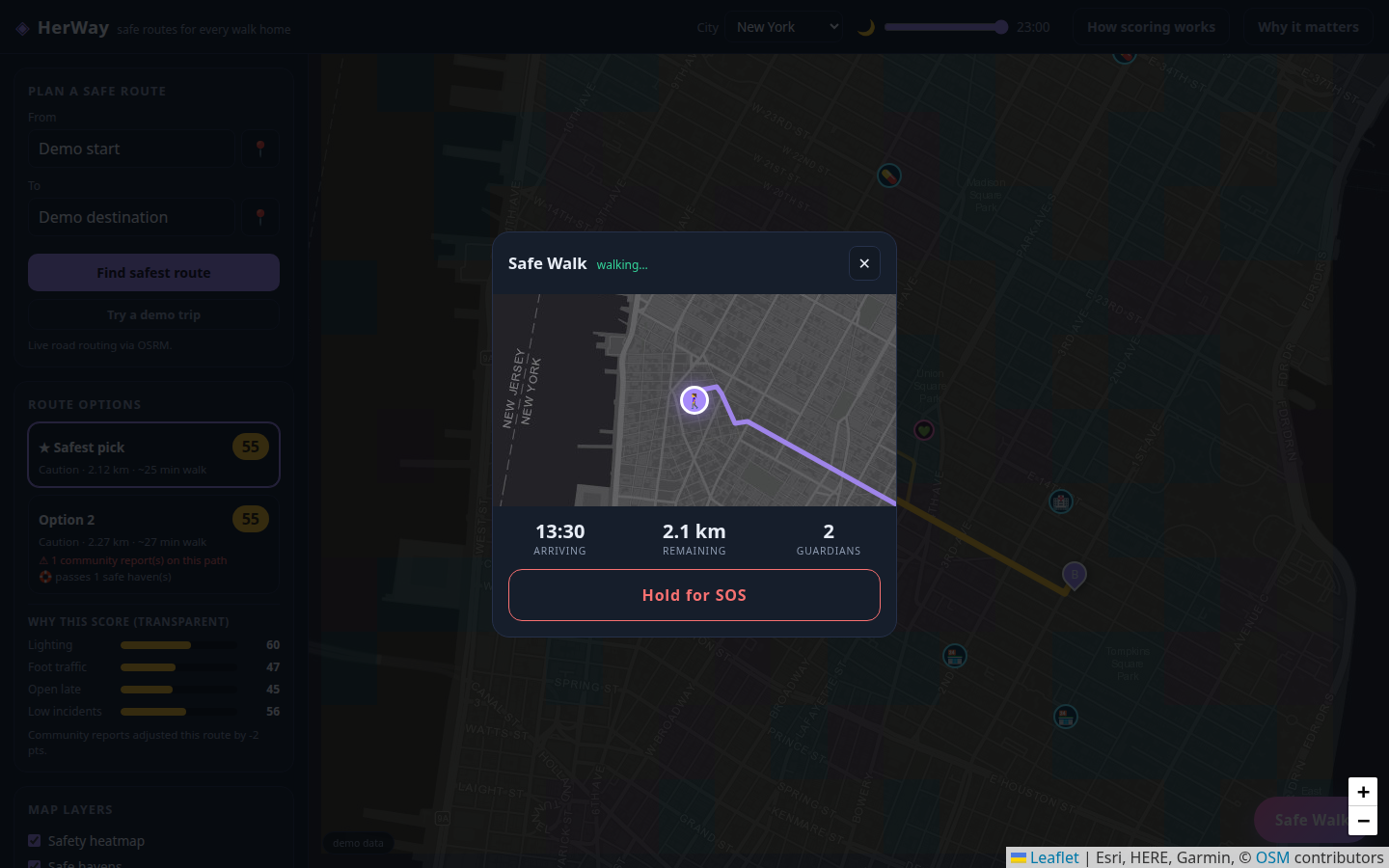
1-safe-routes-night
-
2-safe-walk-companion
-
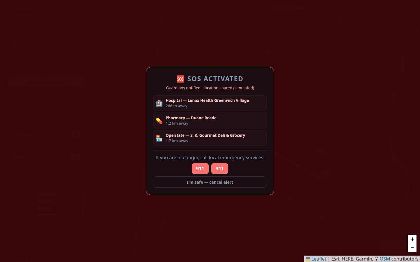
3-sos-alert
-
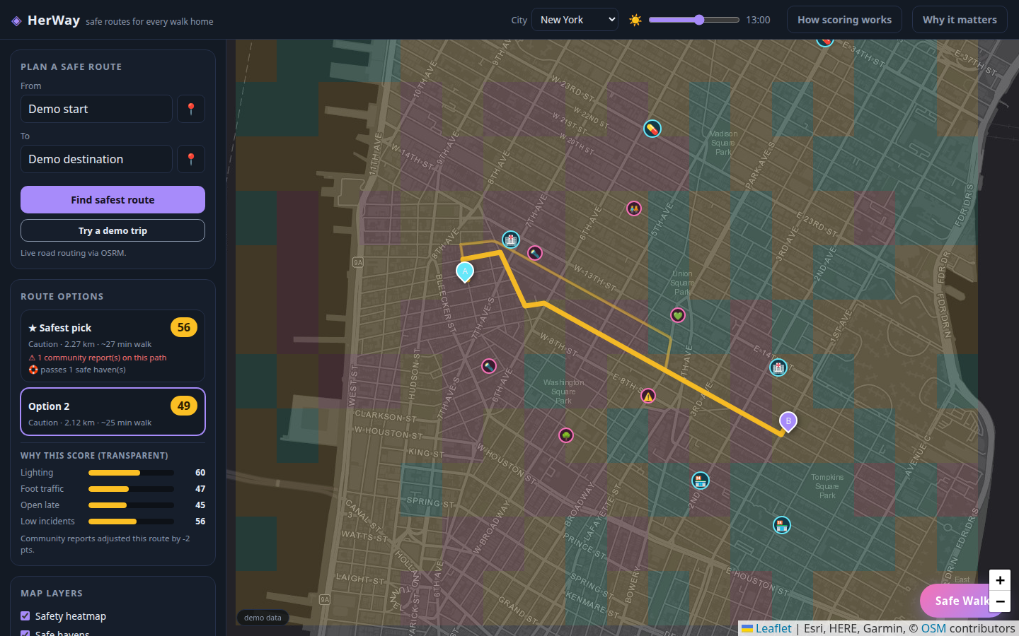
4-day-mode
-
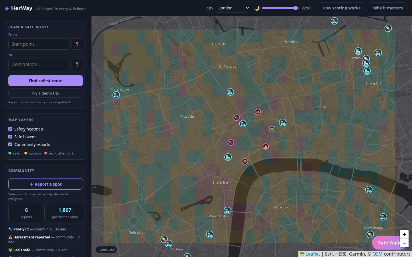
5-london-heatmap
-
6-fake-call
-
7-danger-zone-alert

Inspiration
1 in 3 women worldwide experience violence in their lifetime, and surveys in major cities consistently find that the majority of women change their routes, schedules, and destinations to feel safer — an invisible daily tax on half the population. G.I.R.L.S.' mission of empowering women and SDG 5 (Gender Equality) made us ask: what if navigation optimized for safety, not just speed? Combined with SDG 11's vision of inclusive, safe cities, HerWay was born.
What it does
HerWay is a safety-aware walking route planner:
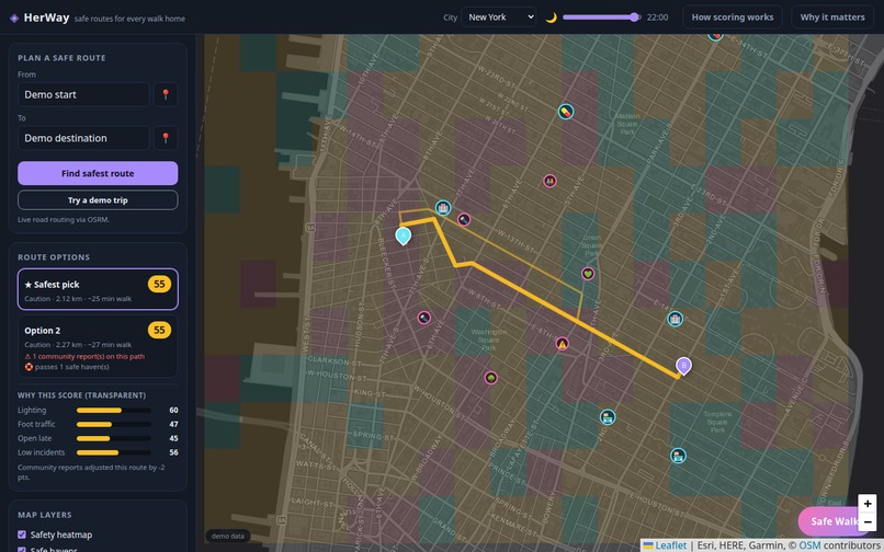
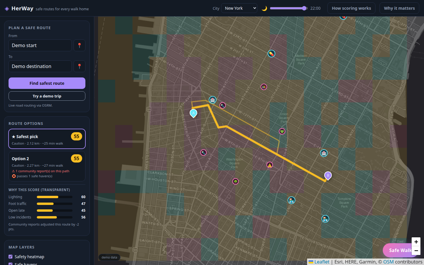
- Scored route alternatives — every walking option gets a 0–100 safety score built from four transparent factors: street lighting, foot traffic, businesses open late, and incident reports
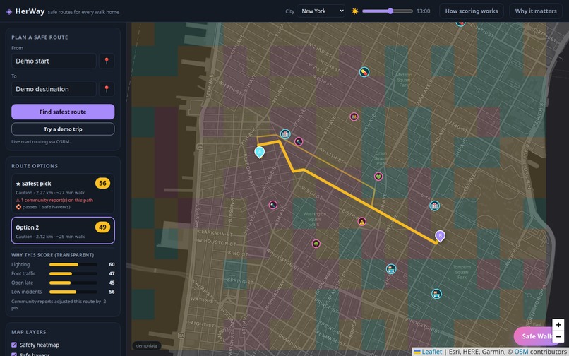
- Time-aware model — slide the clock and watch scores shift: a plaza that's fine at noon can be a risk at 2 a.m.
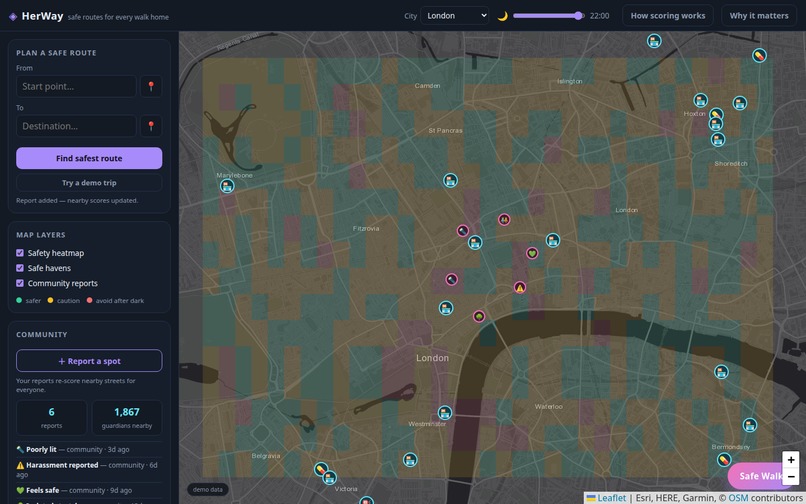
- Safety heatmap — a per-block color overlay shows why each area scores the way it does
- Community reports — anyone can flag a dark stretch, harassment, or a spot that feels safe; every report instantly re-scores nearby streets
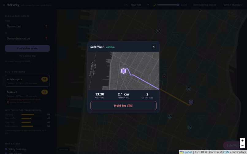
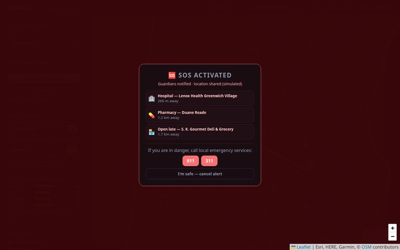
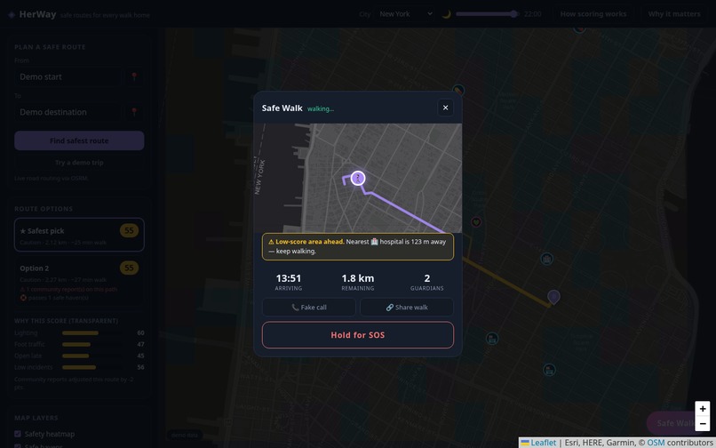
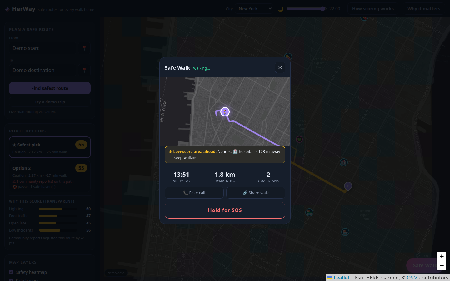
- Safe Walk companion — follows your trip with live ETA, quiet check-ins, danger-zone warnings that point to the nearest safe haven, and a hold-for-SOS panel with your live street address
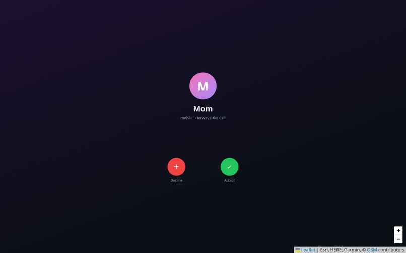
- Fake call — one tap and "Mom" calls, a graceful exit from uncomfortable situations
- Real map data — OpenStreetMap tiles, OSRM pedestrian routing, Overpass API for real safe havens (police, hospitals, pharmacies), Nominatim geocoding — plus geolocation to plan routes wherever you are
How we built it
Deliberately dependency-free: vanilla HTML/CSS/JS + Leaflet, deployed on Vercel — no build step, no API keys, so the demo can never break on hotel Wi-Fi. Every external service (OSRM, Overpass, Nominatim) has a deterministic offline fallback. The safety model is a seeded procedural grid per city — clearly labeled demo data, but architected so real open data (NYC OpenData streetlights, data.police.uk) can drop in behind the same scoring interface.
Challenges we ran into
- No real safety data is free — public crime/lighting datasets are city-specific, inconsistent, and often API-gated; we built a transparent procedural model instead, and disclose it honestly rather than pretending.
- Geocoding ambiguity — Nominatim's viewbox only biases results; an early version routed a Kuala Lumpur address to Buenos Aires. Fixed by hard-bounding searches to the active city and sorting by distance — plus a 30 km sanity guard, because "walks" shouldn't span continents.
- Tile coverage limits — our dark basemap simply has no data past zoom 16; we now upscale real tiles instead of showing "map data not available."
- External API flakiness — Overpass and OSRM can both fail or time out, so every live feature degrades to seeded fallbacks without breaking the demo.
Accomplishments that we're proud of
- The safety score is explainable, not a black box — every route shows its factor breakdown, which is exactly what safety tech should do
- A genuinely end-to-end journey: plan → report → walk with check-ins → SOS with real reverse-geocoded address
- It works anywhere on Earth — geolocation reseeds the model to wherever you stand
- Fully exercised by automated headless-browser tests in Firefox and Chromium (50+ assertions)
What we learned
Designing for safety means designing for trust: transparent scoring beats a fancier but opaque model. We also learned how brittle "just call the API" thinking is — viewboxes that don't bound, tiles that stop at a zoom level, services that 406 at random — and how much resilience a small set of deterministic fallbacks buys.
What's next for HerWay
- Swap the procedural model for real open data: streetlight locations, city crime APIs, OSM lit=yes tags
- Real guardian accounts + live location sharing (WebSocket backend)
- Community report moderation + severity weighting over time
- Voice-activated SOS and wearable triggers
Built With
- css3
- html5
- javascript
- leaflet.js
- openstreetmap
- osrm
- overpass-api
- vercel

Log in or sign up for Devpost to join the conversation.