HeatWise AI
Inspiration
Urban Heat Islands (UHIs) are becoming one of the biggest environmental challenges in rapidly growing cities. Dense concrete infrastructure, reduced green cover, and poor urban planning cause certain neighborhoods to become significantly hotter than others, increasing energy consumption, worsening air quality, and impacting public health.
We wanted to build a solution that not only identifies these hotspots but also helps city planners make informed, data-driven decisions on where and how to invest in cooling interventions.
What it does
HeatWise AI is an AI-powered urban cooling decision support platform that combines machine learning, real-time weather data, geospatial intelligence, and optimization algorithms.
The platform enables users to:
- Detect Urban Heat Islands using real-time weather and machine learning.
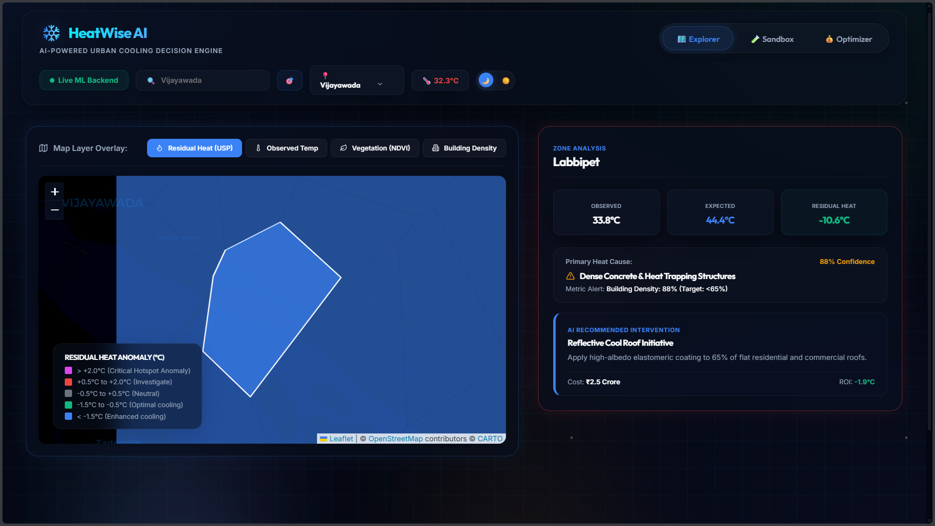
- Analyze the root causes of overheating, including low vegetation, poor surface reflectivity, and high building density.
- Visualize neighborhood-level heat anomalies on an interactive map.
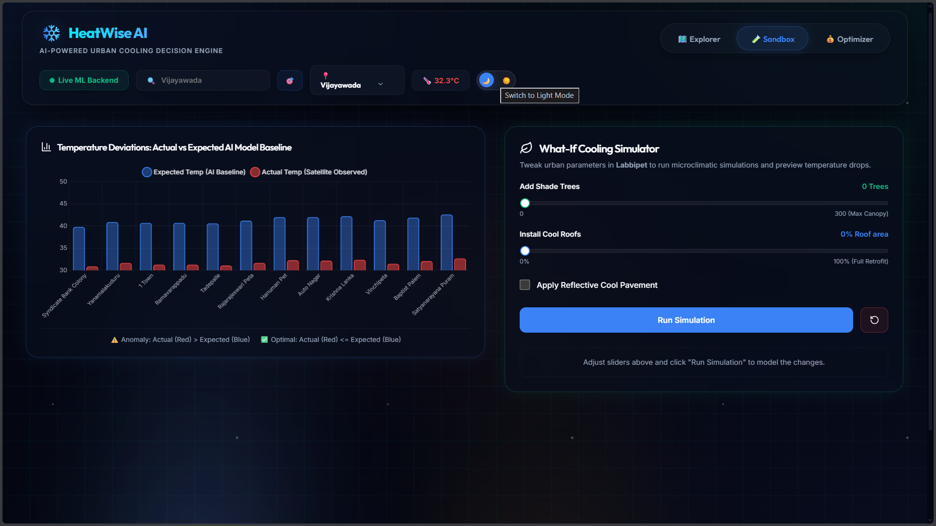
- Simulate cooling interventions such as tree plantation, cool roofs, and reflective pavements.
- Predict temperature reduction and project costs before implementation.
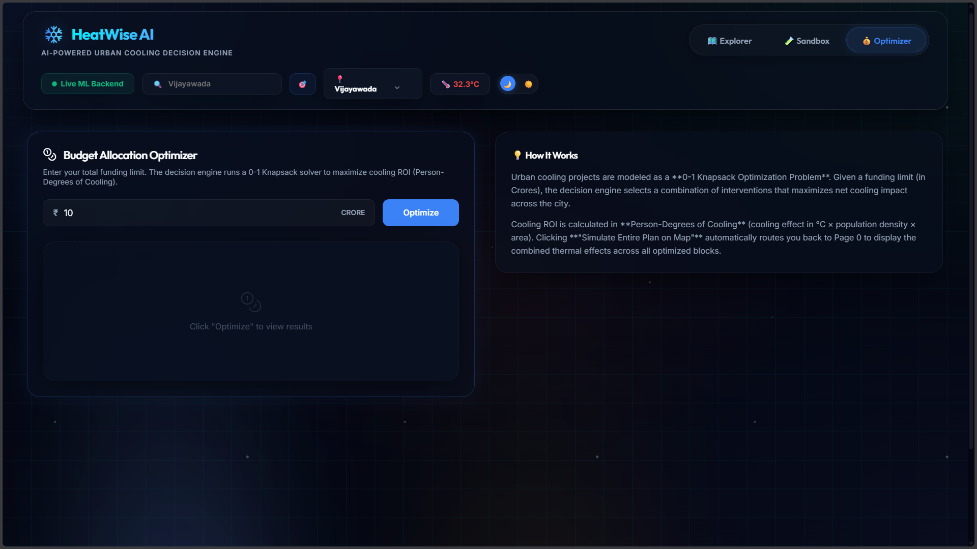
- Optimize city-wide cooling investments using a 0-1 Knapsack optimization algorithm to maximize cooling impact within a limited budget.
How we built it
Frontend
- React (Vite)
- Leaflet Maps
- Vanilla CSS
- Lucide Icons
Backend
- FastAPI
- Python
- NumPy
- Scikit-Learn
- Uvicorn
APIs & Data
- OpenStreetMap (Overpass API)
- Open-Meteo API
- Reverse Geocoding
Our machine learning model estimates the expected neighborhood temperature using environmental indicators such as vegetation index (NDVI), albedo, and building density. By comparing predicted temperatures with observed weather data, the platform identifies residual heat anomalies that indicate Urban Heat Islands.
Challenges we ran into
One of our biggest challenges was generating realistic neighborhood boundaries from OpenStreetMap data while ensuring there were no gaps or overlapping regions.
Another challenge was integrating multiple real-time APIs, handling missing environmental data, and designing a machine learning model that produced meaningful predictions for different urban environments.
Balancing prediction accuracy, interactive performance, and user experience within the hackathon timeframe was also a significant challenge.
Accomplishments that we're proud of
- Built an end-to-end AI-powered urban heat analysis platform.
- Integrated live weather and geospatial data.
- Developed an interactive microclimate simulation sandbox.
- Implemented budget optimization using the 0-1 Knapsack algorithm.
- Designed a modern, intuitive interface for planners and environmental engineers.
What we learned
Throughout this project, we gained hands-on experience with geospatial data processing, machine learning for environmental analytics, optimization algorithms, API integration, and full-stack application development. We also learned how combining AI with decision-support tools can create practical solutions for real-world sustainability challenges.
What's next for HeatWise AI
Future improvements include:
- Satellite imagery integration for real NDVI estimation.
- Higher-resolution environmental datasets.
- IoT sensor integration for real-time microclimate monitoring.
- Multi-city historical trend analysis.
- AI-generated policy recommendations.
- Carbon reduction and energy-saving impact estimation.
- Deployment as a smart-city planning platform for municipalities and government agencies.
HeatWise AI aims to transform complex environmental data into actionable insights, helping cities become cooler, healthier, and more sustainable.
Built With
- 0-1-knapsack-algorithm
- css3
- fastapi
- geospatial-analytics
- gis
- git
- html5
- javascript
- leaflet.js
- machine-learning
- numpy
- open-meteo-api
- openstreetmap
- overpass-api
- python
- react
- rest-apis
- reverse-geocoding
- scikit-learn
- uvicorn
- vite

Log in or sign up for Devpost to join the conversation.