Inspiration
When arriving at Miami Hack Week, Space-Eyes expressed that climate compliance is now a matter of defense, protecting the planet and human welfare. The challenges that we were presented with included risk fire modeling and early fire detection. Space-Eyes is pivoting its successful multi-sensor fusion technology to address the climate challenge around wildfires by leveraging Synthetic Aperture Radar, Hyperspectral, and Weather data.
What it does
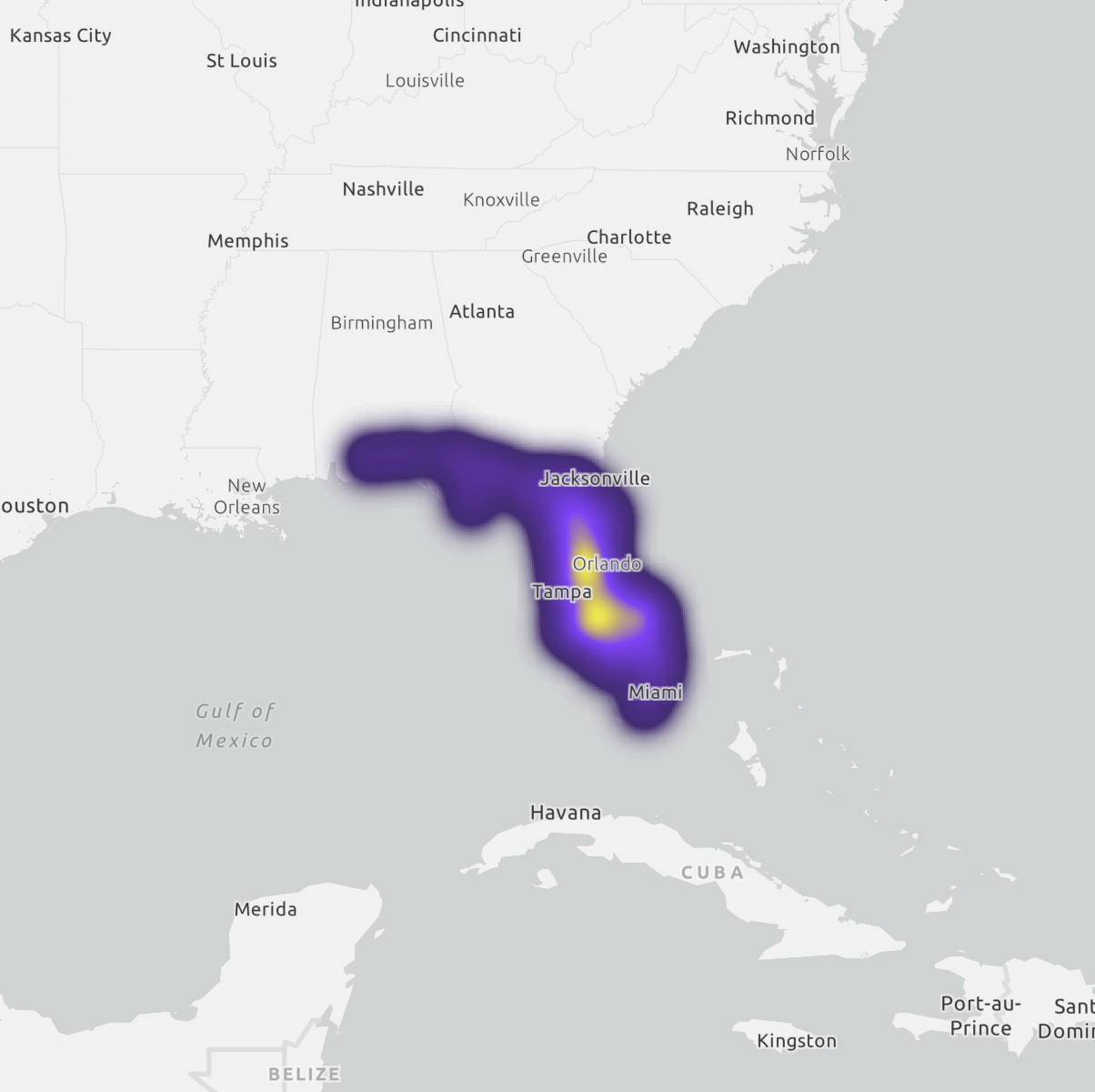
Our project allows the user to access an interactive map of counties in Florida. Each point on the map is related to a county in Florida and includes information such as the most frequent cause of fires in a particular county, average weather, soil temperature, and the likelihood that a fire will occur there in the future.
How we built it
We first honed in on the data that would be most essential in predicting the likelihood that a fire would occur in a specific place and how the weather may correlate to those findings. For this project, we decided to focus on counties in Florida. We then queried weather and wildfire data over a three-year period. We merged spatiotemporal heterogeneous data sources, then conducted exploratory analysis, which included normalizing the data, computing the averages, and condensing all findings into one table. After applying a machine learning classifier and validating the data, we converted the table into GeoJSON format to use on a map. We used ArcGIS and a React application to map the county points and provide information on the averages and wildfire risk predictions.
Challenges we ran into
The challenges we ran into mostly centered around condensing a relatively big undertaking into a few days and using less data to simplify.
Accomplishments that we're proud of
We were able to hone in on a real-life issue, simplify the tasks at hand, and accomplish all tasks as well.
What we learned
Staring at data for hours at a time puts into perspective just how serious this issue is and how it's affecting the weather and nature alike. Wildfires are becoming more and more prevalent every year and it speaks to the actions that should be taken on a global scale to fight climate change.
What's next for Space-Eyes Geospatial Wildfire Risk Prediction
We were only able to scratch the surface of what's possible for this project with the amount of time we had, but there is a lot of possibility for this project. Building upon what we were able to accomplish at this week's hackathon can one day serve as an invaluable resource in climate compliance.


Log in or sign up for Devpost to join the conversation.