-
-
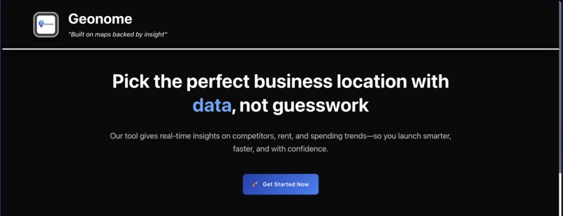
Landing Page
-
Analysis Dashboard
-
Analytics 1
-
Analytics 3
-

Analytics 2


Inspiration
Our inspiration came from a personal experience where my team members and I were planning to start a tea stall, and we couldn't find a location that fit within our target metrics—budget, audience, and competition. From our experience, we understood that many aspiring entrepreneurs, start-ups and small retail businesses face the same challenges when trying to start or grow their new retail business. We recognized the pain point and developed a solution in the form of a movement planning tool that uses Google Maps data to help aspiring entrepreneurs and small businesses analyse location and make smarter business decisions.
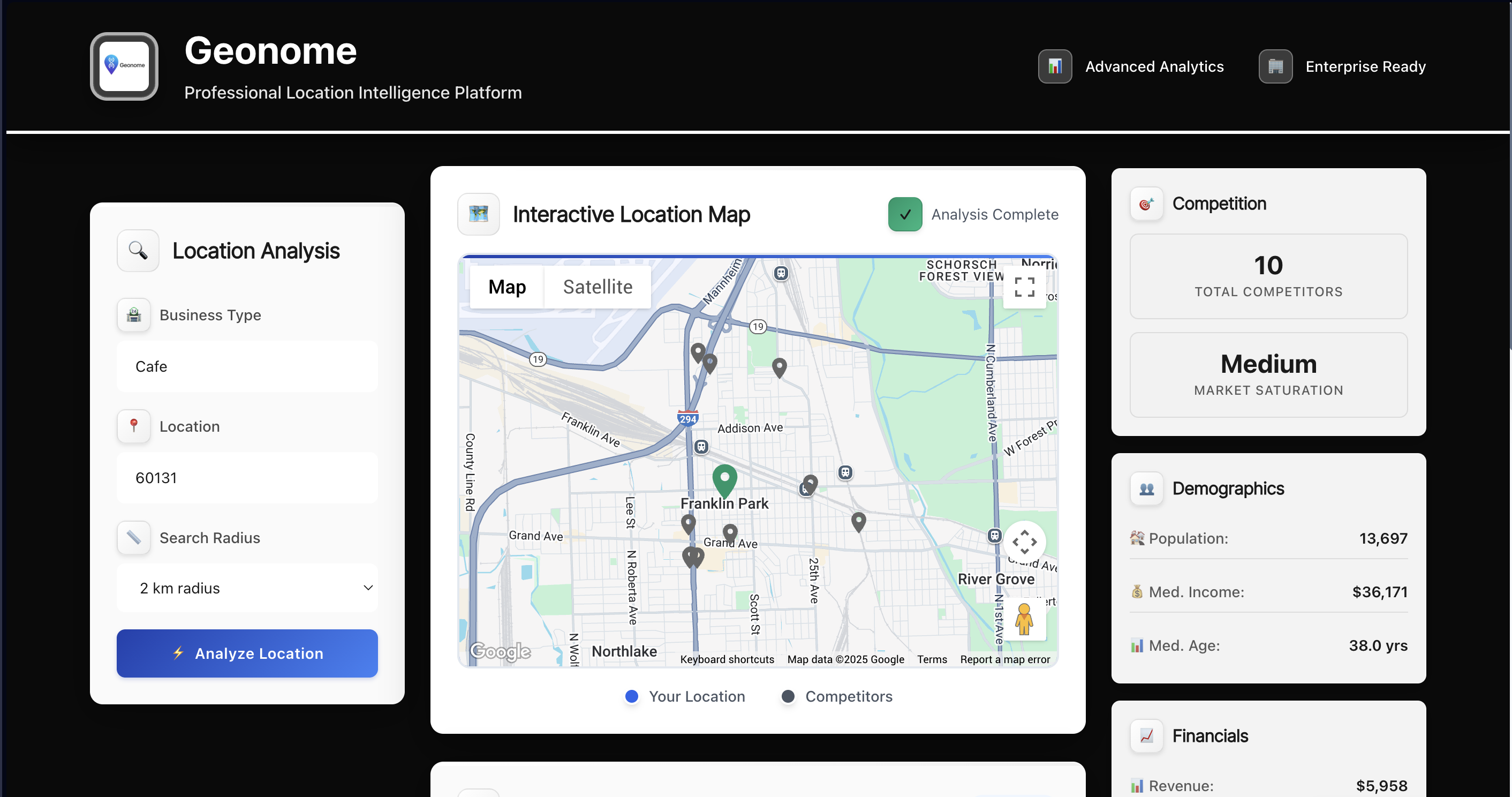
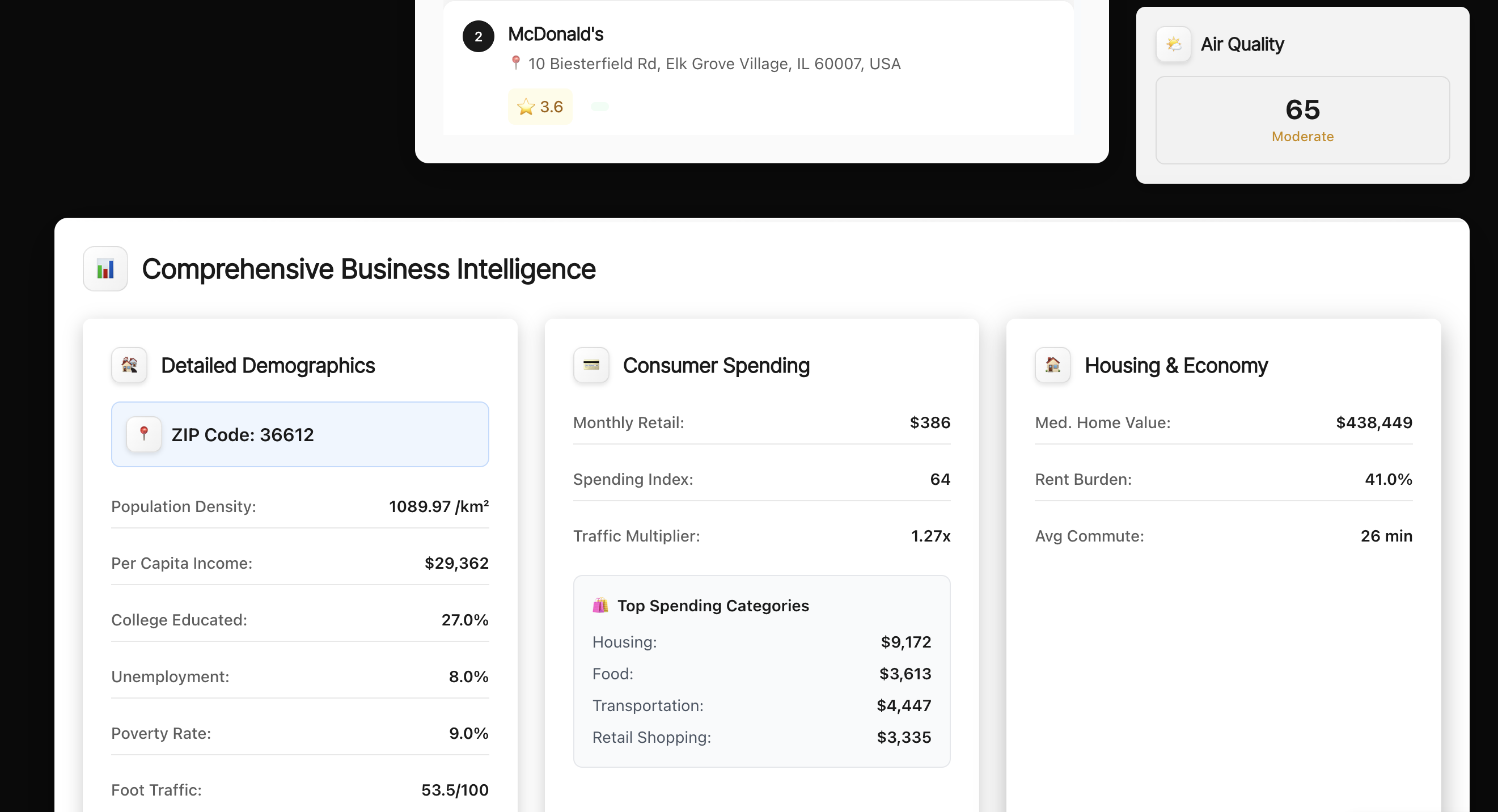
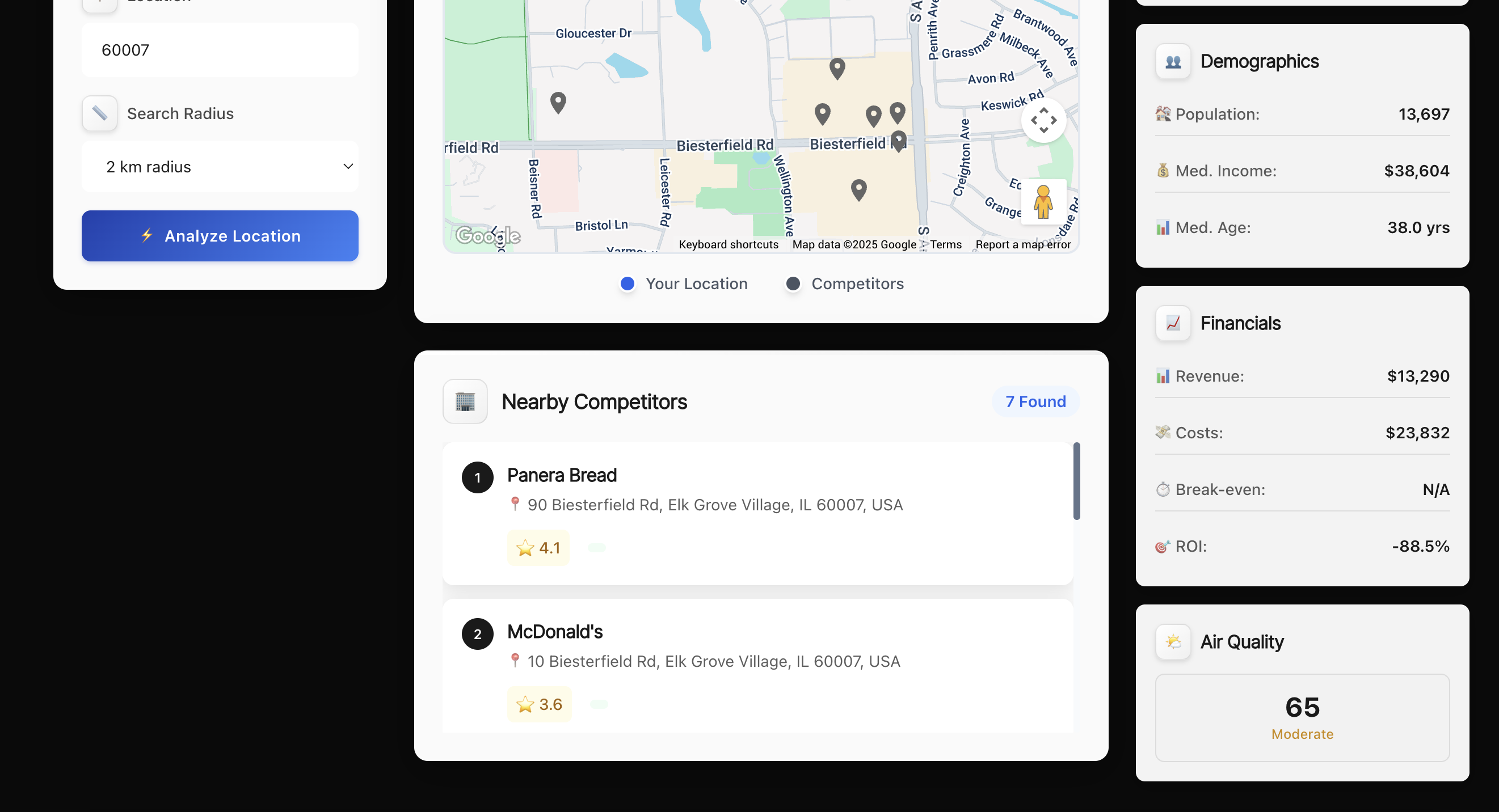
What it does
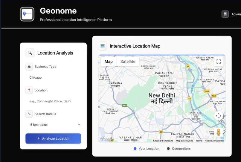
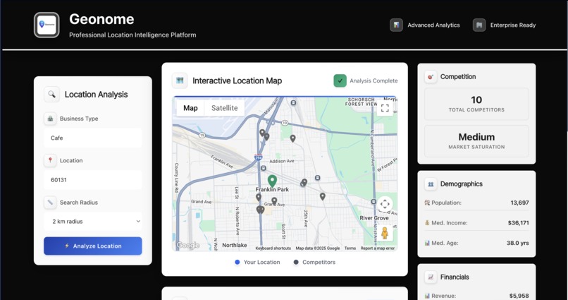
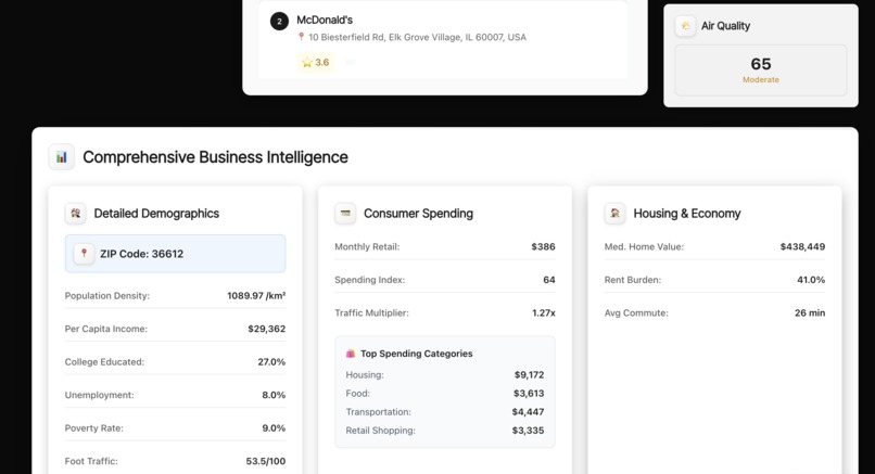
Our software innovatively creates information by providing entrepreneurs and small businesses with real-time data in analyze the most strategic location to set up their business. Leveraging Google Maps and Places APIs, our software displays relevant and useful insights such as competitor location, demographic information, footfall data. Our software is simple to use; the user selects a location and industry, and within seconds, the user can generate a specific and report to evaluate all of the relevant metrics needed to decide on a specific location to start a business or grow a business—taking guesswork out of the equation and reducing risk when starting or expanding a new retail store.
How we built it
We used React and JavaScript for the frontend and Python for the backend data handling. The app integrates the Google Maps API for competitor and location insights, and the WorldPop API for population and demographic data.
Challenges we ran into
We had challenges with location-based APIs' quota limitations on requests and unstructured responses on requests; three separate APIs together tried to provide a comprehensive answer to a question about a location; and we needed an interface that didn't require end-users to be very technically sophisticated while still being a powerful service for the users. A technical challenge in building the service was to balance performance to be real-time and cost-effective
Accomplishments that we're proud of
- Learning and creating an application that seamlessly integrates with other API's
- Networking with various people that have guided us in this process
- Thorough research of the market and the project to create a practical application.
What we learned
Through this project, we learned how useful geospatial data can be towards tangible business problems. We built on our understanding of the Google Maps ecosystem, especially the Places APIs, Geocoding APIs, and Distance Matrix APIs, to figure out how to leverage all of these services together to provide meaningful, actionable insights. We also learned the value of designing end-user-focused time-saving tools to reduce the complexity of data and time-to-action with decision-making.
What's next for Geonome
-Plan to integrate a variety of other data layers, such as population density heatmaps, mobile footfall data, and government zoning regulations. -Aim to allow for predictive analytics using AI to recommend areas with high probability based on industry and historical performance analytics. -Provide a complete and hassle-free app experience


Log in or sign up for Devpost to join the conversation.