-
-
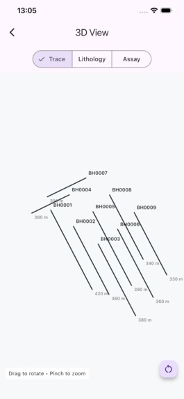
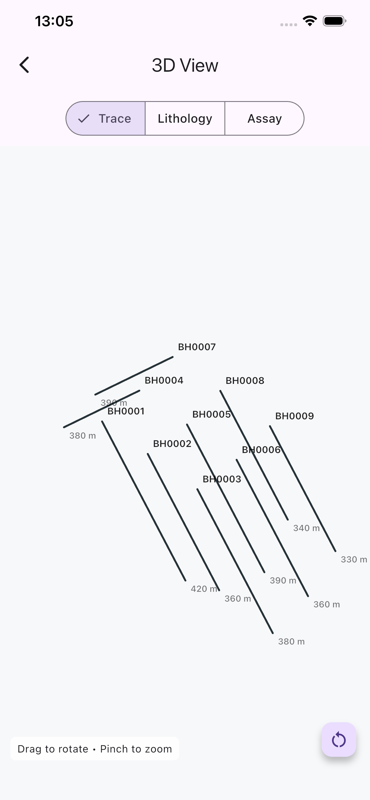
3D Drillhole Viewer – Trace mode
-
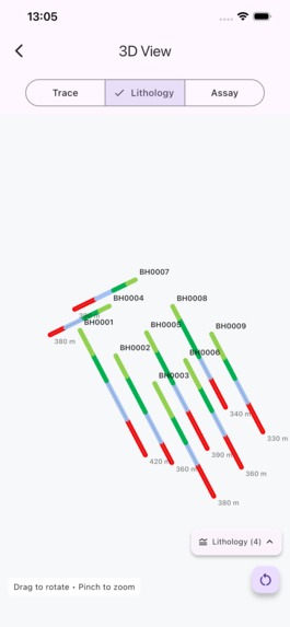
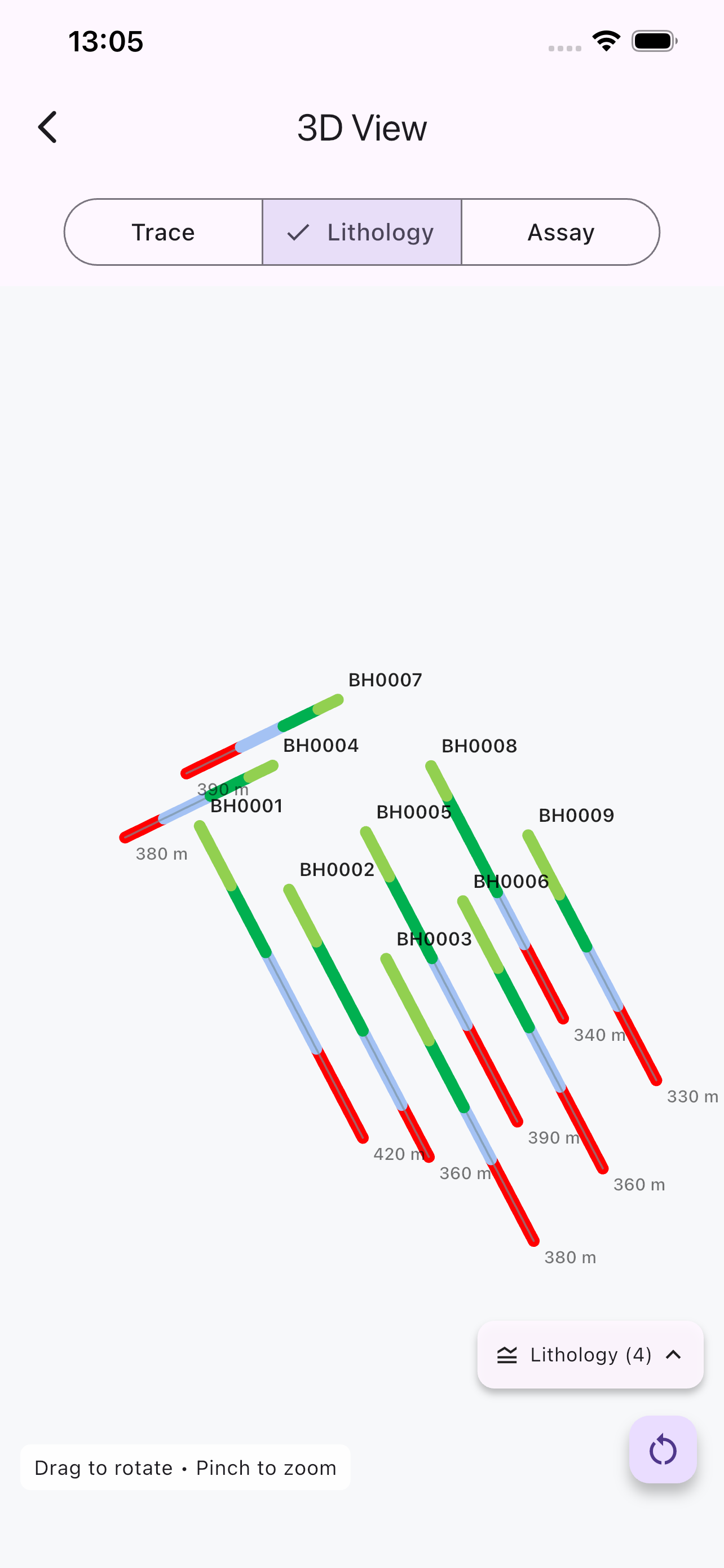
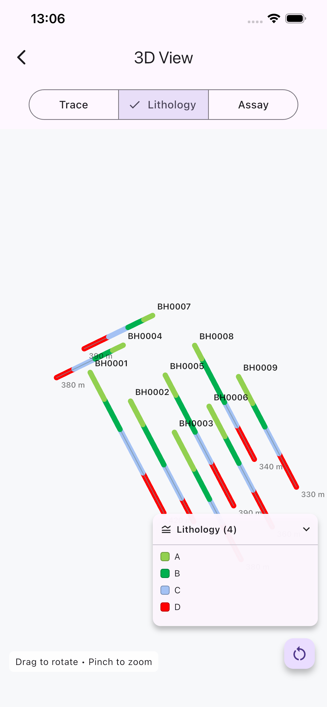
3D Drillhole Viewer – Lithology mode
-
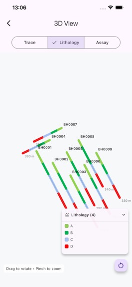
Interactive lithology legend
-
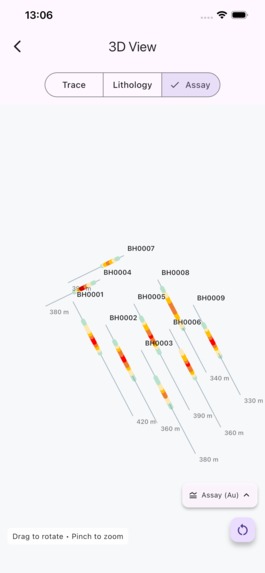
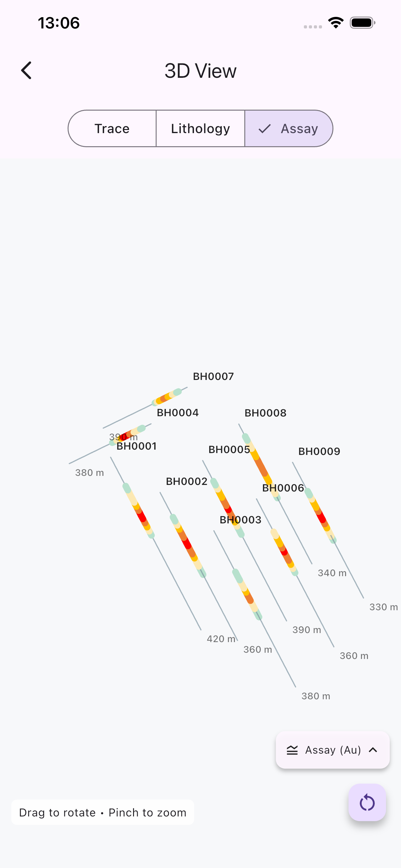
3D Drillhole Viewer – Assay mode
-
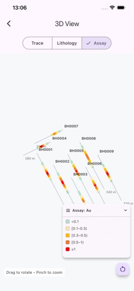
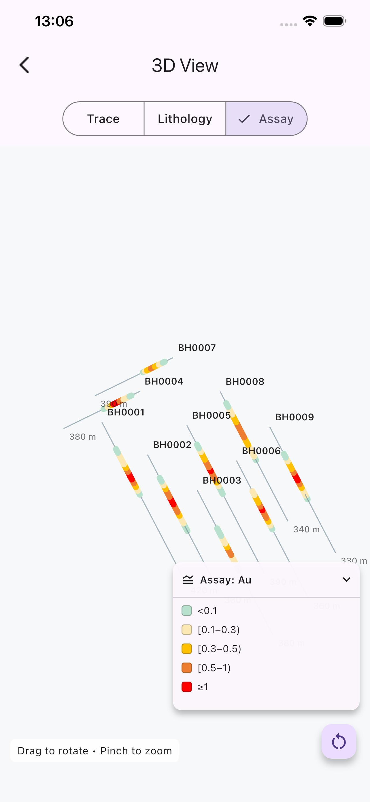
Interactive assay legend
-
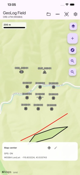
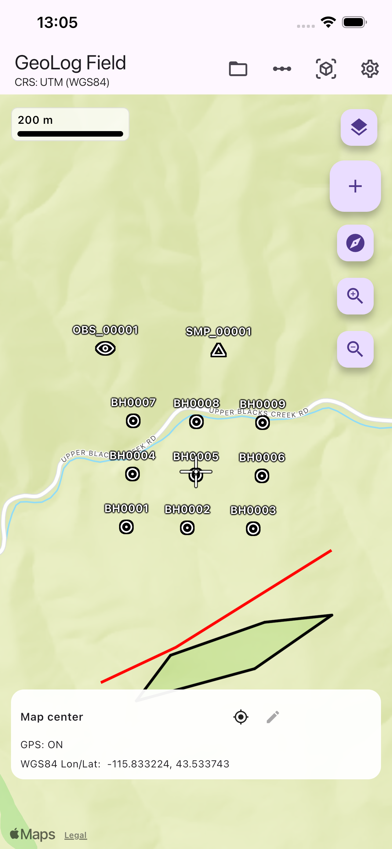
GeoLog Field main mapping interface
Inspiration
GeoLog Field was originally created to solve a practical problem faced by geologists during fieldwork.
Geological observations, drillhole information, lithology, assay data, and mapping are often collected using multiple disconnected tools, making fieldwork slower, more complex, and more prone to errors.
The goal of GeoLog Field is to bring these workflows together into a single mobile application designed specifically for geological field mapping and data collection.
During OpenAI Build Week 2026, I wanted to extend the application beyond traditional 2D maps by adding an interactive Drillhole 3D Viewer that allows an entire drilling project to be explored directly on a mobile device.
Rather than building a standalone demonstration, my objective was to integrate a practical new capability into an existing professional application that can continue evolving after Build Week.
What it does
GeoLog Field is a cross-platform geological field mapping application developed with Flutter for professional geological fieldwork.
The application enables geologists to collect, organize, and visualize:
- Geological observations
- Rock, soil, stream sediment, and other sample types
- Geological drawings
- Geological units and structural measurements
- Drillhole collars
- Survey data
- Lithology intervals
- Assay intervals
- GPS positioning and multiple coordinate reference systems
- Import and export using common geological and GIS formats
The new OpenAI Build Week feature is a project-wide Drillhole 3D Viewer.
The viewer allows geologists to explore an entire drilling project using three interactive visualization modes:
- Trace — drillhole trajectories
- Lithology — color-coded lithology intervals
- Assay — continuous assay visualization using color ranges
The viewer also includes interactive rotation, pinch-to-zoom, drillhole labels, depth labels, expandable legends, and project-wide visualization designed specifically for mobile devices.
How we built it
The Drillhole 3D Viewer was developed through a collaborative AI-assisted workflow using ChatGPT, GPT-5.6 Sol, and OpenAI Codex.
ChatGPT and GPT-5.6 Sol were used throughout the project to discuss feature ideas, architecture, user experience, implementation strategies, debugging approaches, and code reviews.
OpenAI Codex implemented the Drillhole 3D Viewer, reusable drillhole trajectory processing, visualization modes, legends, labels, simulator automation, and the final demonstration video.
Rather than asking AI to generate an entire application, development followed a controlled engineering workflow:
- Feature planning and architecture
- Small, focused implementation tasks
- Review of every code change
- Automated analyzer checks
- Manual testing in the iOS Simulator
- Geological validation before approval
This workflow allowed AI to significantly accelerate development while keeping all architectural decisions, geological correctness, product direction, and final quality under human control.
Challenges we ran into
The biggest challenge was integrating a reusable 3D visualization system into an already existing geological field application without disrupting existing workflows.
The viewer had to support multiple geological datasets, three different visualization modes, expandable legends, drillhole labels, and project-wide rendering while remaining responsive on mobile devices.
Another challenge was maintaining a disciplined AI-assisted development process. Every implementation task was intentionally scoped into small, reviewable changes so that each modification could be verified before becoming part of the application.
Accomplishments that we're proud of
The achievement I am most proud of is successfully integrating a complete Drillhole 3D Viewer into an existing professional geological application rather than creating a standalone prototype.
The final result provides interactive 3D visualization of drillhole trajectories, lithology, and assay data while fitting naturally into the existing GeoLog Field workflow.
I'm also proud of demonstrating that AI-assisted software development can be combined with careful engineering review, geological validation, and human decision-making to produce a practical feature suitable for real-world field applications.
What we learned
This project demonstrated how modern AI tools can significantly accelerate professional software development when used within a structured engineering workflow.
Rather than replacing engineering decisions, ChatGPT, GPT-5.6 Sol, and OpenAI Codex became collaborative development partners that helped plan, implement, debug, review, and refine complex features.
The experience reinforced the importance of combining AI assistance with human expertise, especially in scientific and engineering applications where accuracy and domain knowledge remain essential.
What's next for GeoLog Field
The next major milestone is terrain-aware geological visualization using Digital Elevation Models (DEMs), allowing drillholes to be displayed within real topography instead of empty 3D space.
Future versions will also expand the Drillhole 3D Viewer with richer geological visualization, improved navigation, drillhole filtering, additional analysis tools, and closer integration with desktop geological workflows.
GeoLog Field will continue evolving as a practical mobile platform for professional geological field mapping and visualization.

Log in or sign up for Devpost to join the conversation.