-
-
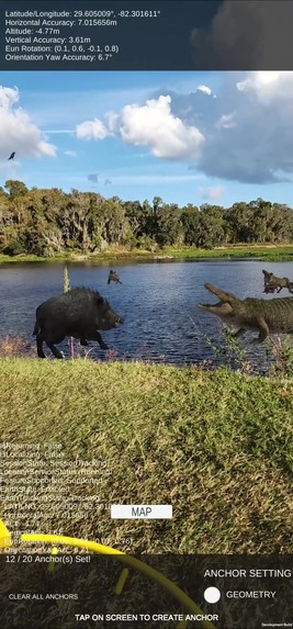
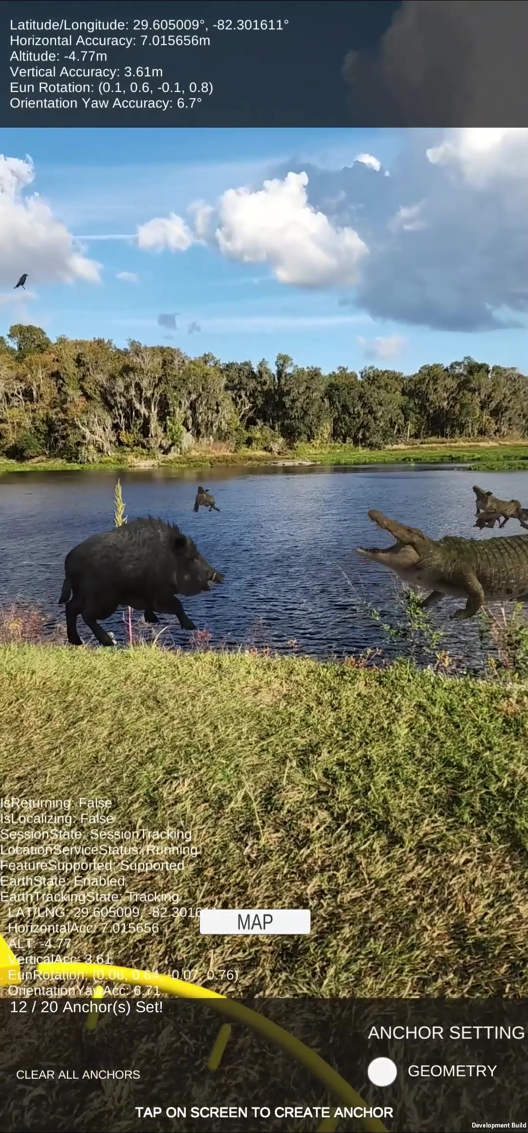
Alligator and wild hog
-

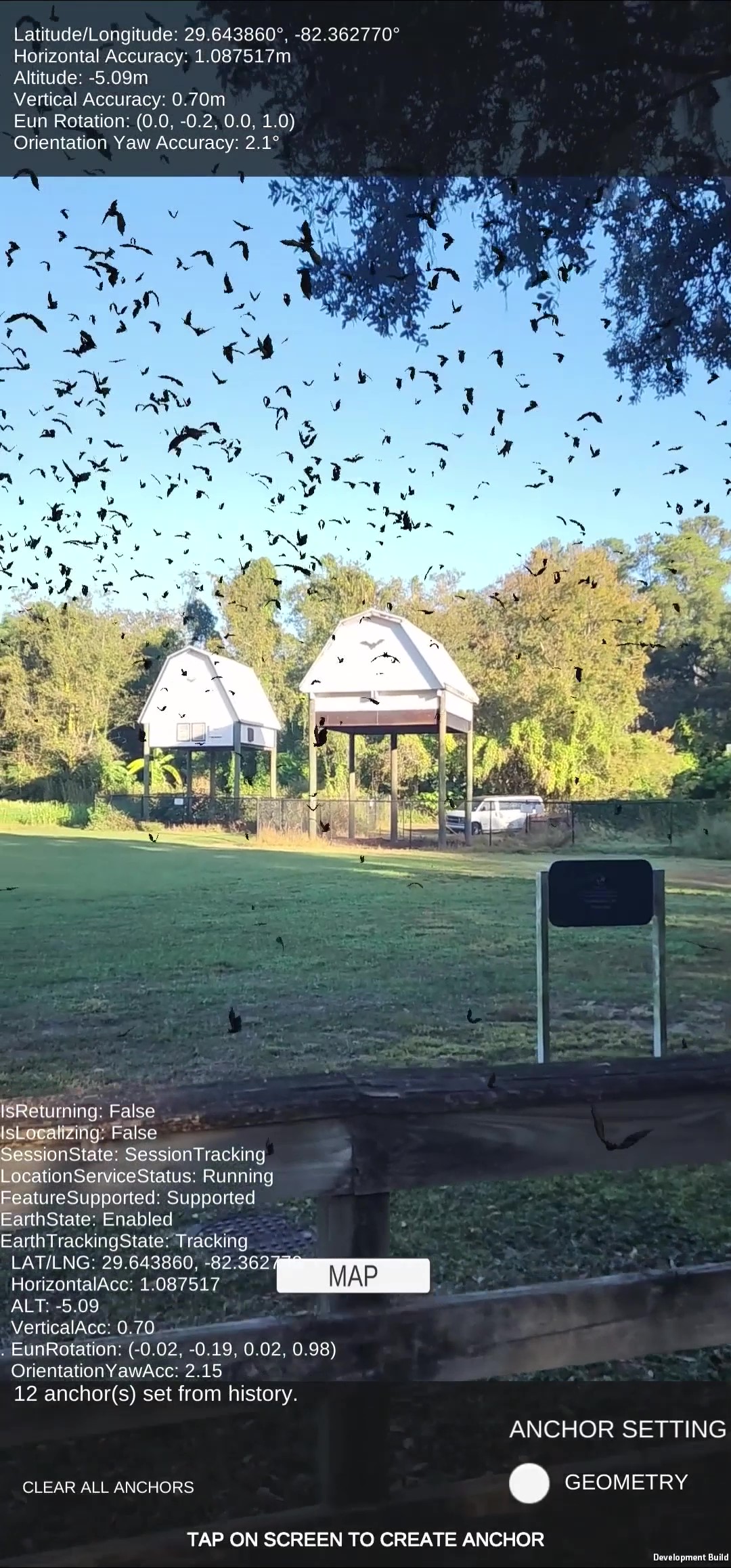
Bats at Bat House
-
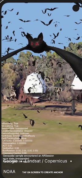
Bats at Bat House
-
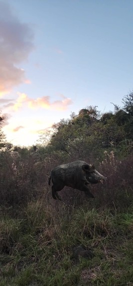
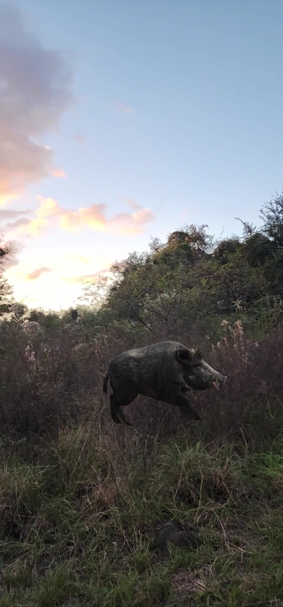
Wild Hog at Paynes Prairie
-

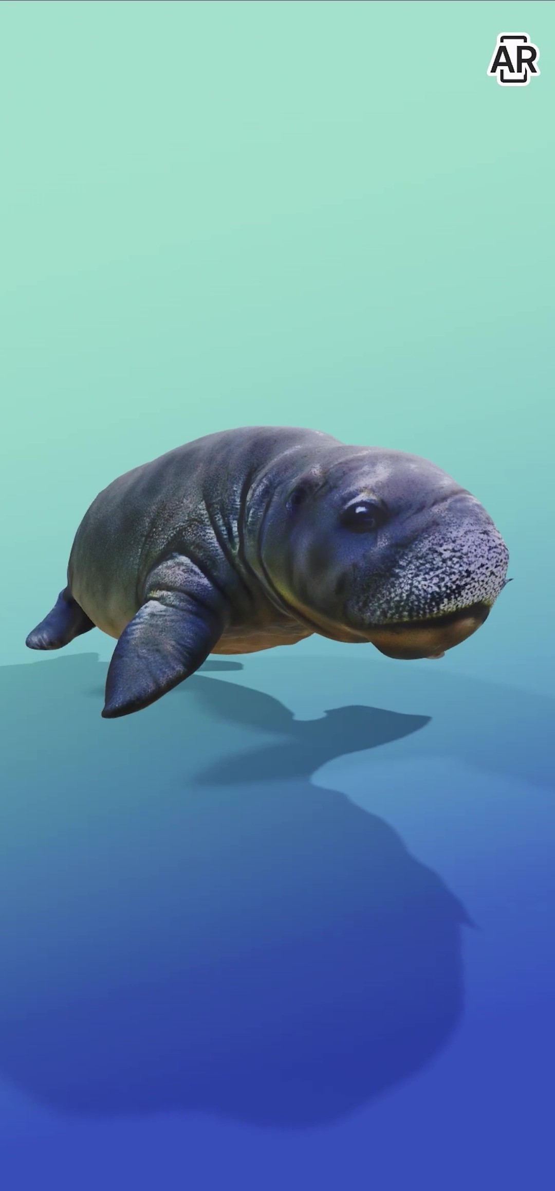
Florida Manatee
-
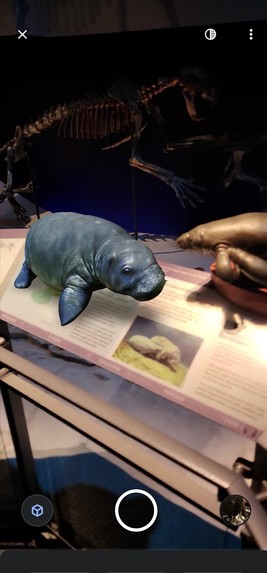
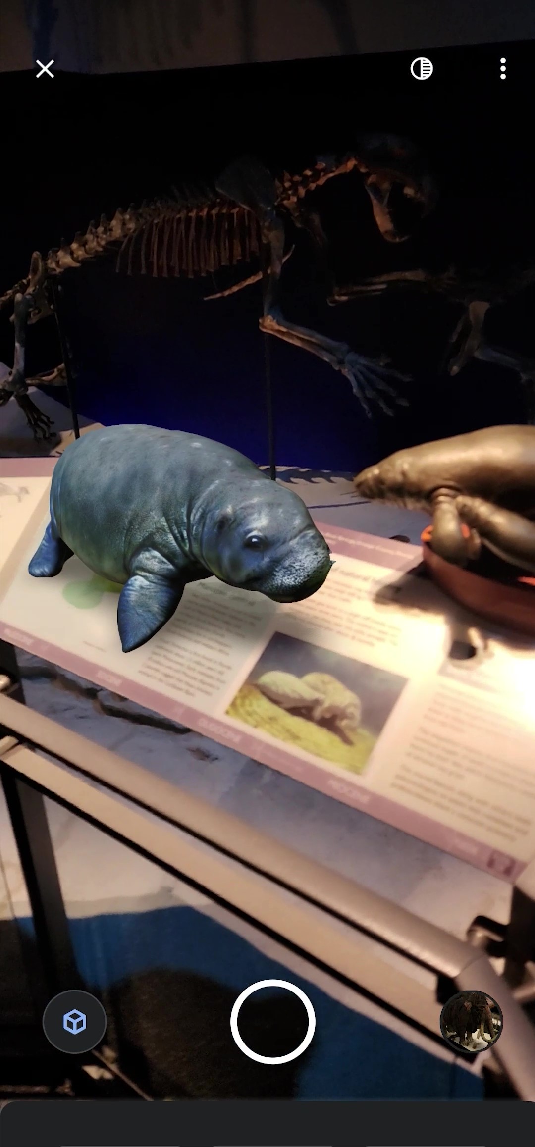
Florida Manatee at Florida Museum of Natural History
-
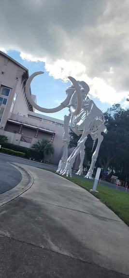
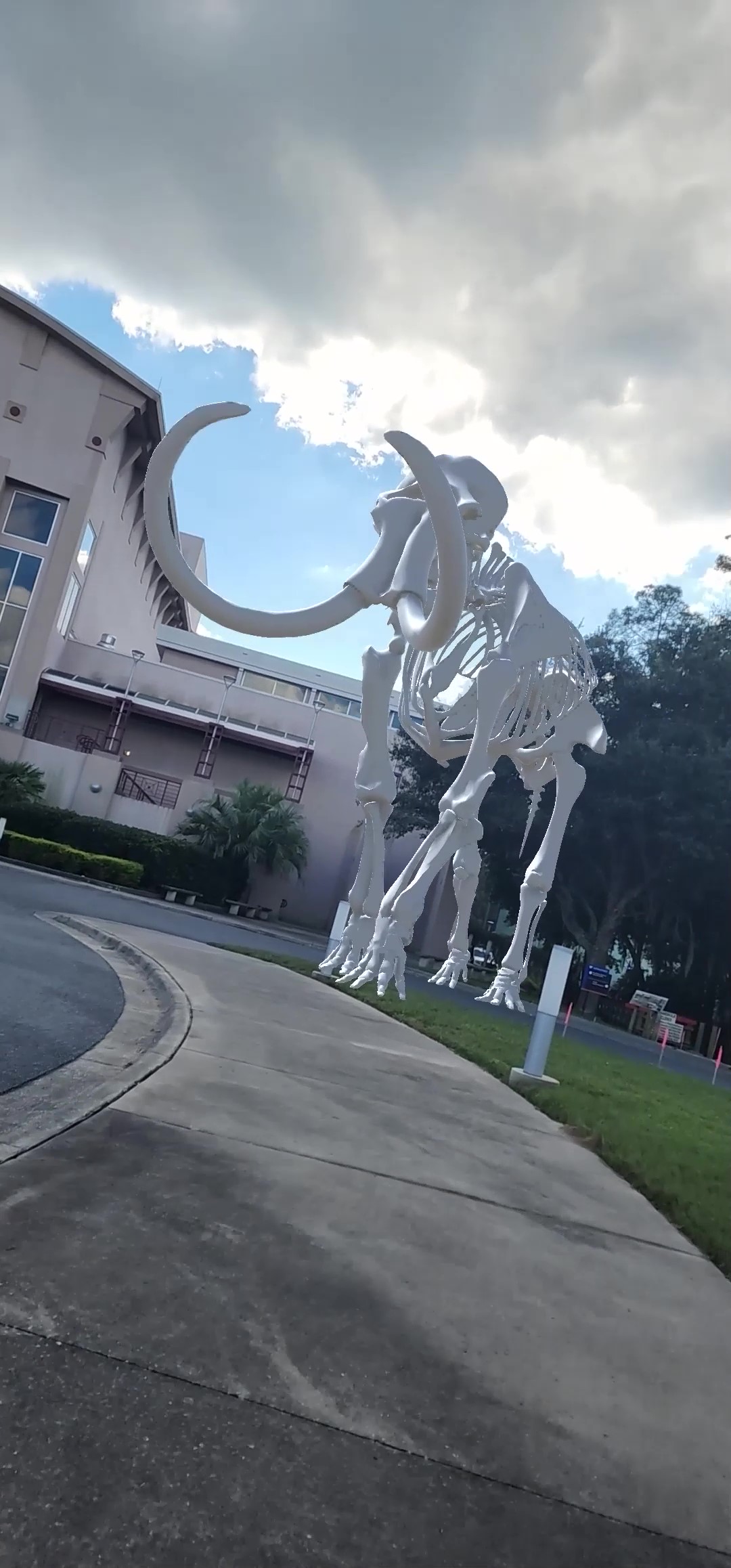
Wooly Mammoth fossil at Florida Museum of Natural History
-

Alligator at the Swamp
-
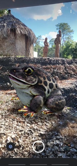
Toad at Florida Museum of Natural History
-

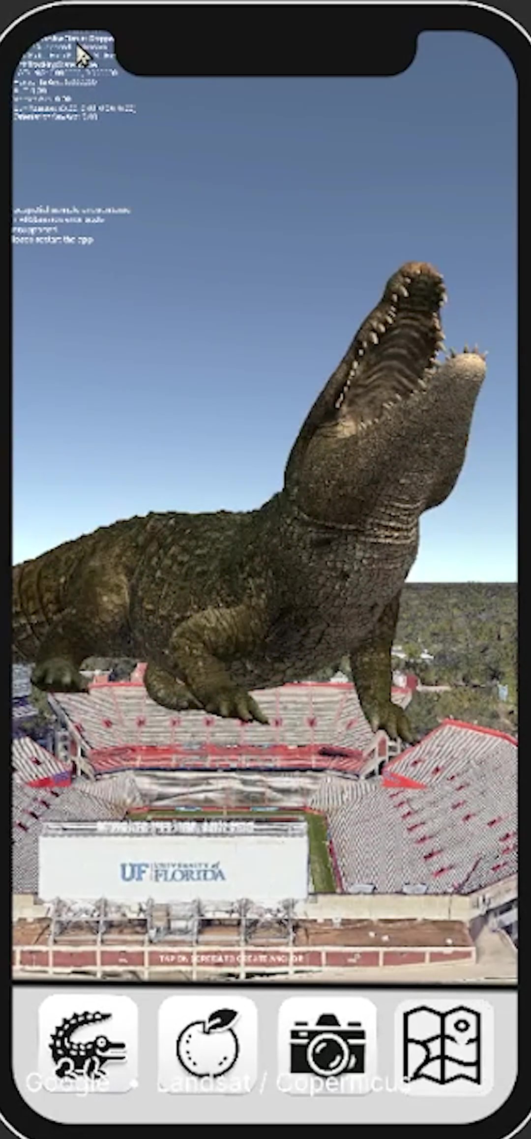
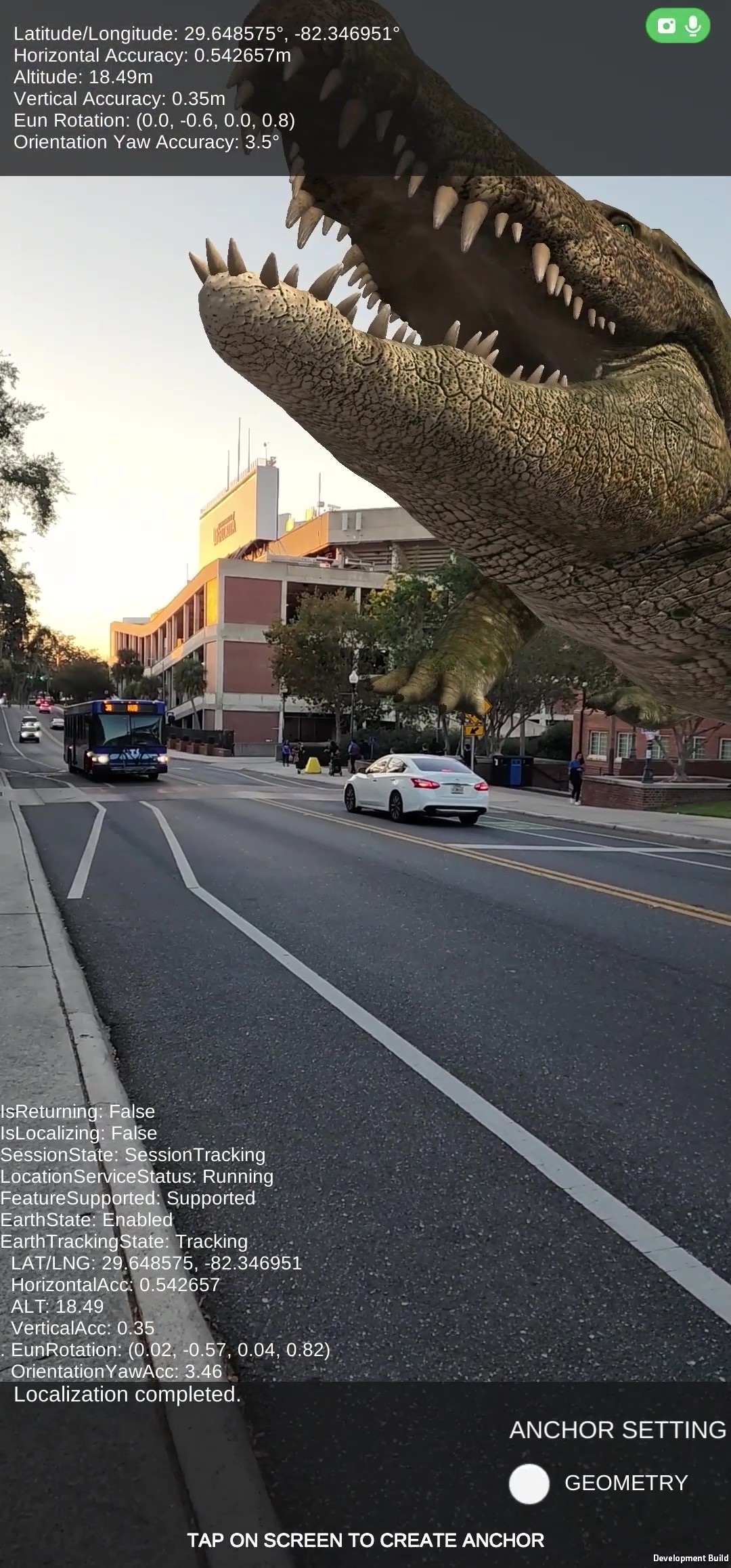
Alligator at the Swamp
-

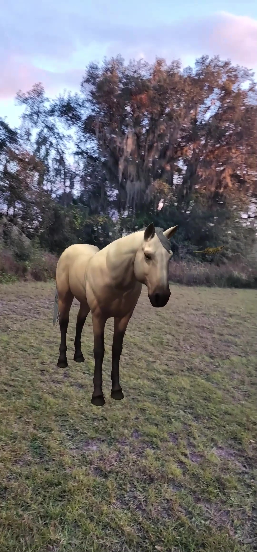
Horse at Paynes Prairie
-
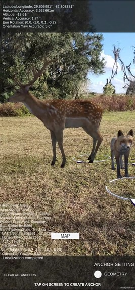
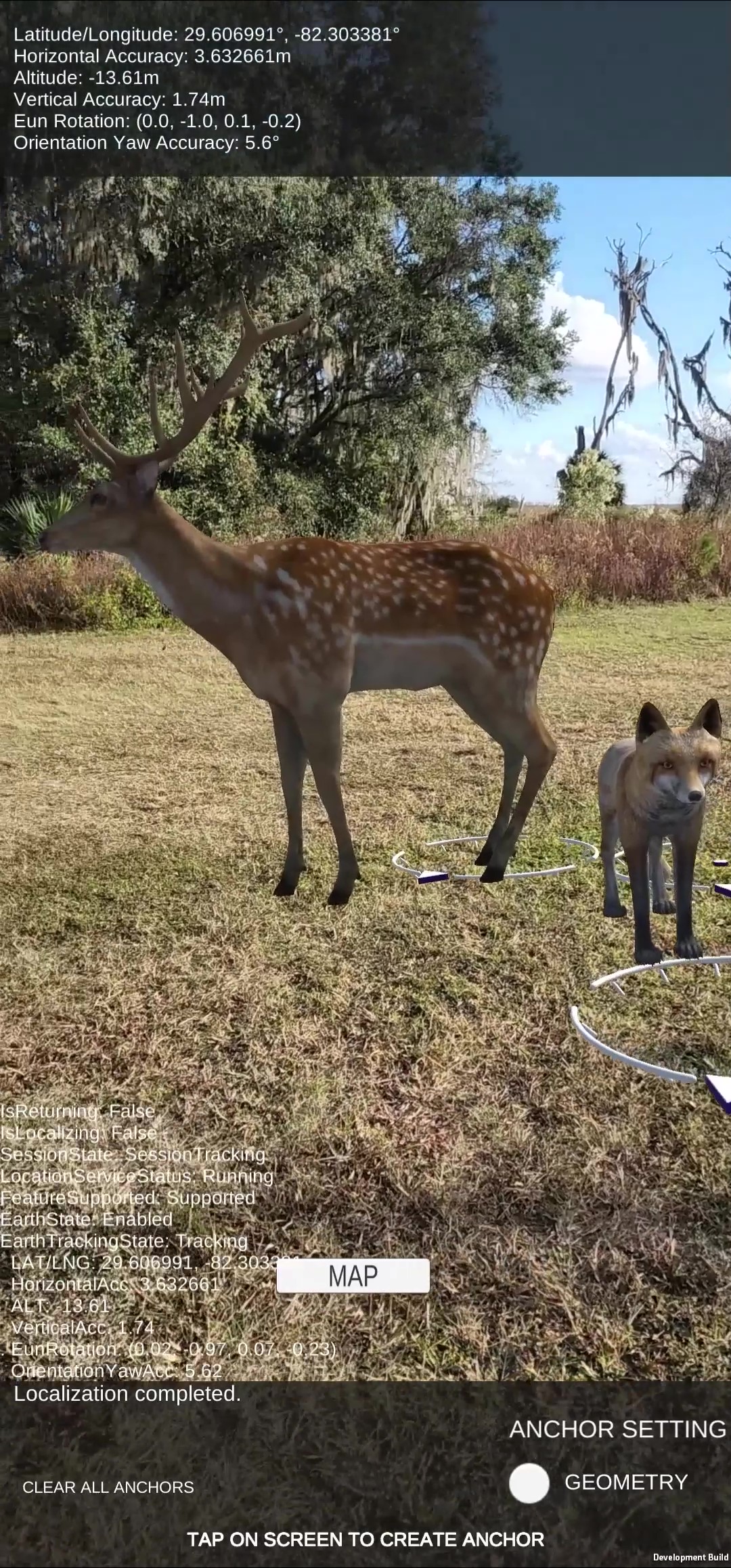
Deer at Paynes Prairie


Inspiration
Inspired by Augmented Reality game like Pokemon Go, this is a geospatial game to discover native animals hiding in our environment. For this demo, 3D models of native animals from Central Florida region appear when entering geo-fenced areas such as Paynes Prairie National Park, Florida Museum of Natural History, UF Bat Conservatory, and various areas of University of Florida campus such as lakes and “The Swamp” Football stadium. The game encourages exploration of the outdoors and serves as a guide while out on the nature trails.
Note: This project was developed for educational purposes to experiment with Geospatial Augmented Reality, and is not officially endorsed by the University of Florida or Florida Museum of Natural History.
What it does
Players can see GPS-located 3D AR experiences in nature such as alligators, bats, butterflies, buffalo, manatees, wild boars and horses. In this game demo, there are 16 different species of animals to discover out in the field.
For those not in the game’s location, the floridamon.com website link offers a 3D model viewer to demo the Augmented Reality animals.
How we built it
The game was created in Unity using AR Core extension for Google Geospatial Creator with Cesium for Google Map Tiles API and Niantic Lightship used for occlusion and segmentation. The animated 3D models were purchased from Unity Asset Store, and several 3D models were generated with Luma AI text-to-NERF Genie app.
Challenges we ran into
Encountered game-breaking bug after importing a unity package into project, causing game development to be restarted and scope of project changed to focus on MVP of Geo-located animals instead of game interaction.
Accomplishments that we're proud of
Was exciting to see the 3D animals out in Paynes Prairie National Park, in the middle of nowhere with no cellular service. Getting the 200 ft alligator to properly segment and occlude with football stadium was a surreal sight, like seeing Godzilla.
What we learned
Learned to work with Geolocations in Unity to build world-scale AR experiences.
What's next for Geospatial Wildlife
Future development is to expand area coverage outside of Gainesville, to the rest of Florida and use more data sets from Map of Life to have the 3D experience dynamically load given a species known area range. Would like to add interactive components such as being able to throw foods and items at the animals, and use different photography equipment to capture the animals.
In a previous project, I created a machine learning tool to identify different species of Butterflies at the Florida Museum of Natural History, and I do plan to incorporate this AI feature into this app with ambitious goal to identify all of the species of animals. This could serve as a research and guide tool, to alert the user if dangerous animals are detected, and how to properly handle these types of scenarios when out in the wild.
Want to add a multiplayer game experience where players can control the animals they have photographed and play with others in their local area. I imagine players could take control of the 200 ft alligator floating over the Football Stadium during events and have large-scale AR experience during stadium events.


Log in or sign up for Devpost to join the conversation.