-
-
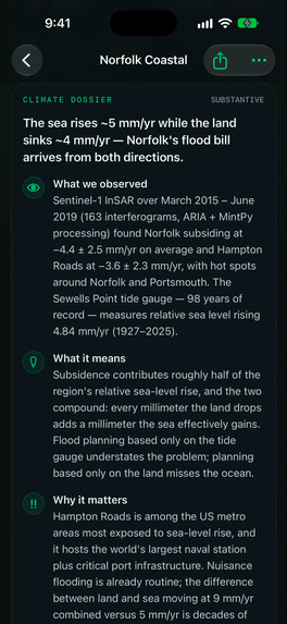
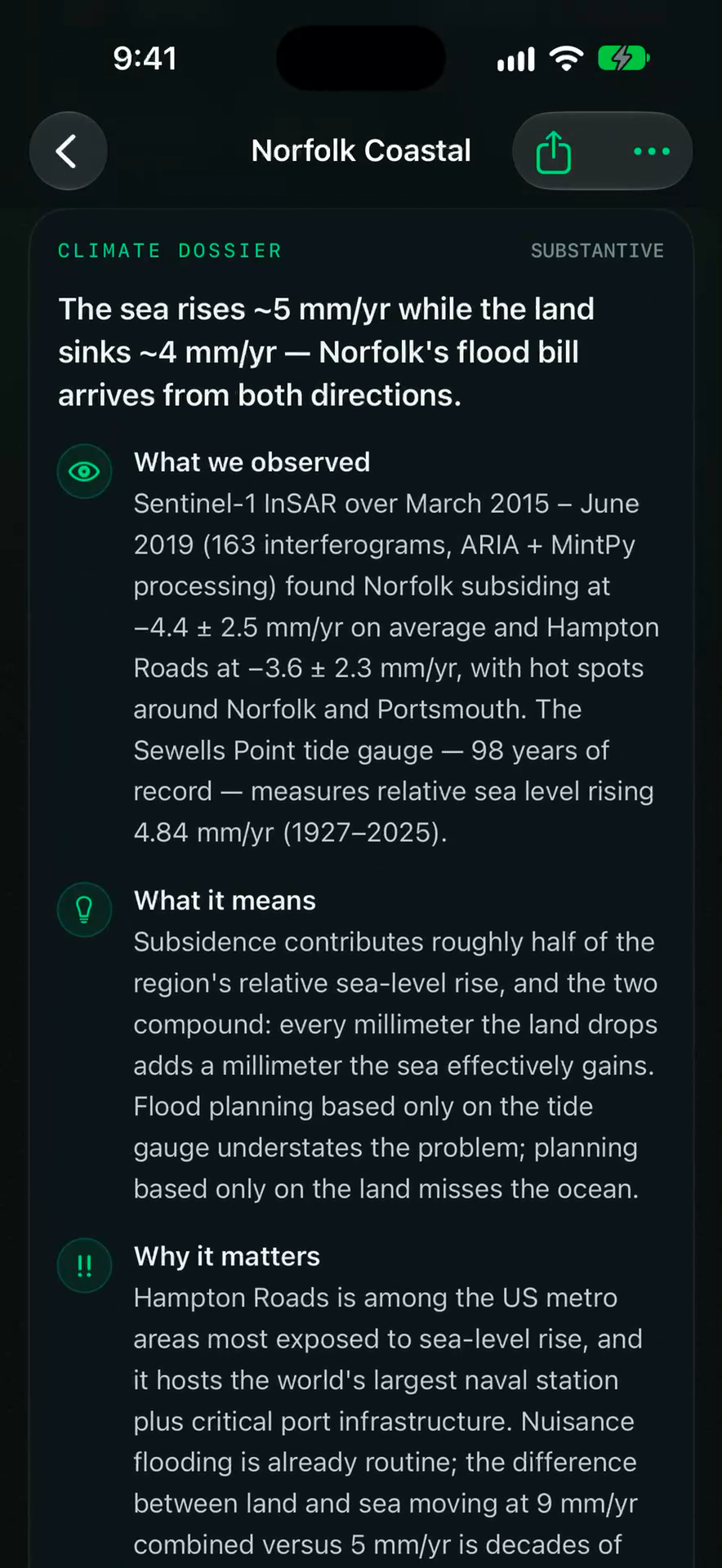
Norfolk coastal subsidence dossier: Land sinking (-4.4 mm/yr) compounding global sea-level rise to over 9 mm/yr of relative flooding.
-
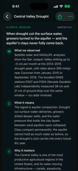
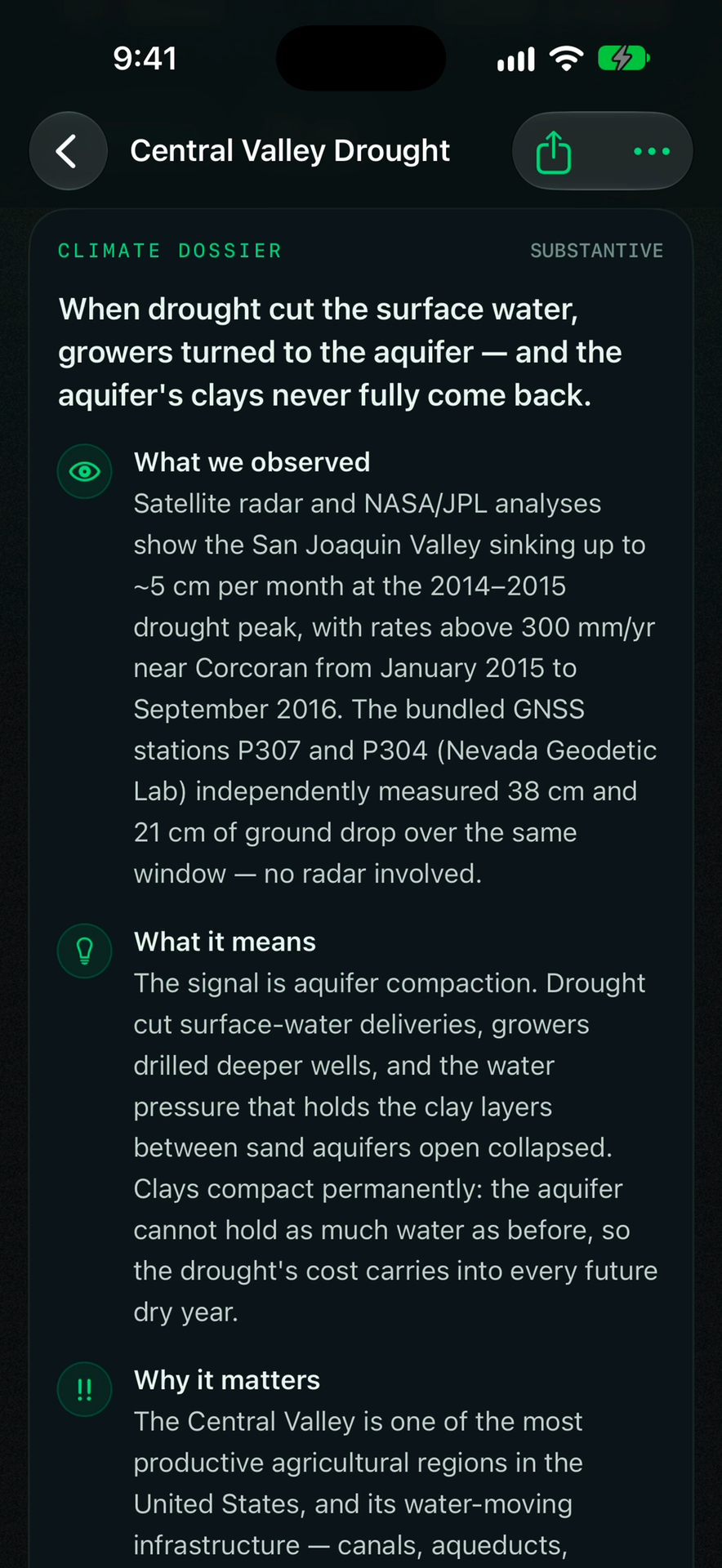
6-section substantive Climate Dossier detailing irreversible aquifer pore collapse, infrastructure impacts, and tailored audience views.
-
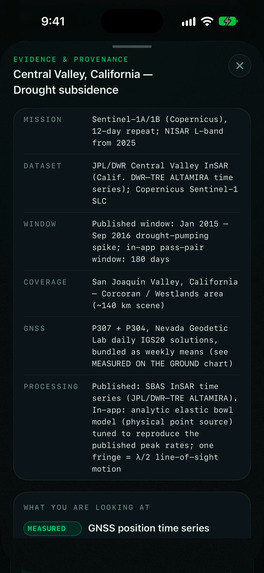
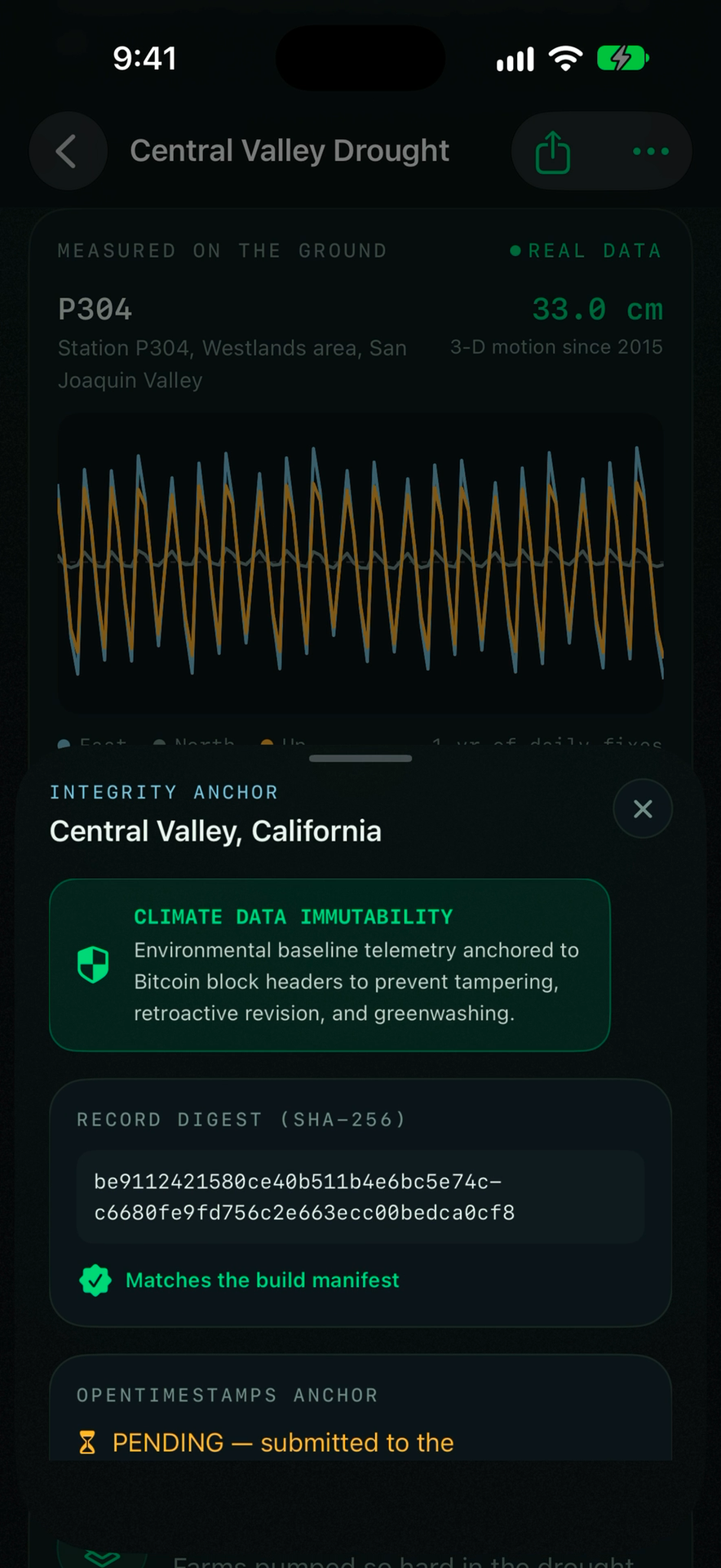
Anti-greenwashing anchor: SHA-256 evidence record anchored into Bitcoin block headers via OpenTimestamps for tamper-proof data.
-
Multi-band radar toggling: Comparing fringe density between Sentinel-1 C-band (5.6 cm) and canopy-penetrating NISAR L-band (24 cm).
-
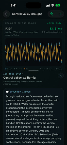
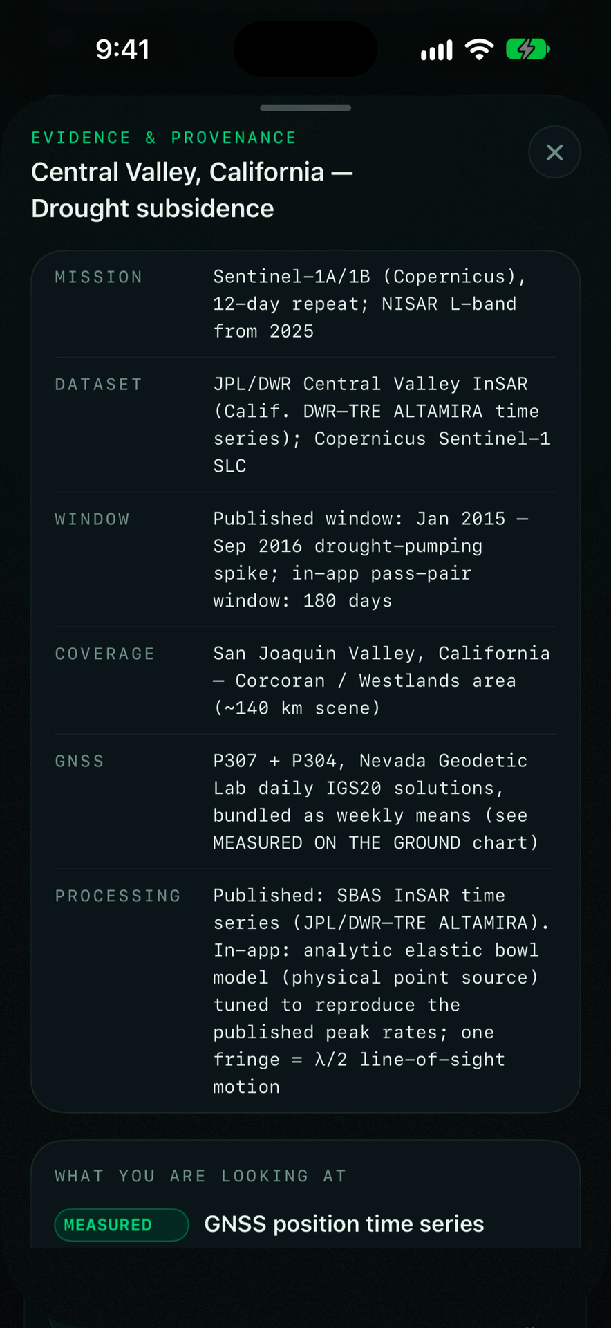
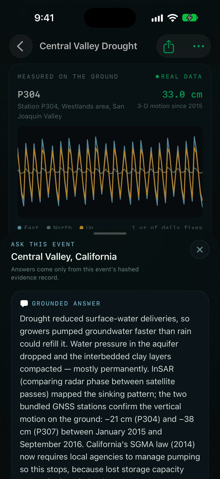
Continuous GPS ground truth from NSF GAGE / NGL Station P307 validating -38.2 cm cumulative vertical drop during peak drought.
-
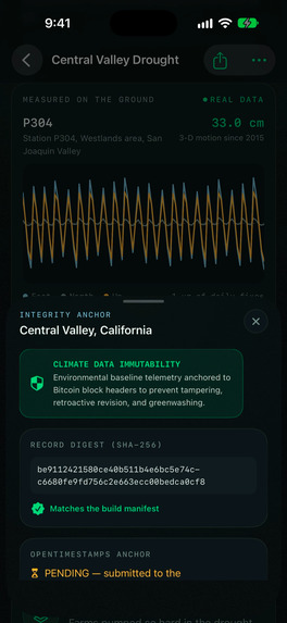
Grounded AI answering climate mechanism queries strictly from cryptographically hashed evidence records with zero hallucination.
-
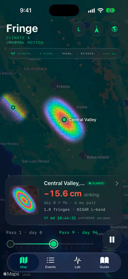
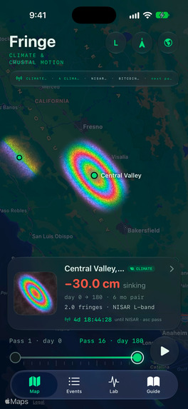
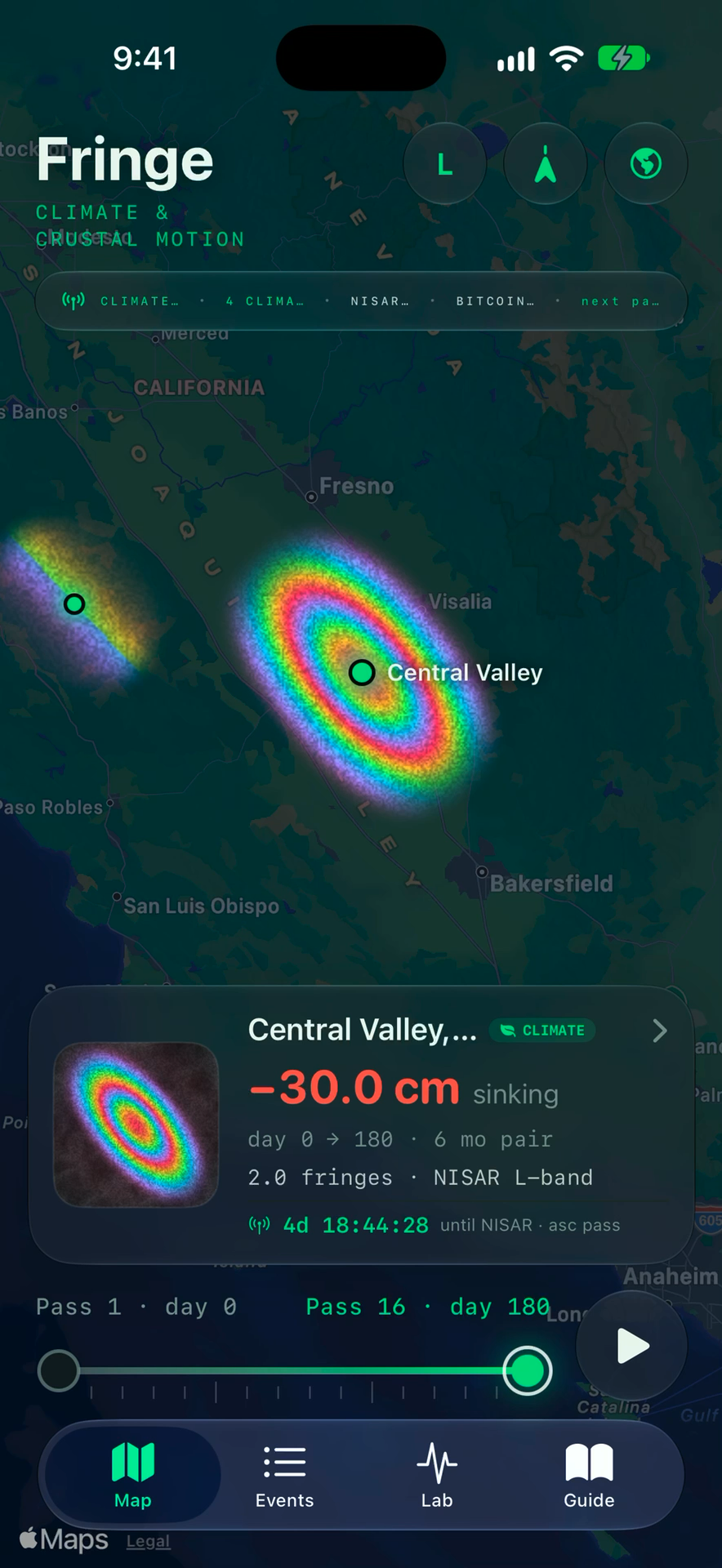
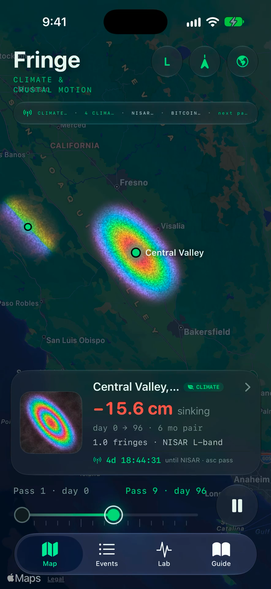
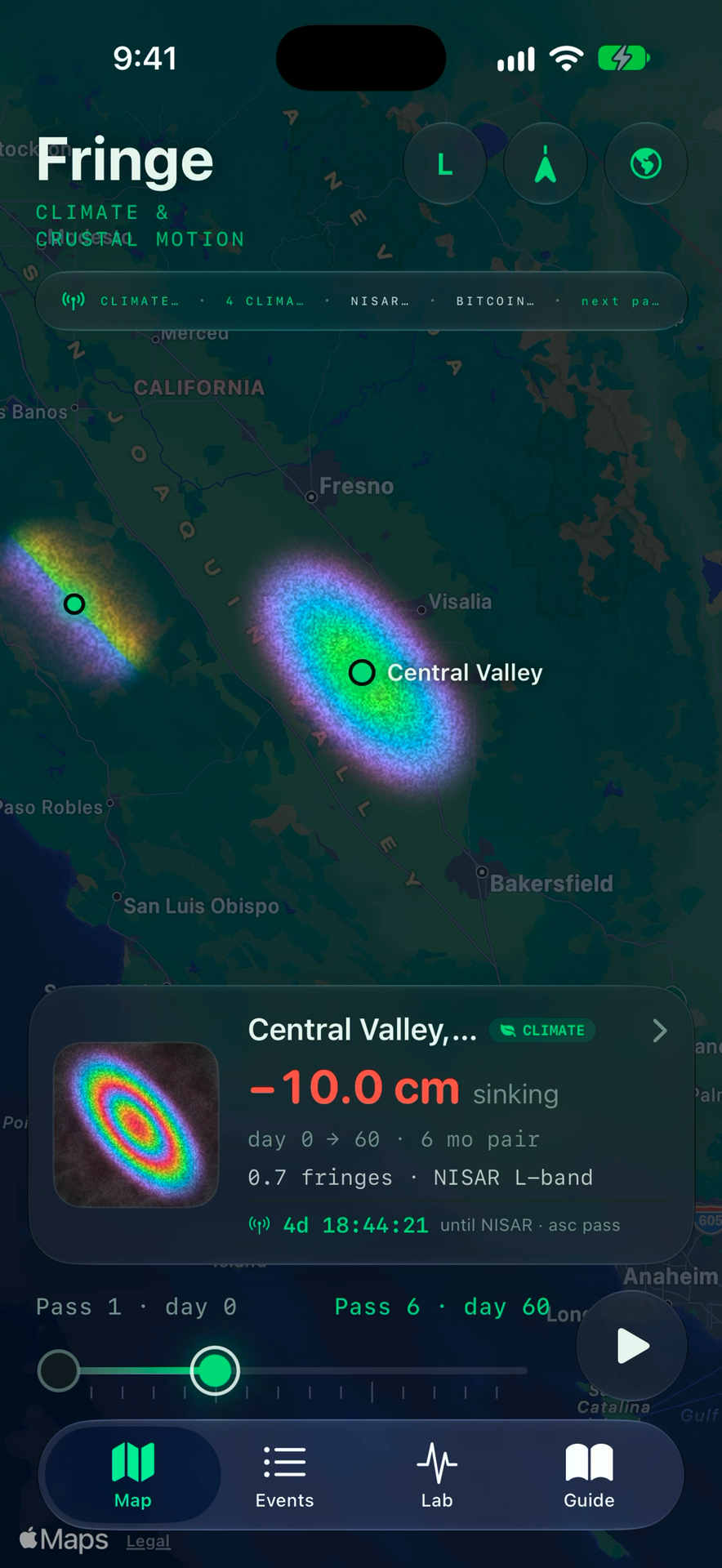
Central Valley drought monitoring via NASA-ISRO NISAR L-band (24 cm) radar interferometry, rendering millimetric ground deformation.
-
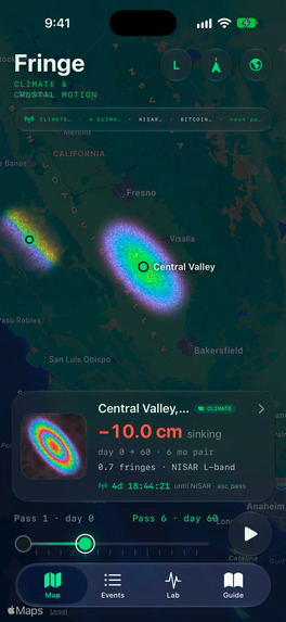
Multi-temporal deformation scrubber animating 30 cm of drought-induced aquifer clay skeleton compaction across San Joaquin Valley.
-
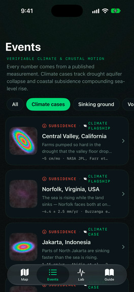
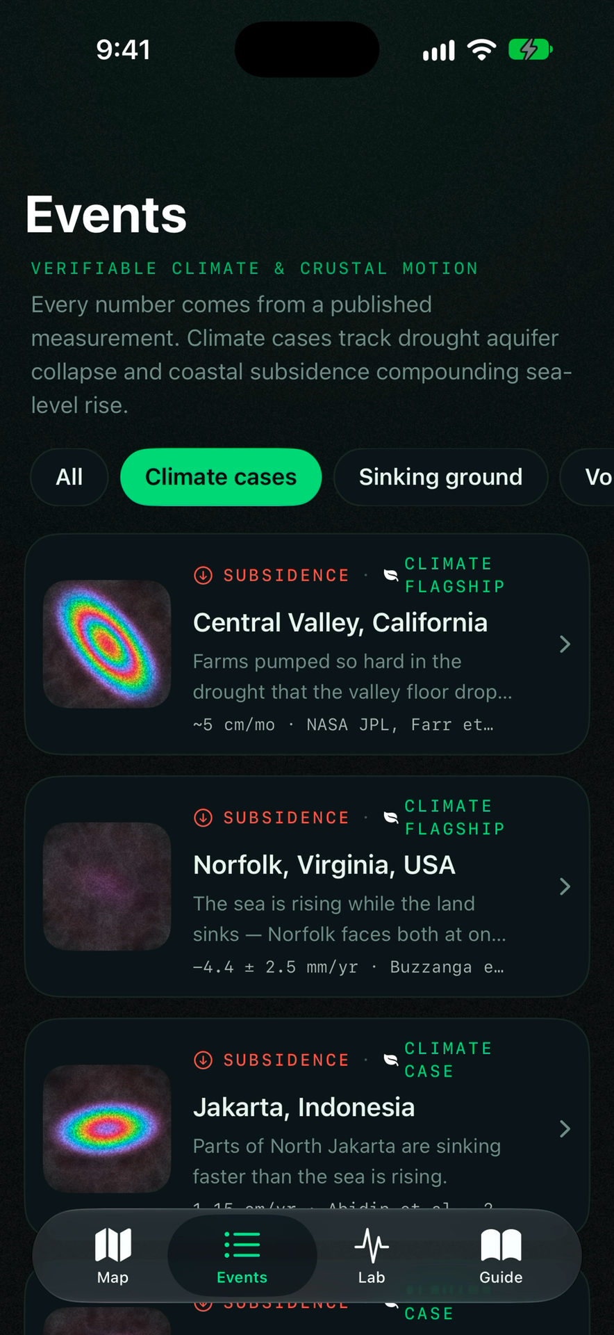
Verified Events Catalog filtered to global Climate cases: Central Valley (-30 cm), Norfolk, Jakarta, and Mexico City sinking ground.
-
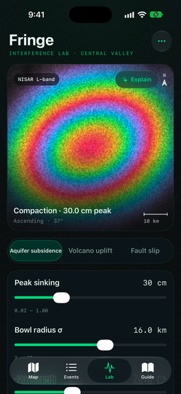
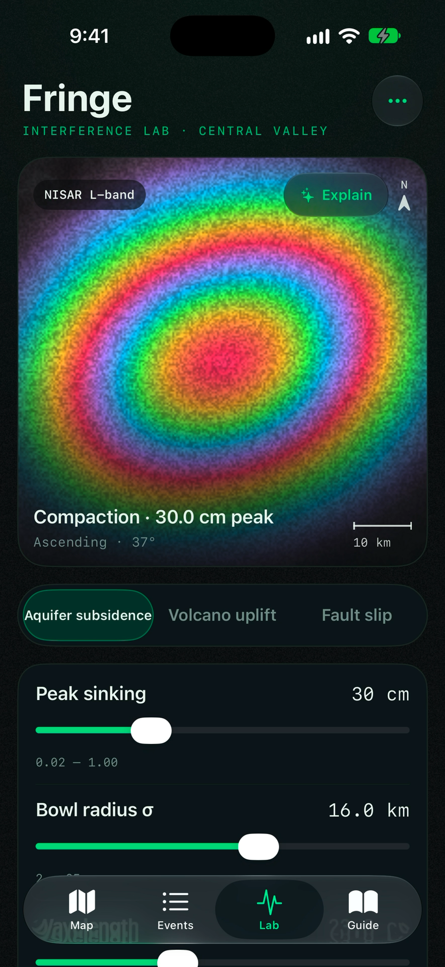
Metal-shaded Interference Lab: Interactive physics simulator modeling radar wavelength fringes and aquifer compaction bowls in real-time.
Fringe — Climate Truth, From Orbit to the Ground
Inspiration
What if the ground beneath your feet was sinking, but you couldn't see it?
From California's disappearing groundwater reserves to Jakarta's sinking neighborhoods, land subsidence is a silent environmental crisis threatening millions of people.
Satellites can measure these changes with remarkable precision, but the data often remains locked behind complex scientific tools. Meanwhile, environmental reporting faces another challenge: how can we trust that the evidence hasn't been manipulated?
We built Fringe to solve both problems—making satellite observations accessible while giving environmental evidence a cryptographically verifiable history.
What it does
Fringe is an offline-first iOS climate monitoring application combining satellite radar, real GPS measurements, interactive simulations, and Bitcoin-backed evidence verification.
Its key features include:
- Interactive InSAR Maps: Visualize ground deformation using colorful radar interferograms, with NISAR L-band and Sentinel-1 C-band configurations.
- Global Climate Case Studies: Explore subsidence in California's Central Valley, Norfolk, Jakarta, and Mexico City.
- Real GNSS Ground Truth: View real 3D displacement measurements from geodetic monitoring stations.
- Bitcoin-Verified Evidence: Use SHA-256 and OpenTimestamps to make environmental records tamper-evident and independently verifiable once confirmed.
- Evidence-Grounded AI: Ask questions about environmental events using scientific records rather than unsupported speculation.
- Interactive Physics Lab: Experiment with radar interference and ground deformation through real-time simulations.
Every visualization is clearly labeled MEASURED, DERIVED, or MODELED to distinguish real observations from calculations and simulations.
How we built it
We developed Fringe using Swift and SwiftUI for iOS 18+, with custom Metal GPU shaders for high-performance interferogram rendering.
Our scientific data sources include NASA-ISRO NISAR, ESA Sentinel-1, Nevada Geodetic Laboratory GNSS stations, NOAA, and USGS.
For evidence integrity, we implemented SHA-256 hashing and a native Swift OpenTimestamps parser. A 16-test XCTest suite validates radar calculations, cryptographic records, and proof decoding.
Challenges we ran into
Our biggest challenge was balancing scientific accuracy, performance, and accessibility.
Rendering realistic radar interference patterns smoothly on mobile required GPU optimization. Implementing OpenTimestamps in Swift introduced additional complexity, while presenting technical geodetic data clearly required careful interface design.
We also made scientific honesty a priority by distinguishing measured observations from modeled scenarios and avoiding unsupported climate claims.
Accomplishments that we're proud of
- Combining satellite InSAR, real GNSS data, AI, and Bitcoin timestamping in one native iOS experience.
- Building an interactive GPU-powered visualization engine.
- Making advanced geodesy accessible to students, researchers, and everyday users.
- Creating an evidence-verification workflow that supports transparency and accountability.
What we learned
We discovered how irreversible aquifer compaction can permanently reduce groundwater storage and how sinking land can intensify coastal flooding.
Most importantly, we learned that environmental data becomes more powerful when people can understand and independently verify it.
What's next for Fringe
Our next steps include integrating operational NISAR science products, introducing automated subsidence alerts, expanding global coverage, and connecting community IoT monitoring stations.
Our long-term vision is to make Fringe an accessible platform for transparent, evidence-based Earth monitoring.
The Earth is changing beneath our feet. Fringe makes that change visible—and the evidence accountable.


Log in or sign up for Devpost to join the conversation.