-
-
Live Conditions
-
Thousand Nights
-
Night Forecast
-
Dossier
-
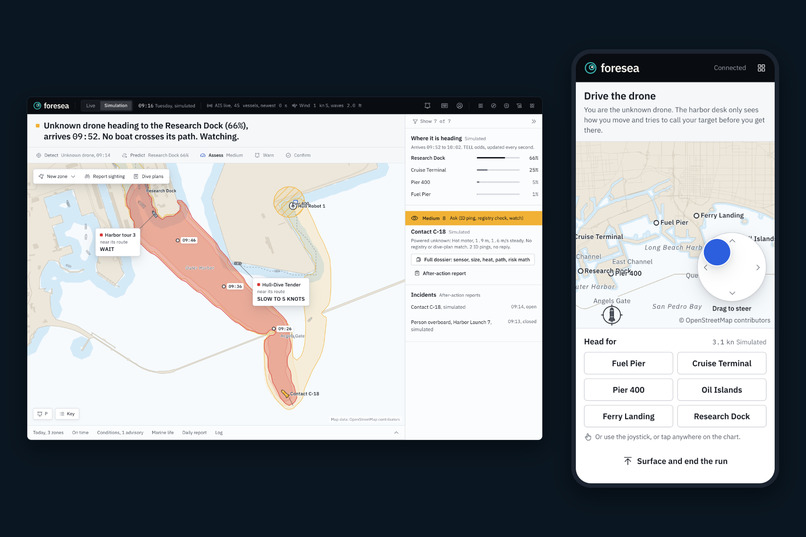
Drive The Drone
-
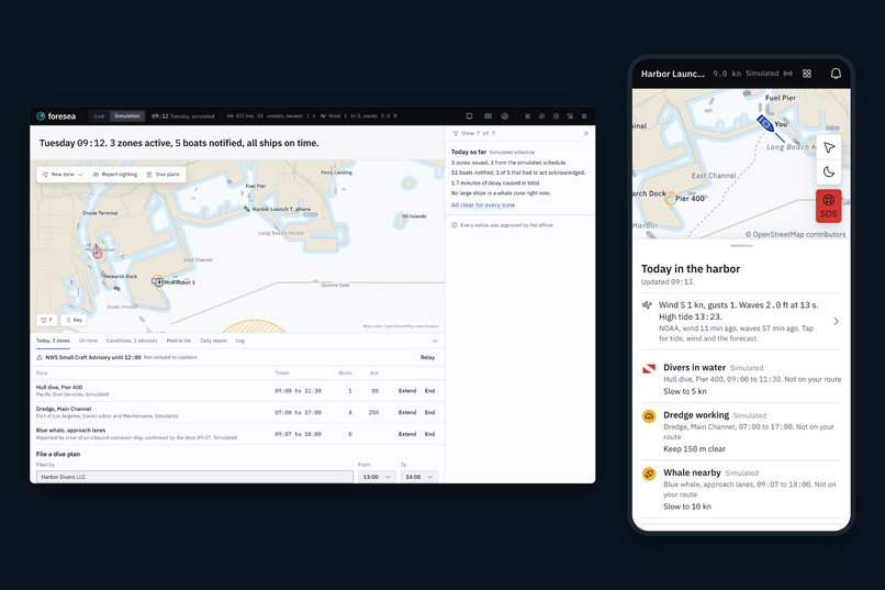
Ordinary Tuesday
-
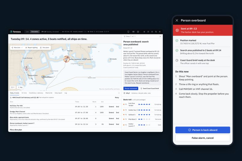
Person Overboard
-
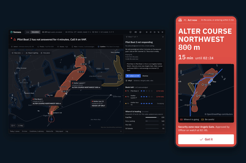
Phone Alert
-
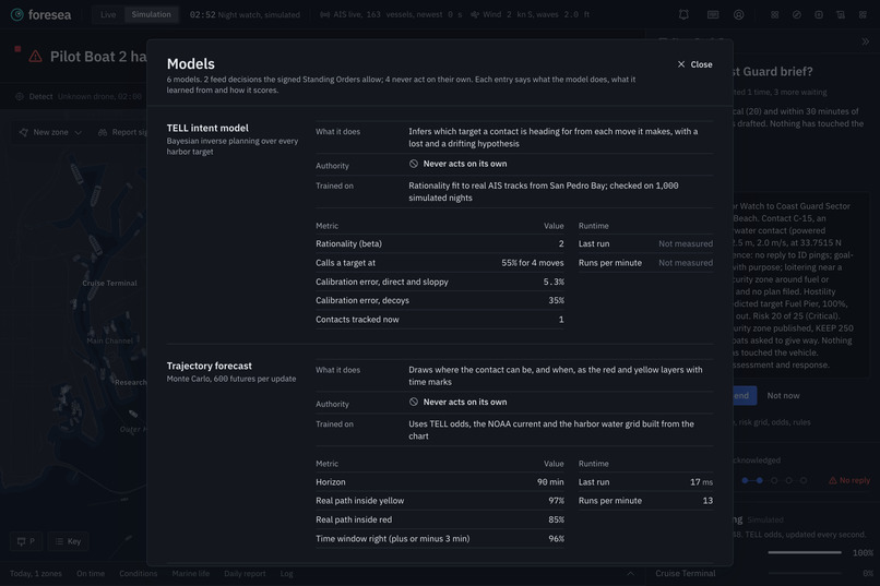
Our Models
-
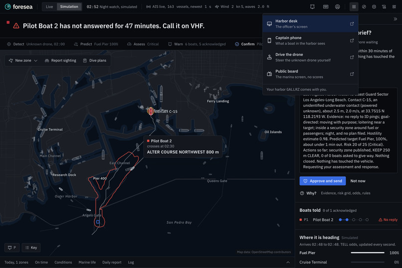
Different views (Harbormaster, Captain, etc.)
-
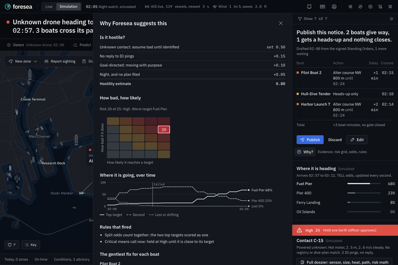
Why It Decided
Inspiration
Imagine the Port of LA at 2 AM. A sensor picks up something small moving underwater near the harbor entrance. It does not answer when you ping it. Nobody knows what it is or where it is going.
Right now the safe move is to close the port. That costs somewhere between $65 million and $150 million a day, and it happens because nobody can tell what the thing is about to do.
At the kickoff for the Hackathon, NULL Systems asked the Marine track one question: how do you respond without shutting the harbor down? We thought about it for a while and realized the real answer is time. If you know early where something is heading, you only have to move the few boats in its way. If you find out late, closing everything is the only option left. So we built Foresea to buy that time.
What it does
The basic rundown of Foresea is that it is a harbor watch system with two sides. The harbor officer gets a desk on a laptop. Boat captains get an app on their phone.
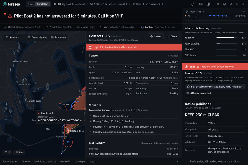
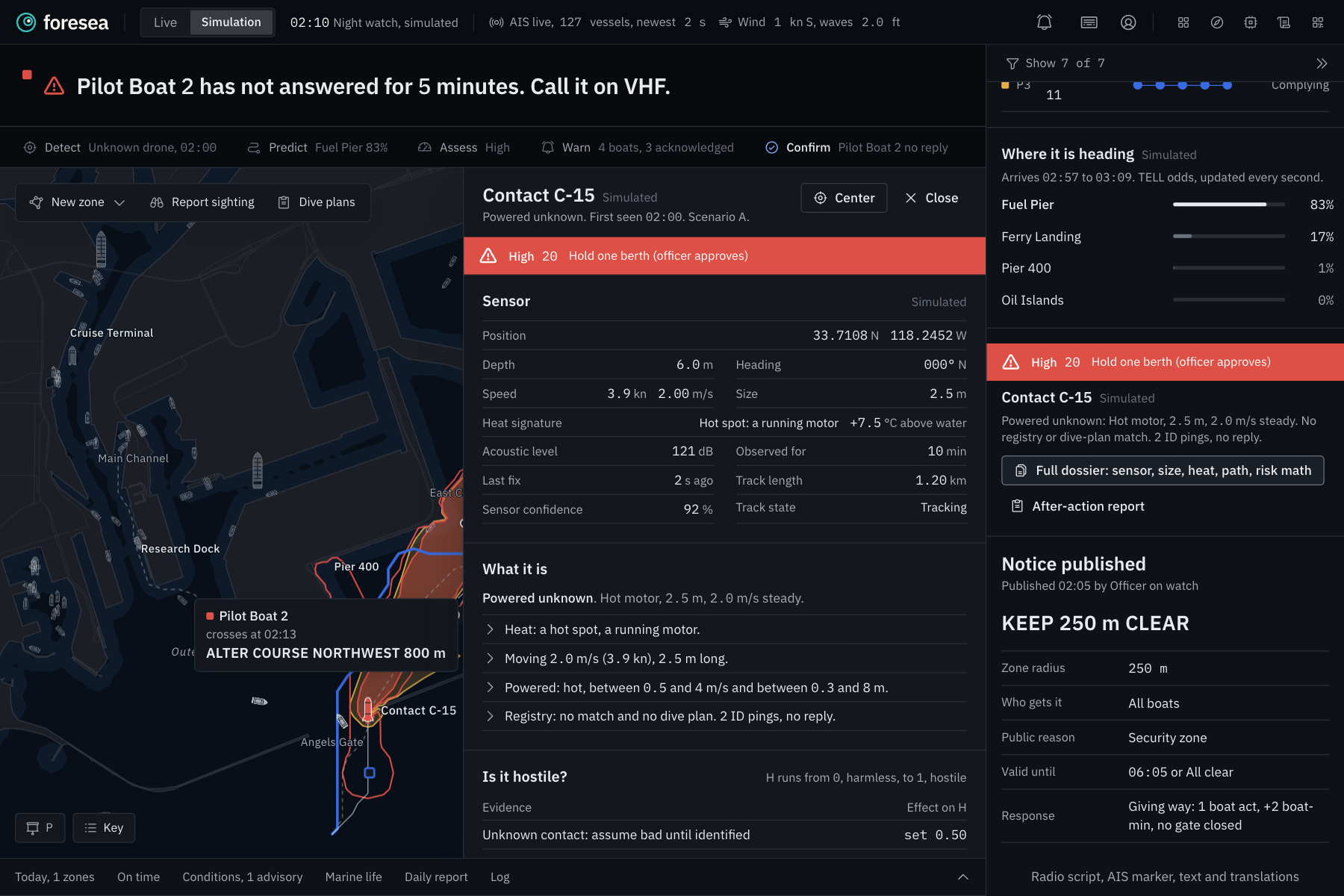
When something unknown shows up in the water, Foresea first works out what it probably is. It looks at size, heat, speed and whether it answers an ID ping, and sorts it into a powered drone, a lost research robot, a marine animal or a person in the water or just a general classification for an event.
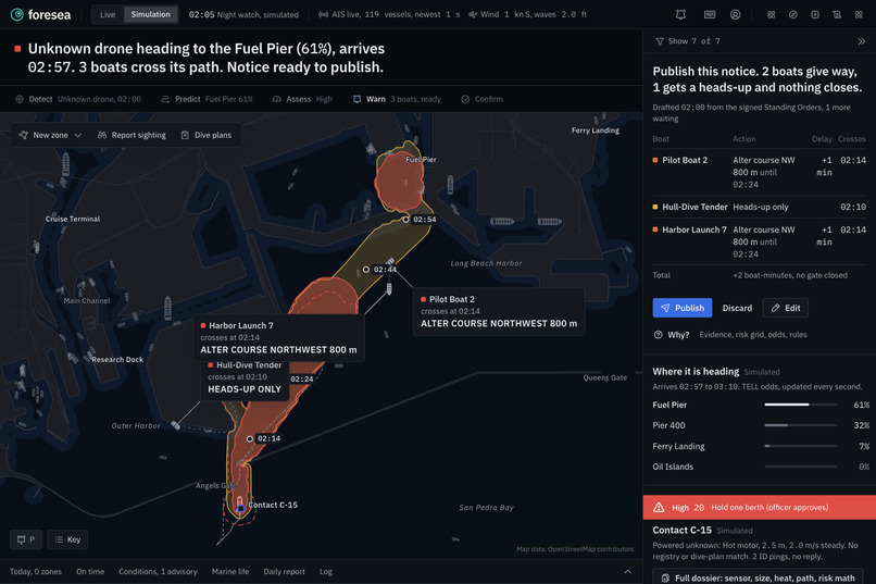
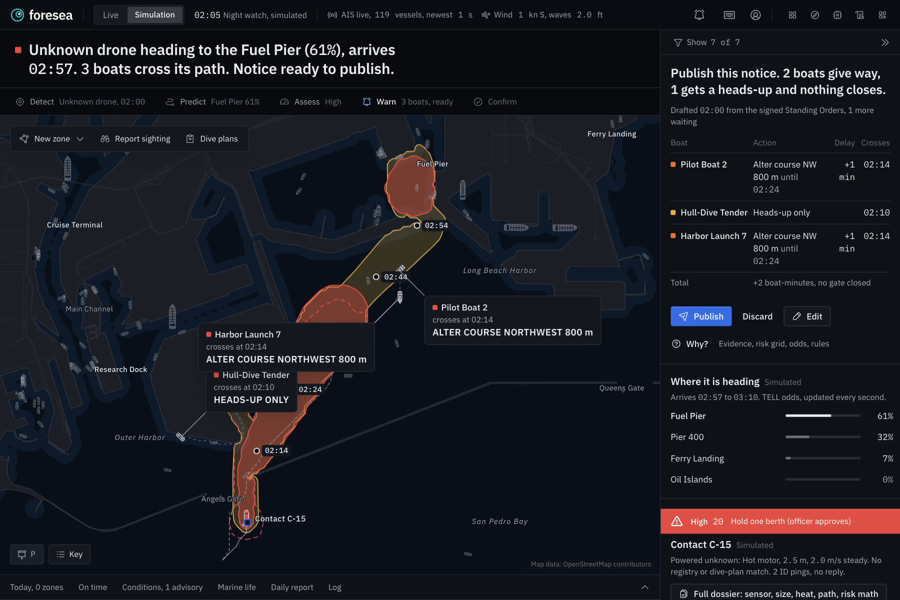
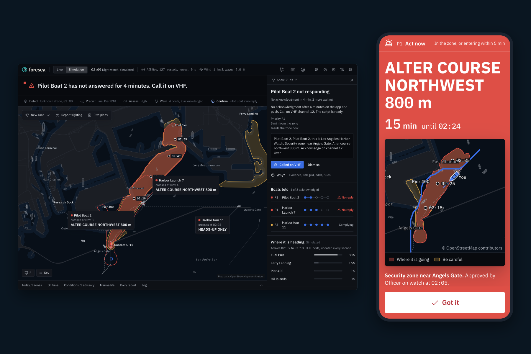
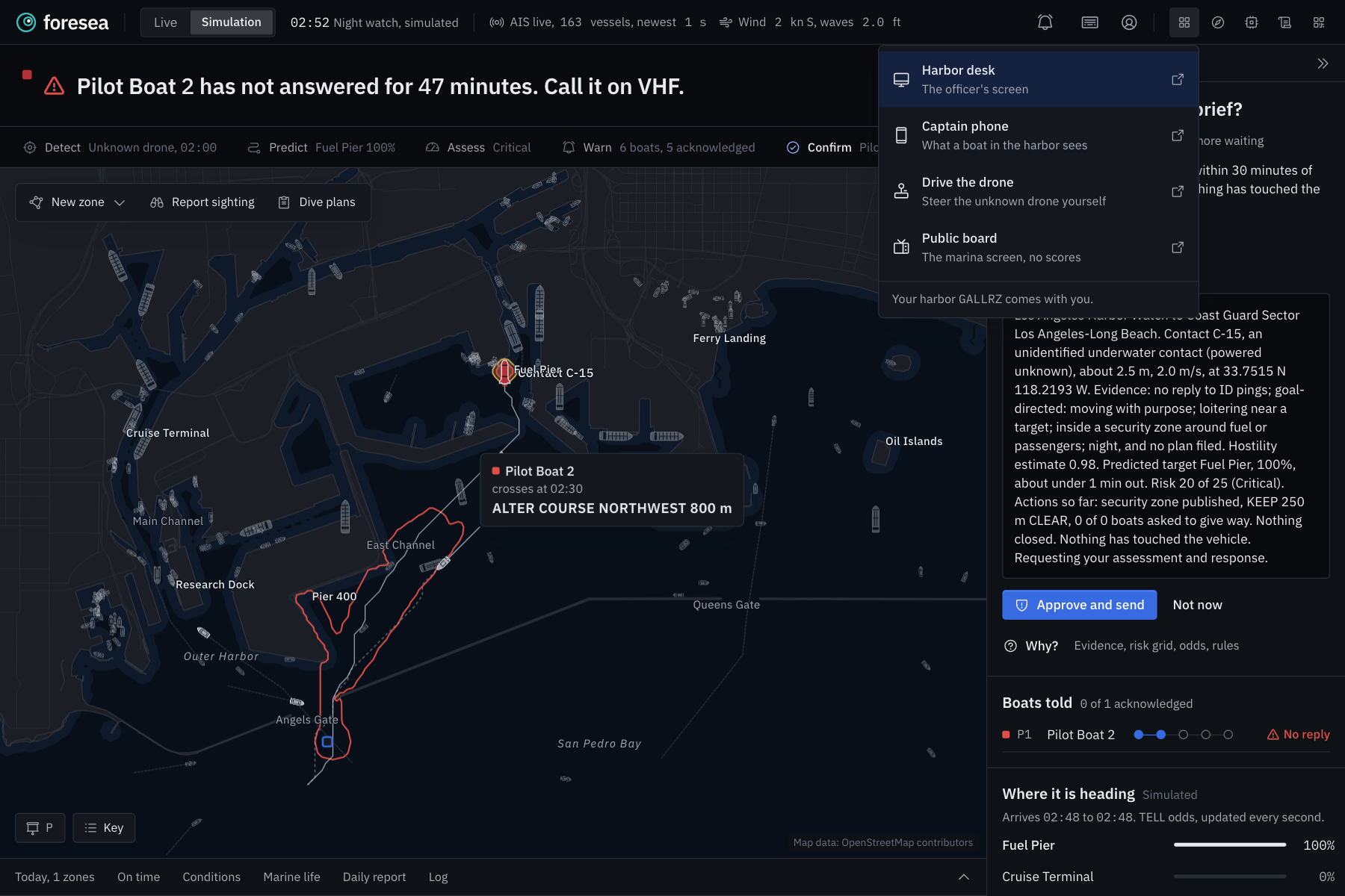
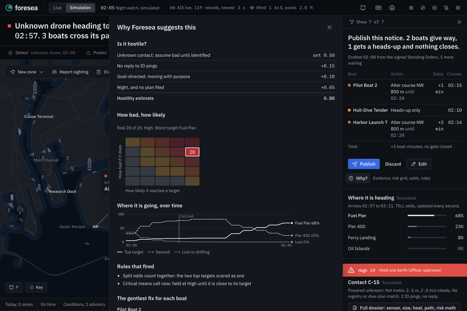
Then it predicts where it is going. Our model, TELL, which is actually trained on 6 hours worth of AIS data, watches every single move the contact makes and updates the odds for every dock in the harbor. On the map it looks like a hurricane forecast for drones. Yellow is everywhere it could be in the next half hour. Red is where it is most likely headed, with time marks so you know when it gets there. As the drone commits to a target, the red narrows down in front of you.
Next it scores the risk on a 5 by 5 grid, the same idea the Coast Guard uses to rate port threats. Basically, how likely is harm, and how bad would it be at the place it is heading.
Then comes the part we care about most. Instead of closing the port, Foresea drafts the gentlest response that still keeps everyone safe. It only moves the boats whose routes actually cross the forecast, gives each one a reroute, and tells you exactly how many minutes of delay that costs. A typical night costs a couple of boat minutes and zero closed gates, which is way better than having the entire harbor closed.
The officer reads the draft, taps Publish, and every captain in the path gets one clear instruction on their phone, like ALTER COURSE NORTHWEST 800 m, with a countdown and their new route drawn on the map. If a captain ignores the alert, the desk gets a card after 4 minutes with a radio script ready to read over VHF.
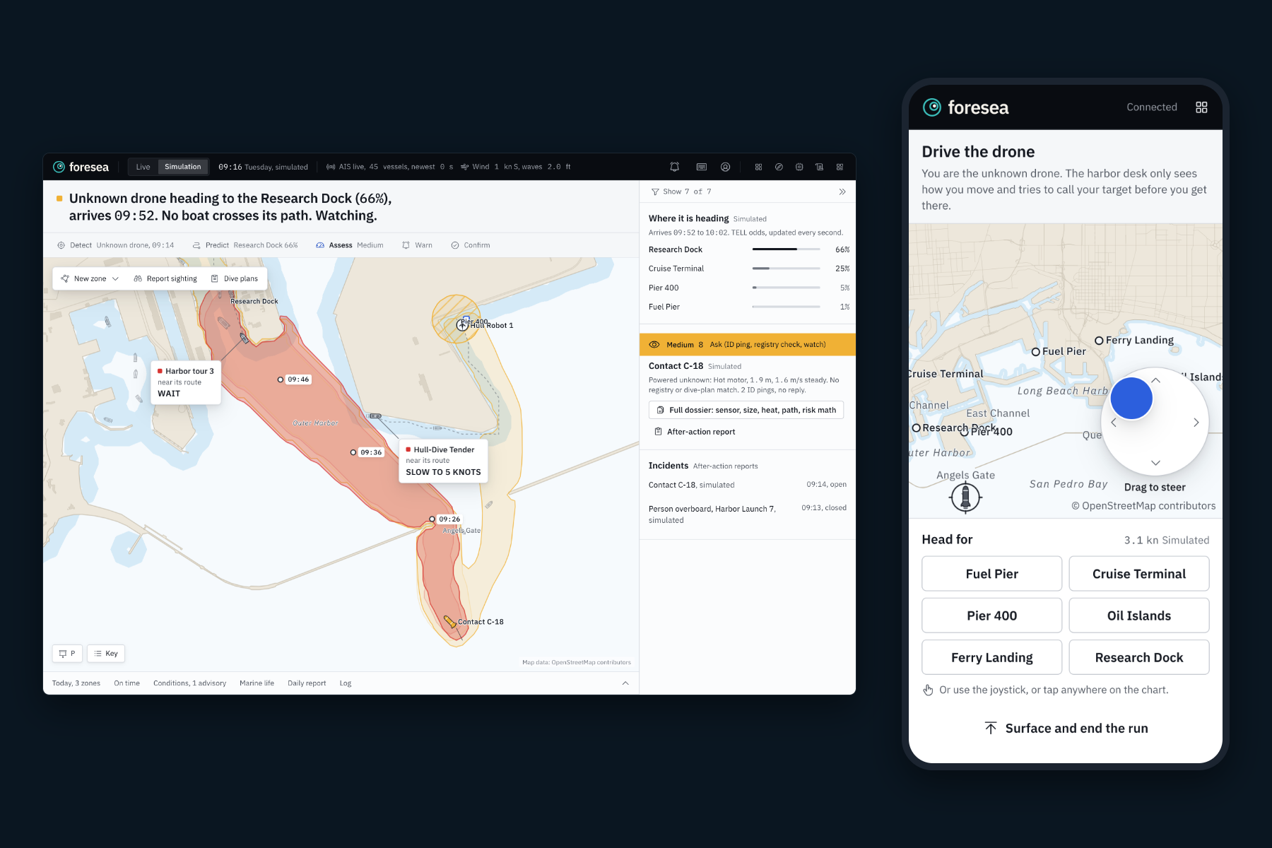
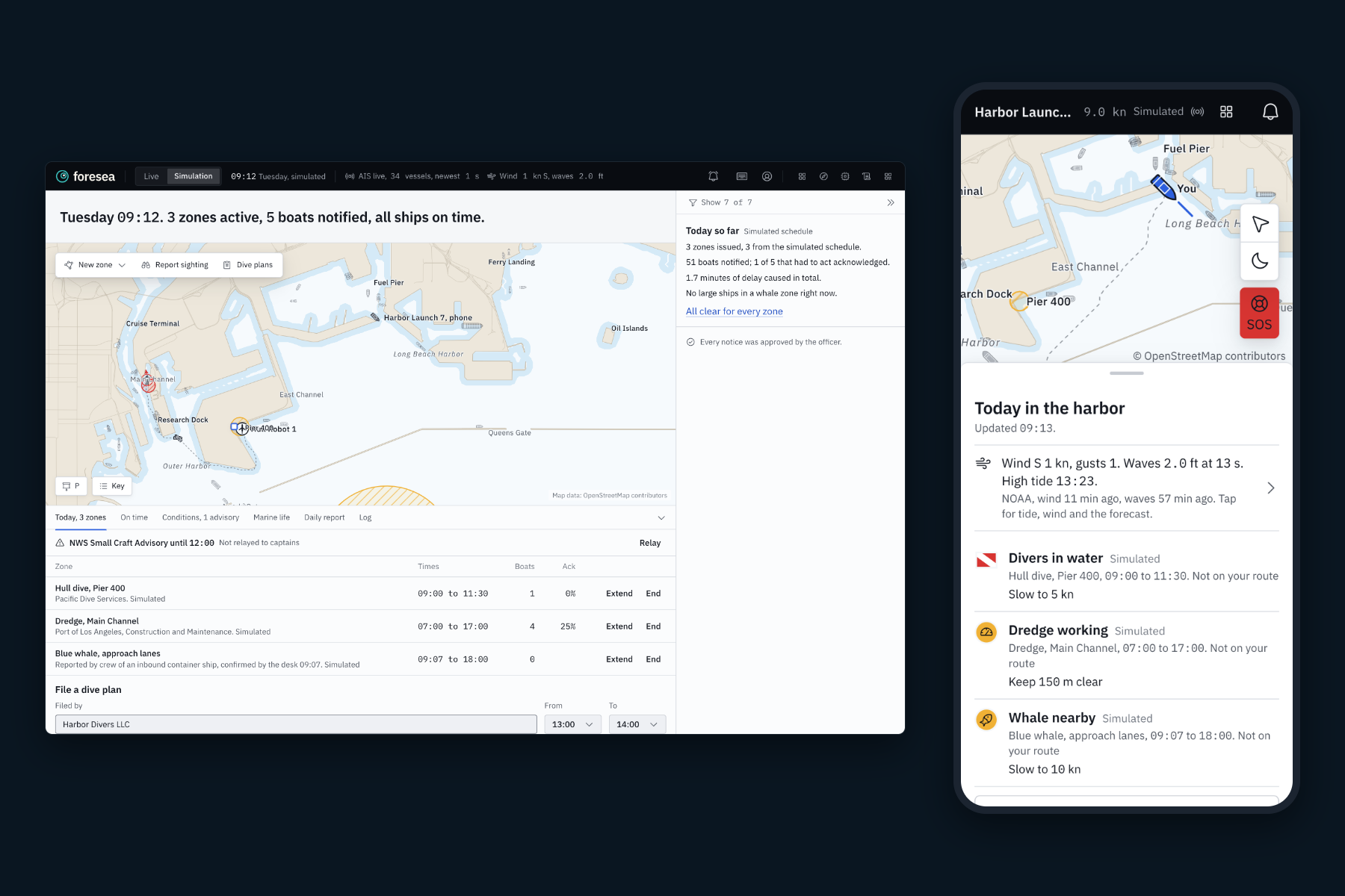
Now, time for the actual best part: The Dual Use! This is what we are proudest of. The same engine that tracks a hostile drone runs the harbor on a regular Tuesday. Dive teams file a dive plan and boats near them get told to slow down. A dredge working the main channel gets a moving keep clear zone. When a captain reports a whale from their phone, the officer confirms it and big ships slow down around it.
The best way to think about this use-case is like Google Maps/Waze but for the sea.
When a research robot loses contact, Foresea sees that it is drifting with the real NOAA ocean current instead of aiming anywhere, calls it "lost, not hostile", messages the owner and turns the drift forecast into a search area.
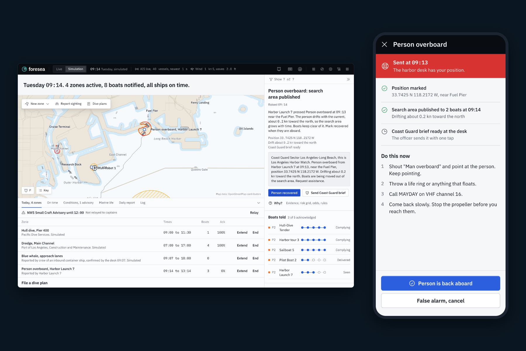
We also added a person overboard button. A captain holds SOS for two seconds and the desk instantly gets their exact position plus a search area that drifts with the current, along with a Coast Guard brief ready to send. That is the same math that tracks drones, used to find a person in the water.
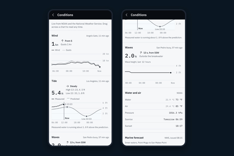
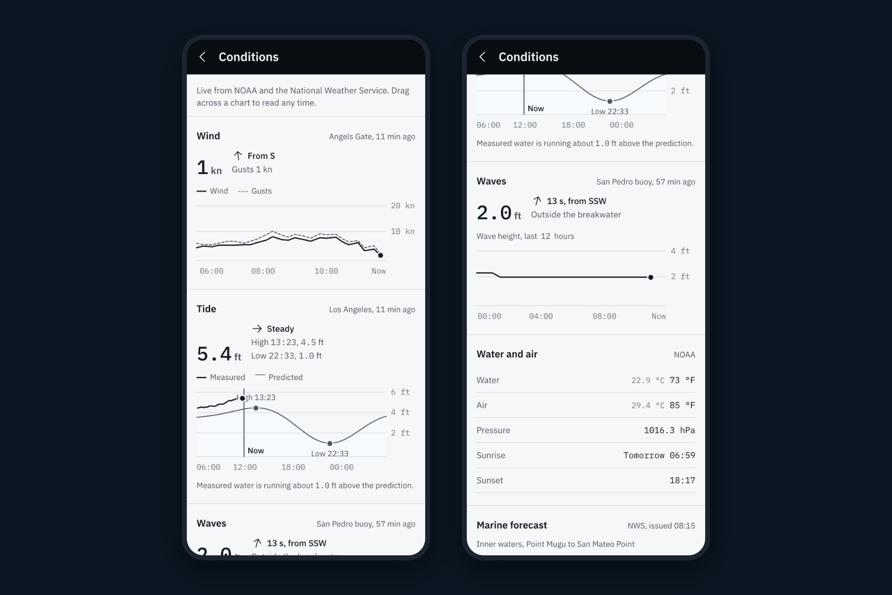
The phone also shows live tide curves, wind, waves and the National Weather Service marine forecast. When the weather service issues a small craft advisory, the officer relays it to every captain in one tap. So the defense side and the everyday side are not two products. They are one system, and the everyday use is what keeps the officer practiced and the captains trusting it for the night it really will matter.
How we built it
Foresea is written in TypeScript from top to bottom. One shared engine runs in the browser, in a background worker and on the server, so the desk, the phones and our tests all use the exact same math.
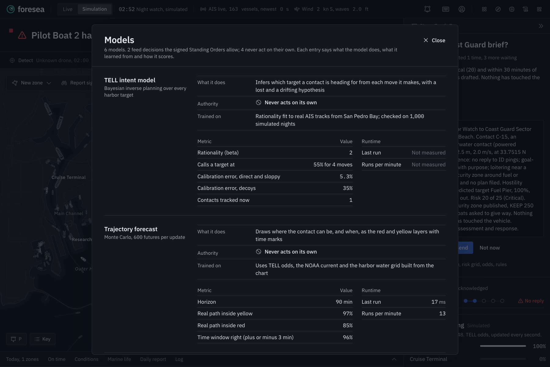
TELL is based on Bayesian inverse planning. For every possible target, it asks how well each move fits a vessel heading there. A move that gets closer to a target over water makes that target more likely:
$$P(g \mid x_{0:t}) \propto P(g)\prod_{k=1}^{t} e^{\beta\,(d_g(x_{k-1}) - d_g(x_k))}$$
Here $d_g$ is the distance through water to target $g$, and $\beta$ controls how purposeful we expect a pilot to be. TELL also keeps two extra hypotheses: "lost" and "drifting with the current". That is how a dead robot never gets mistaken for an attack.
Risk is likelihood times severity on a 5 by 5 grid, with five hard rules on top, like "people are never scored as targets" and "high risk always waits for a person".
The desk and phone app are built with React and Vite. The nautical chart is MapLibre drawing an offline PMTiles map of San Pedro Bay, styled for day and night. A Node server with Socket.IO keeps the desk and every phone in sync within a second and writes an audit log to SQLite. Phones get real push notifications through Web Push and keep working offline with the last known zones.
We trained a traffic model on 2,620 real AIS reports so the desk can flag real ships acting strange, like a ship that suddenly goes dark. IBM Granite 4 runs locally through Ollama and writes the notice, the radio call, the Coast Guard brief and translations into Spanish, Chinese, Korean, Tagalog and Vietnamese. It never makes a decision, and every sentence it writes is checked against the facts. If it gets anything wrong, a template takes over.
Another cool thing, we were actually able to get a lot of live data for this tool. Everything that can be real is real. Ship positions are live from AIS. Tides, currents, wind, waves and water temperature are live from NOAA stations and buoys. Forecasts and advisories come straight from the National Weather Service. The chart is built from OpenStreetMap. The underwater contacts, their sensor readings and the small boats with phones are simulated, because we obviously cannot launch a drone into the Port of LA, and every simulated number says "Simulated" right next to it on screen.
Challenges we ran into
A drone drifting with the current looks a lot like a drone aiming somewhere. Our first version kept accusing a dead research robot of attacking a dock. We fixed it by pulling live NOAA current data and adding a "just drifting" hypothesis.
The free map data marks big parts of the port as "industrial land" even where there is water, so our first harbor map let drones drive through piers. We rebuilt the whole grid from the chart tiles so nothing can cross a breakwater.
A small AI model running on a cheap server sometimes writes bad radio calls. We made a rule that every sentence has to contain the real instruction, place and numbers, or we use the template instead.
Two people trying the site at once would have been controlling the same harbor. We split it so every visitor gets their own private copy, while the live ship and weather data stays shared.
Accomplishments that we're proud of
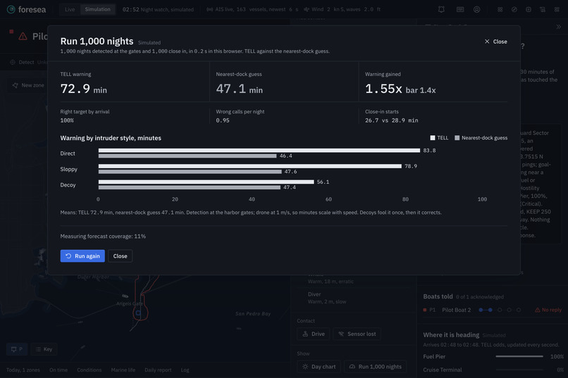
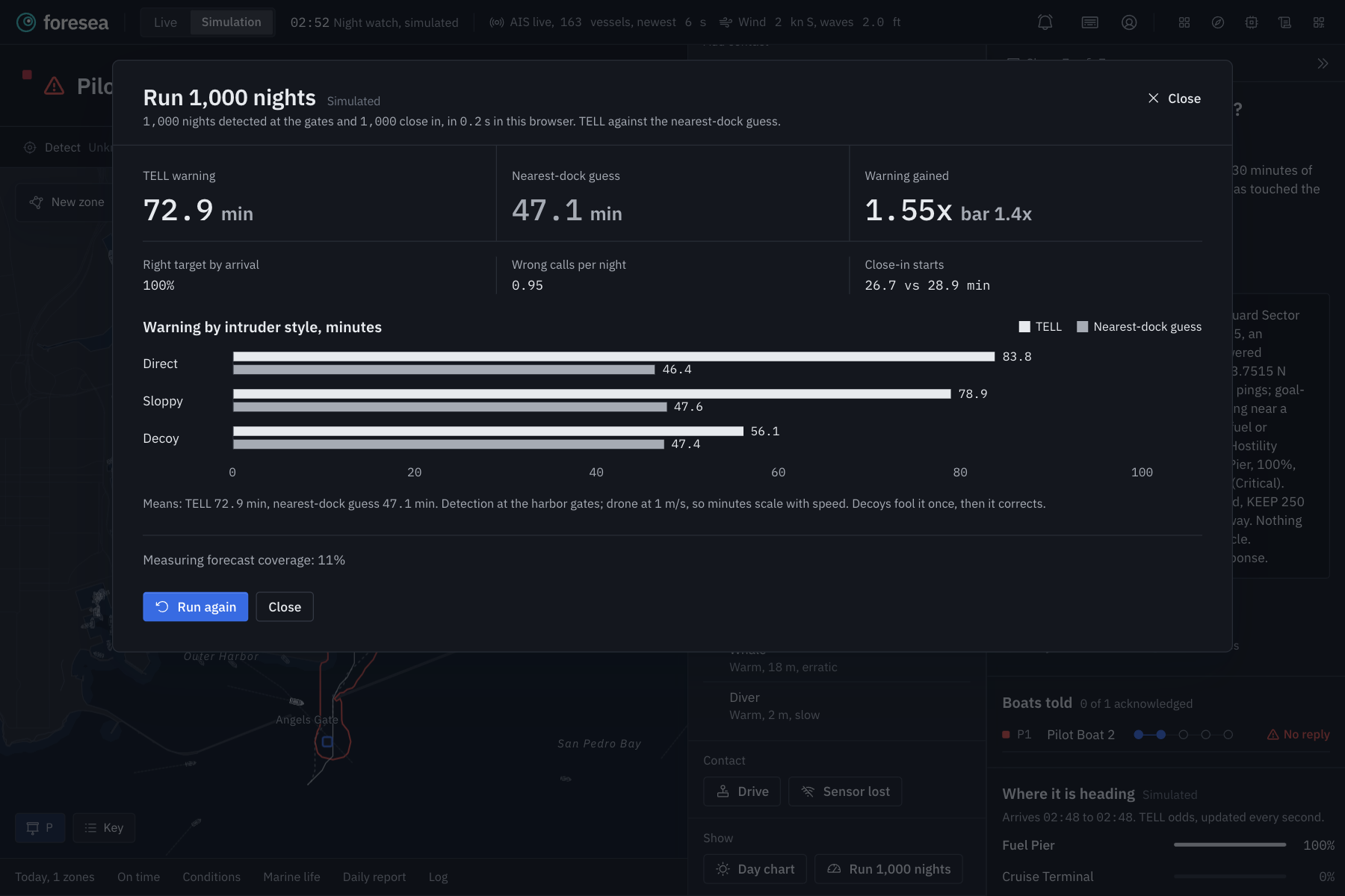
We did not want to just say it works, so we tested it. In 1,000 simulated nights with the drone detected at the harbor gates, Foresea gave about 74 minutes of warning. Just guessing the nearest dock gave about 47 minutes. That is about 1.56 times more warning, and it picked the right target before arrival every single time. When we checked the forecast against the drone's real path, the drone stayed inside the yellow area 97% of the time.
Our traffic model flags only about 0.5% of normal real traffic, but catches 94% of ships that go dark while moving. Five incident scenarios, including a fake out, a lost glider and a late detection, pass every rule we wrote down before we ran them. 353 automated tests and two full end to end walkthroughs with a laptop and two phones pass on every change.
You can grab a joystick on your phone, drive the drone yourself, and watch the desk call your target before you get there, like it will actually predict it no matter where you go.
Only the boats in the path move, each one priced in minutes, and nothing closes. A captain's phone lights up within seconds of the officer tapping Publish, and it still works if the signal drops.
Every number on screen can be traced back to a source or a calculation.
What we learned
The earlier you know, the gentler you can be, since most of the value is not in the actual alarm, it is in moving three boats instead of closing a port.
We also learned to be honest about the weak spot. If the drone is only spotted when it is already very close, guessing the nearest dock is about as good as TELL, because there is no time left to learn anything. Saying that out loud made the rest of our numbers more believable, not less.
What's next for Foresea
We want to sit down with the Port of LA operations team and test it with real officers. Foresea already has a sensor API that accepts detections from real underwater sensors, and it publishes alerts in CAP, the standard format emergency systems already use, so plugging in real hardware is the next step. We would also love to run TELL inside NULL's autonomy simulator and against real drone tracks.
We also want to keep it safe to use. A system like this could be misused to track people or push certain boats out of an area unfairly. Foresea never touches any vehicle, a person approves every public notice, any action can be undone with one tap, and everything is logged with who did it and when and that integrity is one thing thatll stay true no matter what we do next.
Built With
- aisstream.io
- caddy
- claude-code
- express.js
- figma
- hostinger
- ibm
- ibm-granite
- maplibre-gl
- national-weather-service-api
- noaa-co-ops
- noaa-ndbc
- node.js
- ollama
- openstreetmap
- phosphor-icons
- playwright
- pmtiles
- react
- socket.io
- sqlite
- typescript
- vite
- vitest
- web-push


Log in or sign up for Devpost to join the conversation.