-
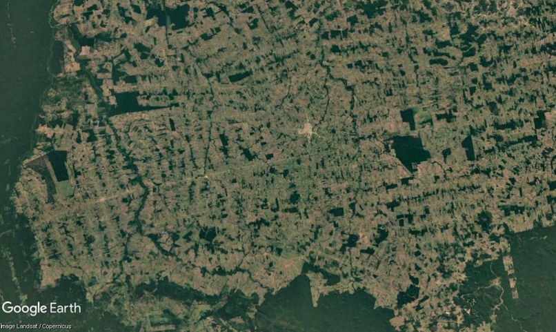
Image to predict
-
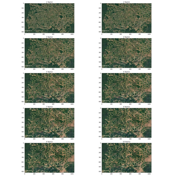
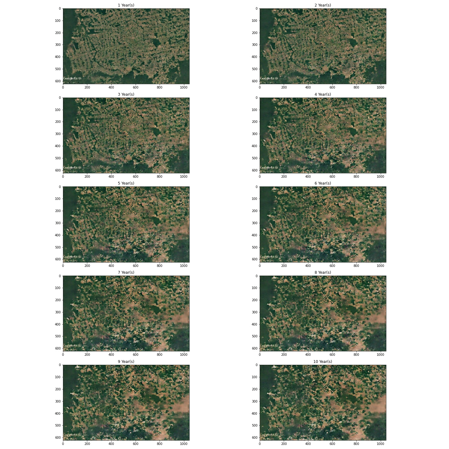
10 years of predictions
-

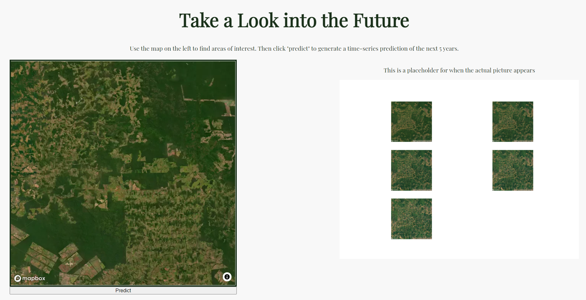
Using Mapbox to select a satellite image and getting predictions from the web app.

Inspiration
The Amazon rainforest has been going through a lot recently, and we wanted to work on a project that would bring increased awareness to our impact on the natural world. Hopefully this will motivate people to learn more about how they can help combat deforestation and other issues that threaten our forests.
What it does
We created a webapp that predicts how the boundaries of deforested areas and the forest would interact with each other over the years.
How we built it
Training data was obtained from historical Google Earth satellite images of various regions of the rainforest. We then trained a pix2pix model to predict what the area would look like in the next year, given the current year's image. For the actual webapp created using Flask, we have an interactive Mapbox map that allows users to select an area of interest, which is then fed into the model. It does successive predictions on previous outputs to obtain predictions for the next 10 years.
Challenges we ran into
There were not as many easily-accessible datasets of before and after or timeseries images of the Amazon. We ended up having to collect a lot of the training data by hand from Google Earth, which was a tedious process.
Accomplishments that we're proud of
We learned how to make a non-ugly(?) website.
What we learned
We got to learn about the pix2pix model and explored the Mapbox API, which is really cool.
What's next for Forecast: Predicting Deforestation in the Amazon
Currently, the model is trained on data about the Amazon. We would like to eventually expand its capabilities to make predictions for other types of forests as well, such as deciduous forests in the US.
Built With
- css3
- flask
- google-colab
- google-earth
- html5
- javascript
- keras
- mapbox
- pix2pix
- python
- tensorflow

Log in or sign up for Devpost to join the conversation.