-
-
FlorCast Logo
-
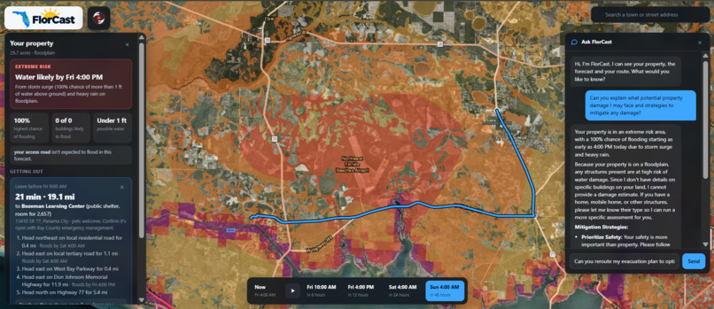
Full View
-
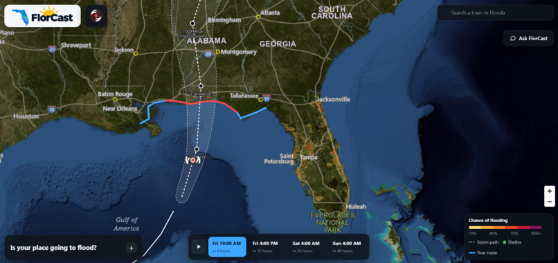
Base Present Flooding View
-
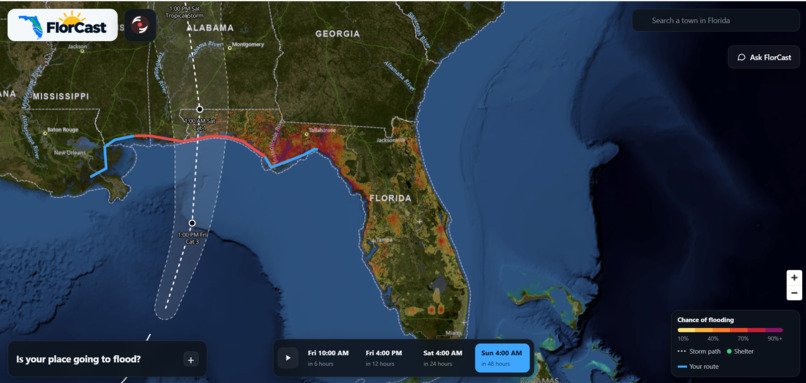
Spatiotemporal Predictions over Time
-
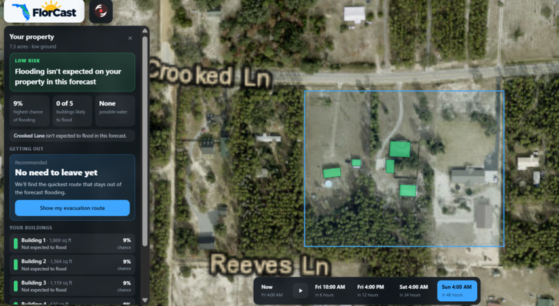
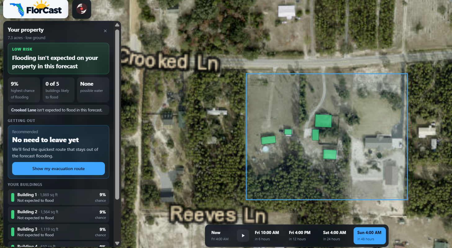
Property Selection and Object Detection
-
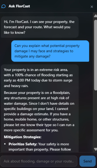
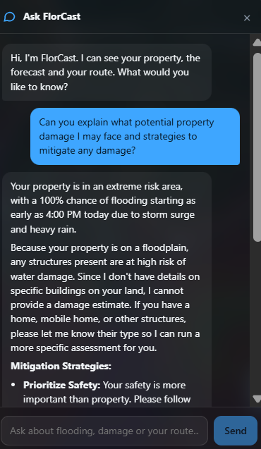
Gemini Powered Chatbot
-
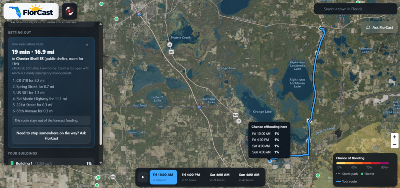
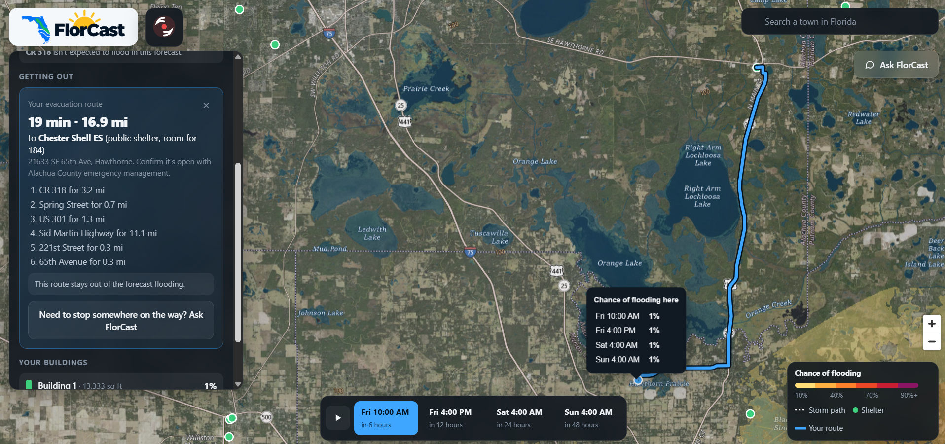
Evacuation route
-
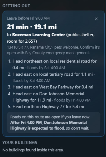
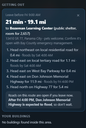
Evacuation Plan
Inspiration
When a hurricane approaches Florida, knowing where the storm is headed is only part of the problem. Families also need to know whether their homes might flood, how much damage their property could face, and whether they'll still have a safe way to evacuate. Most weather forecasts don't answer these questions directly. They show where flooding might occur, but leave people to figure out what that means for their own homes and communities. We built FlorCast to bridge that gap. We wanted to create something that could help people understand its impact and make informed decisions before a storm arrives.
What it does
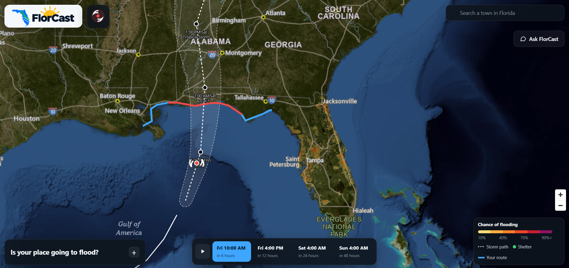
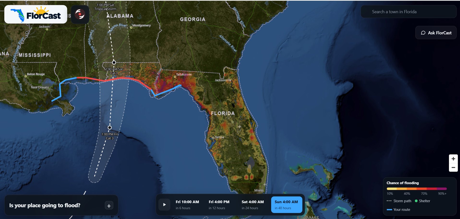
FlorCast is an AI-powered flood forecasting and evacuation planning platform built for Florida. At its core, a trained decision-tree model combines terrain flooding susceptibility with rainfall and storm-surge forecasts to reveal where flood risks may emerge and how they could evolve during a storm.
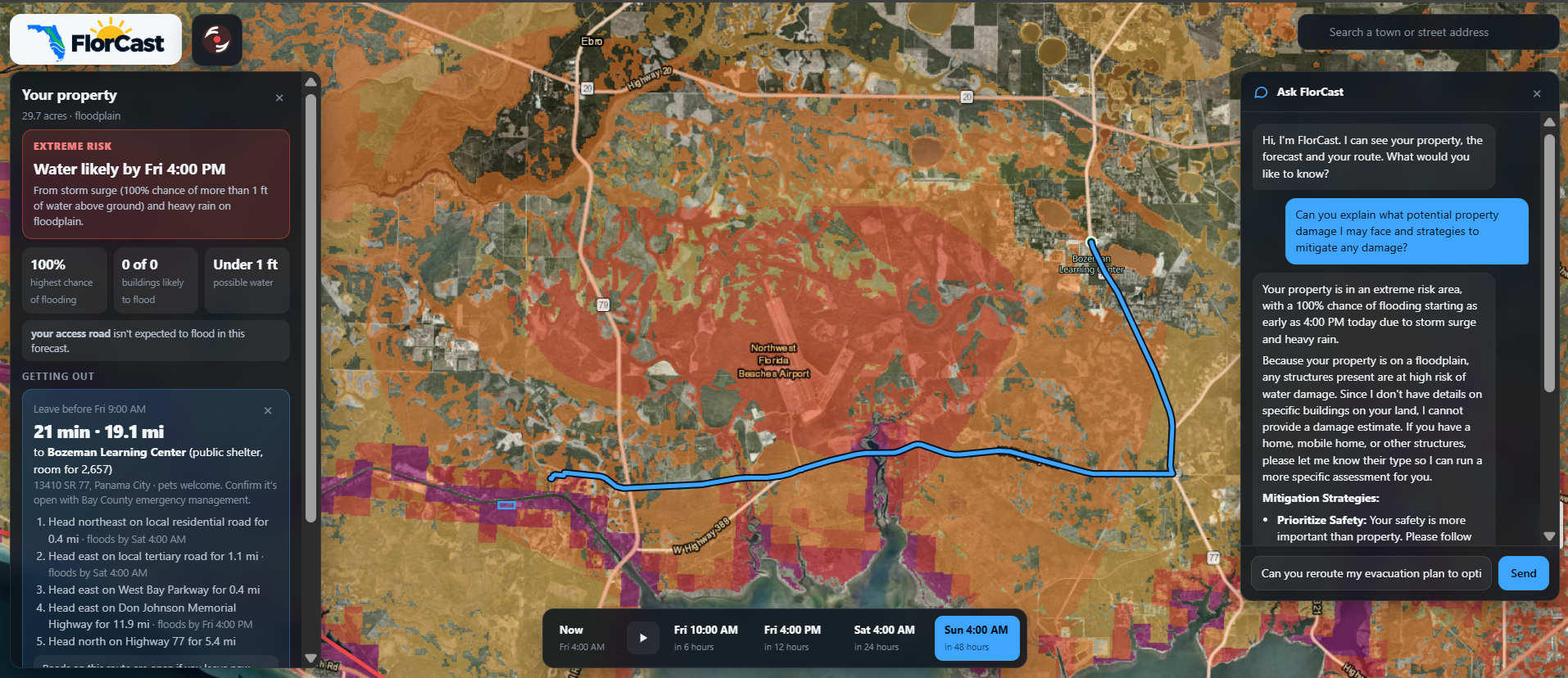
Users can explore an interactive map showing predicted flood risks at 6, 12, 24, and 48 hours into the future. They can select individual buildings or entire properties to see their estimated flood exposure, potential damage, and whether surrounding roads might become impassable.
Beyond forecasting, FlorCast uses AI agents to turn predictions into actionable information. These agents can assess potential property damage, identify nearby shelters, and help plan safer evacuation routes based on predicted flooding.
Users can also interact with FlorCast through a conversational AI assistant. The assistant uses FlorCast's forecasting and routing tools to provide answers grounded in the available data.
How we built it
We built FlorCast with React, TypeScript, and MapLibre GL JS on the frontend, and Python and FastAPI on the backend.
The core of our flood prediction system combines a trained XGBoost decision-tree model that learns terrain flooding susceptibility with probabilistic modeling of rainfall and storm surge. Our forecasting pipeline brings together geographic and weather data, including elevation, waterways, FEMA flood zones, rainfall forecasts, and storm surge information. The resulting predictions are converted into geospatial layers that users can explore directly on the map.
To estimate the impact on specific properties, we use Microsoft's building footprint dataset to identify structures and connect them to predicted flood conditions. We combine estimated water depths with depth to damage relationships to give users an idea of how severely their buildings could be affected.
For evacuation planning, we use the OpenStreetMap road network and shortest path algorithms that account for predicted flooding. FlorCast penalizes roads with higher flood exposure and identify safer alternatives.
We integrated Gemini 3.1 Flash Lite through the Gemini API to power the conversational AI agents. These agents have access to all of the flooding information to create useful and accurate responses.
Challenges we faced
One of our biggest challenges was connecting all the different sources of information needed to forecast flooding. Elevation maps, weather forecasts, river data, and road networks all come in different formats, resolutions, and coordinate systems. Getting them to work together in a single forecasting and mapping pipeline took considerable effort.
Another challenge was handling the amount of geographic data involved. Statewide elevation rasters and road networks are enormous, and processing them naively would make the application too slow to use. We improved performance through compressed datasets, windowed raster reads, caching, and smaller geographic subgraphs for routing.
Accomplishments that we're proud of
Our biggest accomplishment was building a custom model for flood prediction rather than relying entirely on existing forecasting models or external APIs. Developing our own approach to modeling how flooding changes across both space and time was one of the most technically challenging and rewarding parts of the project.
We're also proud of how many addition features we added. Instead of stopping at a flood risk map, we built a system that can estimate property damage, evaluate road conditions, and recommend safer evacuation routes.
What we learned
We learned a lot about combining machine learning with AI agents. The machine learning model provides flood predictions, while the agents use those predictions alongside geographic and property data to help users make decisions. Keeping these responsibilities separate made the system easier to reason about and test.
What's next for FlorCast
Our next priority is improving the accuracy and reliability of our flood predictions. We want to expand our model's training data, validate predictions against real flooding events, and improve how the system communicates uncertainty.
Longer term, we'd like to expand FlorCast beyond Florida and make it useful for other flood prone regions. Our goal is to keep developing a system that doesn't just show people where flooding might happen, but helps them understand what to do about it.


Log in or sign up for Devpost to join the conversation.