-
-
Data Sources, AI And Technology Stack
-
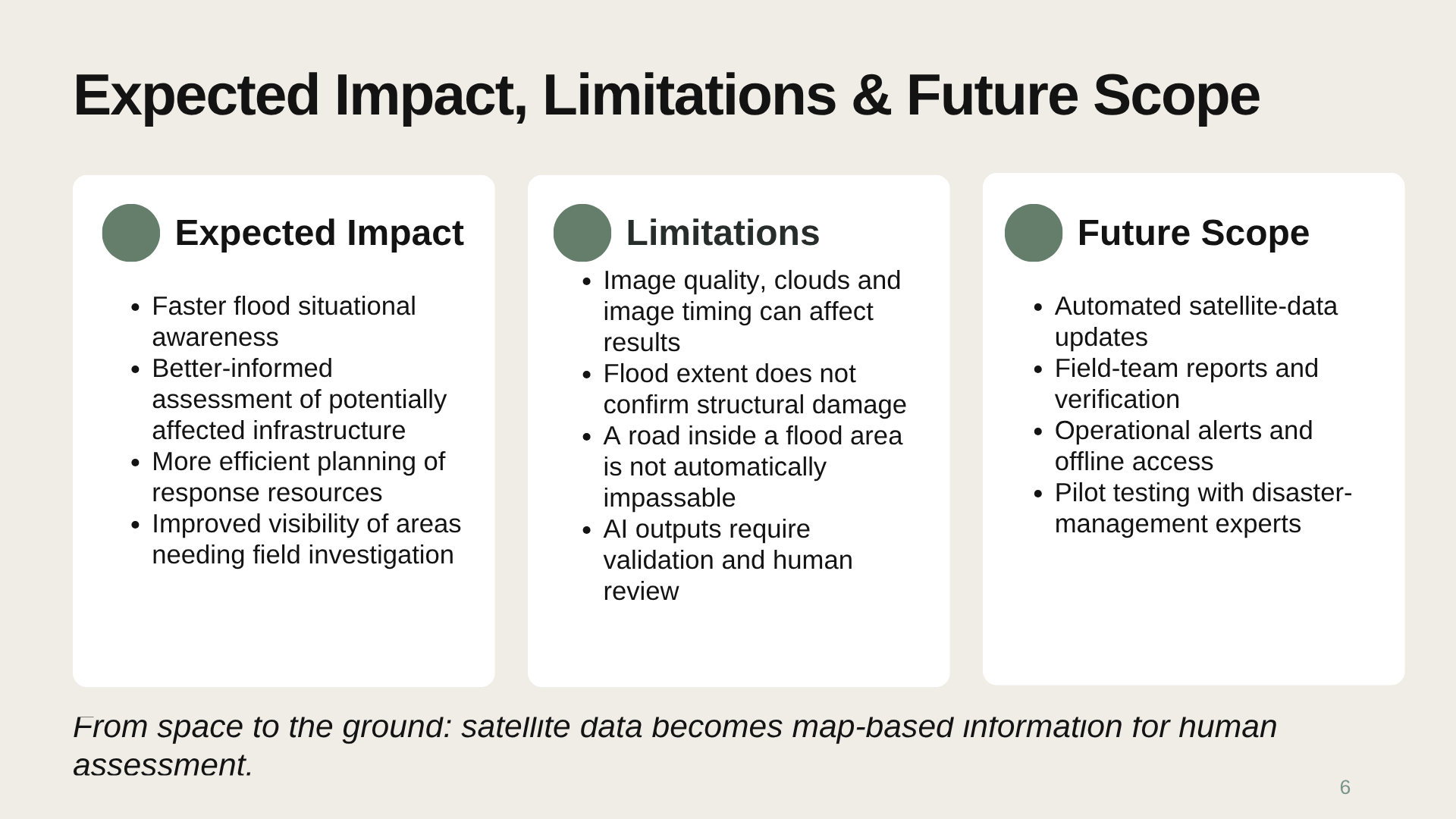
Expected Impact, Limitations And Future Scope
-
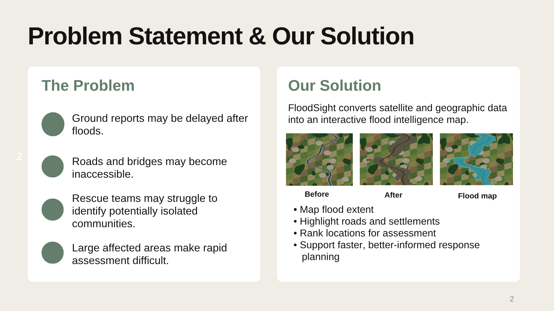
Problem Statement And Solution
-
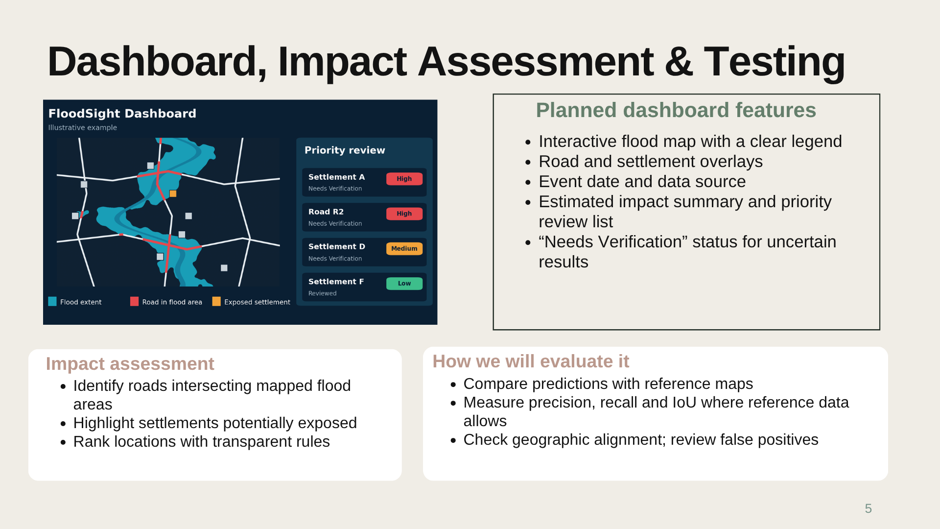
Dashboard , Impact Assessment And Testing
-
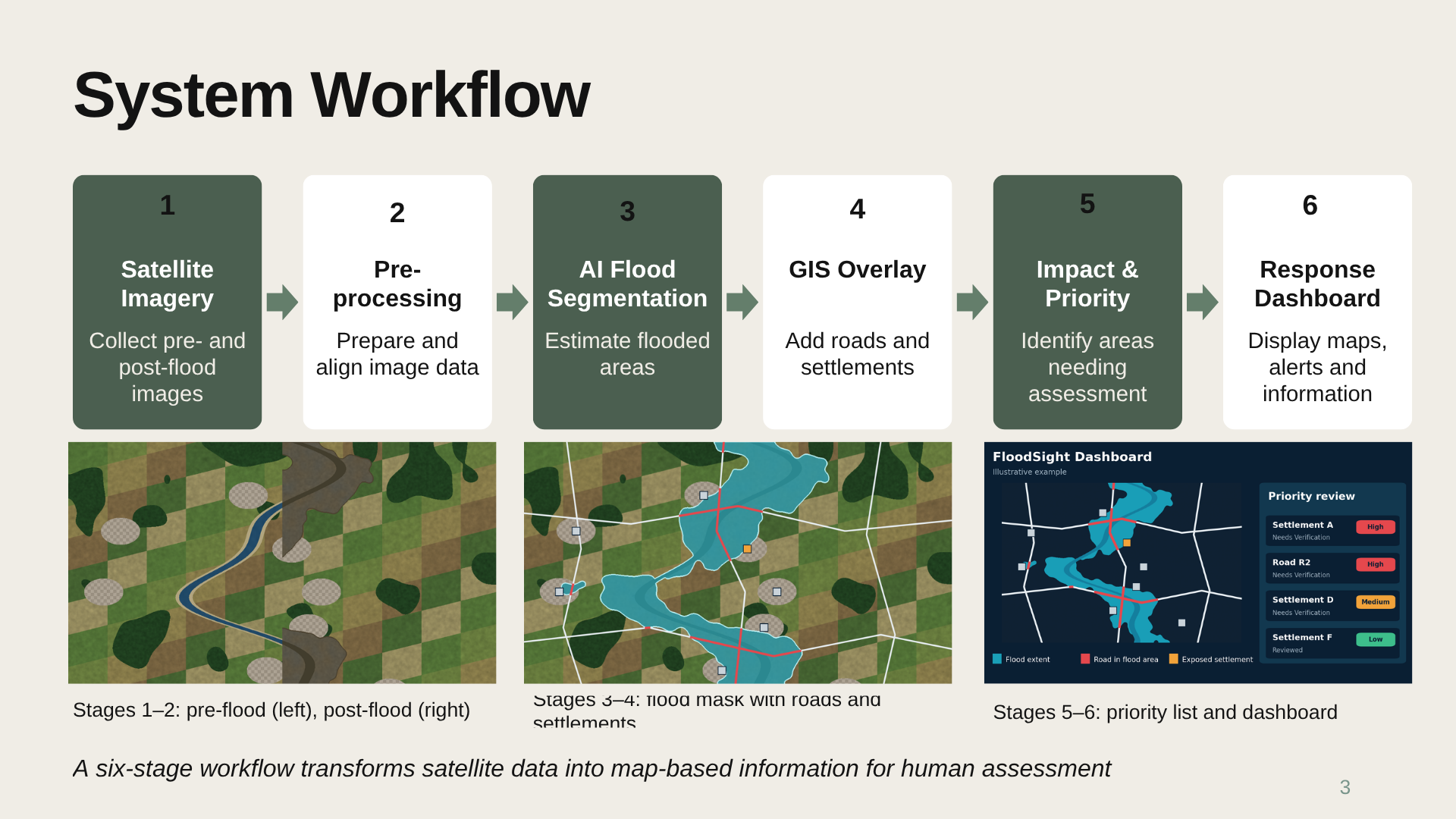
System Workflow
-
Title Page
-
Dashboard Mockup
Inspiration
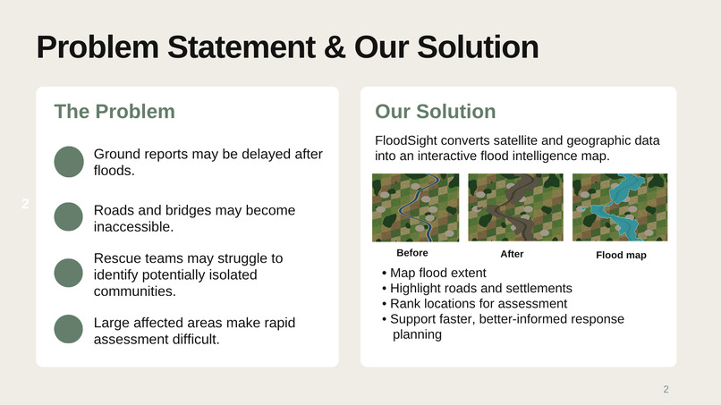
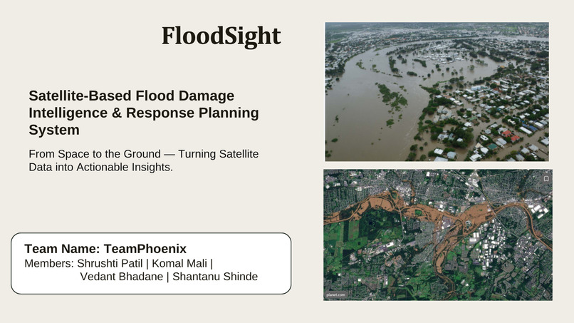
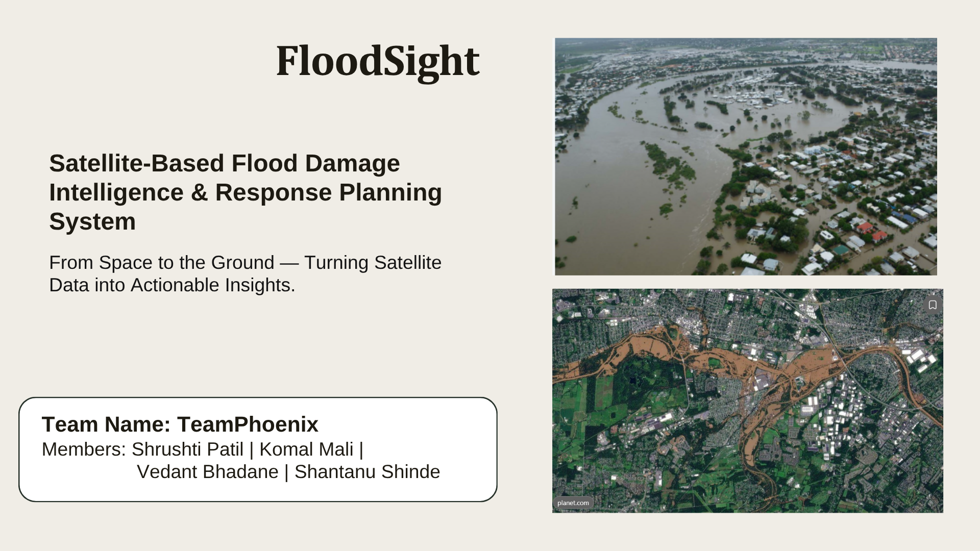
Floods can damage roads, bridges, and other infrastructure while disrupting communication and delaying rescue operations. We were inspired to explore how satellite imagery and artificial intelligence could help disaster-response teams understand potentially affected areas faster. This led us to develop the idea of FloodSight, a satellite-based flood mapping and response planning system.
What it does
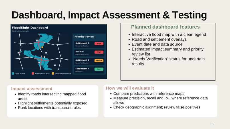
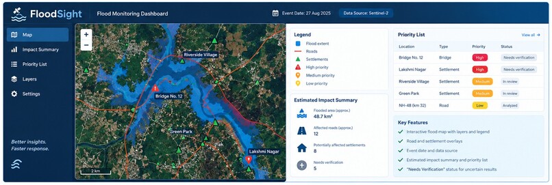
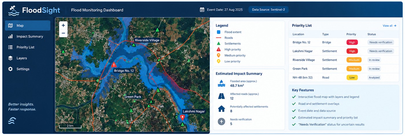
FloodSight aims to identify flooded areas from satellite imagery and combine this information with geographic data about roads and settlements. Its proposed dashboard will help users visualize flood extent, identify potentially affected locations, and prioritize areas for further investigation.
How we built it
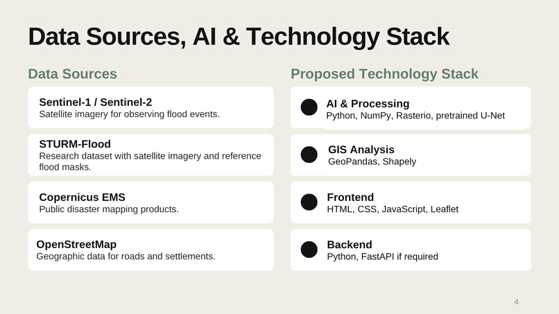
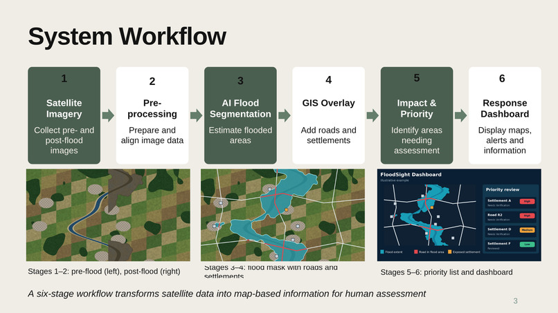
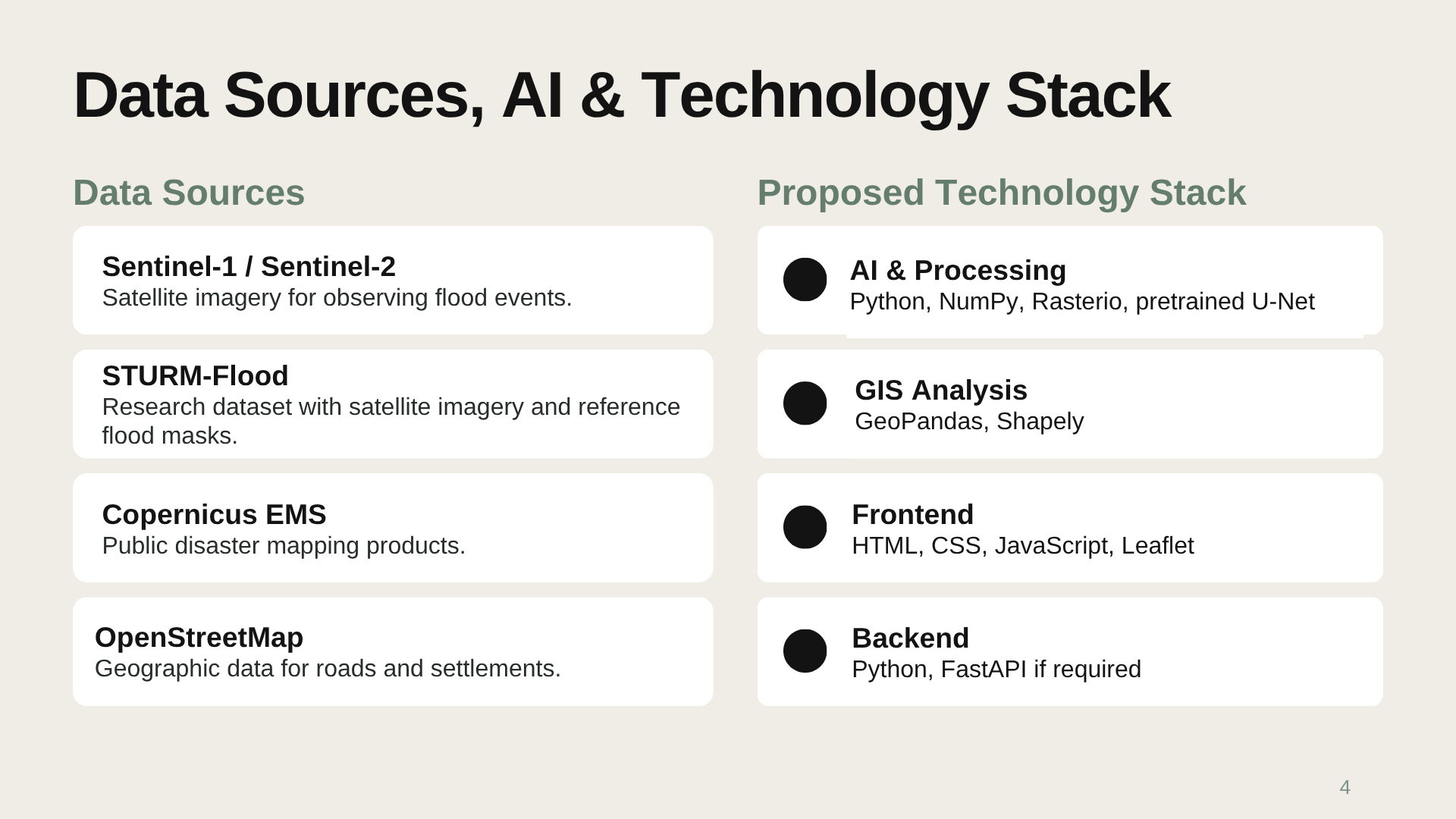
Our proposed approach combines publicly available satellite imagery, flood reference datasets, and OpenStreetMap geographic data. We plan to use Python for image processing, an AI-based flood segmentation model to estimate flooded areas, and GIS tools to analyze nearby infrastructure. An interactive map dashboard will present the results in an easy-to-understand format.
Challenges we ran into
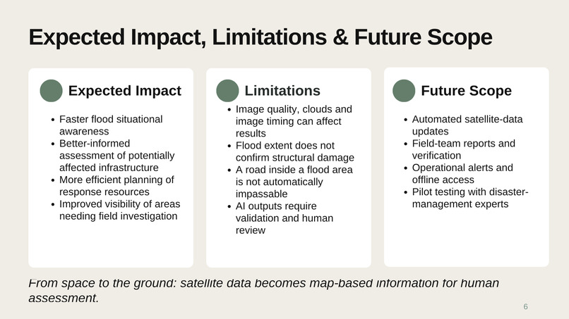
Some of the key challenges include finding suitable satellite imagery, aligning geographic data correctly, handling image quality limitations, and distinguishing estimated flood extent from confirmed infrastructure damage. We recognize that AI predictions can contain errors and that field verification is essential before making critical decisions.
Accomplishments that we're proud of
- Developed a practical solution concept that connects satellite imagery, AI-assisted flood mapping, and geographic data for disaster-response planning.
- Designed a clear six-stage workflow, from satellite data collection to an interactive response dashboard.
- Identified publicly available datasets and suitable technologies for building a feasible prototype.
- Focused on real-world usefulness by highlighting potentially affected roads and settlements rather than only displaying flood maps.
- Prioritized transparency and responsible AI by recognizing the need for human verification of predicted flood impacts.
- Established a foundation for future development, testing, and potential real-world deployment.
What we learned
Through this project, we are exploring satellite image processing, AI-assisted flood mapping, geographic information systems, and interactive dashboard development. We are also learning how to convert technical data into information that can support real-world decision-making.
What's next for FloodSight: AI-Powered Flood Mapping
Our next step is to turn FloodSight into a working prototype by integrating satellite imagery, AI-based flood segmentation, geographic data, and an interactive dashboard.
We plan to:
- Improve flood detection: Test AI models against reference flood maps and evaluate their accuracy.
- Expand impact analysis: Identify potentially affected roads and settlements using geographic overlays.
- Build an interactive dashboard: Display flood extent, event details, priority areas, and verification status.
- Validate results: Compare predictions with available reference data and seek feedback from disaster-management experts.
- Explore real-world deployment: Investigate integration with updated satellite data, field reports, and emergency-response workflows.
Our long-term vision is to make FloodSight a reliable decision-support tool that helps disaster-response teams gain faster situational awareness and plan assessments more effectively. AI-generated results will remain estimates until validated, and field verification will be essential for critical decisions.
Built With
- analysis
- artificial
- css
- data
- disaster
- fastapi
- geopandas
- geospatial
- gis
- html
- imagery
- intelligence
- javascript
- leaflet.js
- learning
- machine
- management
- numpy
- openstreetmap
- python
- remote
- satellite
- sensing
- shapely
- vision

Log in or sign up for Devpost to join the conversation.