-
-
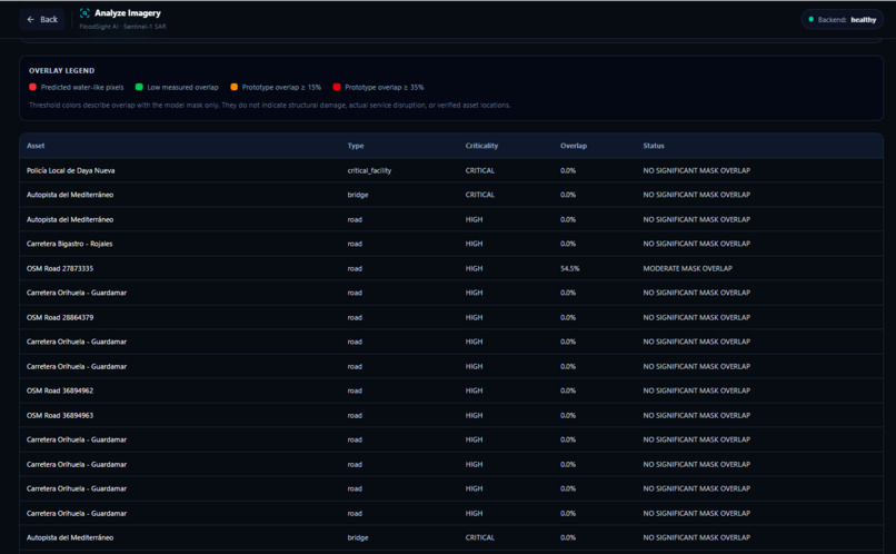
-
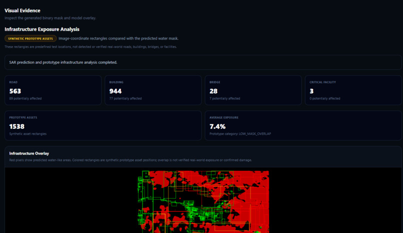
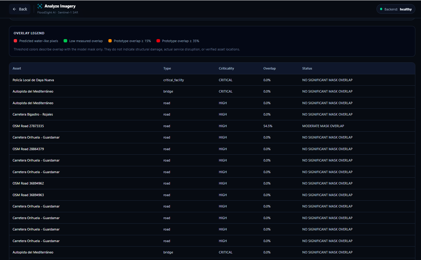
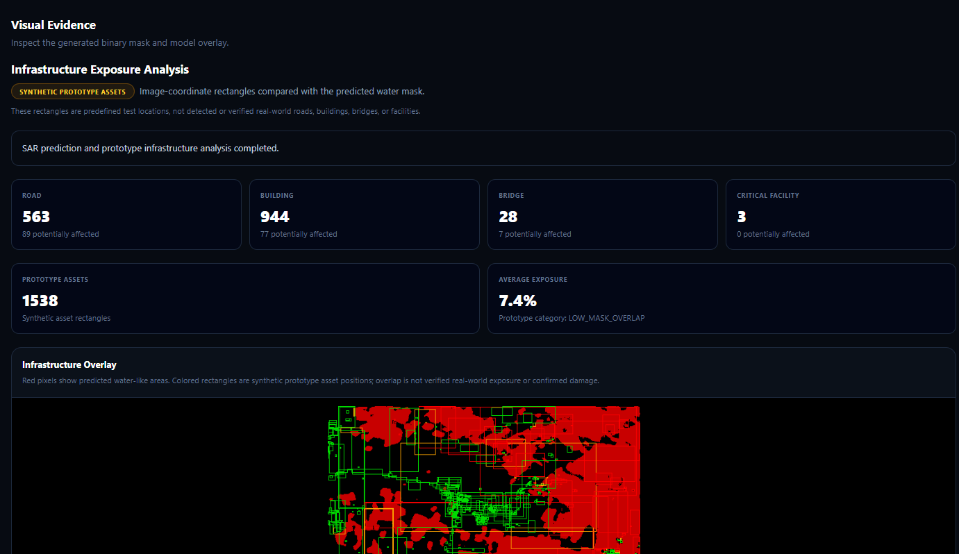
Infrastructure Overlay
-
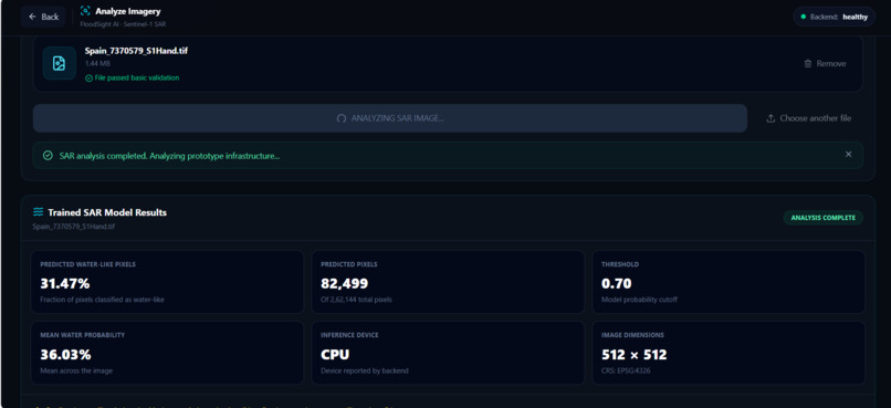
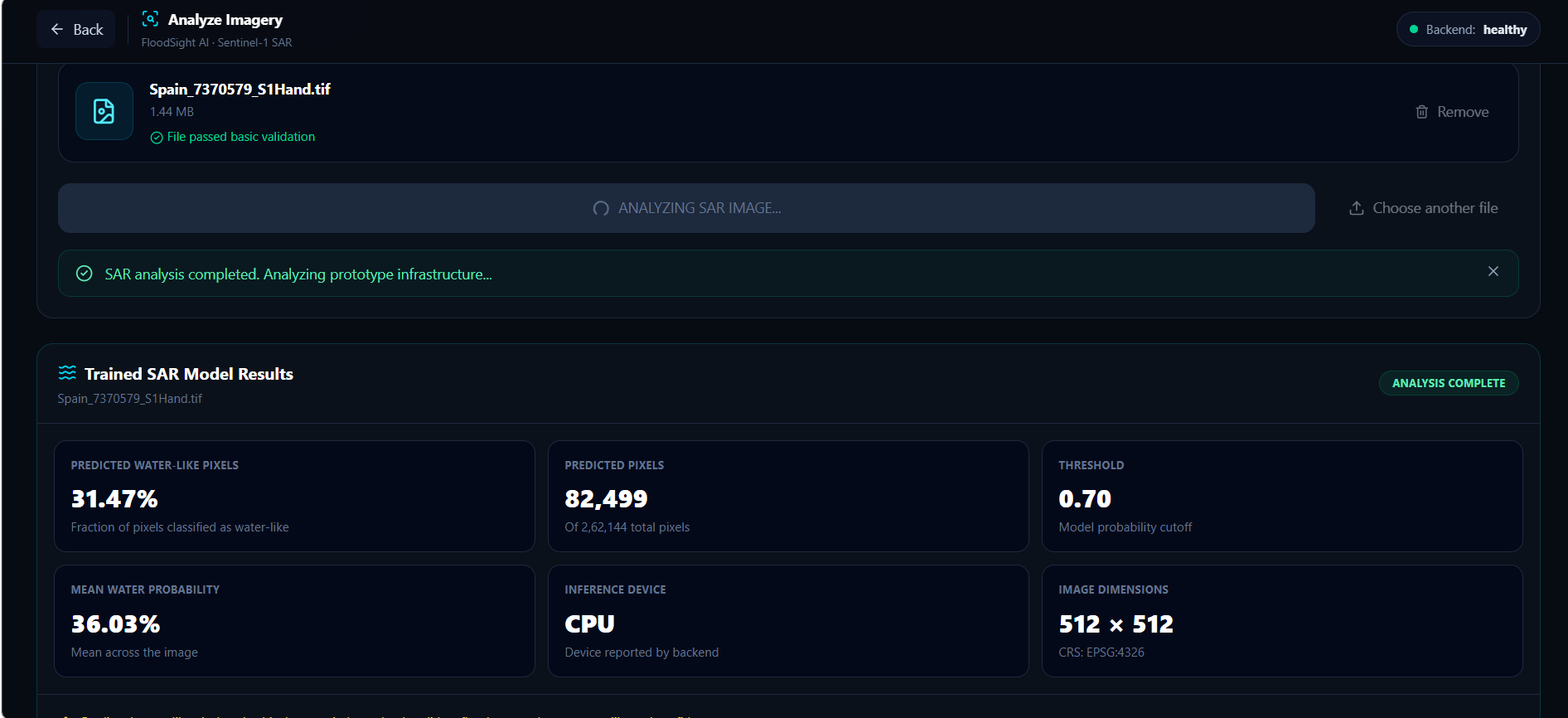
Trained SAR Model Results
-
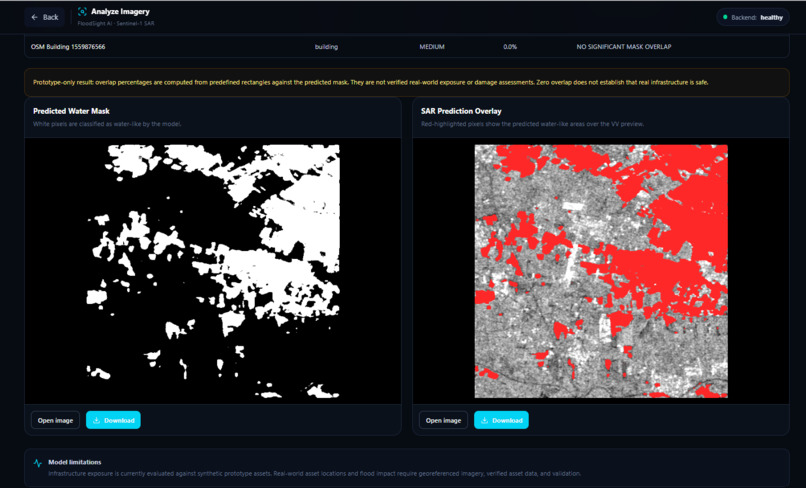
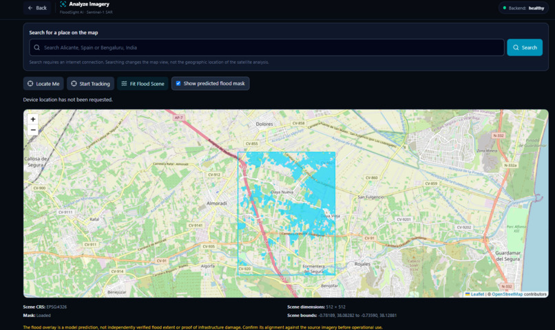
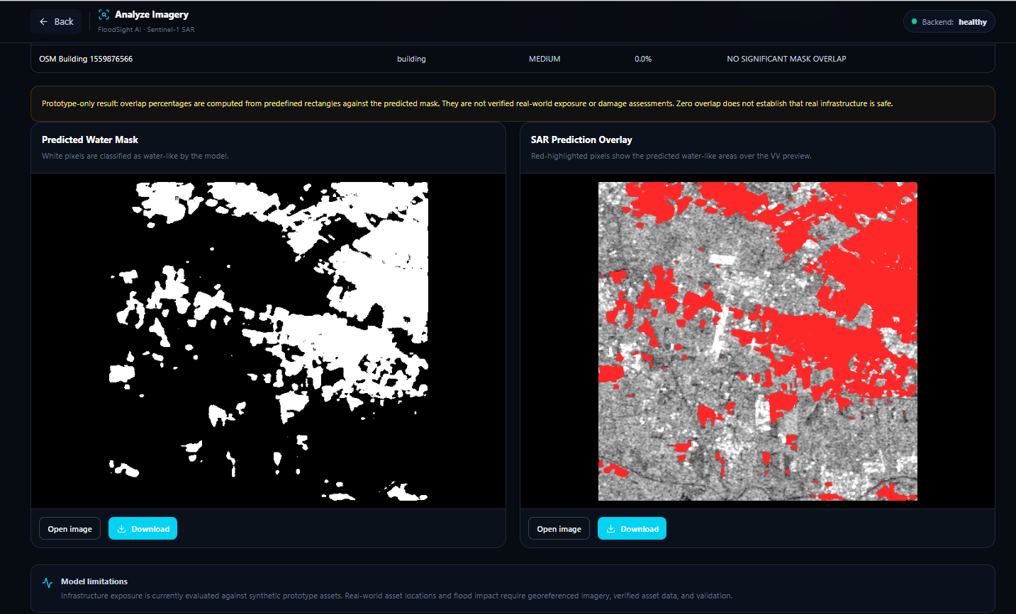
Predicted Flood Mask and SAR Overlay
-
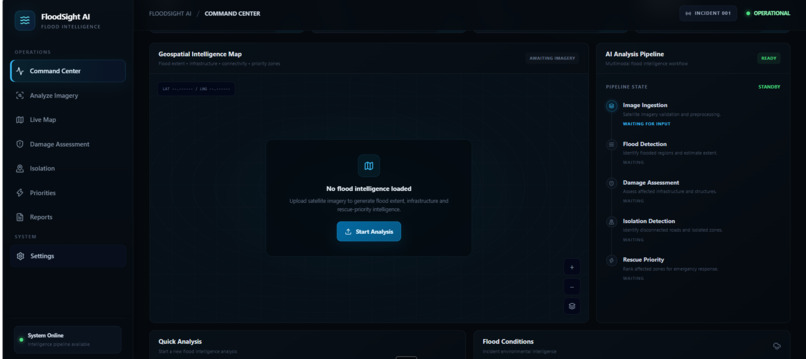
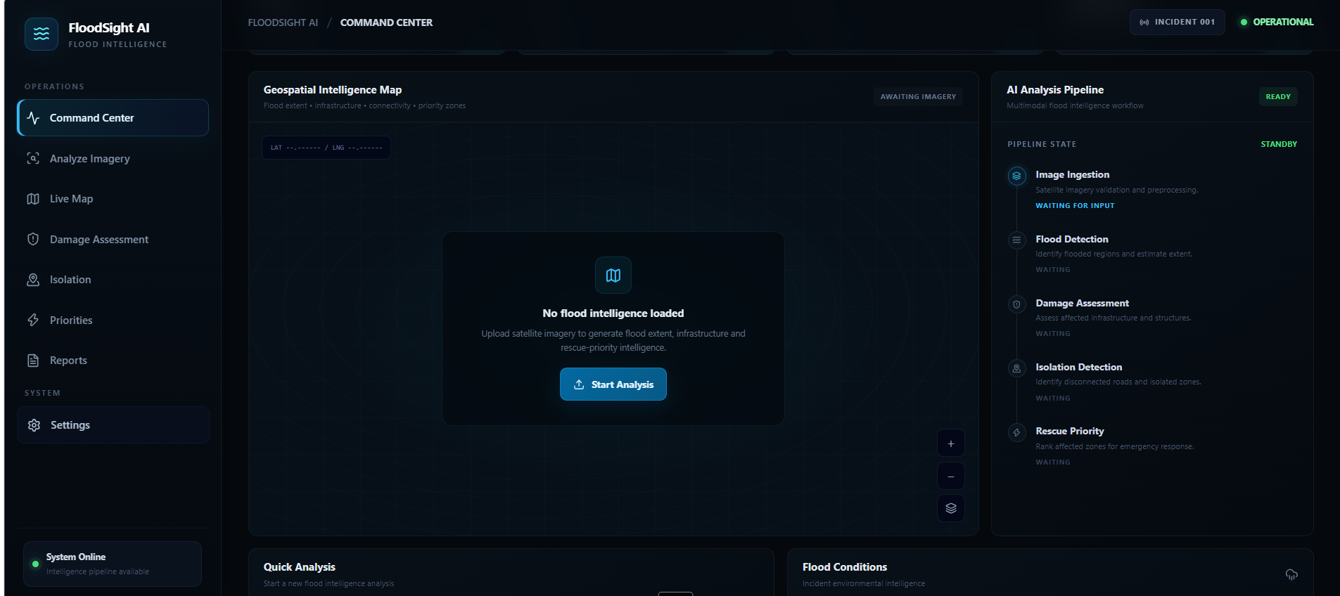
Command Centre
-
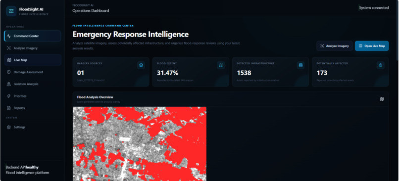
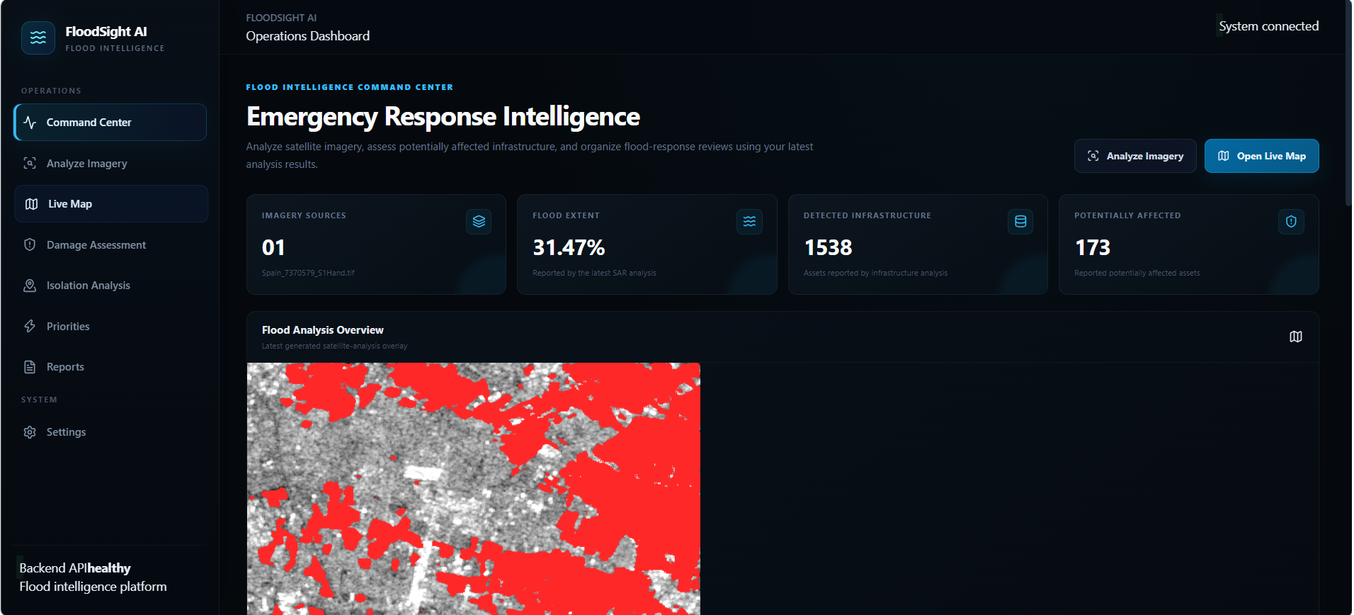
Operations Dashboard System connected Flood Intelligence Command Center Emergency Response Intelligence
-
Infrastructure Exposure Analysis
FloodSight AI — AI-Powered Flood Damage Mapping and Emergency Intelligence
Inspiration Floods can devastate communities within hours, damaging infrastructure, disrupting transportation, and making emergency response difficult. During a flood, responders need more than satellite images—they need actionable information about where flooding may be occurring and which infrastructure could be exposed.
We were inspired to explore how Artificial Intelligence, satellite imagery, and geospatial analysis could help transform complex Earth-observation data into understandable flood intelligence. Our goal was to build a platform that could help responders visualize potential flood-affected areas and identify infrastructure that may require further assessment.
This led us to "FloodSight AI", a prototype designed to connect satellite-based flood detection with infrastructure exposure analysis in a single interface.
What it does FloodSight AI is an AI-powered flood-mapping and emergency intelligence platform that analyzes georeferenced Sentinel-1 SAR imagery and presents the results through an interactive dashboard.
Key capabilities include:
- AI-based flood mapping: Uses a trained U-Net model to generate a predicted water mask from Sentinel-1 SAR imagery.
- Flood coverage estimation: Calculates the percentage of image pixels classified as water by the model.
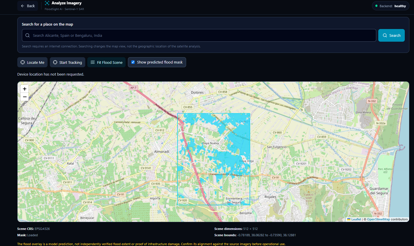
- Geospatial visualization: Displays the flood mask over a geographic map using the image's coordinate reference system and geographic bounds.
- Infrastructure exposure analysis: Integrates OpenStreetMap data to identify mapped roads, bridges, buildings, and critical facilities within the analyzed region and assess their overlap with the predicted flood mask.
- Isolation Analysis: Presents infrastructure records and approximate geographic coordinates derived from raster geometry when direct asset coordinates are unavailable. These estimates require validation and do not independently prove road or community isolation.
- Response prioritization: Organizes infrastructure records using available criticality and risk fields to support further investigation.
- Report generation:Exports saved analysis results as JSON and infrastructure records as CSV.
FloodSight AI is a decision-support prototype. Its predictions and exposure estimates require validation before being used for real-world emergency decisions.
How we built it We built FloodSight AI using a modular frontend and backend architecture.
AI and satellite analysis
We integrated a trained U-Net model for Sentinel-1 SAR imagery to generate a predicted water mask and estimate flood coverage. The backend returns analysis metadata, pixel counts, flood percentage, and mask and overlay resources.
Backend
We used Python and FastAPI to expose the analysis pipeline through API endpoints. The backend also handles geospatial metadata and infrastructure analysis results.
Geospatial and infrastructure analysis
We used georeferenced raster metadata, including geographic bounds and the EPSG:4326 coordinate reference system, to position the flood scene on an interactive map. We integrated OpenStreetMap data through the Overpass API to retrieve infrastructure features and assess their spatial overlap with the predicted flood mask.
Frontend and visualization
We developed the interface using React, TypeScript, and Vite. The application includes a dashboard, satellite scene explorer, damage assessment view, isolation analysis, response priorities, and report export functionality.
We also implemented browser-based persistence for analysis results so that users can navigate between operational views without immediately losing their current results.
Challenges we ran into One of our biggest challenges was connecting the AI output to a reliable geospatial visualization. Producing a flood mask is only one part of the problem; positioning it correctly on a map requires consistent image dimensions, geographic bounds, coordinate transformations, and raster orientation.
We also encountered integration challenges between the backend response schema and the frontend components. Some fields, such as image dimensions and infrastructure coordinates, needed to be mapped correctly to ensure that the dashboard and operational pages displayed the available data.
Another challenge was integrating infrastructure features from OpenStreetMap with the predicted flood mask. Infrastructure records may contain pixel-space geometry rather than direct latitude and longitude fields, requiring careful handling of coordinate estimates and their limitations.
Finally, we had to distinguish between visualizing potentially affected infrastructure and proving that a road or community was physically isolated. Reliable isolation assessment requires road-network connectivity and accessibility analysis, which goes beyond simple spatial overlap.
These challenges taught us to prioritize data consistency, transparent limitations, and end-to-end testing rather than relying on visual output alone.
Accomplishments that we're proud of
- Built a working end-to-end prototype connecting a trained Sentinel-1 SAR model to a web-based flood intelligence interface.
- Integrated predicted flood masks, flood coverage estimates, and geospatial metadata into an interactive map.
- Connected OpenStreetMap infrastructure records with the flood analysis workflow.
- Implemented multiple operational views for examining flood predictions, infrastructure exposure, and response priorities.
- Added JSON and CSV export functionality for saved analysis results.
- Resolved frontend integration issues and verified that the project passes linting and the production build.
- Established consistency between the model-reported flood percentage and the percentage calculated from its predicted water-pixel count.
We are particularly proud of bringing AI inference, geospatial visualization, and infrastructure data together in one prototype while making the limitations of the current analysis explicit.
What we learned Through FloodSight AI, we learned that building a useful AI system involves much more than integrating a model.
We gained practical experience with Sentinel-1 SAR imagery, U-Net-based segmentation, FastAPI, React, TypeScript, geospatial metadata, coordinate reference systems, and OpenStreetMap integration.
We also learned the importance of validating data across system boundaries, debugging API-to-frontend mismatches, and checking that numerical outputs are internally consistent.
Most importantly, we learned that a predicted flood map is not automatically a validated flood map, and infrastructure overlap is not automatically proof of isolation. Real-world reliability requires reference data, geospatial validation, uncertainty assessment, and network analysis.
What's next for FloodSight AI Our next goal is to evolve FloodSight AI from a working prototype into a more thoroughly validated flood intelligence platform.
Planned improvements include:
- Stronger scientific validation: Compare predictions against suitable reference flood maps and evaluate segmentation performance using metrics such as Intersection over Union (IoU), precision, recall, and F1-score.
- Improved geospatial accuracy:Validate raster alignment, pixel-to-coordinate transformations, mask orientation, and infrastructure locations against the original source data.
- Road-network isolation analysis: Integrate road-network connectivity and flood-related accessibility analysis to identify potentially disconnected routes and communities.
- More reliable infrastructure assessment:Improve asset-level exposure calculations and distinguish predicted overlap from verified damage.
- Enhanced emergency prioritization:Incorporate transparent criteria such as infrastructure criticality, predicted exposure, accessibility, and data confidence.
- Broader testing:Evaluate the platform on additional georeferenced satellite scenes and flood events.
- Improved reporting: Include map outputs, analysis metadata, confidence information, and validation results in downloadable reports.
Our long-term vision is to make FloodSight AI a transparent and accessible decision-support tool that helps emergency teams turn satellite observations into timely, geographically grounded information for flood response.
Built With
- fastapi
- geotiff
- javascript
- leaflet.js
- machine-learning
- openstreetmap
- overpassapi
- python
- pytorch
- react
- remotesensing
- restapi
- typescript
- unet
- vite

Log in or sign up for Devpost to join the conversation.