-
-
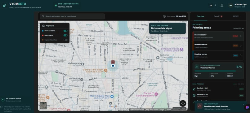
See the flood. Find the stranded. Route the rescue
-
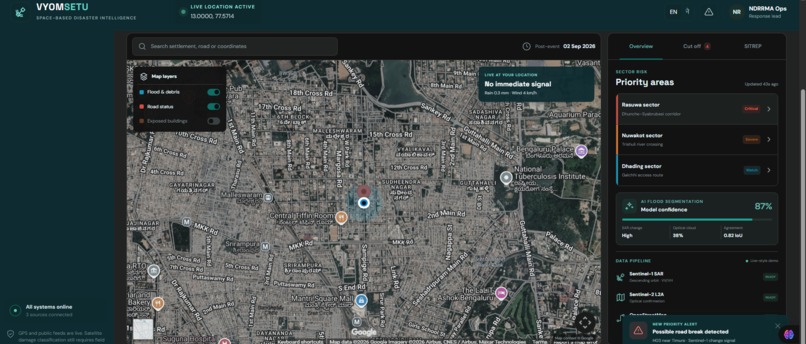
Live satellite image of my current location.
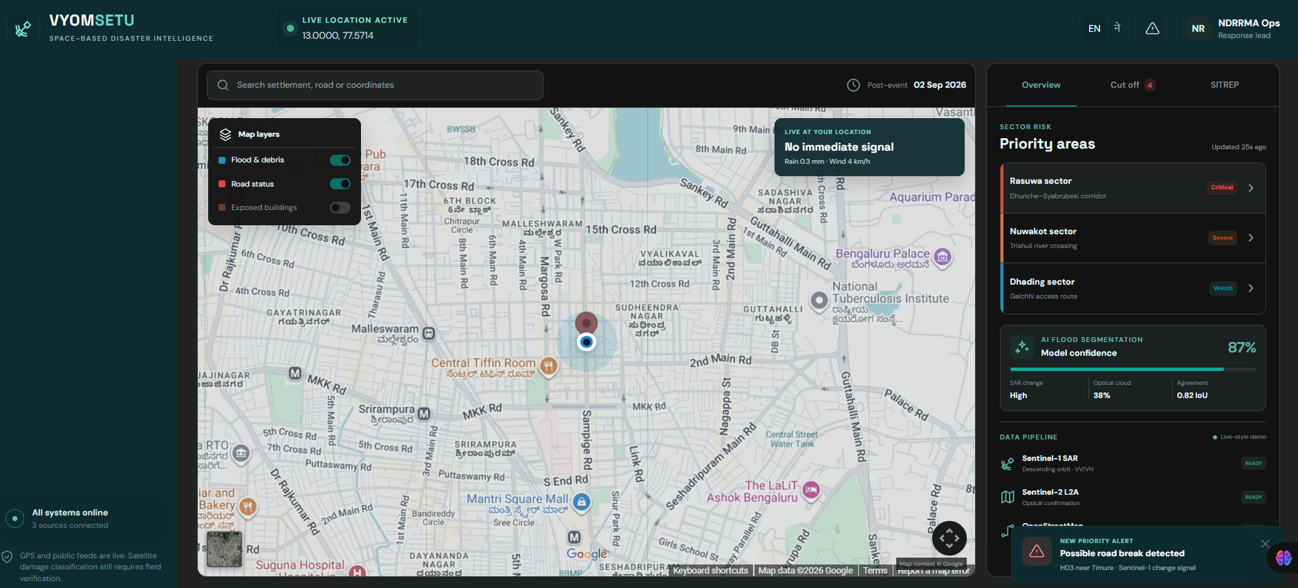
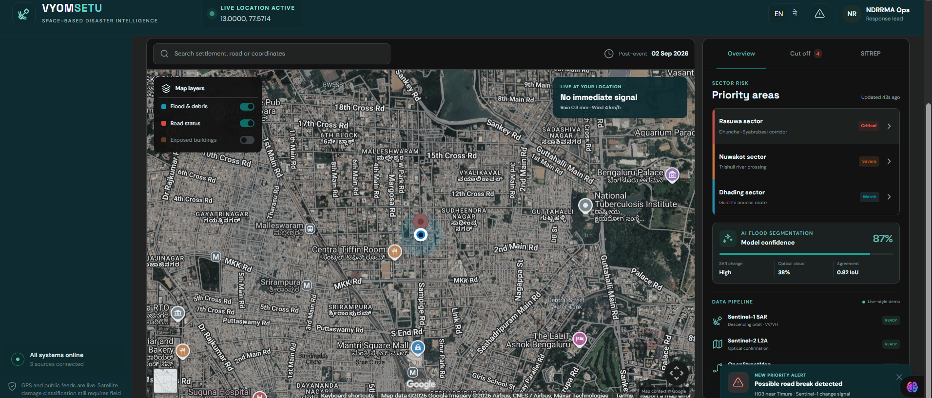
Inspiration: Floods can destroy roads, isolate communities, damage bridges, and disrupt communication infrastructure within hours. During a disaster, responders cannot afford to wait for manual damage surveys or outdated maps. I wanted to build a system that answers three critical questions as quickly as possible: What has been damaged? Who may be cut off? And where can rescuers safely go? That idea became FloodSentinel AI — a disaster intelligence platform that combines satellite imagery, AI-based flood and damage analysis, geographic data, and interactive maps to turn raw disaster information into actionable rescue intelligence.
What it does: FloodSentinel AI analyzes flood-affected areas and presents the results on an interactive map designed for both emergency responders and affected users. The system can:
- Detect and visualize flood-affected regions from satellite imagery.
- Identify potentially damaged or inaccessible roads and bridges.
- Compare affected infrastructure with the surrounding road network.
- Identify communities, buildings, hospitals, shelters, and other important locations that may become isolated.
- Display affected areas and infrastructure on a map.
- Generate an emergency-focused view showing danger zones, blocked routes, affected infrastructure, and accessible alternatives.
- Provide alerts when important locations or routes are potentially affected.
- Help responders prioritize areas where assistance may be needed most urgently.
- Provide a responsive interface designed for mobile phones, tablets, laptops, and vehicle/dashboard displays.
The goal is simple: See the damage → understand the impact → identify who is isolated → find the safest available route → act faster.
How we built it: FloodSentinel AI was designed as a modular geospatial AI system. The workflow begins with satellite and geographic data. The AI analysis layer processes imagery to identify flood-affected areas and potential infrastructure damage. These results are converted into geographic features and displayed on an interactive mapping interface. The platform combines: Satellite/remote-sensing data → AI image analysis → geospatial processing → infrastructure impact analysis → map visualization → emergency alerts and routing Google Maps provides the familiar geographic interface and road-network context, while the AI layer adds disaster-specific intelligence on top of the map. The frontend is designed responsively so the same core system can operate across Android, iOS, desktop browsers, and vehicle dashboard-sized displays. The architecture was intentionally designed around independent modules so that additional satellite providers, AI models, emergency data sources, and routing systems can be integrated without rebuilding the entire application.
Challenges we ran into: The biggest challenge was turning complex geospatial information into something that a person can understand during an emergency. Satellite imagery can contain clouds, shadows, water reflections, changing image quality, and differences between images captured before and after a flood. Infrastructure damage also cannot always be confirmed from imagery alone. Another challenge was translating an AI prediction into a useful emergency decision. Detecting water is only the beginning. The important question is whether that water affects a road, bridge, hospital, shelter, or community. We therefore focused on presenting AI results with clear confidence information and geographic context rather than treating every prediction as absolute ground truth. Designing one interface for completely different users was another challenge. A disaster-management professional may need detailed layers and analytics, while a person inside a vehicle needs a simple, readable route and warning.
Accomplishments that we're proud of: The biggest accomplishment is turning a complex remote-sensing problem into an intuitive emergency intelligence experience. FloodSentinel AI brings together several normally separate capabilities:
- Flood-area intelligence
- Infrastructure impact analysis
- Isolation-risk identification
- Interactive geospatial visualization
- Emergency prioritization
- Route awareness
- Location-based alerts
- Responsive multi-device design I am especially proud of the idea that the system does not stop at this area is flooded. It tries to answer the much more useful emergency question:
What does this flood mean for people and infrastructure, and what should responders look at next? As a solo developer, building the concept across AI, geospatial analysis, mapping, responsive UI, and emergency-oriented UX was itself a major accomplishment.
What we learned: I learned that solving a real-world disaster problem requires much more than an accurate AI model. A useful disaster system must combine: AI accuracy + geographic context + uncertainty + usability + speed + human decision-making. We also learned that AI predictions should support emergency decisions rather than blindly replace human judgment. The project reinforced the importance of designing for stressful environments. During an emergency, information needs to be visual, prioritized, understandable, and actionable within seconds. Most importantly, I learned that the strongest AI applications are not necessarily the ones that produce the most information — they are the ones that help people make the right decision faster.
What's next for FloodSentinel AI
The next stage is to evolve FloodSentinel AI from a disaster-mapping platform into a continuously updating AI emergency intelligence network. Future versions could include:
- Near-real-time satellite imagery ingestion.
- Automatic before/after satellite comparison.
- More advanced road and bridge damage detection.
- AI-based flood-depth and severity estimation.
- Population and building-level isolation-risk estimation.
- Integration with official emergency-management and weather feeds.
- Dynamic route risk scoring.
- Automatic safe-route recalculation as conditions change.
- Multilingual emergency notifications.
- Offline/low-connectivity emergency operation.
- SOS and responder coordination features.
- Drone and ground-camera data integration.
- Predictive flood-spread modeling.
- A dedicated emergency-response dashboard.
- Integration with connected vehicles and emergency fleets.
The long-term vision is simple: FloodSentinel AI should become a digital emergency layer between what is happening on the ground and the people who need to respond.
From satellite imagery to situational awareness. From situational awareness to action. From action to faster rescue.

Log in or sign up for Devpost to join the conversation.