Inspiration
During floods, rescue teams need to know which areas are affected, which roads may be damaged, and which villages have lost access to nearby towns or hospitals. However, heavy rainfall and damaged communication networks can make it difficult to collect information from the affected areas.
This inspired us to develop "FloodScope", a satellite-based flood damage mapping system that can help rescue teams understand the situation even when information from the ground is limited.
What it does
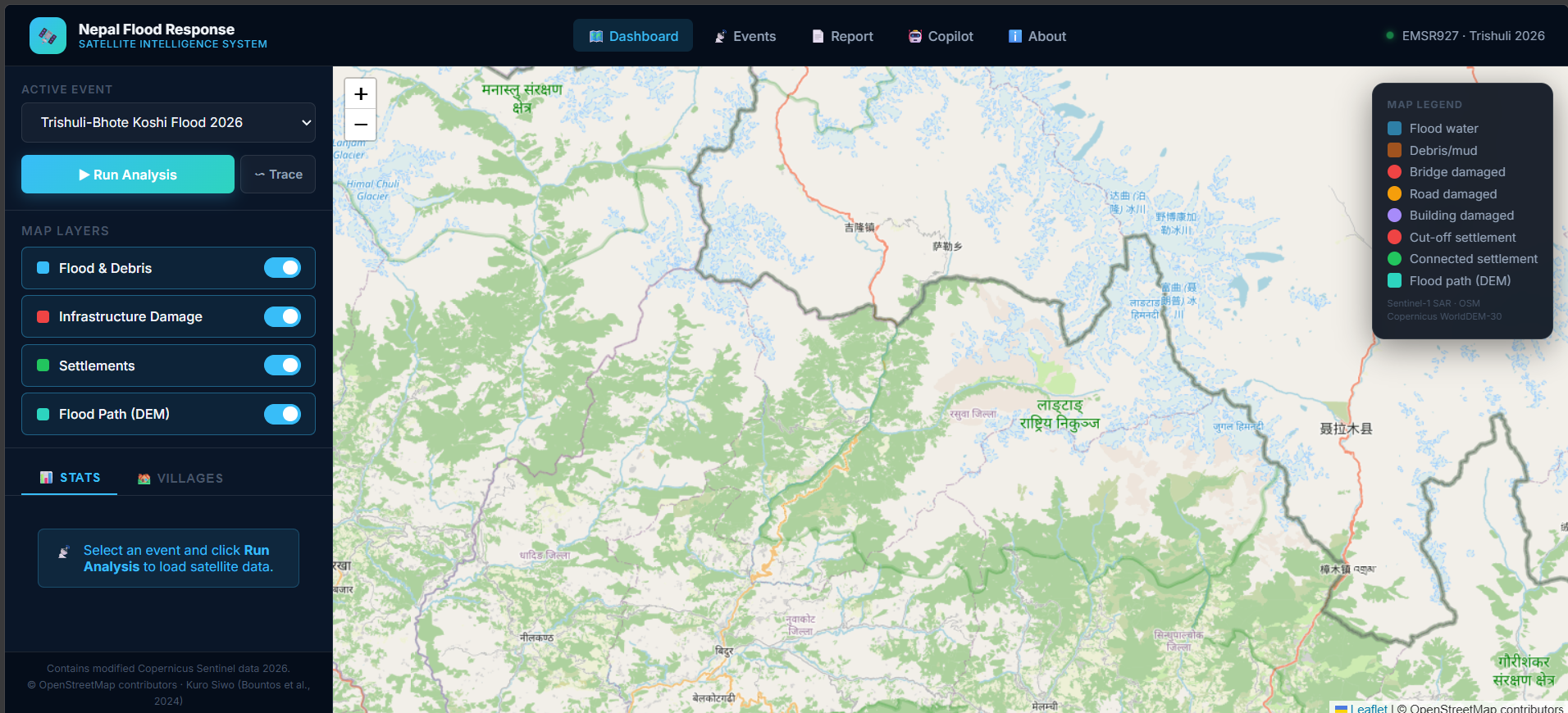
FloodScope uses satellite images taken before and after a flood to identify changes in the affected area. It combines this information with geographical data about buildings, roads, bridges, and settlements to provide a clearer picture of the possible impact.
The system is designed to:
- Map flooded and debris-covered areas using Sentinel-1 radar imagery and Sentinel-2 optical imagery when available.
- Identify buildings, roads, and bridges that may be affected by the flood.
- Find settlements that may have lost road access to the nearest town or hospital.
- Generate a short situation report to help users understand the results.
How we plan to build it
The project combines satellite data processing, geospatial analysis, and AI. Sentinel-1 and Sentinel-2 imagery will be used to compare conditions before and after the event. OpenStreetMap data from before the flood will provide information about roads, buildings, and bridges, while elevation data will help us understand the surrounding terrain.
For the AI component, we plan to use a flood segmentation model to identify flood-affected areas in satellite images. The results will be displayed on a map dashboard so users can explore the affected locations and understand the possible impact on nearby infrastructure and settlements.
We will also study the August 2026 Trishuli flood in Nepal and compare our independently generated results with the official Copernicus Emergency Management Service reference maps for validation.
Challenges
One of the main challenges is identifying floodwater from satellite images, especially in mountainous areas where terrain, radar shadows, debris, and cloud cover can affect the results. Comparing images from suitable dates and the same radar orbit is also important for reliable change detection.
Another challenge is determining whether a settlement is cut off using road network data. A mapped road segment overlapping a flood-affected area does not necessarily mean the road is completely impassable, so the results need to be presented as estimates rather than confirmed damage.
We also need to make sure that the system uses only permitted input data and that the AI-generated reports contain numbers calculated by the system instead of unsupported information.
What we hope to learn
Through FloodScope, we aim to gain practical experience in satellite image processing, geospatial data analysis, AI model evaluation, and building a useful map-based application. We also want to understand the limitations of satellite-based disaster analysis and how to communicate uncertain results responsibly.
FloodScope is being developed as an educational prototype to explore how satellite data and AI can support disaster assessment. It is not intended to replace field verification or official emergency response systems.
Built With
- geopandas
- openstreetmap
- python
- pytorch
- rasterio
- react
- sentinel-1
- sentinel-2

Log in or sign up for Devpost to join the conversation.