-
-
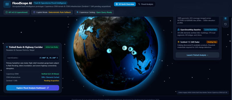
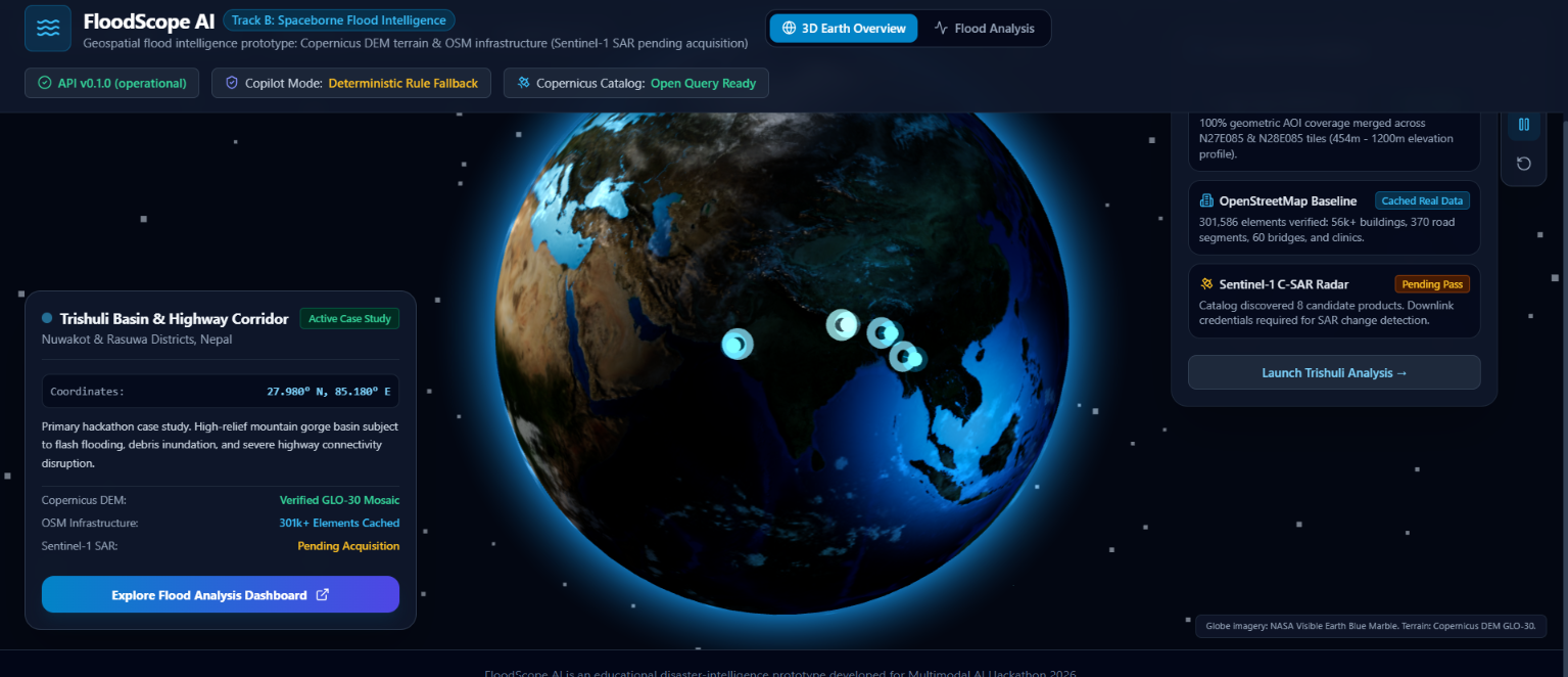
The 3D Earth landing page.
-
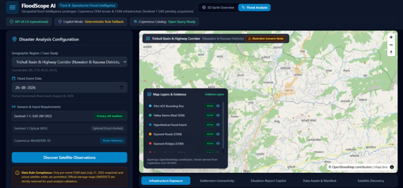
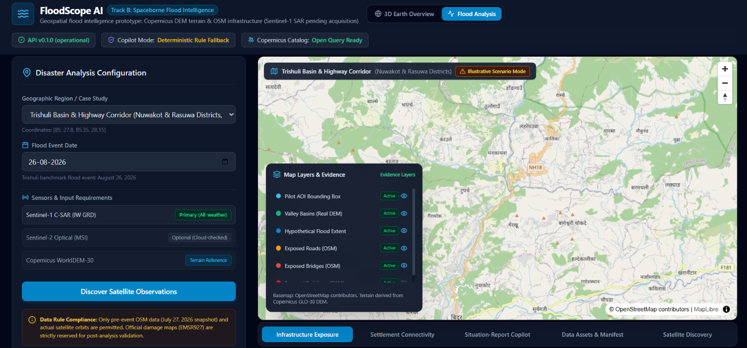
The hypothetical flood scenario and infrastructure exposure results.
FloodScope AI
Terrain-Aware Flood Intelligence for Disaster Preparedness
Inspiration
Floods in mountainous regions can develop rapidly, threatening communities, transportation networks, bridges, and essential services. Understanding the surrounding terrain and identifying infrastructure that may be exposed to flooding are important steps toward disaster preparedness.
FloodScope AI was developed for the Multimodal AI Hackathon 2026, Track B: Spaceborne Flood Intelligence, using the August 26, 2026 Trishuli flood in Nepal as its case study.
Our goal is to explore how geospatial data, interactive visualization, and AI-assisted reporting can help make flood-risk information easier to understand and investigate.
What It Does
FloodScope AI is a geospatial flood-intelligence prototype that combines elevation data, terrain analysis, mapped infrastructure, and AI-assisted reporting in an interactive dashboard.
Key capabilities include:
- Interactive 3D Earth: Explore a globe visualization and navigate toward the Trishuli study region.
- Terrain Analysis: Use Copernicus DEM GLO-30 elevation data to explore elevation, slope, and terrain characteristics.
- Hypothetical Flood Scenarios: Explore terrain-based scenarios by adjusting scenario parameters and examining the resulting simulated inundation area.
- Infrastructure Exposure Analysis: Identify mapped buildings, roads, and bridges that intersect the simulated flood extent.
- Interactive Geospatial Dashboard: Explore terrain and potential infrastructure exposure through a map-based interface.
- Bilingual Situation-Report Copilot: Generate situation-report drafts in English and Nepali using the analysis outputs available to the application.
How We Built It
We built FloodScope AI using a geospatial processing backend and an interactive web frontend.
Frontend
- React and TypeScript for the application interface.
- Three.js for the interactive 3D Earth visualization.
- MapLibre GL JS for geospatial mapping and layer visualization.
- Vite for frontend development and building.
Backend
- Python and FastAPI for API endpoints and application services.
- Rasterio and NumPy for raster and terrain data processing.
- Shapely for geospatial geometry operations.
- OpenStreetMap infrastructure data for mapped buildings, roads, bridges, and other features.
Data and Analysis
The prototype uses Copernicus DEM GLO-30 elevation data and OpenStreetMap infrastructure information. Terrain-derived analysis and spatial intersections support exploration of hypothetical inundation scenarios and potentially exposed infrastructure.
The architecture is designed to support further integration of spaceborne observations and more advanced flood-mapping workflows.
Challenges We Faced
One challenge was integrating raster elevation data with vector-based infrastructure information in a way that could be explored through an interactive web application.
We also worked to make the visualization intuitive while keeping the analysis understandable. The project combines a 3D Earth overview, terrain analysis, scenario exploration, and infrastructure exposure information in one application.
Another important challenge was communicating uncertainty. A simulated flood extent should not be confused with a satellite-observed flood boundary, and an infrastructure intersection should not be interpreted as confirmed damage.
What We Learned
Through this project, we explored how geospatial raster processing, vector data, interactive visualization, and API-based application design can work together in a disaster-preparedness prototype.
We also learned that useful AI-assisted reporting requires clear connections to computed results and careful communication of limitations. Presenting uncertainty honestly is as important as presenting the visualization itself.
Current Limitations and Future Work
The current prototype uses real elevation and mapped infrastructure data, but its flood extent is a hypothetical terrain-based scenario. It does not establish the verified flood boundary or actual infrastructure damage from the August 26, 2026 Trishuli event.
Sentinel-1 SAR data acquisition and satellite-based flood-change detection remain future work. Integrating and validating those observations would be an important next step toward more evidence-based flood mapping.
Future improvements could include validated satellite-derived inundation masks, rainfall and river-discharge inputs, improved hydrological modelling, uncertainty estimation, and more extensive validation against observed flood conditions.
Impact
FloodScope AI demonstrates a potential approach to making terrain information and infrastructure exposure easier to explore in flood-prone regions.
By bringing geospatial analysis, interactive mapping, scenario exploration, and bilingual reporting together, the project aims to support preliminary investigation and disaster-preparedness planning.
FloodScope AI is an educational and preliminary assessment prototype, not an operational emergency-response system.
Built With
- analysis
- artificial
- data
- fastapi
- geospatial
- gl
- imagery
- intelligence
- javascript
- maplibre
- numpy
- openstreetmap
- python
- rasterio
- react
- satellite
- shapely
- three.js
- typescript
- vite


Log in or sign up for Devpost to join the conversation.