-
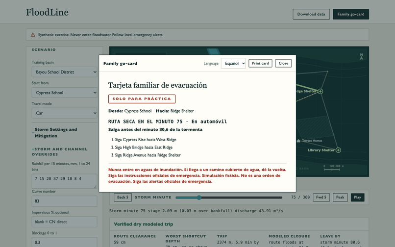
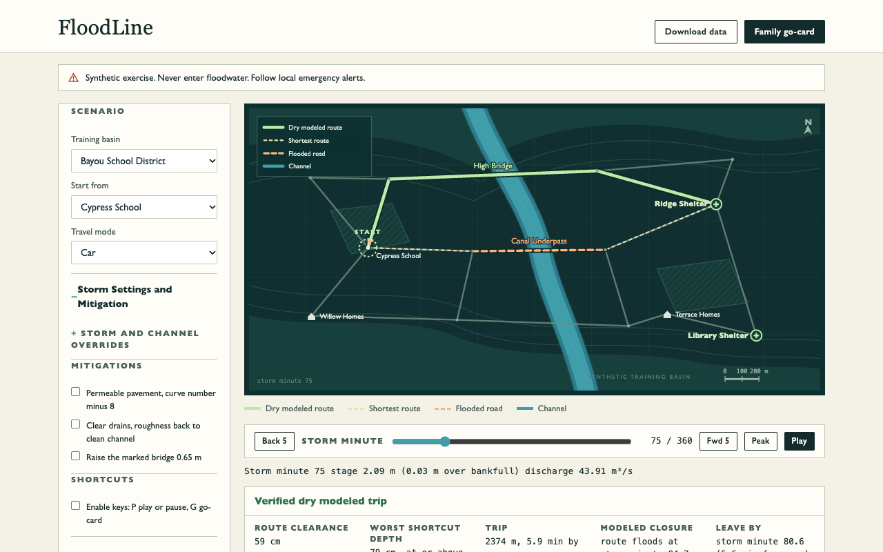
FloodLine desktop hydrology and dry-route evacuation workbench
-
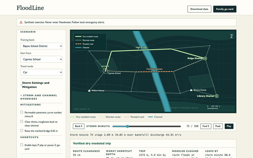
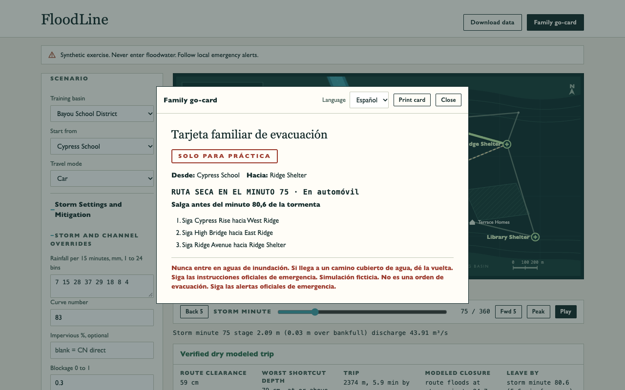
Bilingual English and Spanish printable family evacuation go-card
Track
Climate Action
Inspiration
The shortest way out on a dry day can be the first to disappear in a flash flood. FloodLine lets a school or family practice what that looks like before an emergency. The exercise explains why rainfall intensity, road elevation, culvert blockages, and departure timing matter without asking anyone to share a real address or school location.
What it does
Choose one of three fictional watersheds (Bayou School District, Coastal Delta Town, Impervious Urban Core) or enter a custom storm in 15-minute rainfall blocks. Scrub through six hours to compare the shortest route with the shortest route on modeled dry streets. FloodLine checks whether a detour actually stays dry across the full modeled trip and shows when its current dry departure window closes. In the Bayou drill, the underpass hits 79 cm of modeled water at minute 75 while the High Bridge detour stays dry; by minute 101, no dry exit remains and the evacuation card safely withholds directions.
Toggle green-infrastructure mitigations (permeable pavement reducing Curve Number, clearing a modeled culvert blockage, or raising one evacuation bridge) and compare exact peak channel depth drop, extra departure lead-time, and sites kept dry. Families can print a 1-page practice go-card in English or Spanish, and judges can download the map as GeoJSON, the hydrograph as formula-safe CSV, or a deterministic canonical JSON audit record with a SHA-256 fingerprint.
How we built it
The USDA NRCS TR-55 Curve Number equation partitions rainfall into initial losses, retention, and runoff. A volume-preserving triangular hydrograph turns excess rainfall into channel discharge, and bisection solves the Manning open-channel equation for water surface elevation. FloodLine compares modeled depth against fictional road elevations and runs Dijkstra's shortest-path algorithm across remaining dry roads. Everything runs 100% offline in plain HTML, CSS, and zero-dependency ES modules with a strict connect-src 'none' Content Security Policy and scope-limited offline service worker cache.
Challenges we ran into
Making sure the model never over-promises safety required hardening subtle edge cases: validating composite channel roughness up front, distinguishing verified-dry trips from trips that outlast the simulation horizon (tri-state tripDry), rejecting duplicate/dangling street graph IDs and out-of-range bridge lifts, and neutralizing Unicode Cf characters in CSV exports.
Accomplishments that we're proud of
- 287 of 287 automated tests pass with 0 failures (
npm test), covering TR-55 runoff conservation, Manning bisection accuracy, Dijkstra dry-route exactness, tri-state horizon bounds, GeoJSON/CSV/SHA-256 JSON determinism, bilingual EN/ES print cards, and WCAG 2.1.4 keyboard ergonomics. - Verified in headless Chrome at desktop (1280x800) and mobile (390x844) with zero console errors, zero page errors, zero external network requests, working offline reload, and clean 1-page EN/ES print layout.
What the model cannot do
This is a fictional educational training exercise, not a flood forecast, an active-emergency route planner, or a substitute for official National Weather Service or local guidance. No amount of floodwater is safe to enter. The model does not represent water velocity, damaged pavement, backwater, or live road closures.
What's next for FloodLine
Add optional local elevation profile imports for classroom GIS labs, multi-shelter capacity balancing, and additional printable family checklist languages.
AI Tools & Sources Disclosure
Built from scratch during the official unihacks window (Nov 15, 2026 to Jan 25, 2027) with zero pre-existing codebase. AI coding tools (Cognition Devin / GPT-6.2 Sol / SWE-2) assisted with designing and implementing the hydrology simulation, interface, exports, and 287-test suite. The watersheds and street networks are synthetic; formulas cite the USDA TR-55 runoff method, USGS Manning flow equation, and the NWS Turn Around Don't Drown campaign. No real school records, household locations, or live weather data were used, and no AI model runs at runtime.
