-
-
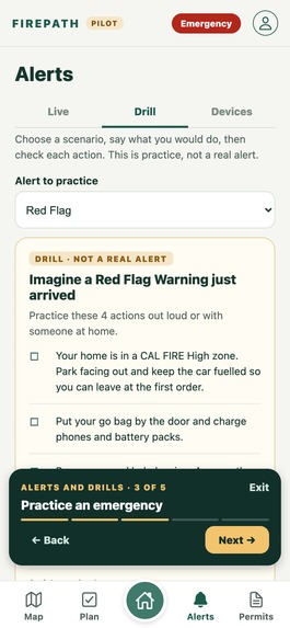
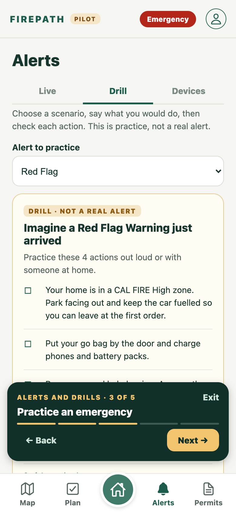
Practice a Red Flag drill built for this household
-
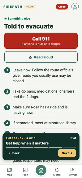
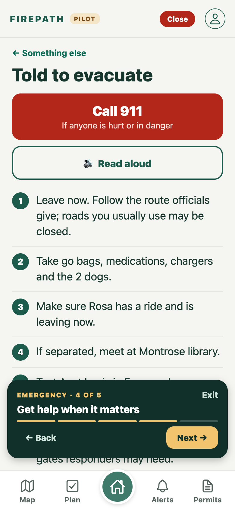
Emergency: Call 911, then steps for the people in this home
-
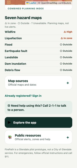
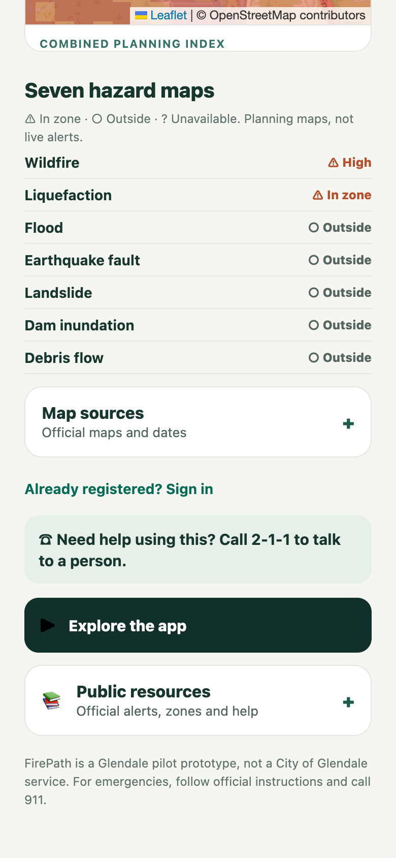
Seven state and federal hazard maps at one address
-
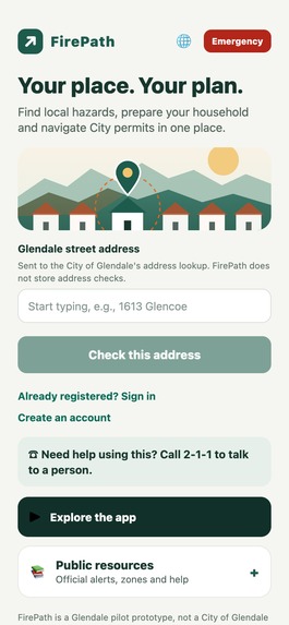
Check any Glendale address, no account needed
-
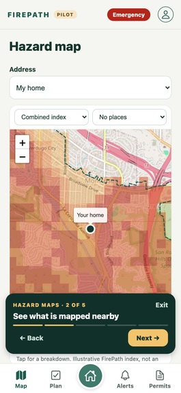
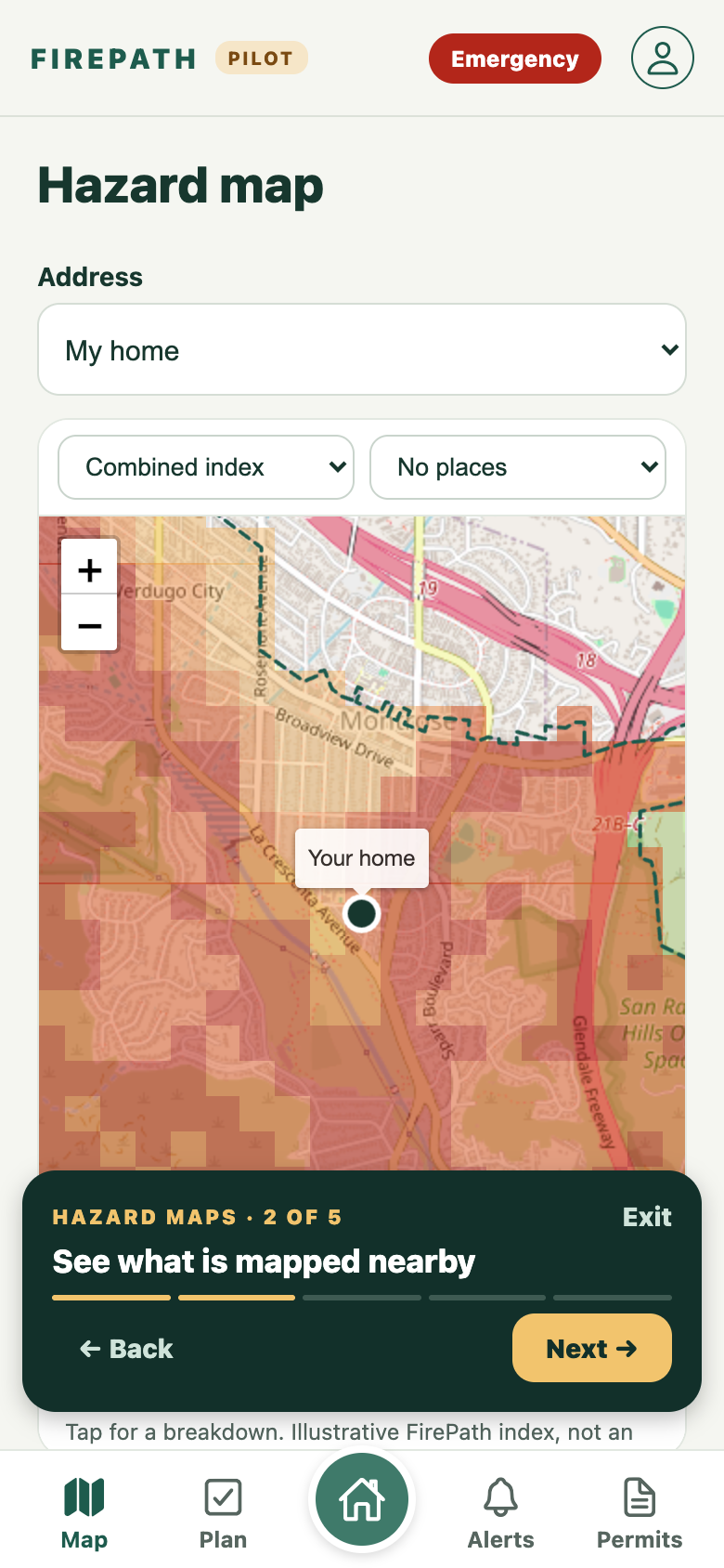
Hazard map: combined planning index, with a 3D terrain view
Inspiration
We spoke with Glendale’s emergency preparedness and information systems staff. They described a problem that stuck with us: the City has useful hazard maps and property data, but residents still have to figure out what applies to their address and what to do next. Staff also helped us understand how valuable a small detail—like two dogs in the backyard or someone who needs help leaving—could be to responders.
What it does
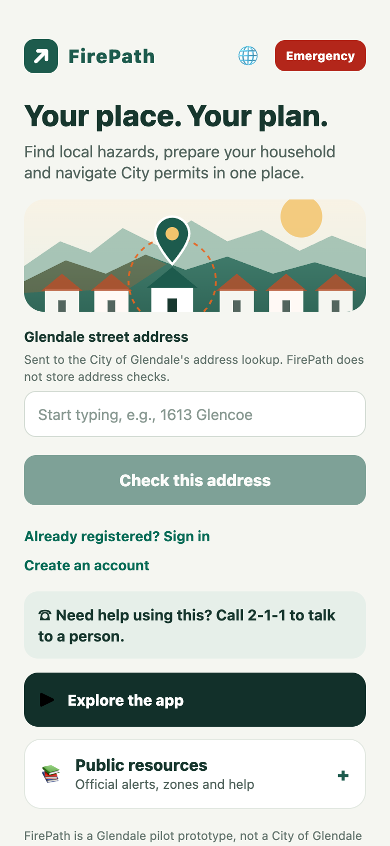
FirePath turns a Glendale address into a personalized preparedness plan. Residents can see mapped hazards, add household needs, work through a checklist, practice an alert, and print a plan. The app also brings in weather alerts, public City records, and permit guidance.
On the map, anyone can switch to a 3D view of real terrain and buildings, tap any lot, and see its parcel, zoning, fire station district, nearby schools, mapped hazards and City permit history in one card.
Residents can preview a short brief of the information they might choose to share with first responders. That brief does not go to dispatch today; it shows what a future, City-approved connection could make possible.
How we built it
We built the resident experience with Expo and React Native, with a Node API behind it. FirePath combines public hazard maps, Glendale permit records, and National Weather Service alerts with details residents enter about their household. We designed the app to distinguish planning data, live information, and prototype features. Hazard lookups run on HackerFund's open GlendaleGisMcp project; parcels come from the LA County Assessor's public GIS, zoning and districts from the City of Glendale's public GIS, and the 3D map uses MapLibre with OpenStreetMap buildings. It is deployed on Vercel.
Challenges we ran into
The hardest challenge was turning scattered data into advice someone could understand and act on. A place outside a mapped hazard zone is not necessarily safe, and an unavailable map is not an “all clear.” We also had to be careful about privacy: information meant to help responders should only reach them with consent and an approved connection.
Accomplishments that we're proud of
We built an address check across seven hazard maps and connected it to household-specific steps, practice drills, and printable plans. We brought public City records and permit guidance into the same experience. Most of all, we moved beyond a generic emergency checklist toward a plan that reflects the people and animals at a particular place.
What we learned
Our conversations with City staff changed the direction of the project. A narrow home-fire tool was less useful than broader emergency preparedness. We learned that the City already uses parcel-linked information across departments and that responders rely on fast, concise information in existing dispatch workflows. For FirePath to make a difference, it has to fit how residents and City teams actually work.
What's next for FirePath
We want to test the app with Glendale residents, improve the clarity of its recommendations, and strengthen authentication and consent. With City participation, we would connect official evacuation zones and orders to registered addresses and explore how a resident-approved brief could fit into responder workflows. An in-home alert device could become another way to deliver verified alerts.
Built With
- chatgpt
- claude
- esp32
- esri
- expo.io
- leaflet.js
- maplibre
- node.js
- openstreetmap
- python
- react-native
- vercel

Log in or sign up for Devpost to join the conversation.