-
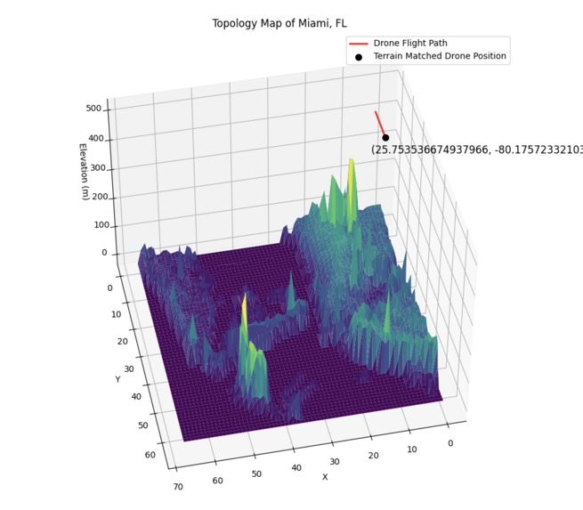
3d topographic plot of miami w matched drone path
-
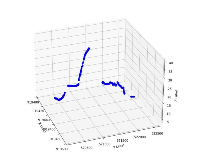
lidar altitude sensor readings for flight path - point cloud format
-
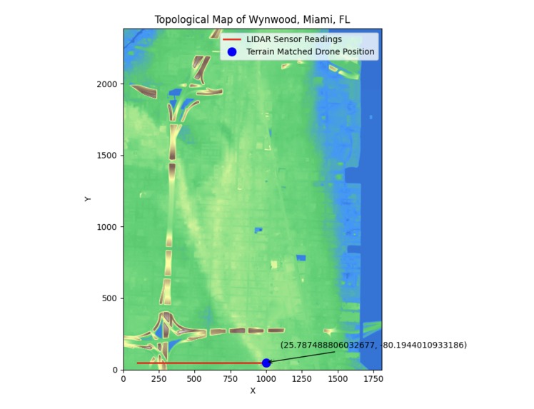
2d topographic plot of wynwood w matched drone path


Inspiration
In war-time areas like Ukraine, drones and other GA aircraft are unable to access GPS to navigate due to RF-blocking and EMP techniques from Russia. Critical operations in aviation, logistics, and defense responses become at risk when this happens, and redundancy measures for navigation must be implemented.
What it does
Our technology gives drones precision navigation without GPS. We use LiDAR sensors to get altitude readings for a flight path, and apply our best fit algorithm to match input data to a pre-processed topographic database to get precise location information.
How we built it
We started with processing multiple databases, in LAS and GeoTIF formats, that we got from NOAA of the Miami-Dade LiDAR scan done in 2018. Once we processed that data to a format we could work with, we developed the matching algorithm. Our algorithm searches the database row by row, column by column, compares the inputted LiDAR altitude readings, and returns the best match. We then tested our algorithm with sample data.
Challenges we ran into
We had to develop what assumptions we would make for our input data, which would dictate our approach to the problem at hand. We then had to figure out the format of the database we would use - whether we import LAS files in point cloud format or use a 2d elevation raster from TIF files. The biggest challenge was the development of the main algorithm to match data, and improving both the performance and the accuracy.
Accomplishments that we're proud of
We managed to work with new file formats for us, that being LAS and GeoTIF files for our database. We are proud of the charts and simulations that we created using our processing algorithms for large amounts of data, and working with the math behind high level probability methods for matching algorithms.
What we learned
We learned a lot about LiDAR technology and the formats that LiDAR readings were stored as, as well as general knowledge about topological data. We improved our python skills by developing our own algorithms and working with new python libraries, like Laspy and OSGeo.
What's next for Erebus Defense Technologies - GPS Denied Navigation
Funding. 😛
To expand on that, this is just the beginning for Erebus Defense Technologies. We can improve the terrain matching algorithm in the following ways:
- apply advanced statistics methods like cross correlation and fast fourier transforms for better matching
- normalize LiDAR sensor readings
- improve performance of the matching algorithm
- use multiple LiDAR sensors for more accurate positioning
- perform sensor fusion with accelerometer and gyroscope readings
- field tests to identify further opportunities for improvement
We have other ideas for GPS denied navigation, namely:
- apply our terrain matching algorithm underwater using Sonar
- celestial navigation - calculate position off of night sky constellation patterns
- WiFi / BlueTooth triangulation for indoor navigation
Built With
- drones
- laspy
- matplotlib
- noaa-climate-data-online
- numpy
- osgeo
- python


Log in or sign up for Devpost to join the conversation.