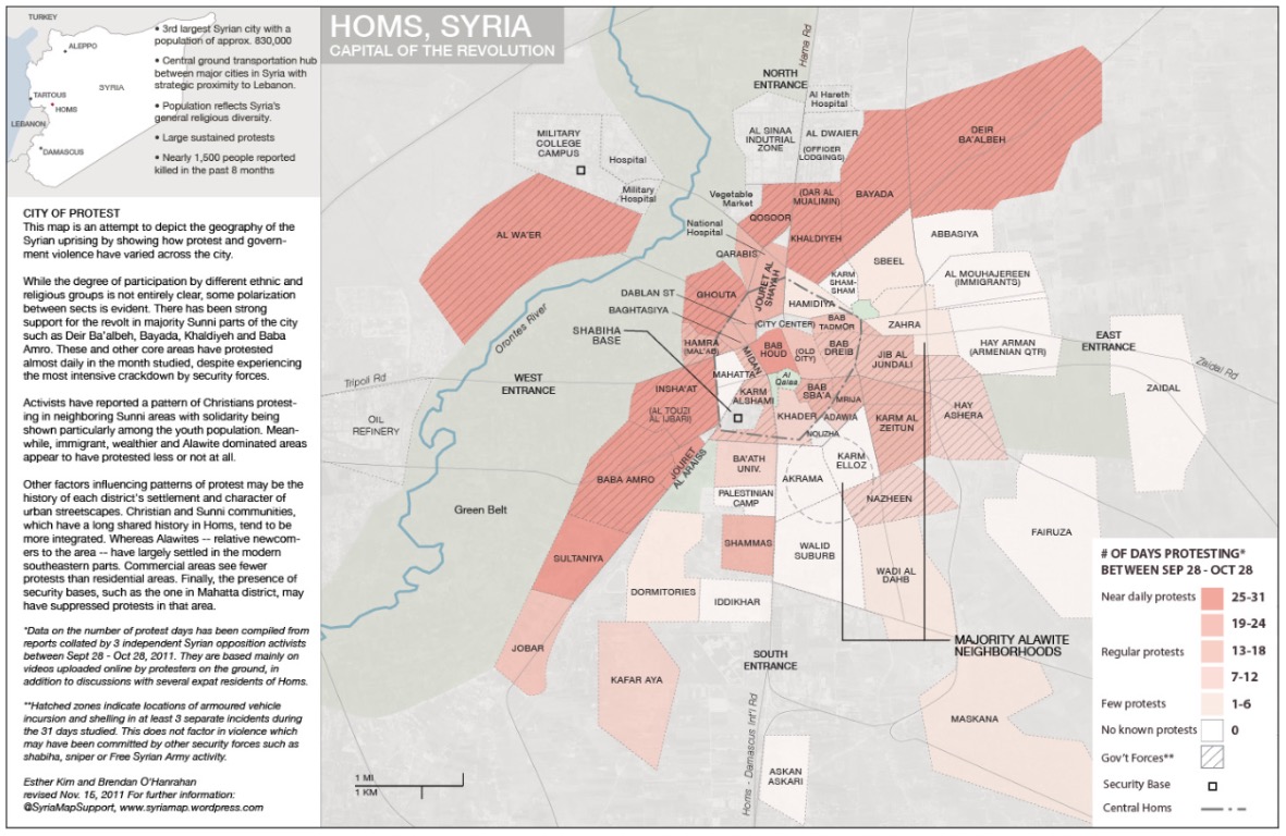
Syria Map is a collaborative project to create graphics which monitor patterns and developments in the current unrest in Syria. We worked with local residents, activists, professional mappers and journalists to develop an informed picture of what is happening on the ground.
Esther Kim is an architectural designer with an avid interest the Arab Spring and the opportunities of Social Media to report on it. She tracked the final events of the Libyan Revolution in real time through an Interactive Google Map. She received her M.Arch from Columbia University and has a B.A. in History from Brown.
Brendan O’Hanrahan is an Irish ecological consultant living in Scotland. He utilizes GIS in his professional work and in creating base maps for the Syria Map project. He has an interest in MENA issues, particularly the history and politics of the Maghreb. Brendan served as a Geo-Location coordinator for Libya Crisis Map (for UN OCHA) from March-May 2011, and assisted with producing detailed maps for analysisteam. He is a graduate of Trinity College, Dublin.

Log in or sign up for Devpost to join the conversation.