Inspiration
We can find a street on Google Maps. But where is the blocked drain beside it? Where does garbage keep accumulating? Is yesterday’s complaint still unresolved—and what happened next?
A street can be visible while the environmental concerns affecting its community remain overlooked.
Residents notice litter, dumping, blocked inlets, and standing water every day. Yet their observations often remain scattered across conversations, photographs, and social-media complaints, without consistent evidence or visible follow-up.
Our ambition is to build a social platform for community care: a place where residents and volunteers contribute observations, confirm conditions, follow progress, and help their neighborhoods track problems toward resolution.
The connection to OneAquaHealth extends beyond the street. Rainfall can move litter and debris through connected stormwater systems toward urban freshwater environments. DrainWatch brings these potential concerns into view, connecting citizen participation with environmental awareness and community readiness.
What it does
DrainWatch: Stormwater & Litter Watch is a community reporting and readiness prototype for Track 6: Resilience Informatics.
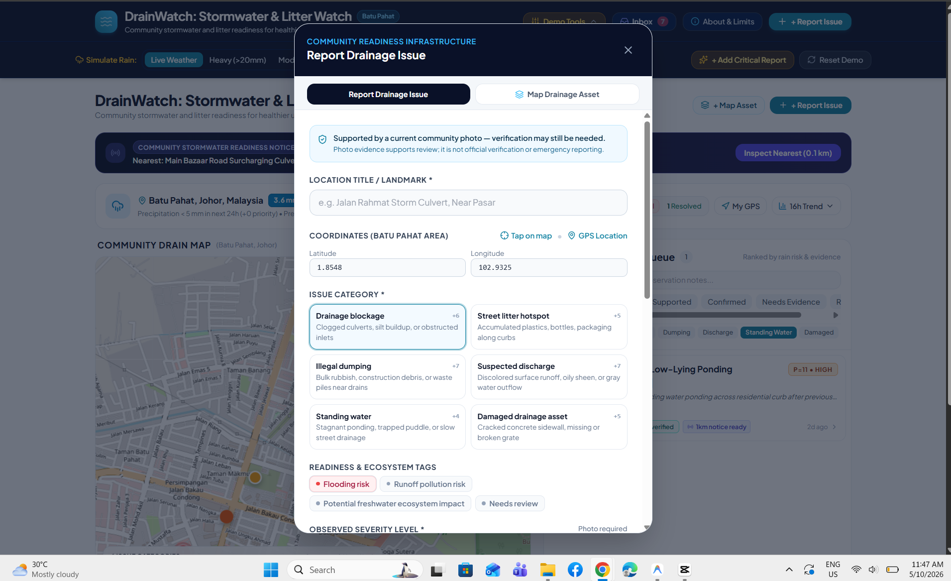
It supports six structured categories:
- Drainage blockage
- Street litter hotspot
- Illegal dumping
- Suspected discharge
- Standing water
- Damaged drainage asset
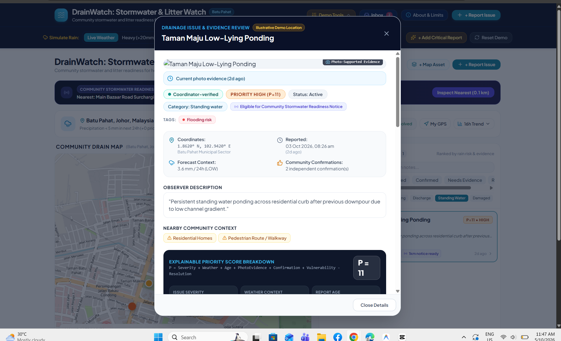
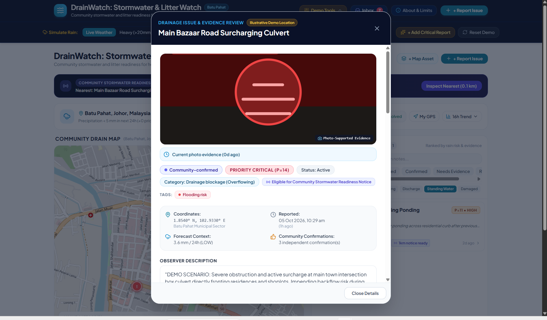
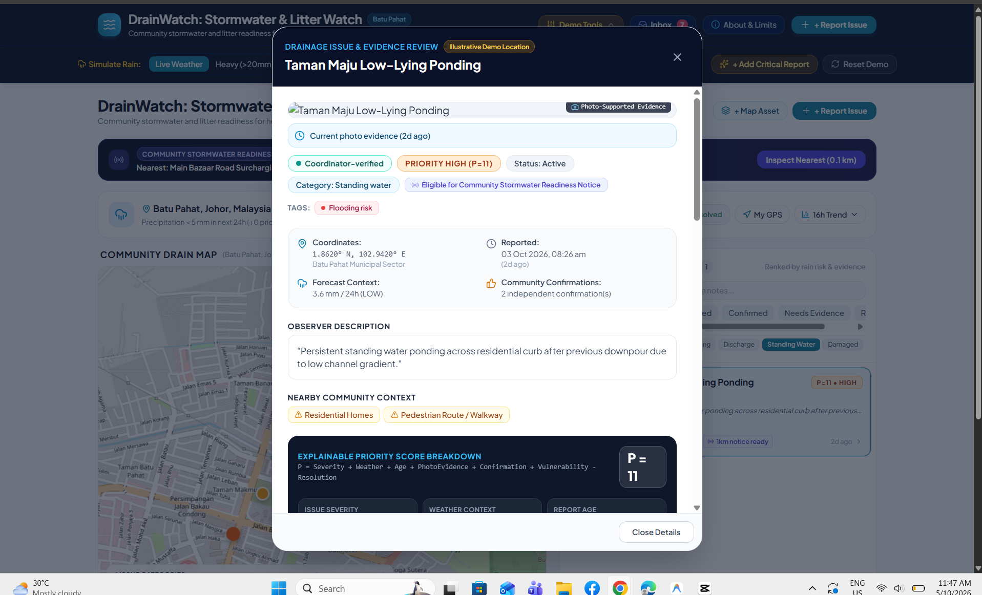
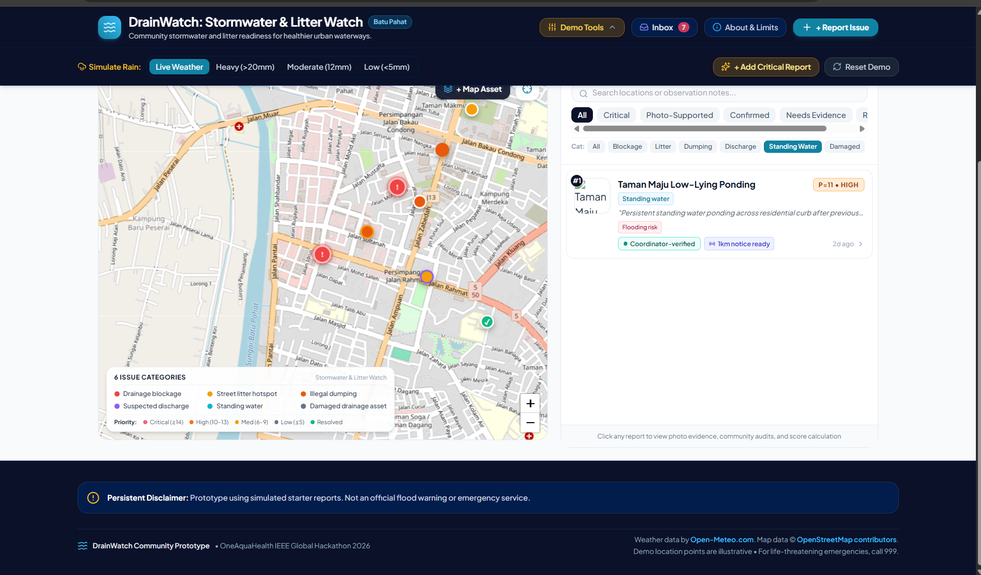
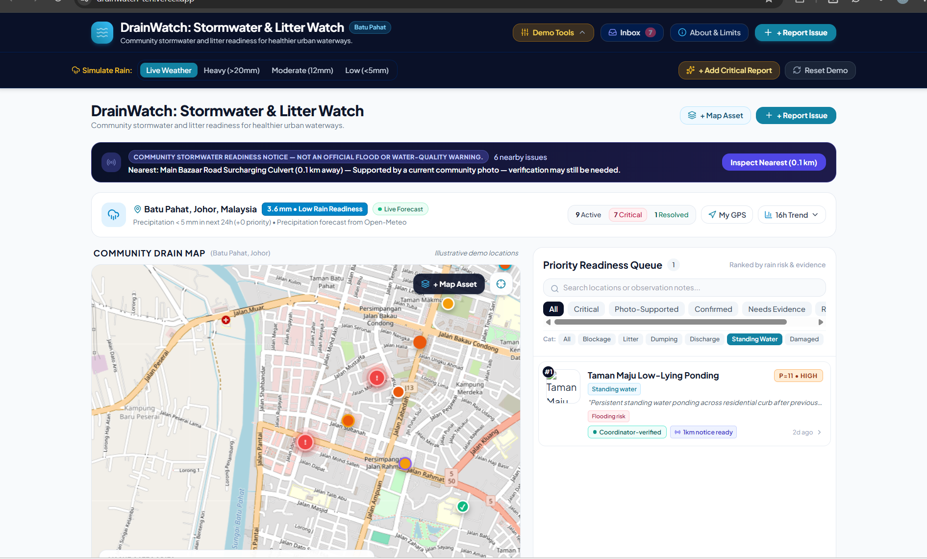
Users can submit photo-supported observations, explore reports on a map, filter categories, inspect evidence, record community confirmation, follow issues, and mark reports resolved.
The readiness queue combines report severity, rainfall context, evidence freshness, community confirmation, and resolution status. Users can inspect the reasons behind a priority rather than trust an unexplained number.
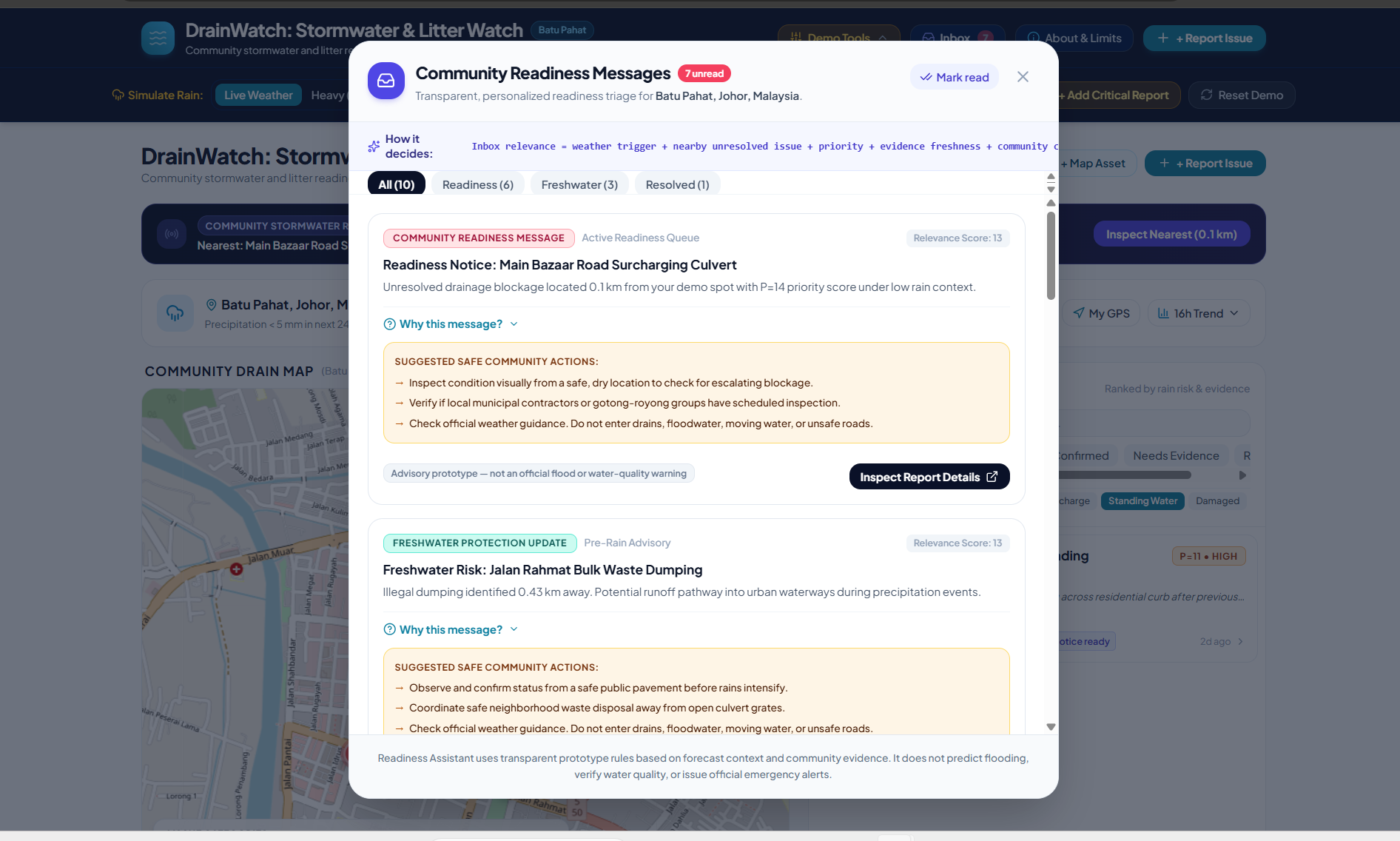
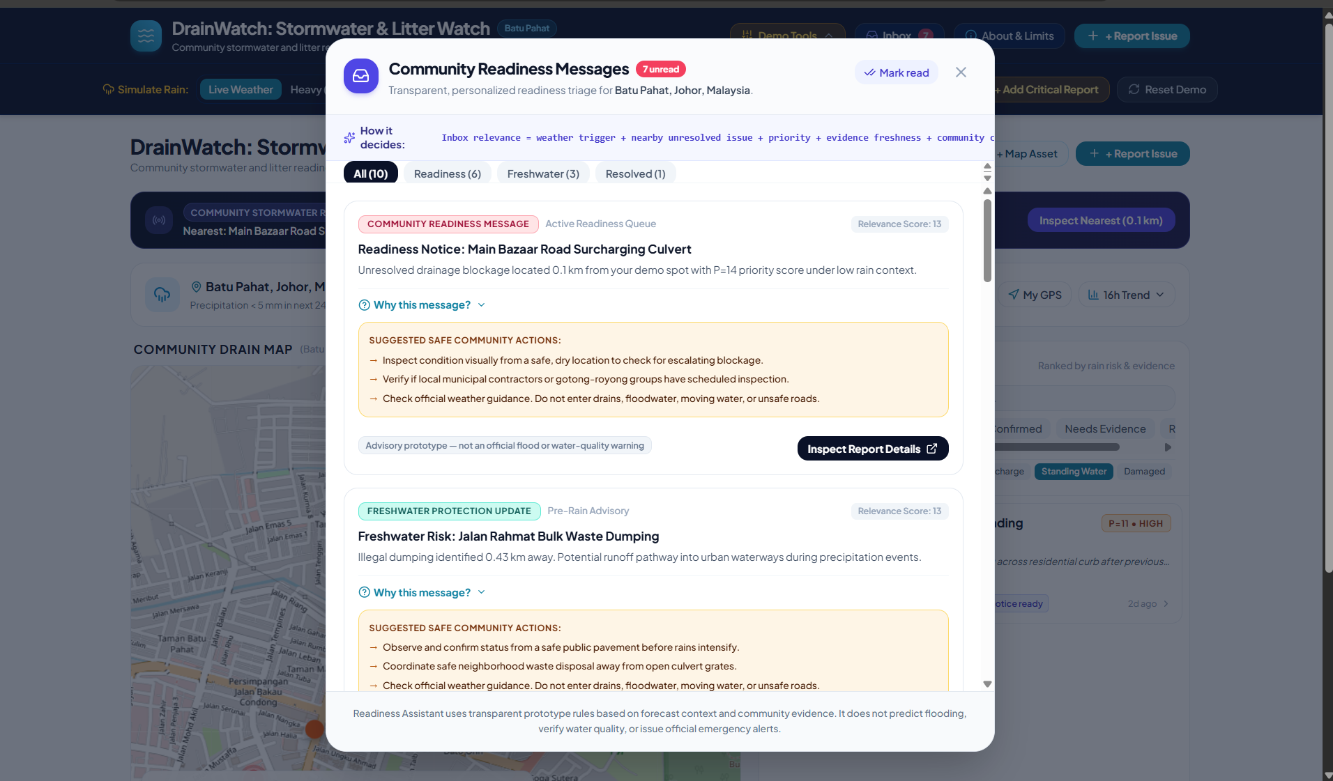
The Readiness Inbox dynamically evaluates reports and creates location-personalized advisory messages. It considers rainfall, distance, report priority, evidence freshness, confirmation status, resolution, and issue category.
Each message includes “Why this message?” so users can inspect the evaluated signals. Litter, dumping, and suspected-discharge reports receive freshwater-focused context, while other categories receive community-readiness context.
Personalization uses the selected location or browser GPS when the user grants permission. It is not based on personal profiles, and followed issues do not currently influence inbox scoring.
The assistant uses transparent rules and dynamically assembled text—not a trained AI model or generative AI.
Our core workflow is:
Report → Inspect evidence → Prioritize → Confirm → Follow progress → Record resolution
How we built it
We built the application using React and Vite, with Tailwind CSS for styling. Leaflet and OpenStreetMap provide the interactive map, while Open-Meteo supplies precipitation forecast context.
The Readiness Inbox is implemented in JavaScript through generateInboxMessages(). React recomputes messages when report, weather, or location state changes. Read-message IDs are saved in browser localStorage to maintain the unread state across refreshes.
Reports and prototype preferences are maintained locally. Vercel hosts the public application, and the source code is available on GitHub.
The demo supports live forecast context and clearly labeled simulated weather scenarios. This lets users explore changes in prioritization without confusing simulated heavy rain with an actual forecast.
Explainability is central to the design: report details expose priority factors, and inbox messages explain their relevance.
Challenges we ran into
The central challenge was making community information useful without overstating its authority.
A photograph supports review but does not prove contamination. Community confirmation adds context but is not official verification. An elevated priority indicates a need for attention—not a prediction that flooding will occur.
Connecting drainage reporting to freshwater ecosystem health required equal care. We expanded the prototype to include litter, dumping, and suspected discharge while using potential-impact labels rather than claiming pollution detection.
We also needed to balance our wider social-platform ambition with a focused implementation. The current version demonstrates reporting, confirmation, following, prioritization, and status updates. Shared accounts, moderation, and real volunteer coordination require further development.
Accomplishments that we're proud of
We created a publicly accessible prototype that connects:
- Location-based drainage and litter reporting.
- Photo-supported evidence and community confirmation.
- Rainfall-aware, explainable review priorities.
- Dynamically generated, location-personalized inbox messages.
- Issue-following and resolution status updates.
- Visible freshwater relevance and safety boundaries.
The inbox is not simply a fixed set of sample messages. It evaluates the reports currently in application state, including newly submitted observations, and updates as relevant inputs change.
Our strongest accomplishment is bringing scattered local observations into a structured workflow where the concern, supporting evidence, priority, and recorded status are visible together.
What we learned
One Health alignment is more than adding an environmental label. A project needs a clear connection between what people observe, the environmental pathways involved, and the decisions its evidence can reasonably support.
For DrainWatch, that connection is:
Street-level litter and drainage concerns → rainfall and runoff → potential impacts on connected freshwater environments → community readiness and follow-up.
This supports the OneAquaHealth vision of connecting urban freshwater ecosystem health with biodiversity and human well-being. DrainWatch contributes at the urban runoff interface; it does not directly assess biodiversity, contamination, disease risk, or health outcomes.
We learned that transparency strengthens trust, participation needs visible progress, and responsible limitations are part of good product design.
The prototype uses nine simulated starter reports and illustrative locations in Batu Pahat. Messages are dynamically generated from those reports and any additional reports entered locally.
Data is stored in the browser, not synchronized across a shared multi-user platform. Confirmation records are not independently authenticated identities, and marking a report resolved is not proof of safe drainage flow or water quality.
DrainWatch does not measure contaminants, pathogens, or ecological damage; establish where every drain discharges; predict flooding; or issue official flood or water-quality warnings.
Users must observe from safe public locations, never enter drains or floodwater, and follow official emergency guidance.
What's next for DrainWatch: Stormwater & Litter Watch
Our long-term vision is a community action network for healthier urban waterways—not a generic social feed, but a platform where contributions lead to evidence, accountable follow-up, and documented outcomes.
The next stages are:
- Build a shared backend with authenticated roles, privacy controls, moderation, and duplicate-report review.
- Introduce structured community updates and verified partner coordination, with clear ownership of follow-up.
- Connect observations to validated drainage and receiving-water information where available.
- Pilot with residents, community organizations, environmental researchers, and local authorities.
- Support safe, permitted volunteer participation under verified organizers, rather than hazardous self-directed drainage work.
Future AI assistance could help summarize evidence, translate readiness messages, suggest report categories, and identify possible duplicates. These capabilities would require evaluation, human review, transparent eligibility rules, and template-based fallbacks. AI would assist communication—not independently verify contamination, predict floods, or issue emergency instructions.
A pilot would measure report completeness, corroboration, time to review, documented resolution time, recurring hotspots, and sustained participation. Ecological or health benefits would require separate field measurements and partner evaluation.
Batu Pahat is our illustrative demonstration setting. The wider opportunity is an approach communities can adapt to their own waterways, languages, infrastructure, and local partners.
DrainWatch makes the problem visible, the priority understandable, and the progress traceable—turning local concern into a foundation for collective care.
Built With
- css
- javascript
- leaflet.js
- localstorage
- open-meteo
- openstreetmap
- react
- tailwind
- vite

Log in or sign up for Devpost to join the conversation.